|
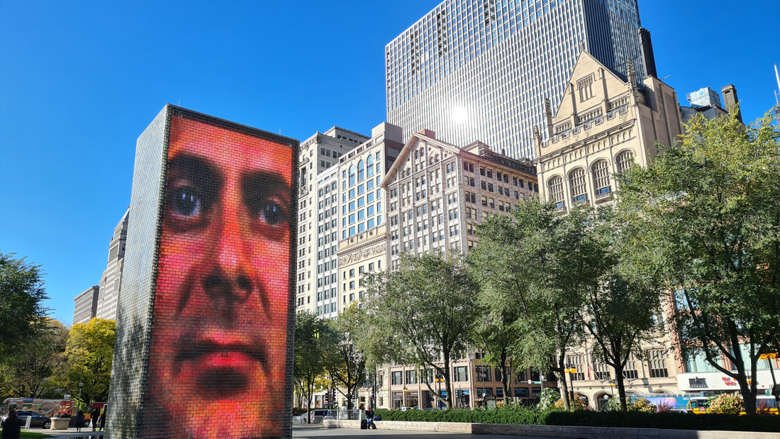
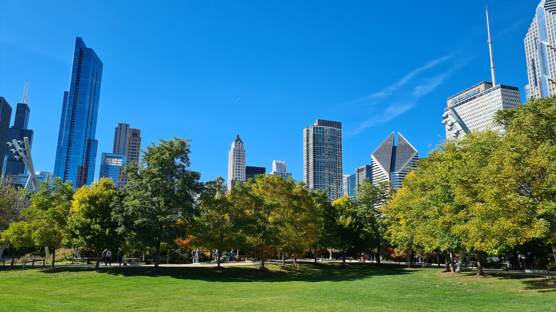
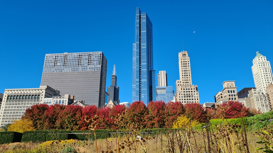
The Millennium Park is an attraction you can't miss when you are in Chicago. It's located in downtown Chicago at the lakefront. It is the perfect location to go for a relaxing stroll, enjoy a concert, meet up with some friends or just admire the stunning architecture around the park.
The interactive video sculptures by Jaume Plensa is worthwhile a visit. Two 50-foot glass brick towers are positioned on the edge of a black granite pool and larger-than-life faces of Chicago locals are projected on these monumental towers. In the summer, the towers cascade with water making it a favourite with kids allowing them to splash around in the water on a hot summers day.
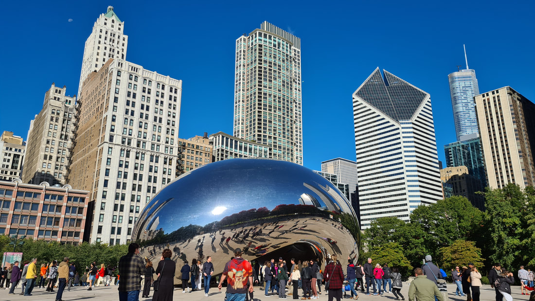
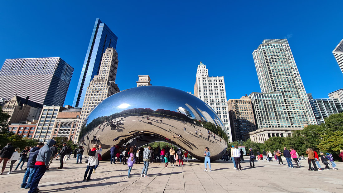
The park is home to the iconic Cloud Gate statue , better known as The Bean. Designed by the internationally acclaimed artist Anish Kapoor, Cloud Gate was his first permanent public outdoor public work in the United States, and widely considered hi most famous work.
The art work reflects Chicago's famous skyline, an impressive sight on a sunny day. The Bean can be found above the McCormick Tribune Plaza where you'll outdoor dining in the summer and a free ice skating rink in winter.
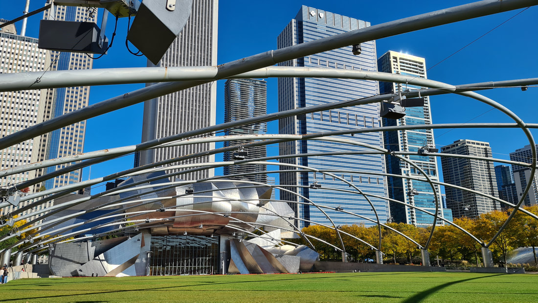
The Jay Pritzker Pavilion & the Great Lawn. The one of a kind entertainment area is just stunning, its crown of stainless steel ribbons and plates protecting the entertainers below. With a state-of-the-art sound system designed to provide similar acoustics of an indoor theatre, it's the place to enjoy free events like the annual Summer Music Series and Summer Film Series, the Chicago gospel Festival, the Chicago Jazz Festival and many more. The great lawn is the perfect spot to sprawl out on and enjoy a picnic.
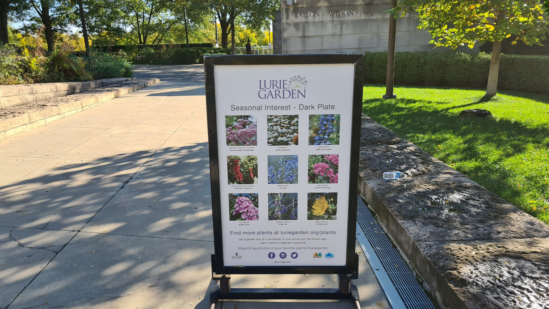
Lurie garden is an award-winning garden that combines naturalistic plantings and ecologically sensitive maintenance practices to create an relaxing urban oasis. With a wide variety of plants , animals and insects, it offers visitors a four-season experience where the seasonal changing colours provide a stunning feast for the eyes.
0 Comments
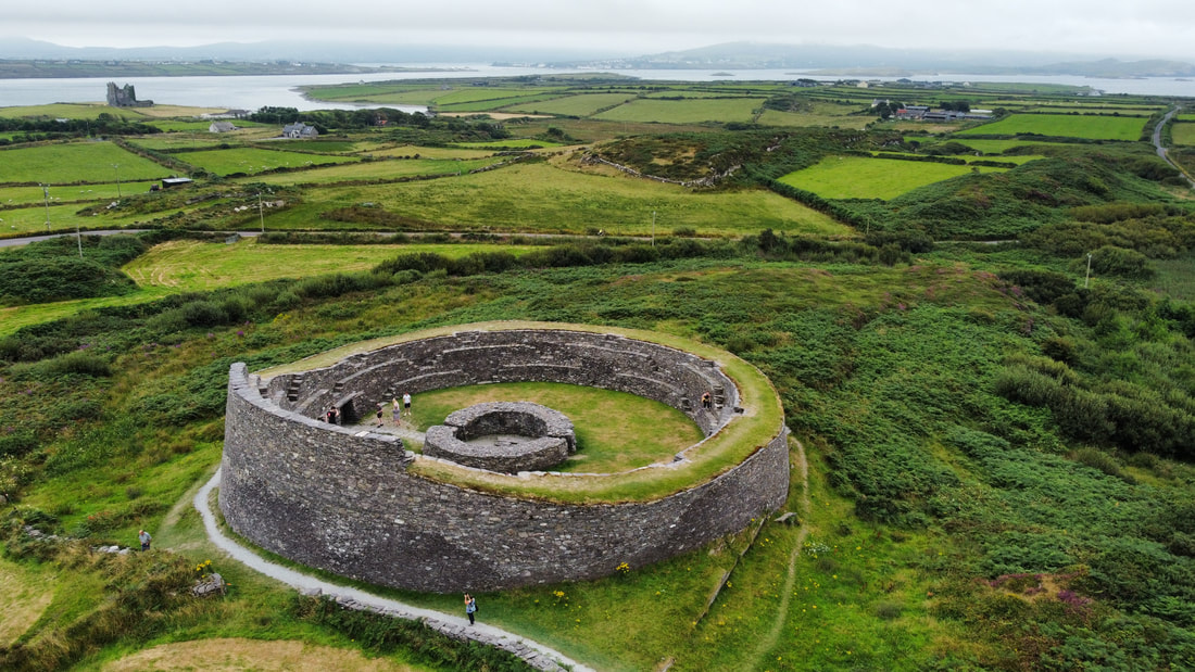
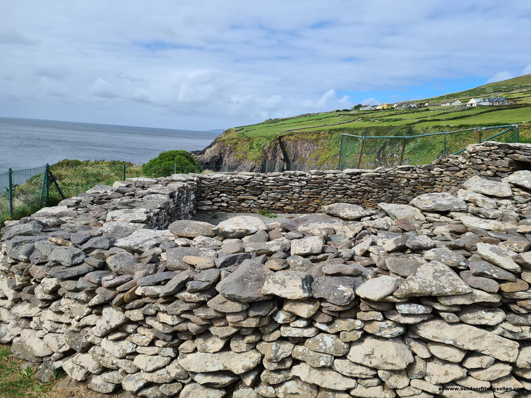
Cahergal Stone fort is located close to the town of Cahersiveen in County Kerry. After having parked up our car in the designated carpark, we walked the short distance towards this National Monument while admiring the stunning landscape surrounding the ring fort.
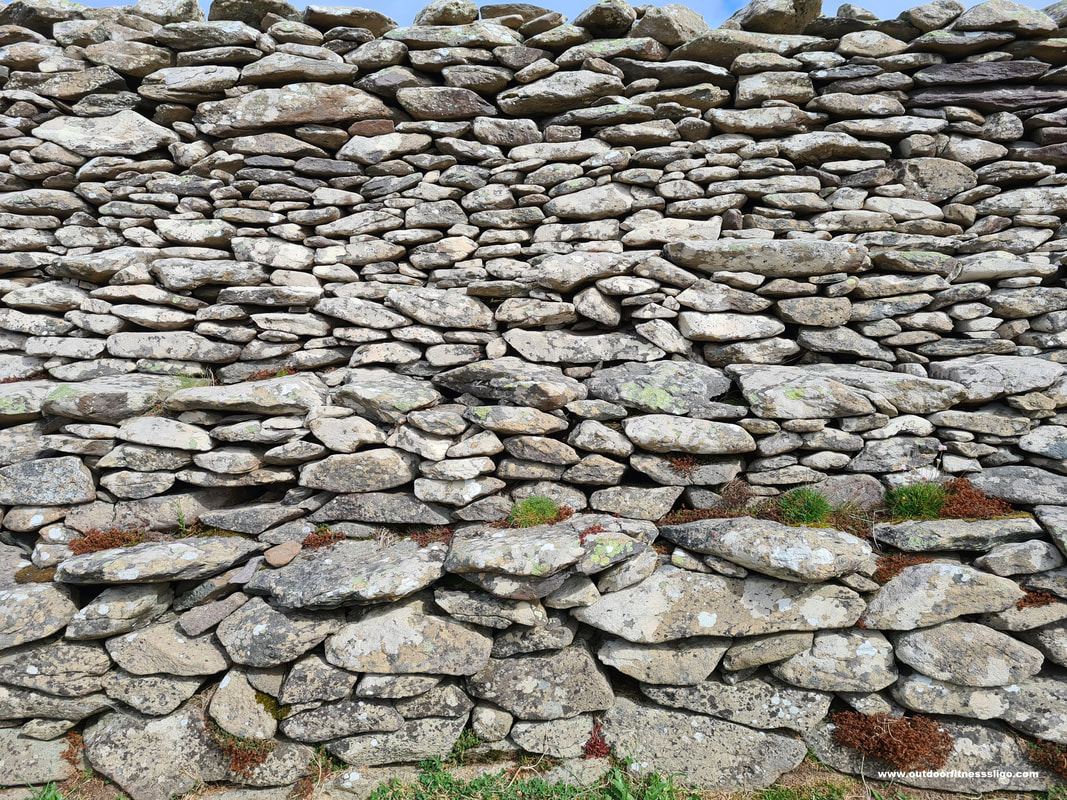
From the path, we looked across the Ferta River Estuary and admired the ruins of Ballycarbery Castle while the many bees zoomed around taking nectar from the heather. Cahergal Ring Fort is a particularly fine and impressive example of a stone fort with massive dry stone walls. There are flights of steps leading to different terraces in the inner face and upper parts of the wall that were reconstructed.
The reconstructed lintelled entrance is the only entrance into the fort and must have provided security for the fort's inhabitants in times of siege. Inside the fort are the remains of a circular stone house where once, somebody of importance lived. Where it is very difficult to date these stone forts, Cahergal was probably built between 500 and 800AD.
At walking distance from Cahergal Ring Fort is another impressive ring fort called Leacanabuaile (Leacanabuaile stone fort - OUTDOORFITNESSSLIGO).
The colourful village of Sneem might be small, but it's worth a visit when you find yourself in County Kerry. Located on the Iveragh penisula, it lies on the estuary of the river Sneem.
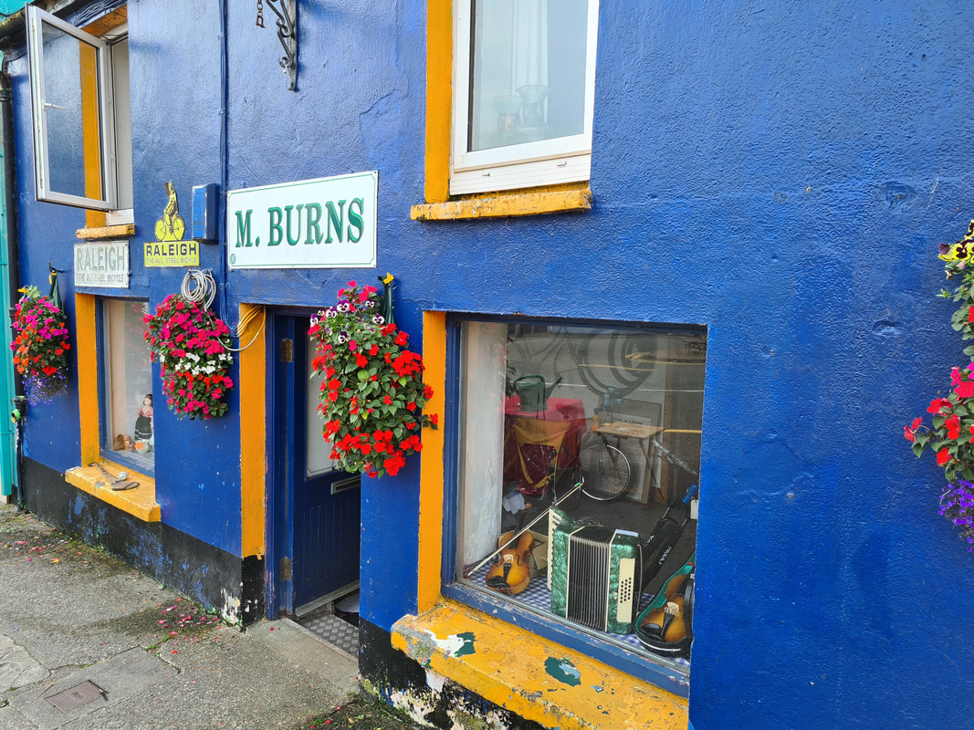
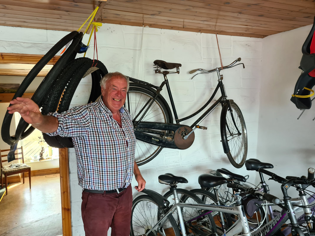
With its brightly painted houses, Sneem was voted Overall tidy Towns winner in 1987 and one of Ireland's Top 10 tourism towns, and it isn't hard to see why. We had the pleasure to walk through the town on a sunny morning in July and meet some characters as colourful as the houses. Mickey Joe Burns is one of those stores where you have to pop into ... From the brilliant chats and stories to the old Raleigh bicycle on the wall, it is the place to be when you want to experience Irish culture. Also, when you find yourself in Sneem and you want to experience the area at a slower pace, M.Burns rents out bicycles as well.
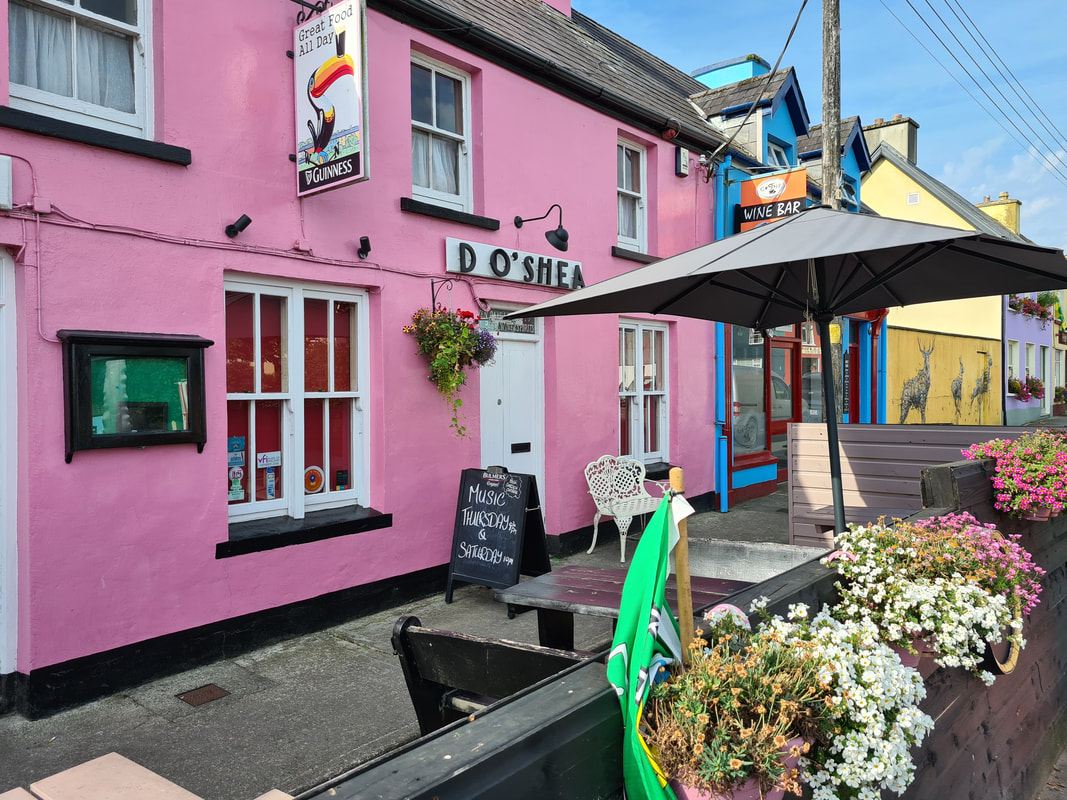
A bit further down the road is D O'Shea's (website) which has been a public house for half a century. Finding D O'Shea's is easy, with its bright pink colour, it can be spotted from far away. Whether you are calling in D O'Shea's for a quiet pint or to enjoy a traditional music session, it's the perfect spot to spend a summer afternoon or evening.
Another must do is a walk along the Sneem Sculpture Trail where you find a selection of statues and monuments dotted throughout the village. Starting at the South Square Fair Green, you will stroll passed "The Way the Fairies Went", also known as the Pyramids, the "Peaceful Panda" from China and many other monuments
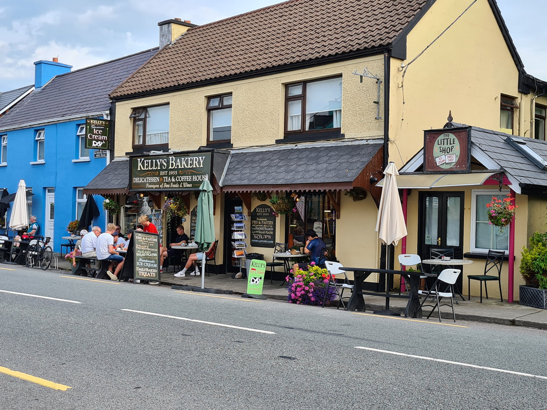
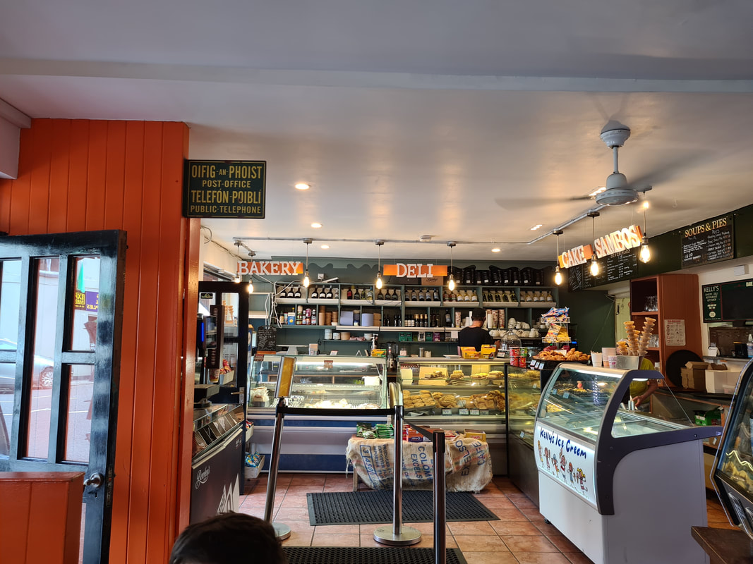
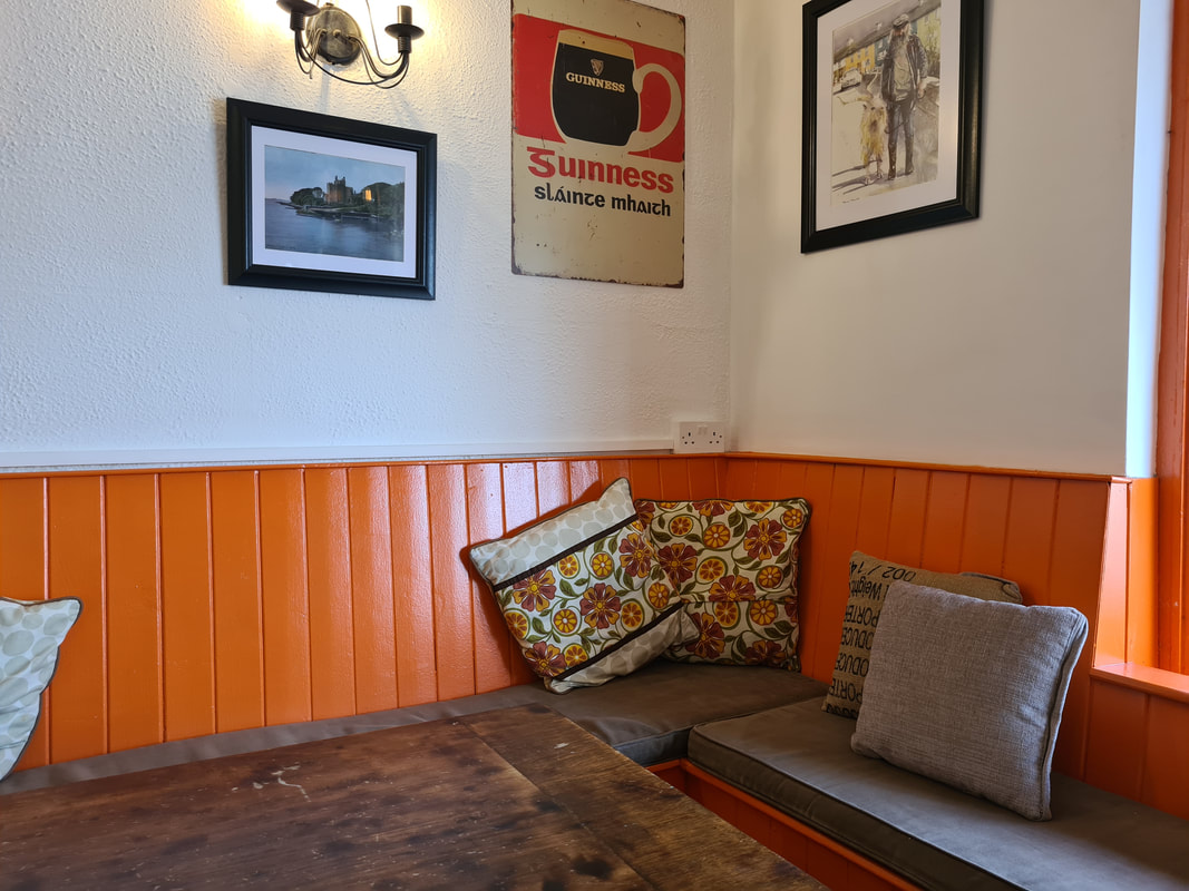
After our early morning stroll, we had worked up an appetite and decided to get a snack. Across the road from D'OShea's is Kelly's bakery, a family owned bakery, delicatessen and coffee shop where you can enjoy some of the freshly baked produce, local artisan cheeses, ice cream,.... all in the comfort of the cosy interior or on one of the outside tables.
We opted for the homemade sausage rolls followed by delicious apple tarts all rinsed down with fresh coffee and hot chocolate for the boys. Before we said goodbye to Sneem, we visited the Charles de Gaulle monument which is located in the corner of the North Square. When the president of France resigned his presidency in 1969, he sought peace and quietness in Sneem where he stayed in Heron's Cove. So whenever you are passing through Sneem, take the time to stop and discover this little gem.
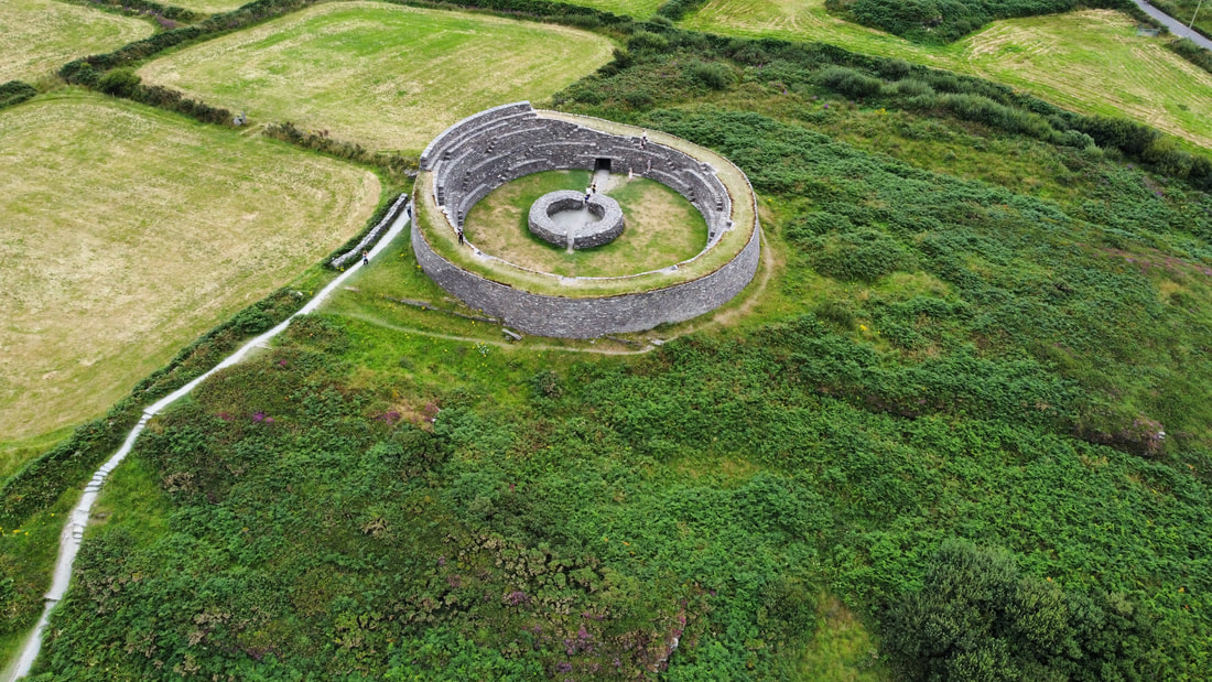
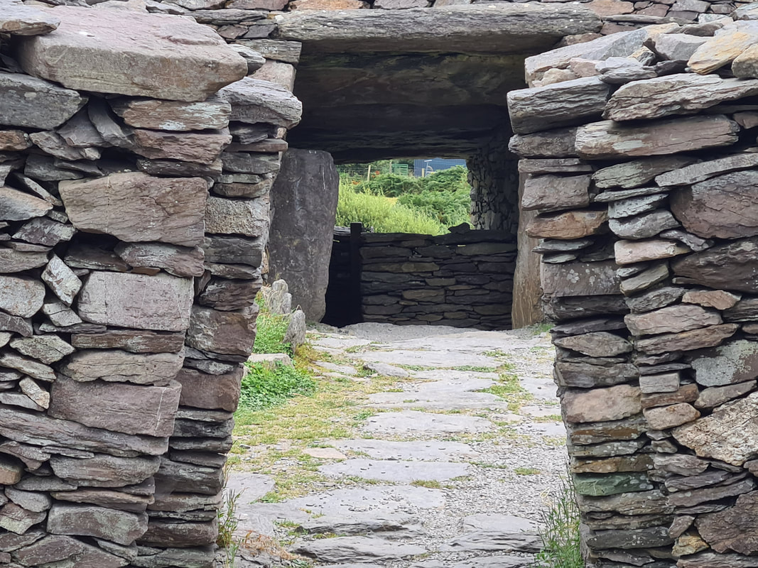
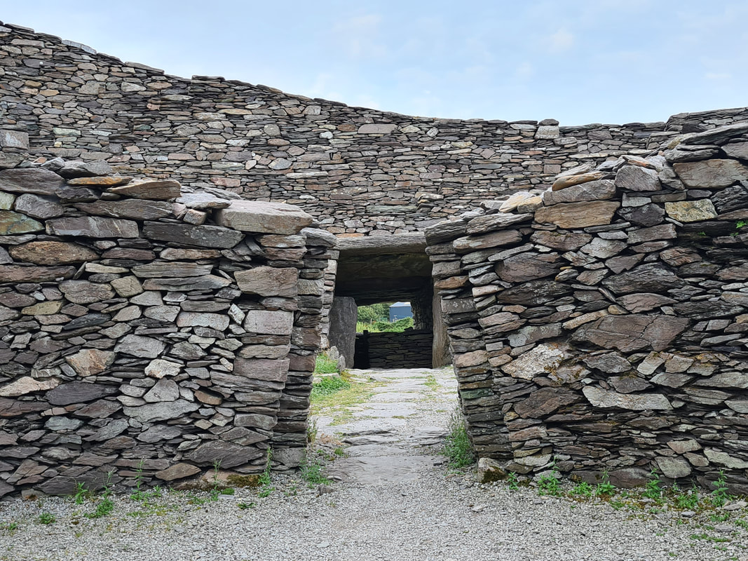
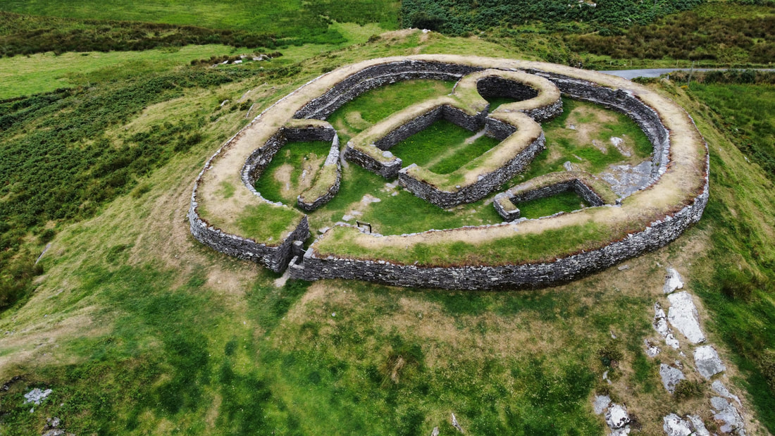
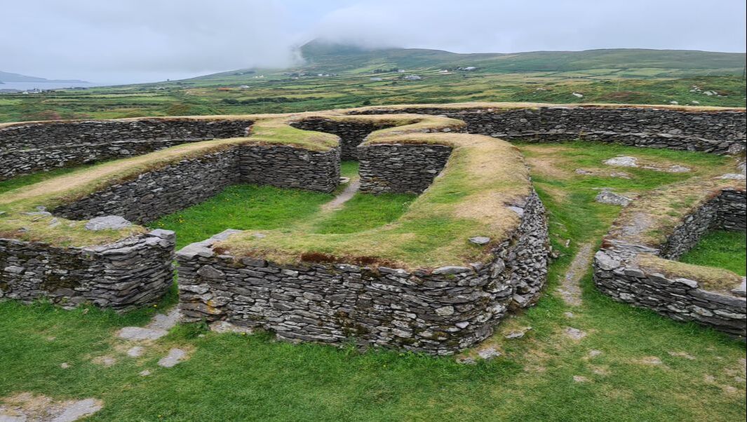
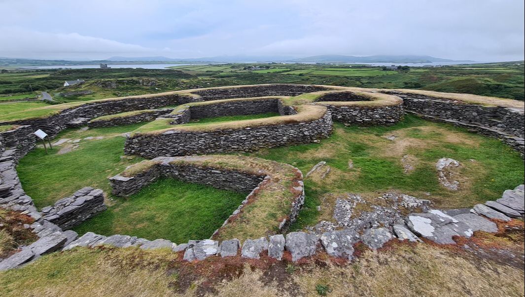
The Leacanabuaile stone fort is a National Monument in County Kerry located a short distance from the pretty village of Cahirciveen.
It is located at short walking distance from the older Cahergal Stone fort and the easiest way to visit both forts is to park your vehicle in the designated car park that is located at short walking distance from both forts. Entrance to both ring forts is free. The Leacanabuaile fort (or cashel) was built around the 9th century as a defended farmstead. It is perched on a rocky outcrop with commanding views of the stunning surrounding area providing the people who lived there with the perfect protection against potential invaders.
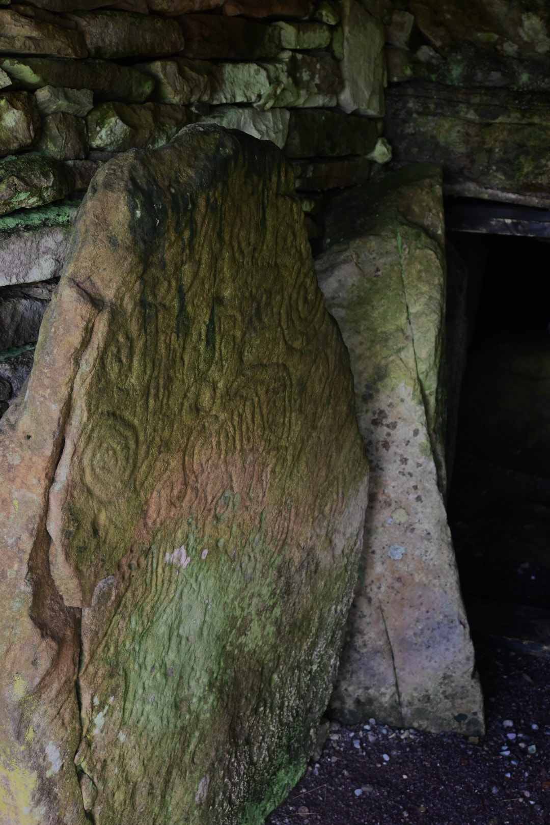
The fort has been extensively excavated and restored showcasing in its interior a rather complete example of how such cashel might have looked during the ninth or tenth Century when it was occupied.
Within the 2.5 meter thick walls are the remains of four houses. The oldest of these houses is a circular hut that is located against the west wall of the fort. During extensive excavations, Iron knives, pins, bone combs and mill-stones were found. Within the protective walls of the fort is also an entrance to a souterrain, a roughly 1 meter tall underground passage following a zigzag path for about 11 meters into a chamber inside the fort's walls. This may have been an escape route to the outside for the occupants when the need existed to make a quick escape.
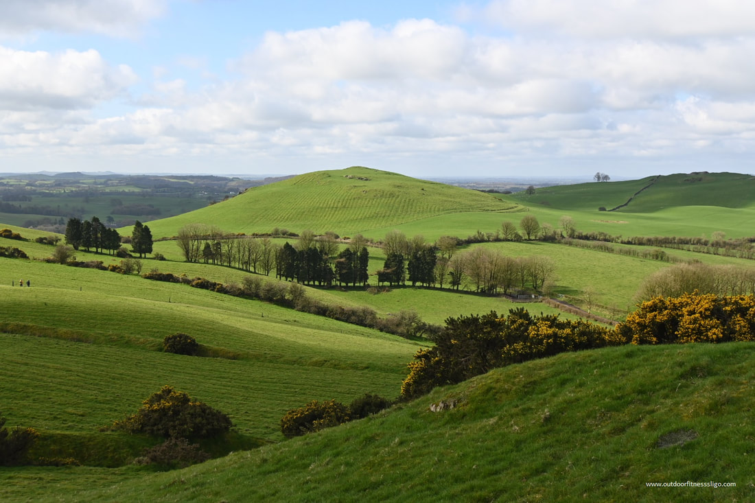
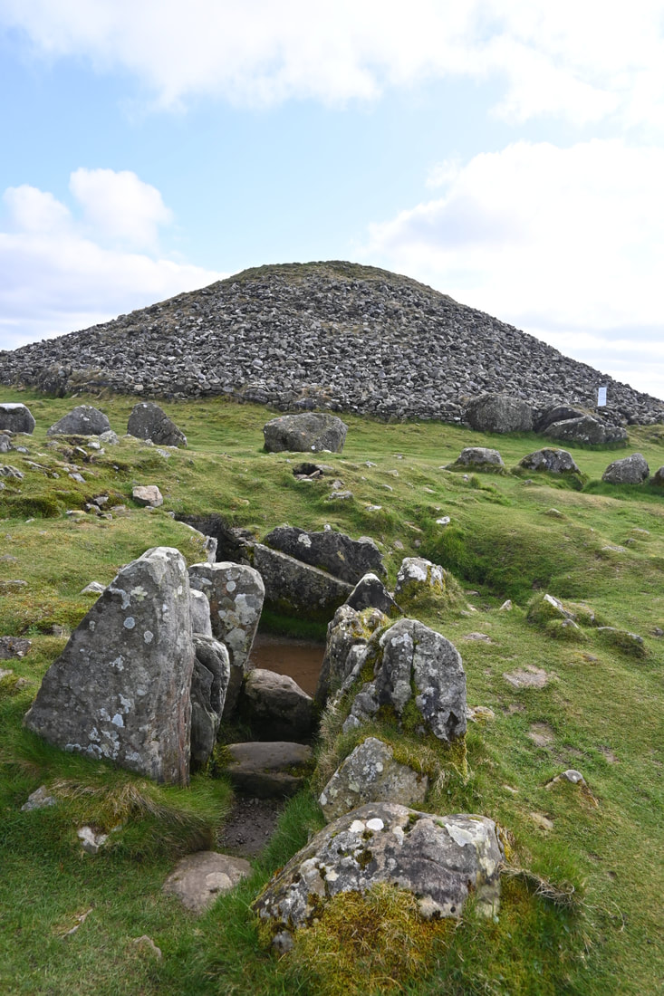
Sited on the highest hilltops in County Meath, the Loughcrew megalithic Cemetery are a group of Neolithic passage tombs near Oldcastle.
These tombs were built by Neolithic societies, Ireland's first farmers around 3000 BC. From the carpark, there is a short but steep climb through fields towards the top of the hill, so suitable footwear is required. Also, wheelchair access is not available. Although lacking a defined path, it is easy to navigate to the cairns as the route is highlighted by markers.
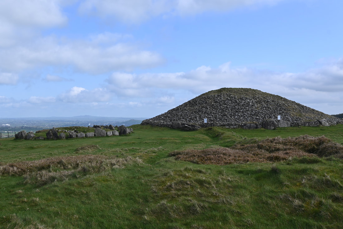
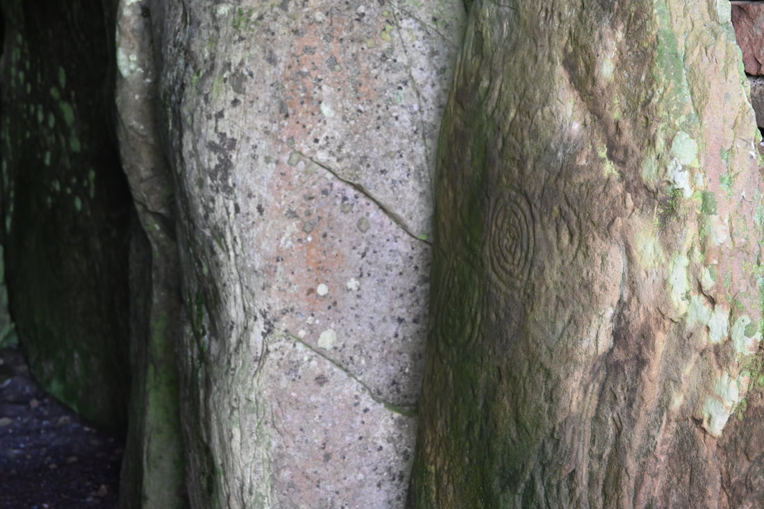
Traces of about 25 tombs survive at Loughcrew with Cairn T one of the largest in the complex. Located on Carnbane East, this cairn is a classic example with a cross-shaped chamber covered by a mound of stones or cairn that is 35m in diameter. On the equinox days ( March 21st and September 21st), sunlight enters the tomb at dawn and illuminates a series of radial line patterns which are carved on varies stones within the tomb. Where the tomb is closed, you can see some of these beautiful decorated stones at the entrance as well.
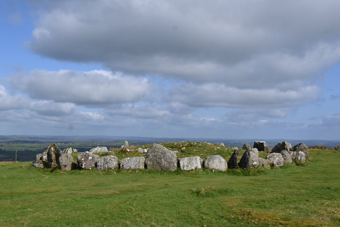
Although these monuments are called tombs, these monuments are unlikely to have been built primeraly for burial, but must have served as a focal point for a tribe as well. On the slopes of Patrickstown is cairn X which includes one of the most accomplished design in passage tomb art, a rayed circle. The views from the hill over County Meath's landscape is just fabulous, especially when you visit the tombs on a sunny day.
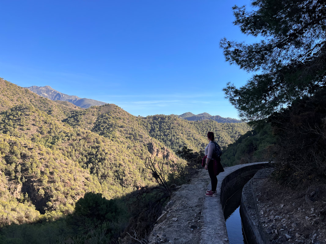
This walk is often referred to as the Caminito del Rey of Frigiliana, although lesser known. It is compared to the much more famous Caminito del Rey nearby Ardales because of its unique water channels that cling to the edge of the cliffs.
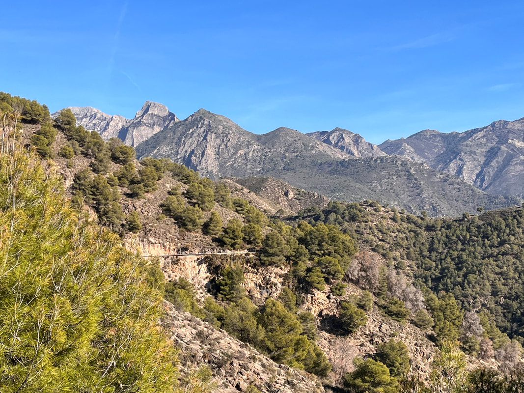
But more about this section of the path later. The first part of the walk is where you have to follow the Higueron river. Nearby the Frigiliana bus stop, take Camino Boticario which brings you down to the river. From here, follow the river bed upstream (although, most of the time there isn't any water at all in the river) while entering the stunning natural park Sierra de Tejeda, Almijara and Alhama. This area is one of the most remote areas of Andalucia, so come well prepared bringing plenty of water and some snacks. Another important rule to keep in mind is to respect nature and don't leave any rubbish behind. The area is a walkers paradise with dozens of signposted walks starting from the villages or the recreational areas. The diverse geology of the area brings with it a huge range of plants and animals, many of them being rare.
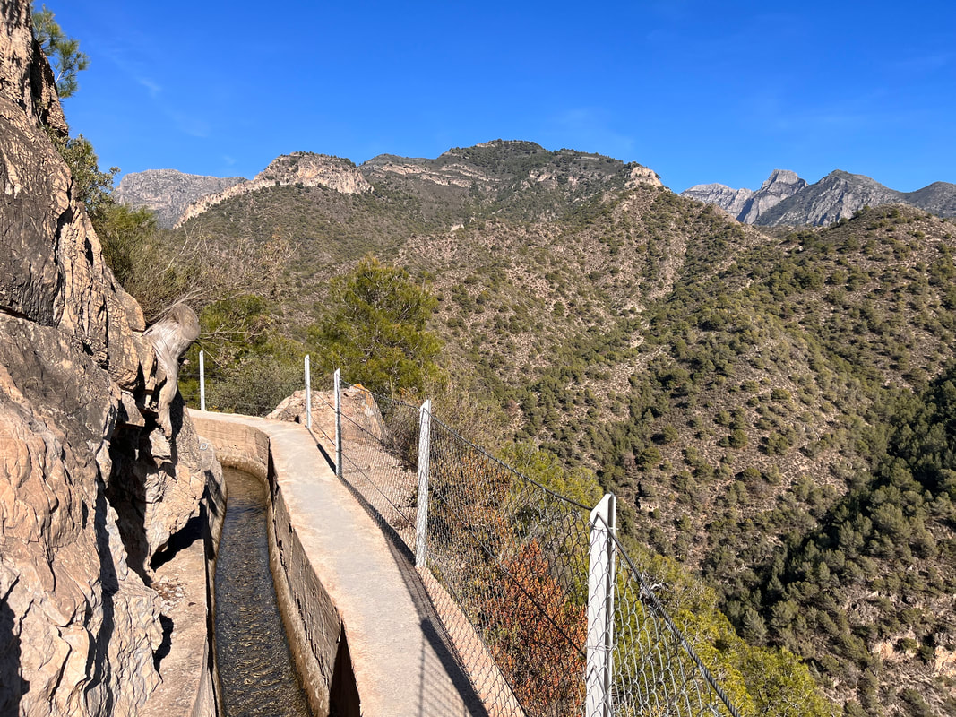
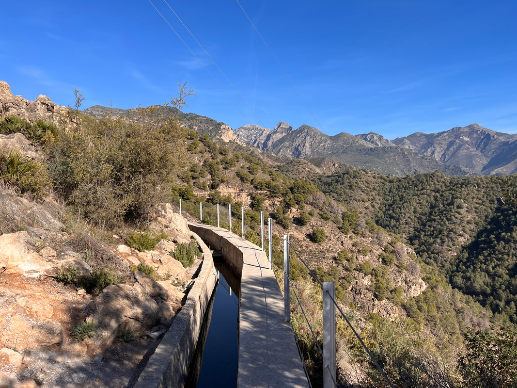
The first part of the walk is easy where you just have to follow the dry river bed until the last kilometer or so where you might have to wade through some parts of the refreshing river, although on the day we done it, we managed to just avoid the bit of water. Climbing out of the valley leaving the river Higueron behind, you climb a short distance until you reach the irrigation canal (Acequia de lizar). this is the most spectacular part of the walk providing you with stunning views towards the natural park it's mountain peaks and as far as the coast.
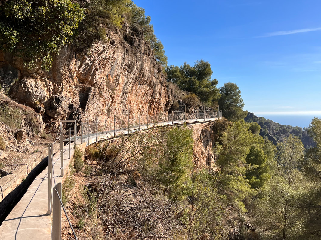
From here onwards, the path is along the edge of the irrigation canal. Care is needed on the first kilometer as there is no safety barrier and misplacing a foot could mean sliding down a steep slope. There are also sections where the concrete of the irrigation canal is broken, but work is being carried out to fix these sections.
Whenever you meet other walkers going into the opposite direction, a bit of juggling is required to pass each other. Then again, as this walk isn't very well known, it is in general very quiet. After a while, safety barriers are placed along the path protecting you from a nasty fall. At this point , they have installed a metal grid over the irrigation canal forming an easy to walk path.
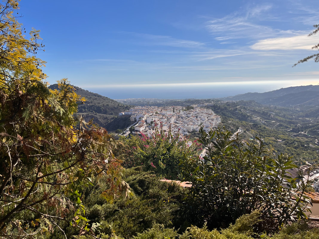
The whole irrigation canal is an engineering marvel where it clings to the edge of steep cliffs, bringing fresh mountain water to Frigliana. reaching the end of the walk, you can admire the views towards the coast and admire the white-washed village of Frigliana below. At the retention basis and a small parking lot, you have 2 options to walk back to the village. the first one is the road that winds itself back into the valley. the better one is to walk to the ruins of the old castle and follow a trail back down to the village where you can enjoy a well deserved meal or drink.
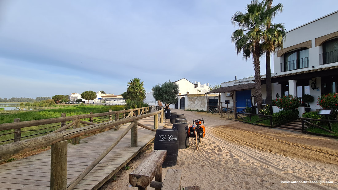
Trying to cycle through El Rocio is not an easy feature. With its dusty sandy roads, a horse would probably have been easier than a fully loaded bicycle.
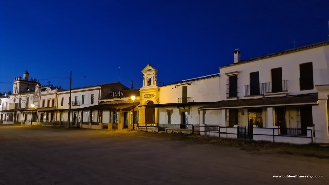
And those horses seem to be the main means of transport. Most of the houses have beautiful verandas and in front of them you will find wooden rails used for tying up horses. El Rocio is located in the south of the province of Huelva and forms the gateway to the Donana National Park. On this particular day in early June, the village had a deserted feel to it with only the odd horse and rider crossing the street. But don't be fooled, where most of the year, the village is quiet, but 50 days after Easter, "Romeria" takes place. During this religious fiesta, a million pilgrims decent upon the village travelling in groups known as religious confraternities. The goal of every pilgrim is to touch the Virgin Mary who is paraded around the huge sandy square for over 12 hours. Many of the pilgrims belong to a particular "brotherhood" of which there are around a 100 in Andalucia, each representing a town or city. Each brotherhood has its own sacred ox cart (Simpecado) that will lead the pilgrims to El Rocio, turning the village in a colourful and noisy fiesta. But on this particular day in early June, it was me on my bike and maybe another 100 villagers.
So what is there to do in El Rocio ?
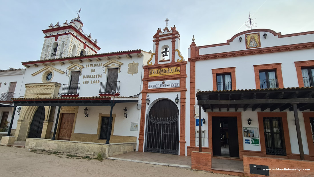
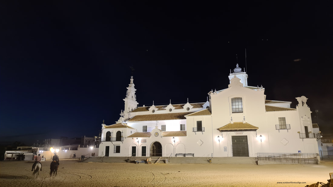
a) Visit the impressive Hermitage of El Rocio, home to the smallcarved wooden statue of the Virgin of El Rocio b) Visit the Donana Natural Park. As Spain's largest wetland area, it is home to thousands of storks, swans and flamingos. The park is also home to the endangered Iberian lynx. From the village promenade, you have brilliant views over the wetlands. As one of Europe's most beautiful and important wetlands, it brings different ecosystems (marshland, lagoons, pine groves, beaches,...) to the many visitors. If you want to venture further into the park, you can book jeep or bus trips that bring you deeper into the park. C) Chozo El Toruno. In Plaza del Acebuche, you find one of the last huts that were entirely built with local plant materials like chestnut,...
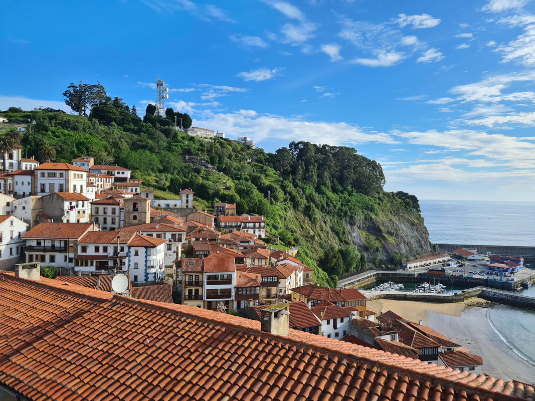
For the night , I stayed at Palacio Donana, a comfortable hotel. Keep in mind that throughout the year, it is easy enough to find accommodation in El Rocio, but during Romeria, beds are booked up months in advance. The smal fishing town of Llastres lies in a stunning setting. Wedged between the mountains and the sea, this Asturian town is considered one of Spain's most beautiful villages.
The towns is build upon a slope and each of Llastres steep streets provides you with stunning views across the sea. And it's the sea that has made Llastres into what it is today, a village famous for its fishing activity. Once a town dedicated to whale fishing, the hustle and bustle of the port is worthwhile to watch. Where the fishermen are preparing their boats or bringing in the catch of the day, once the fish is landed in the port, it will go on sale in a popular auction that happens daily in the fish market. 
And with fresh fish landing every day, it isn't hard to see why Llastres is also famous for its excellent seafood cuisine. With plenty of restaurants and cider bars, you're spoiled for choice.
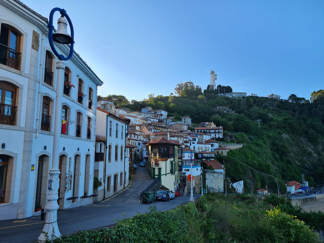
Llastres has a spectacular old quarter with cobbled streets that are lined with simple fishermen's houses, but also palaces and emblazoned houses. There is the old whaler's quarter, the Clock tower and Church of Santa Maria de Sabada. The clock tower (Torre del Reloj) fulfilled the functions of being a watchtower and belfry.
Where the natural beauty of the coastline draws many tourists, it is also known as the "Dinosaur coast". The local geological formation presents a high abundance of dinosaur remains, and many dinosaur footprints can be observed along this coastline.
For the night, I had opted to stay at hotel Lastres Miramar, a 2-star hotel that provided me with a brilliant room and a brilliant dinner and breakfast. A special mention is the stunning terras of the restaurant. Overhanging a cliff, it provides guests with stunning views of the coastline and a relaxing atmosphere to enjoy the delicious food.
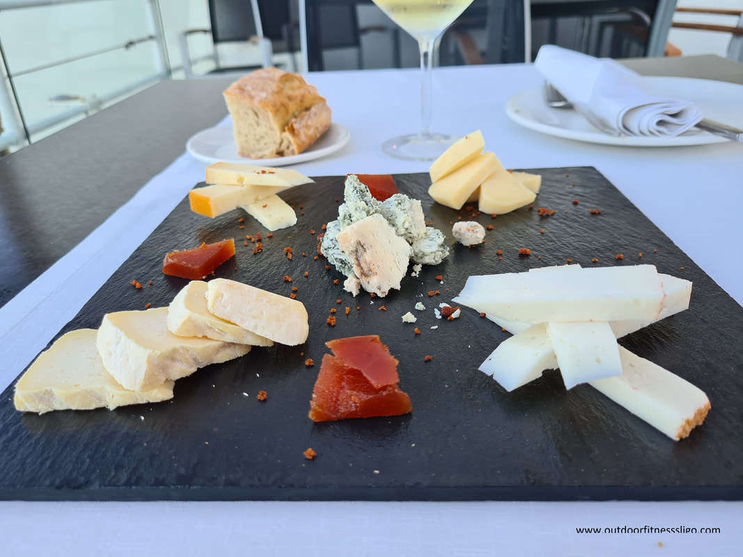
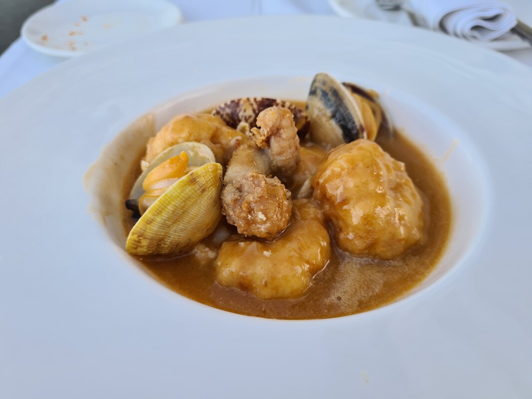
I opted for the cheese table followed by beautiful prepared Merluza. So, if you find yourself in Asturias, I would highly recommend a detour to this beautiful fishing village.
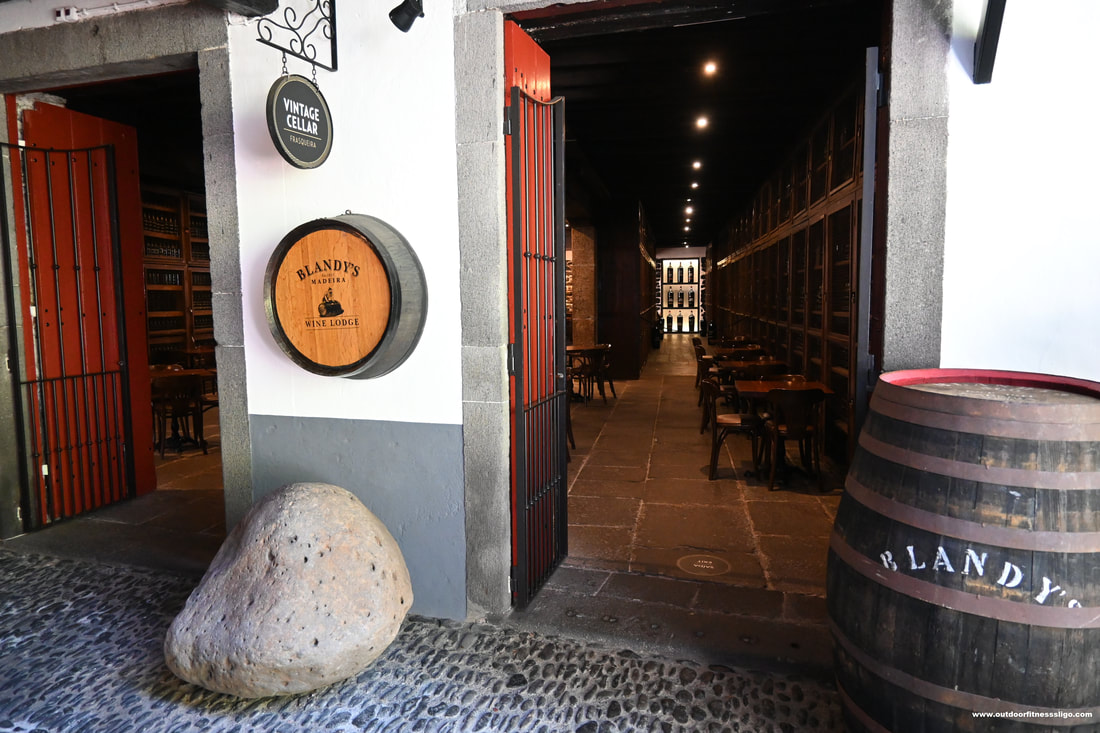
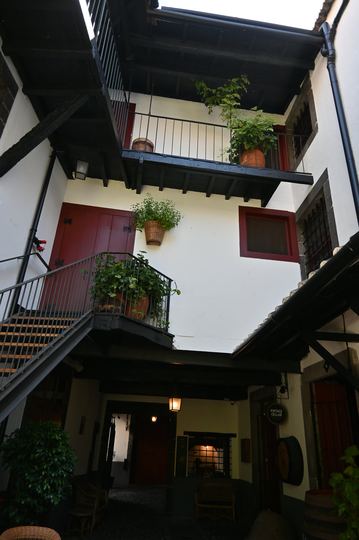
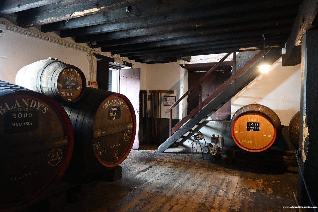
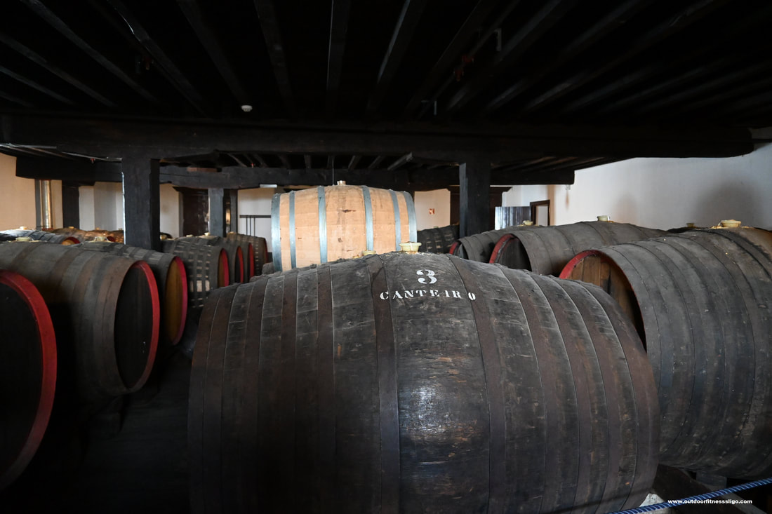
When there is wine tasting to be done, we love to be there. And on this particular day, we found ourselves in Funchal, Madeira. And what better opportunity than learn all about the famous Madeira wine, and off course taste a few during the course of the day. Blandy's wine lodge (www.Blandyswinelodge.com) is located in a historical building in the centre of Funchal. After having purchased our tickets, we proceeded with a guide to the magnificent Canteiro ageing rooms where we admired the old casks filled to the rim with Madeira wine. before we tell you more about the tour, let's first tell a little bit more about Madeira wine. What is Madeira wine? Madeira wine is a fortified wine that is produced in a variety of styles ranging from dry wines which can be consumed on their own as an aperitif to sweet wines that are paired with desserts. The history of Madeira wine. Where Madeira has a long winemaking history, Madeira was a popular port of call during the Age of Exploration. When wine was taken onboard the ships travelling on long sea voyages, neutral grape spirits were added to stop the wine from spoiling. The wine onboard the ships was exposed to excessive heat and movement which transformed the flavour of the wine. this was the start of the wine making process that is still used today, basically oxidizing the wine through heat and ageing.
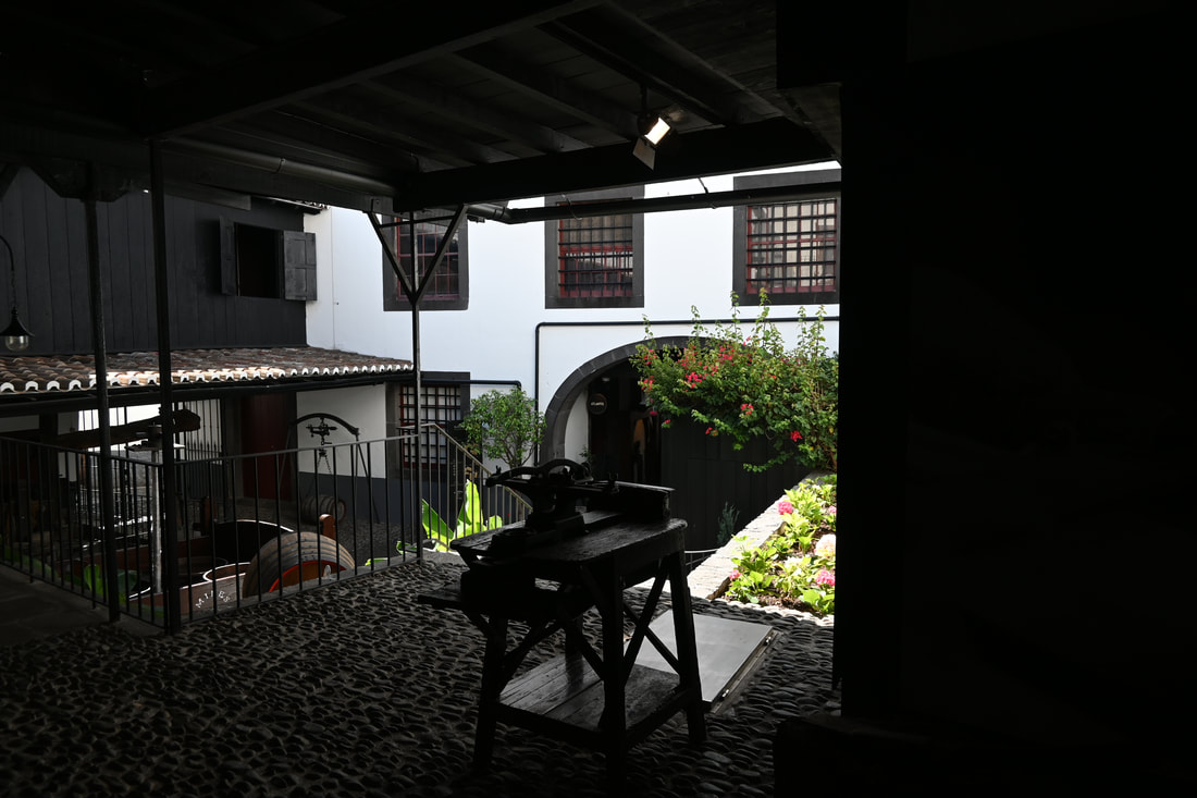
Now that we have dug into the history of Madeira wine, let's talk about the different tours at offer on Blandy's wine lodge. There are 3 tours available, the lodge tour, the premium tour and the vintage tour. Each of the tours brings you to the Cooperage, Canteiro ageing rooms, vine to wine exposition, satinwood vats and tasting. With the premium tour, you also get to visit the Blandy's museum where you can admire unique items from the history of Madeira. The vintage tour will also give you access to the attics of the wine lodge where the wines are aged in the Canteiro system, you also get to admire the huge vats in the Lion's room and you get an exclusive view of the Blandy's family private collection of unique vintage wines. And to round it all off, the tasting on this tour includes one vintage Frasqueira sample.
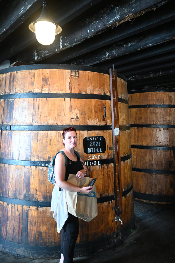
Where the younger blends are produced with artificial methods that heat and accelerate the ageing process, the older blends like Colheitas and Frasquerias are produced using the Canteiro methods. During the tour , we learned about the cooperage where local farmers sell their grapes to Blandy's , discovered the process to turn grapes into Madeira wine and got to admire the different vats and ageing process.
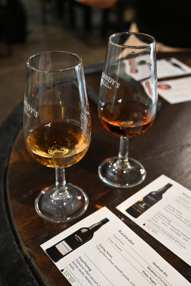
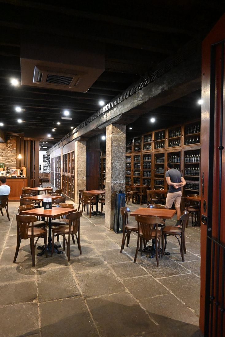
To round it all off, we got to taste 2 different Madeira wines. And we must say, we enjoyed the tasting a lot. Afterwards, we browsed the shop in search for some special Madeira wine. You can look for a bottle of the wine made in the year you were born,.... They also provide a great service allowing you to purchase a bottle at a reduced rate (this is as part of the entrance ticket), then pick up your bottle in the airport terminal when you head back home. Highly recommended tour if you are interested in the history of Madeira wine.
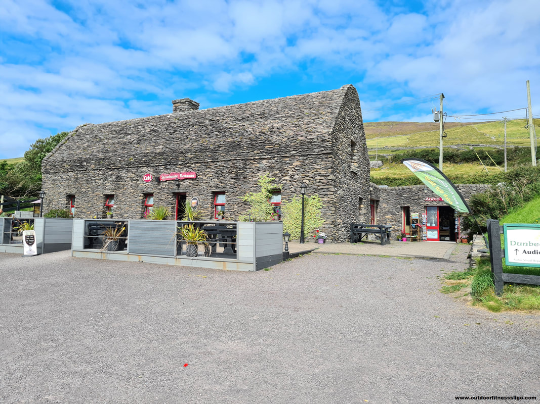
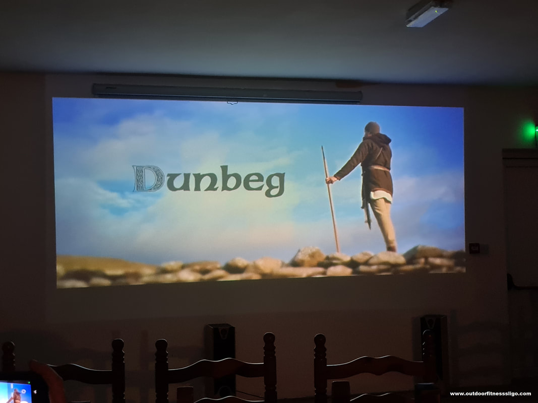
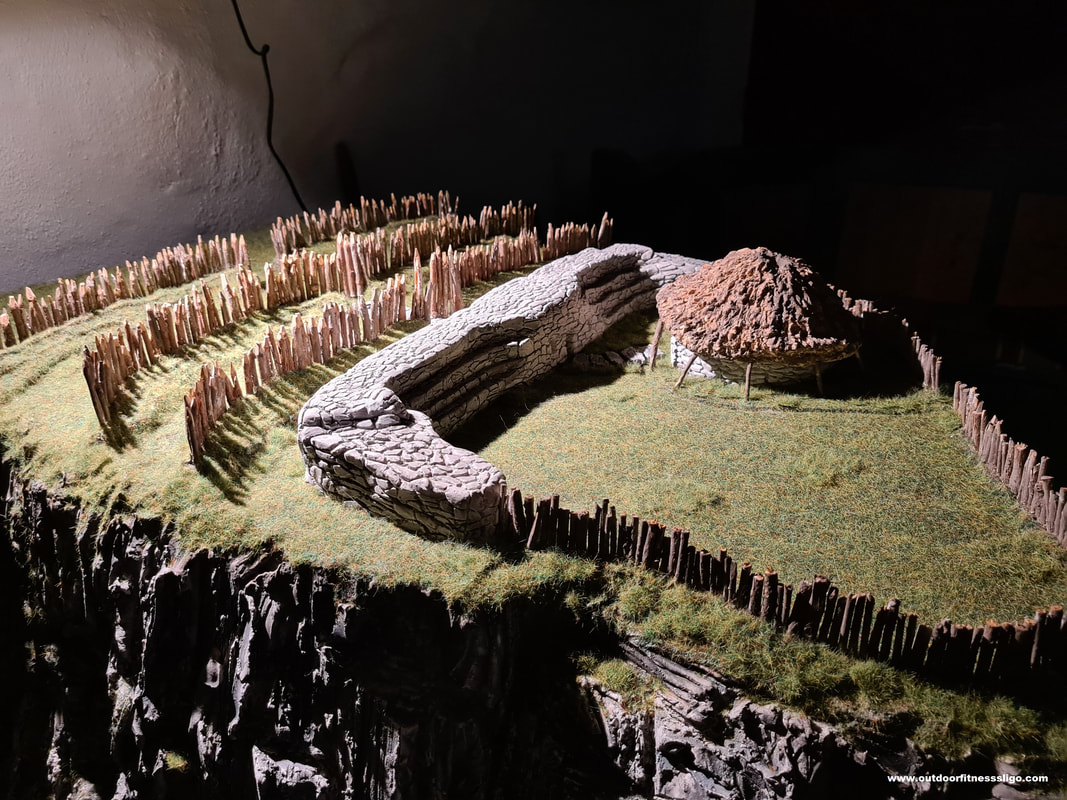
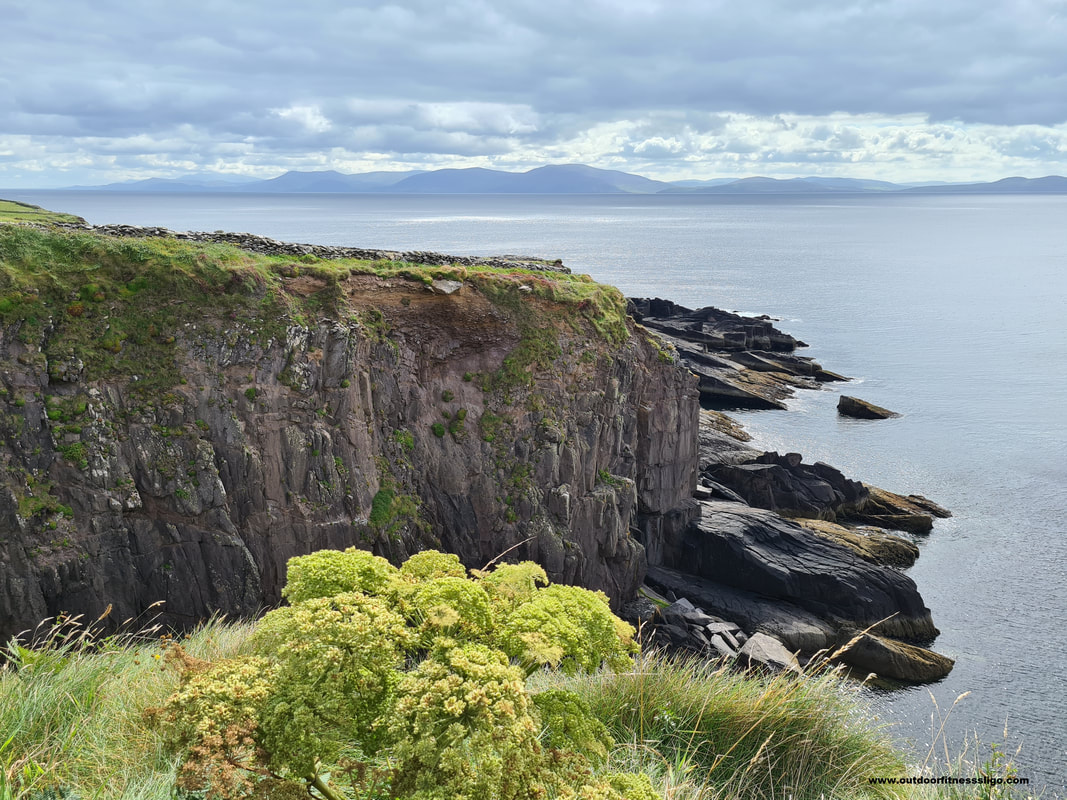
On an sunny day, we decided to visit Dun Beag Fort on the Dingle peninsula. (http://dunbeagfort.com. The fort is dramatically set on a sheer cliff overlooking Dingle Bay. This promontory fort dates to 580BC and is one of the few remaining in Ireland. In County Sligo where we live, we have a few promontory forts (www.choosesligo.com/promontory-forts.html) as well , each of them balancing on the edge of a cliff surrounded by the Atlantic. When we arrived at Dun Beag fort, we bought our tickets at the small ticket office and crossed the street to the tourist shop / restaurant where we first watched a short audio-visual presentation that explained the history of the fort and what life was like for people living on the peninsula during this time. The restaurant / tourist shop deserves a noteworthy mention as well. It has a one-of-a-kind stone roof, blending it into the rugged landscape of the Dingle peninsula.
A short walk towards the coastline brought us to the fort where we admired Dingle Bay. Excavations within the fort have shown that the fort was primarily occupied between the 8th and 11th Centuries AD, when it was defended by a series of ditches and earthen banks. Within those earthen banks was a substantial stone wall with on the inside steps allowing soldiers to defend the fort during an attack. The interior of the fort contains the remains of a large stone-built beehive as well as a souterrain. It is believed that the fort was home to a local noble who ruled the surrounding villages. With the cliff edge slowly falling into the Atlantic due to erosion, the fort is getting closer and closer to the cliff edge. Hence for safety reasons, a large part of the fort can not be entered.
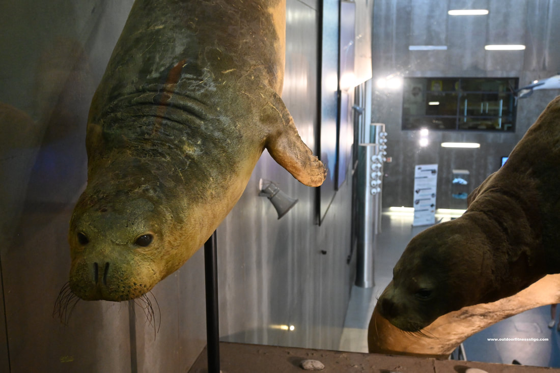
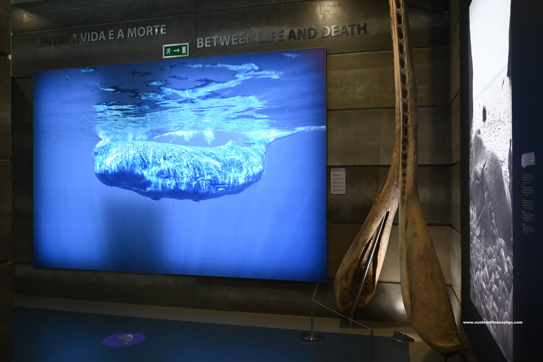
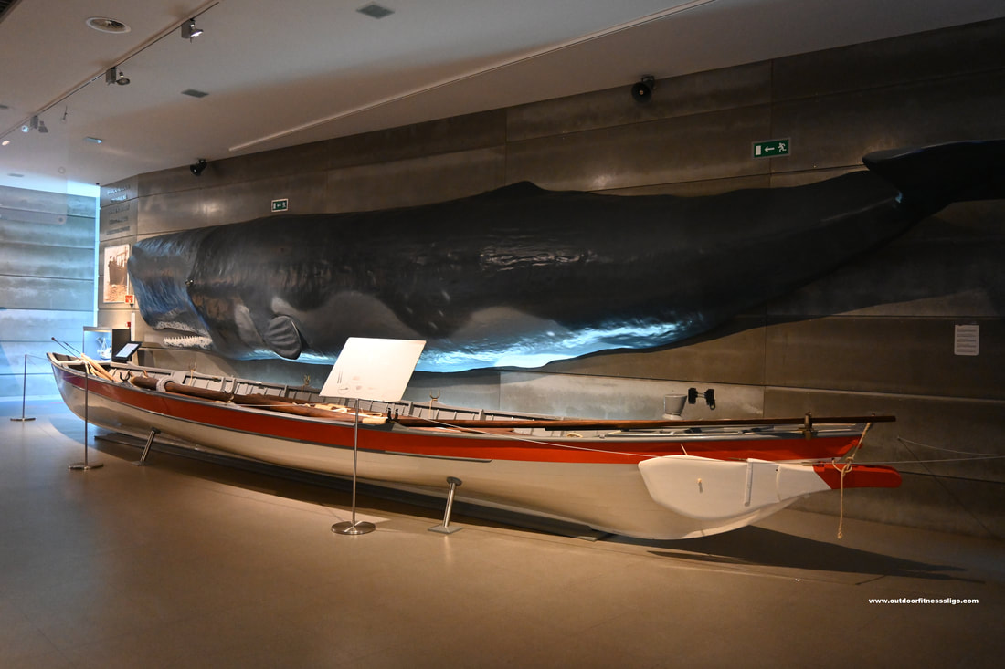
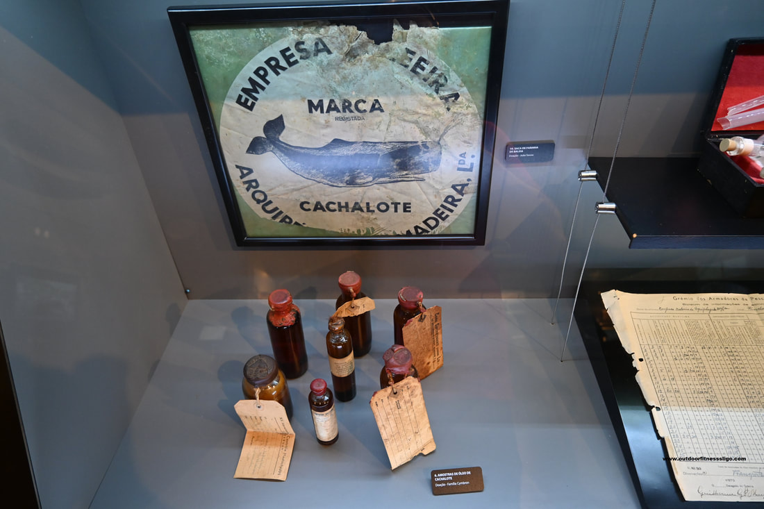
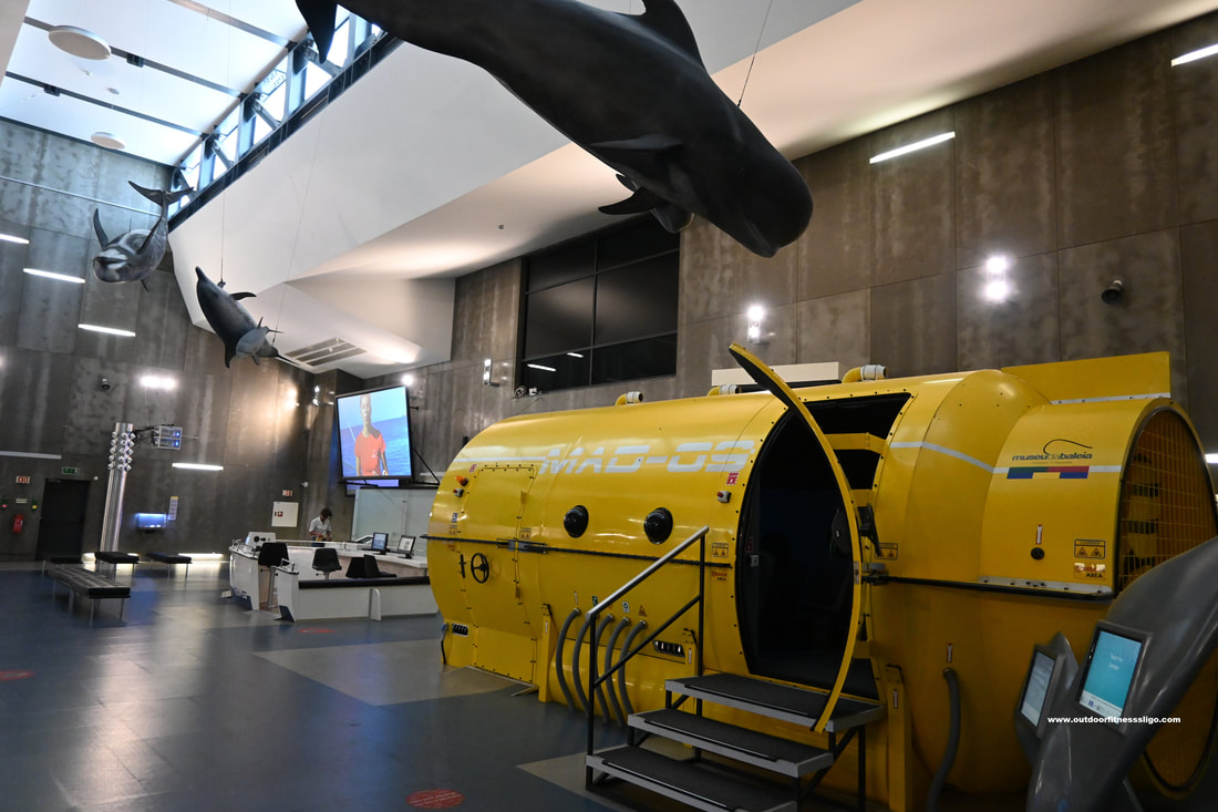
The Museu da Baleia da Madeira (Madeira Whale museum) is located in the village of Caniçal. The village was the former centre of the whaling industry until the ban on whaling in 1981. The museum is located in a modern building on the outskirts of Canical and is home to permanent and temporary exhibitions. At the reception, you receive a headphone set which you wear throughout the exhibition. By selecting your language , you get explanation about each of the exhibits in your own language. The permanent exhibitions occupy over 1000m2 divided into the following 2 rooms: Exhibition 1: The whaling room: In this room, you are transported back to the 1940s where you get to discover the whaling industry of Madeira. The room is divided in different thematic areas ranging from the lookout network to the factory processing the whales to the different hunting techniques. Over the years, the Madeira coastal lookout network was established with the building of lookout posts along the coast of Madeira, in the Desertas Islands and the island of Porto Santo. These lookout posts allowed the full coverage of the seas of this archipelago up to 15 miles allowing them to spot whales in all directions. In the late 1940s, EBAM constructed of a modern factory which industrialized the processing of the whales. The museum has an old film showcasing the entire process, but also explaining the products that were obtained from the whales.
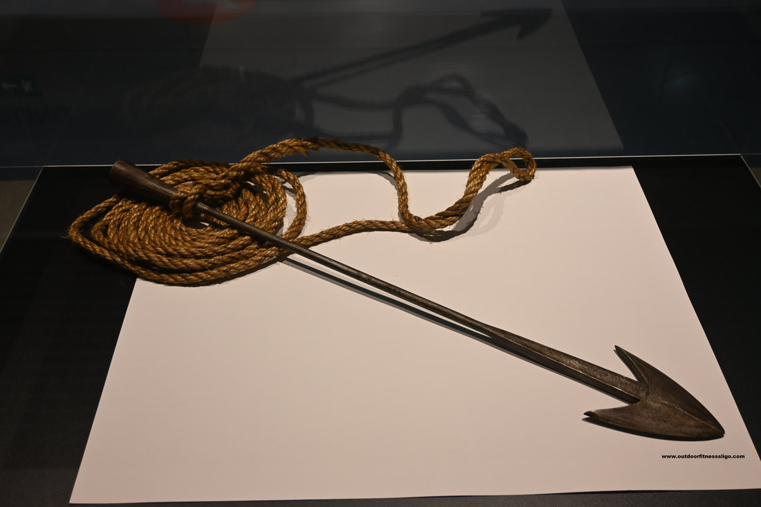
In this room, you find 2 original whaling boats and a mosaic of 84 photographs honorring the whalers It was hard to believe that these giants were hunted with boats often much smaller than the whales themselves. In this room, you also find the harpoon tip used in John Huston's film Moby Dick with some of the scene's filmed in Caniçal with the help from the local whalers. The harpoon tip is the original one used by Gregory peck (Captain Habab) in the confrontation with Moby Dick.
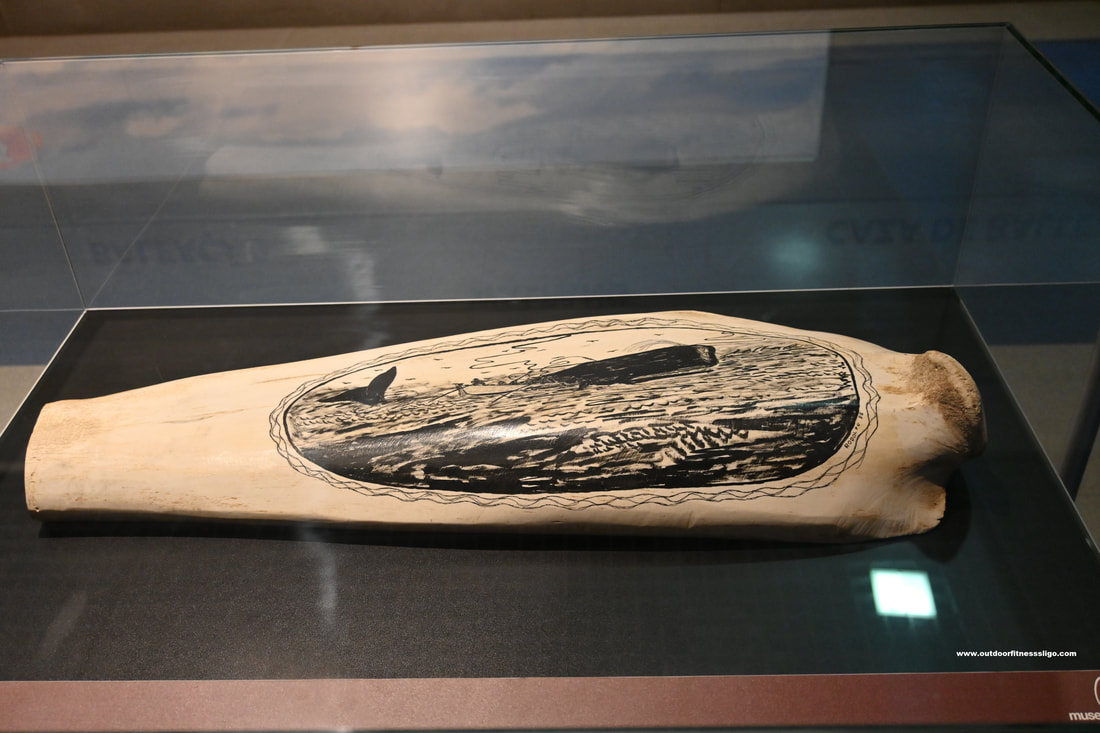
In the museum are also plenty of examples of Scrimshaw. Scrimshaw is scrollwork, engravings, and carvings done in bone or ivory, artwork created by the whalers engraved on the by products of the whales such as bones and cartilage.
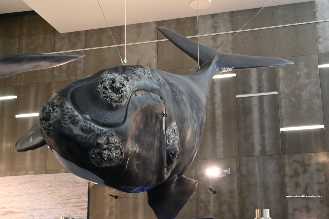
Exhibition 2: Whales around Madeira In this exhibition, you dive into the vast sea and learn all about whales, dolphins and other sea creatures. Among the spectacular full-size models of whales, dolphins,... you can explore several stereoscopic 3D movies. Enter the submarine and dive into the vast ocean, a guaranteed hit with kids. The museum is well thought out and educates visitors on the history of whaling and how it provided a living for many families in Madeira , but it also educates us on the current treats for these majestic creatures.
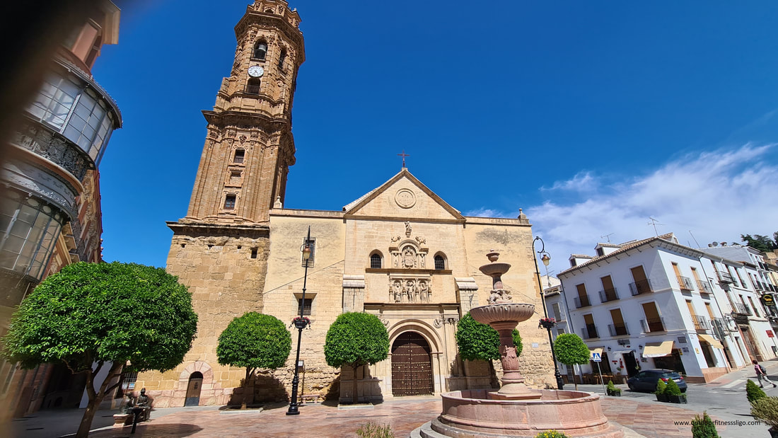
I found myself walking through the streets of Antequera under a scorching sun. It was early May and the temperature already hit 35 degrees Celcius.
The short walk (climb) from Plaza de San Sebastian to the Alcazabar was though going. After having cycled that morning in blistering heat from Ronda to Antequera through the stunning El torcal de Antequera natural park made famous for its unusual limestone rock formations, the first heatwave of the year took its toll. But the uphill struggle was soon forgotten when I cast my eye over beautiful Antequera. Antequera is a town much quieter than the likes of Ronda, Seville, Granada,... still so worth a visit.
The historic monumental wealth can be seen all over the town, from the many churches and convents to the palaces. Then there is the impressive Alcazabar that with its strategic position overlooks the town and provides stunning views all across the area.
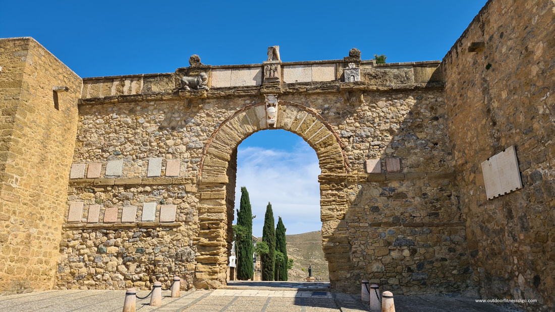
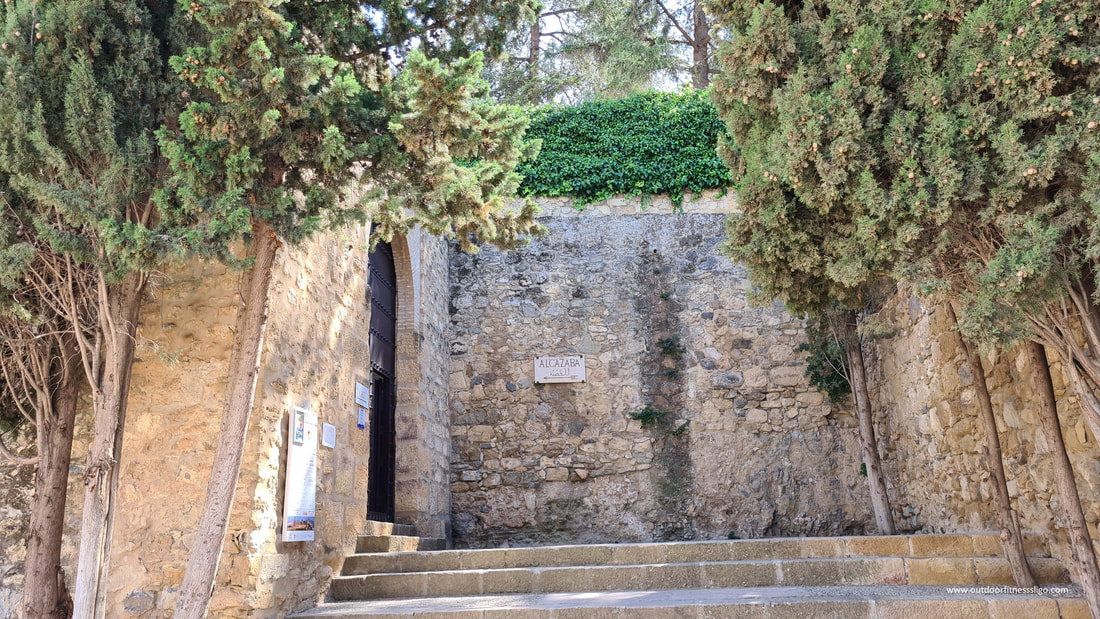
Just outside Arco de los Gigantes, I bought my entrance ticket for the Alcazabar. Here you can also pick up a handheld audio guide in various languages (Options are English, Spanish, French, Italian and German). Guided tours are also available, but I opted for the self-guided tour. Arco de los Gigantes: The Arco de los Gigantes is situated at the entrance to the ancient Arab medina and route to the souk. The outside of the Arch bears the coat of arms of Fernando I, featuring the lion, the castle and stargazer lilies. Entering the Alcazaba is done by entering the Puerta de la Alcazaba, the outermost gate of the complex.
Alcazaba:
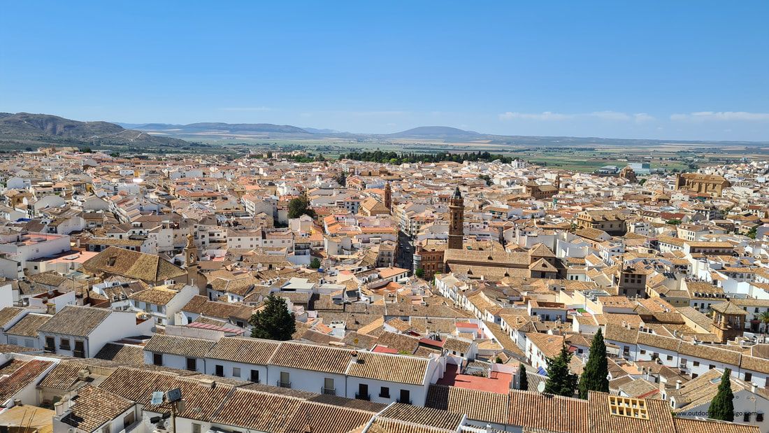
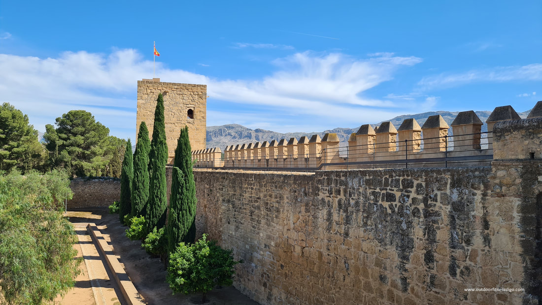
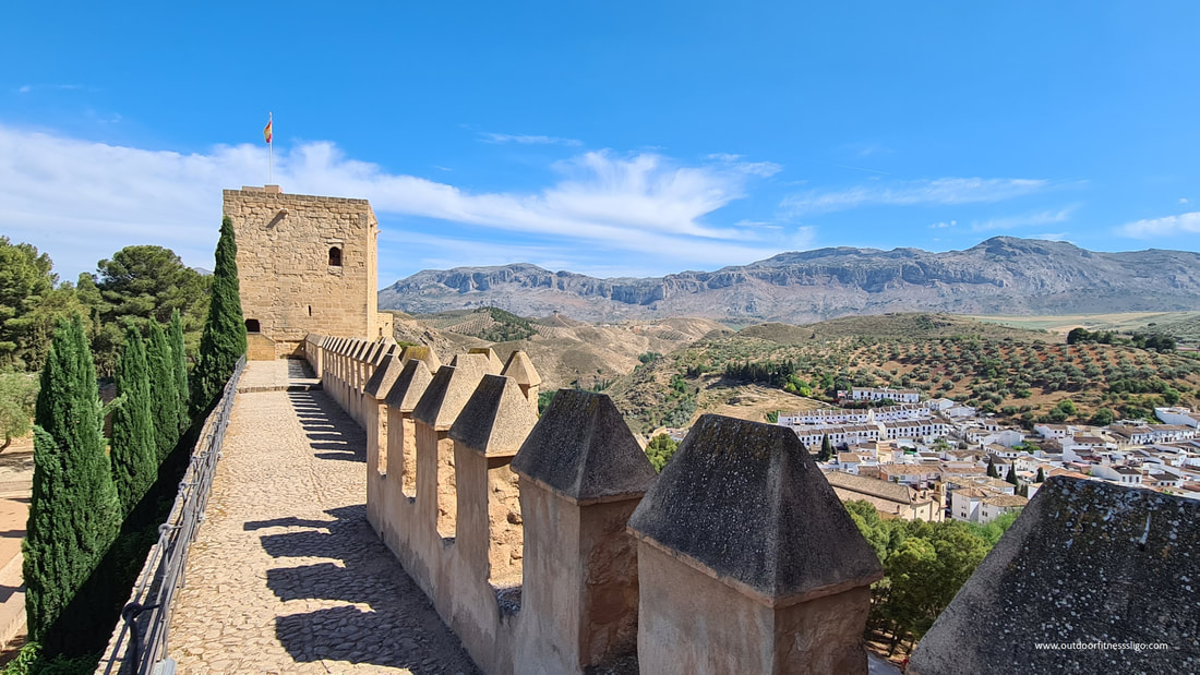
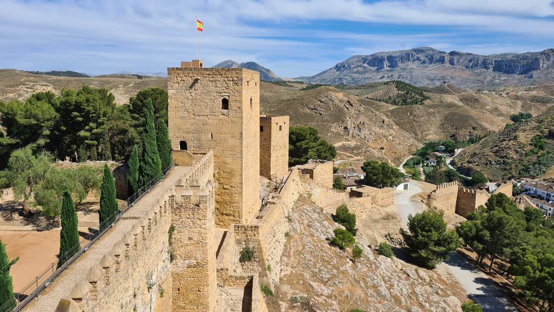
When entering the Alcazaba, you will get a feel for the cheer size of the Moorish Fortress. The fortress covers an area of 62000 sqm and was originally part of a Roman Citadel. Throughout its 8000 years, it has been an important fortress and cultural centre. Around the Alcazaba, you can see several Roman ruins that are still being investigated, the first being Roman baths that date back to the 3rd Century AD and tombs. In the 11th century, Antequera became an important Caliphate. By the 14th Century, Christian advances from the North had reduced Al-Andalus considerably with the likes of Antequera, Ronda and Almeria defending their borders . During this era, the Alcazaba was built to counter the Christian advances from the North.
The Patio de Armas isthe central square that was originally used as barracks for troops. this central square provides you with access to the different parts of the fortress.
a) Torre del Homenaje: the keep, also known as the five-cornered square because it is L-shaped, is considered to be one of the highest towers in Al-Andalus. It was here that prince Don Fernando commemorated taking Antequera. b) Templete y Chapitel: Built by the Christians, the pyramidal spire crowns the Muslim tower and houses the original bell and clock. By climbing up this tower, you will be rewarded with stunning views across Antequera and towards the Pena de los Enamorados (Rock of the lovers). The rock's profile resembles a human face and has been the subject of local legends. c) Torre Blanca: the white tower dates back to the Nazarid dynasty. The lower floor of this building was used for defense while the living quarters were above this floor. d) Mezquita y Aljibe: The ruins of the mosque and the water tank are in the central square e) Torre del Quiebro: The tower was demolished in 1510 by order of the governor of the fortress and was recently rebuilt.
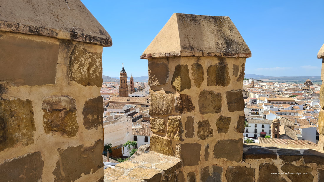
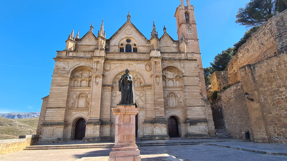
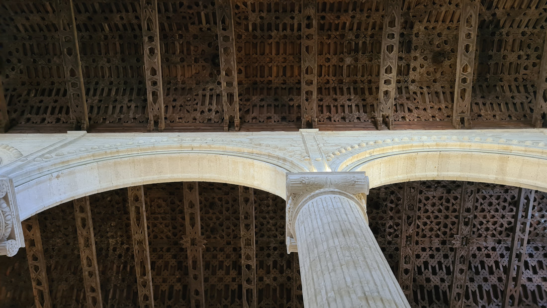
After an educational visit, I exited the Alcazaba and made my way over towards the Colegiate de Santa Maria la Mayor. Admission to this stunning building is included in the price
Collegiate de Santa Maria la Mayor The Royal Collegiate church is divided into three naves by the use of huge columns. The beautiful Coffered Mudejar ceiling is just a piece of artwork as is the Tabernacle chapel.
Cerdo IbericoWhere I ran out of time, I didn't get the chance to visit the Antequera Dolmen Site. This complex contains three megalithic monuments: the Menga and Viera dolmens and the Tholos of the Romeral. The Mena dolmen is about 6000 years old. These importance of these three Dolmen along with El Torcal and La Pena de los Enamorados natural formations made it declared a UNESCO World Heritage Site in 2016 due to its status as one of the most notable prehistoric archaeological sites in Europe
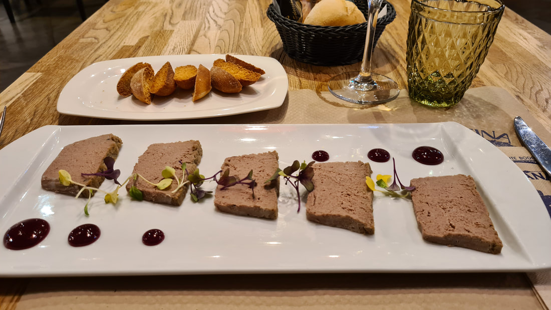
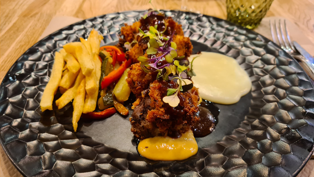
After my educational afternoon, I wanted to treat myself to a great meal. Antequera has a huge selection of restaurants and bars, and on this particular evening I opted for Abrasador Bodegas Triana. And after a day in the saddle, I was hungry. So on my own, I managed to finish a plate of pate, home made croquetas followed by Cerdo iberico. This restaurant showed me again how great Spanish Cuisine and restaurants are. Two girls managed to serve about 40 tables efficiently providing them with drinks and food all while the restaurant was fully booked... and this on an ordinary weekday. And with the high quality of the food matched with very reasonable pricing , it isn't hard to see why. Antequera is a great town to spend a few days visiting the many tourist sites and sampling the great food in the many restaurants.
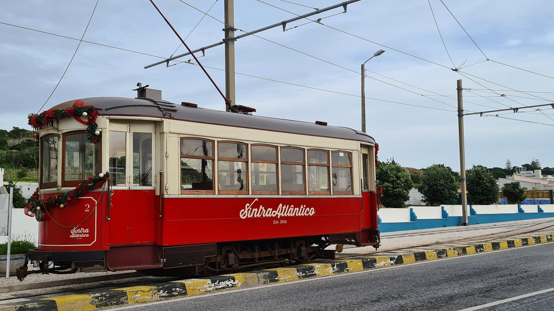
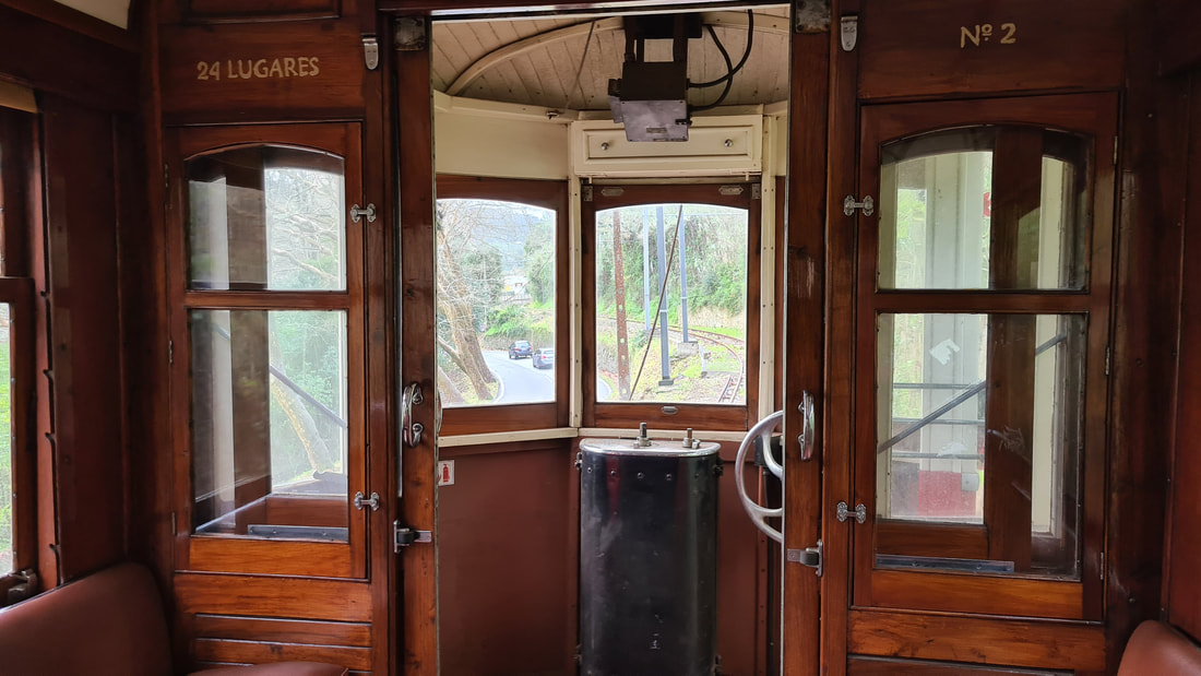
Getting to Sintra is easy, but once you reach the outskirts of Sintra, it is a bit of a disaster traffic wise. Traffic jams are a daily occurance, mainly because of its popularity with tourists. A better way to travel to Sintra is by the Sintra Atlantico tram which travels between Praia de Macas and Sintra.
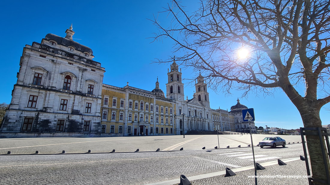
Where the historic tram line commenced operation in 1904, the tram that nowadays operate on the line dates from the 1930s. inside the tram are all the original features, from the wooden benches to the brass dials, it is a super fun experience to travel on the tram. it's slow, it's bumpy and noisy, but climbing slowly towards Sintra from the coast, the entire 13km journey takes about 40 minutes passing through the rural area of Colares. Colares is an interesting area for winelovers. The area is famous for its sandy, phylloxera-free soils and ungrafted vines as the amazing tannic red wine it produces from the area's Ramisco grape. We took the tram during Christmas and were lucky enough to have the entire tram to ourselves with exception of the 2 drivers who juggle around sticks and pedals to bring the tram to a safe halt around the corner from the MUSA museum. It's a hassle free way of traveling to Sintra without having to find a parking spot in the busy tourism town. For more information, visit the following website: https://sintratlantico-casadoelectrico.weebly.com/ The National Palace of Mafra was proclaimed a Unesco world Heritage site in 2019, and when we visited the palace on a sunny day in January, it wasn't hard to see why.
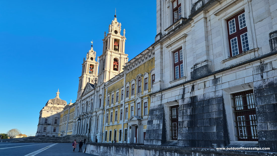
With its imposing facade of approximately 220 meters in length, it's just monumental. In the middle is the church, built out of white marble which is symmetrically flanked on both sides by the palace. Where the wealthy king wanted to rival the splendour of Rome, he wanted a building that matched the grandeur of some of the buildings in the Vatican. The 2 towers of the church have a total of 92 church bells that were made in Antwerp, and story goes that the order was that huge that the bell-founders wanted to be paid in advance which the king did, but not only that, he doubled the amount he promised them to pay.
The spacious royal apartments are located on the second floor. Where the king was located on one end of the building, his queen was on the other side of the building. The galleries connecting the living quarters of the king and queen are 232 meters in length making them the largest palatial corridors in Europe.
Walking these galleries nowadays, it is just difficult to grasp how long it must have taken to built this huge palace. Construction started actually in 1717 and went on until 1755 and it is said that the construction nearly bankrupted the entire country. The royal convent and Palace of Mafra is the most important Baroque monument in Portugal. The building covers an area of almost 37790m2 (4 hectares) , including 1200 rooms, more than 4700 doors and windows, 156 stairways and 29 inner yards.
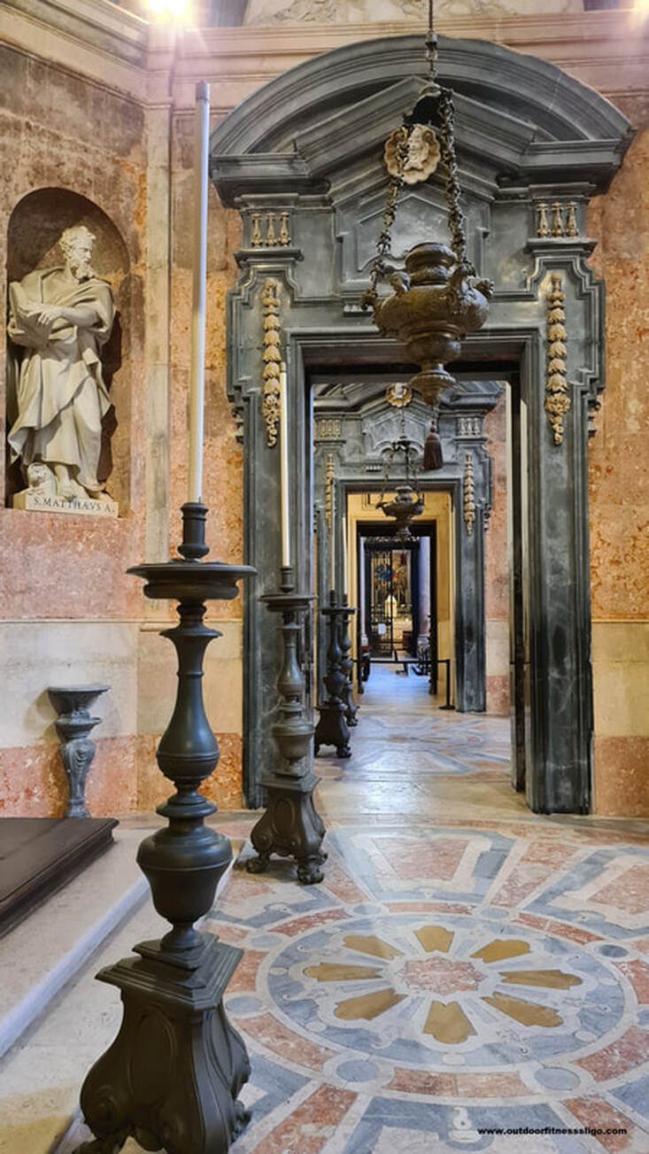
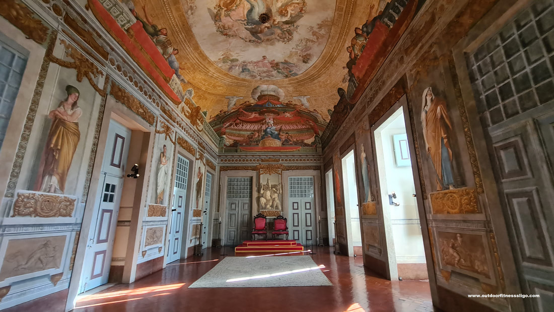
Many paintings and murals by some of Portugal's finest artists are on display around the palace. The throne room, the Guard room and the room of Goddess Diana are decorated with fabulous murals.
Another special room is the hunting trophy room where you find chandeliers made out of antlers, chairs covered in deerskin,...
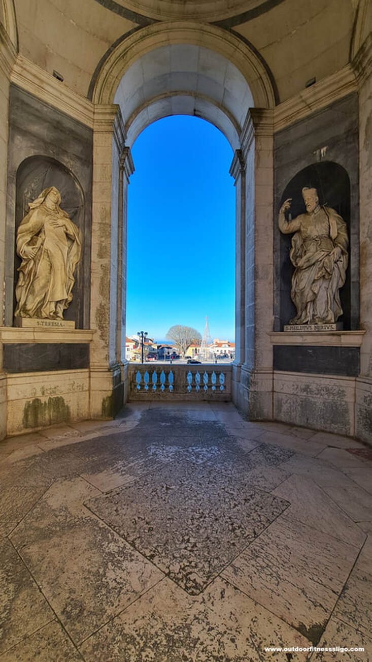
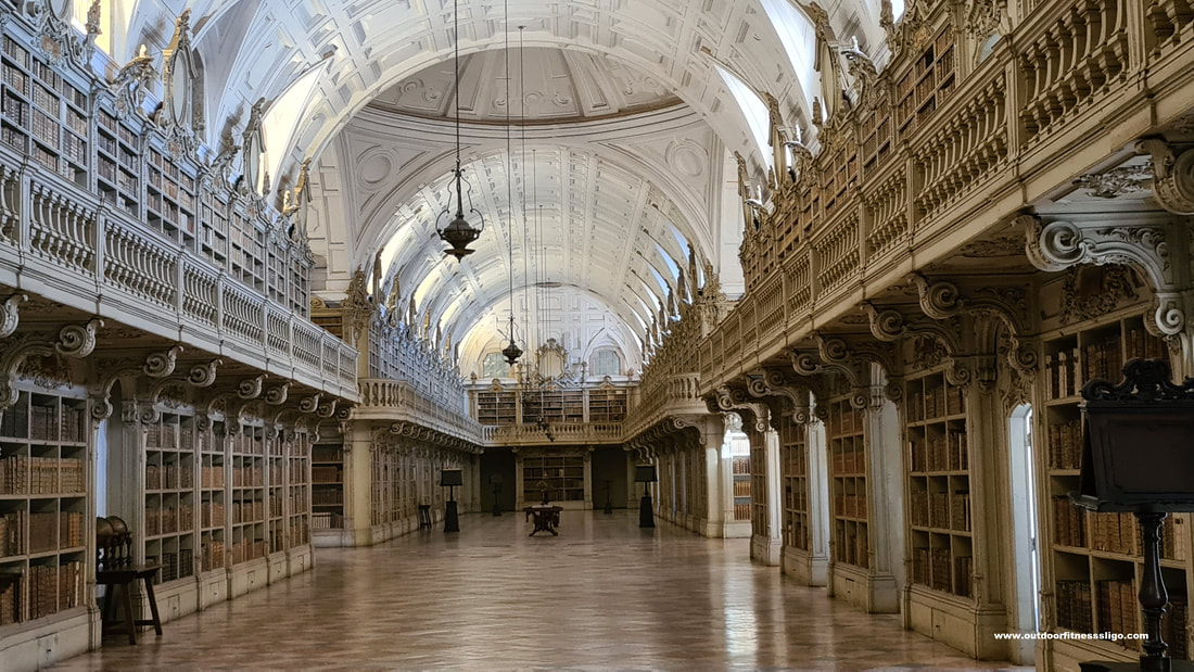
The highlight of this magnificent palace is the Rococo library which is located on the 2nd floor. The grandeur of this library is difficult to describe.
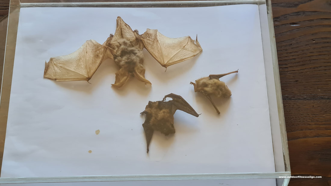
The library is huge, to be exact 88 meters king with the entire floor covered with rose, grey and white marble tiles. The wooden bookshelves are situated on the sidewalls containg over 36,000 leather-bound volumes. Among them are many valuable bibliographical jewels, all of them protected by homing bats. Yes, you hear that correctly, the library has a bat colony which protect the books from insect damage. The library was used in Gulliver's Travels as the great chamber of war for the Emperor of Lilliput.
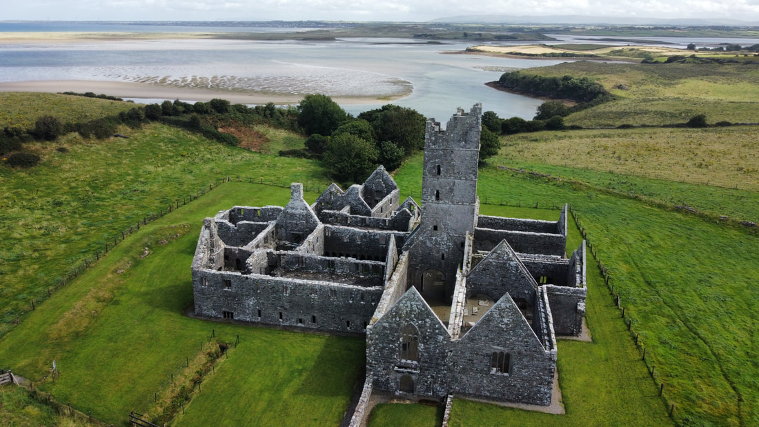
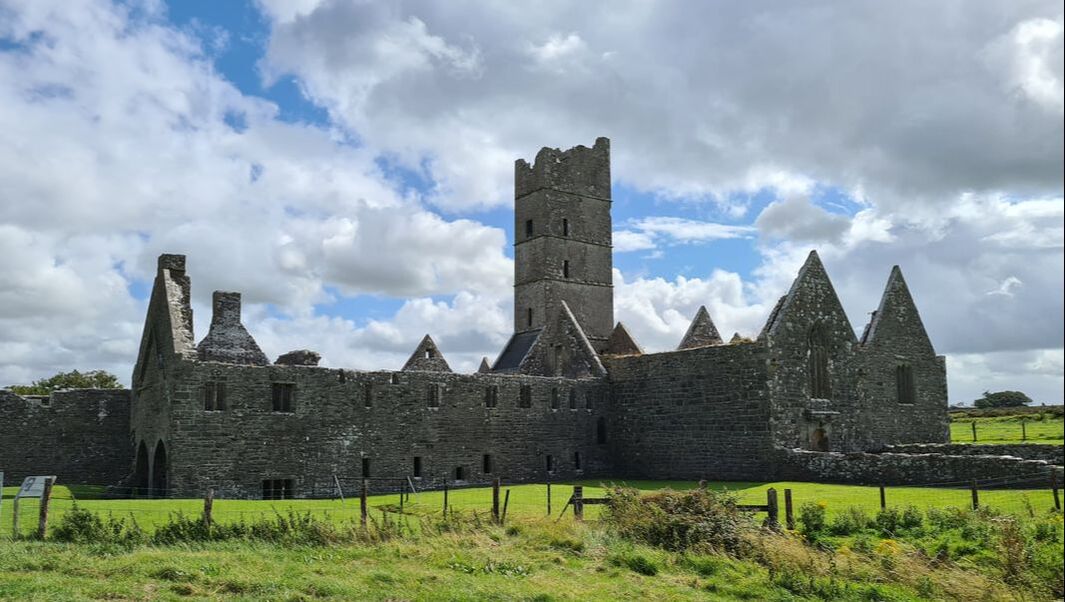
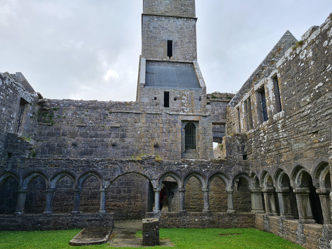
On a sunny day in August, we found ourselves driving along the Moy estuary in County Mayo. Our plan was to visit the stunning Franciscan Friary of Moyne that is located not to far away from the small town of Killala and close by another magnificent Friary called Rosserk Friary (https://www.outdoorfitnesssligo.com/blog/rosserk-friary-county-mayo ).
When visiting the Friary, be mindful that it is located on private land. This means you have to cross some fields where cattle might graze, so it is important to close gates,....
The Friary was founded by Mac William de Burgo in 1460 and despite its turbulent history, it kept its community of friars until the end of the 18th Century.
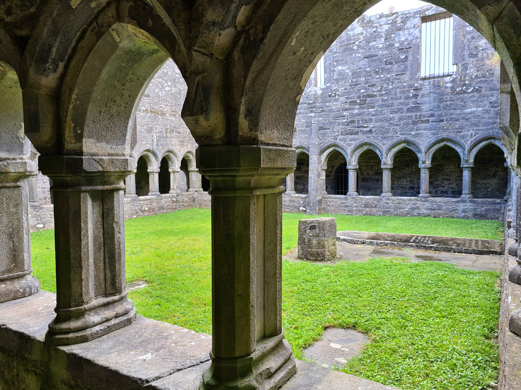
The enclosed cloister walkways where the friars prayed, meditated and did some monastic work, are among the finest in Ireland. The church, with its elegant bell tower, stands tall on the south side of the cloister. On the opposite site is the kitchen and refectory (dining hall) with a pulpitum (a recess where a friar stood and read aloud to his community as they were eating). On the east side of the cloister is the sacristy and the chapter house where the community met to discuss business and to read the daily chapter of the order's rule. Above the chapter house is the dormitory.
|
�
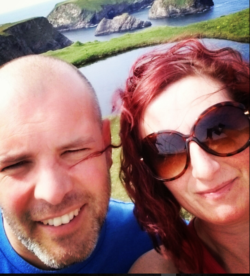
About the AuthorWe are Peter & Dolores De Bie. We love the great outdoors, discovering new parts of the world and writing about our adventures along the Wild Atlantic Way and further afield Categories
All
|
 RSS Feed