|
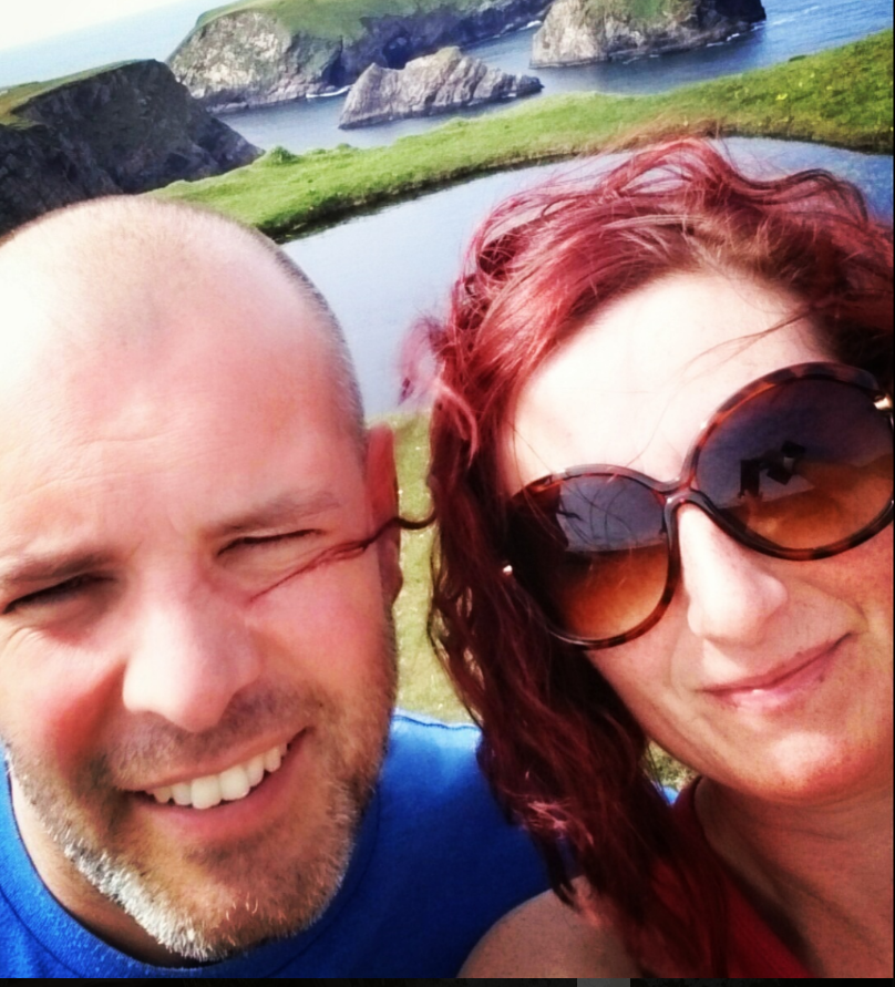
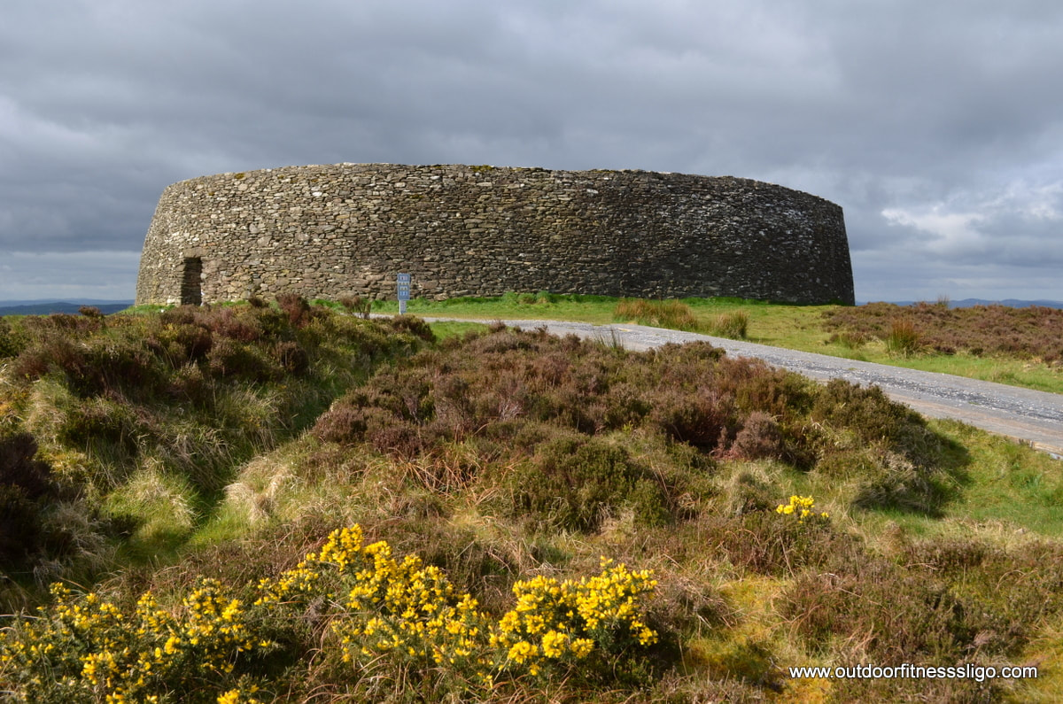
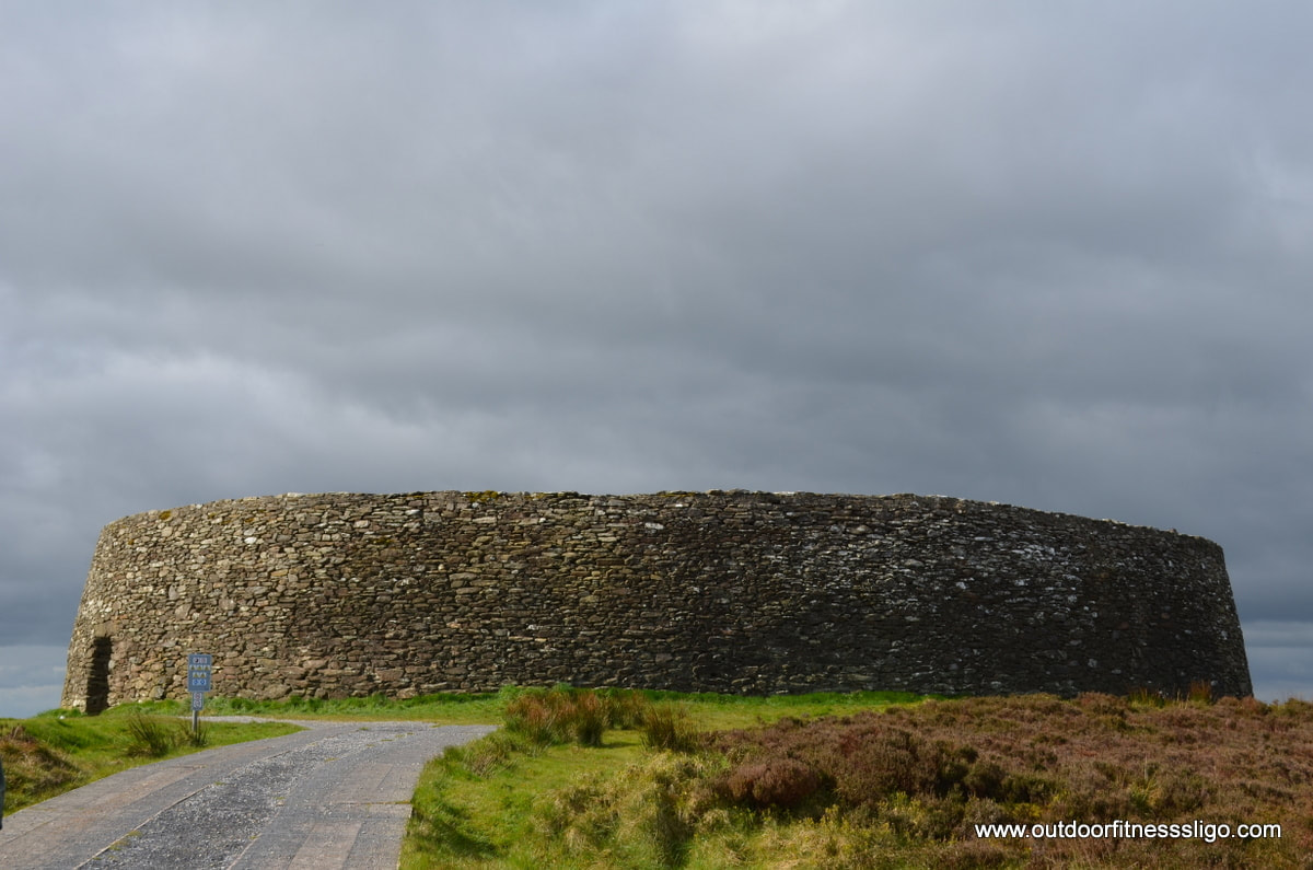
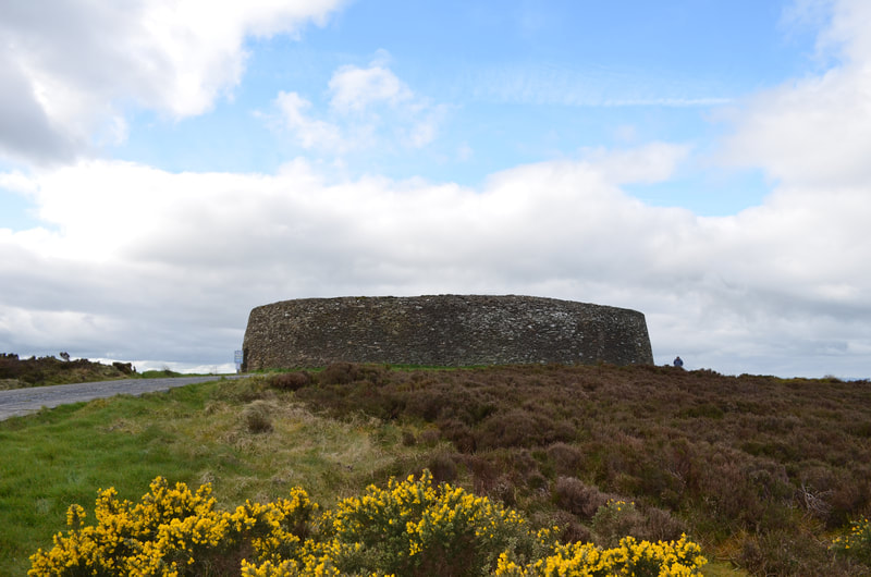
It was meant to be a dry day in April, so we decided to do a day trip to Inishowen. The plan was to drive up from co.Sligo in the morning and drive the Inishowen 100, a sign-posted drive bringing you to all the scenic locations along the peninsula of Inishowen. We had reached out to our twitter followers the day before and received a lot of recommendations of things to see and do. We were also warned that trying to do everything in a day would be a push, but more about that later. After a quick enough drive towards Letterkenny, we headed towards Grianan of Aileach, a hilltop stone ringfort which demands amazing views towards the Inishowen peninsula.
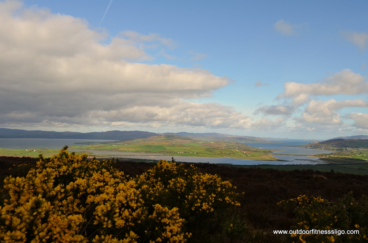
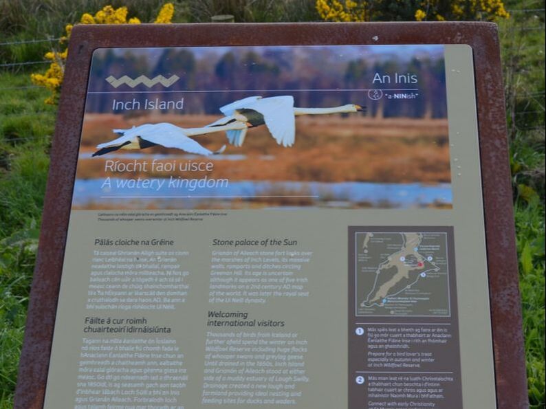
After an informative break, we headed further along our route with next stop Inch Island. Inch Island is a wildfowl sanctuary popular with hibernating swans and geese who arrive from Iceland to enjoy the much milder climate of Donegal.
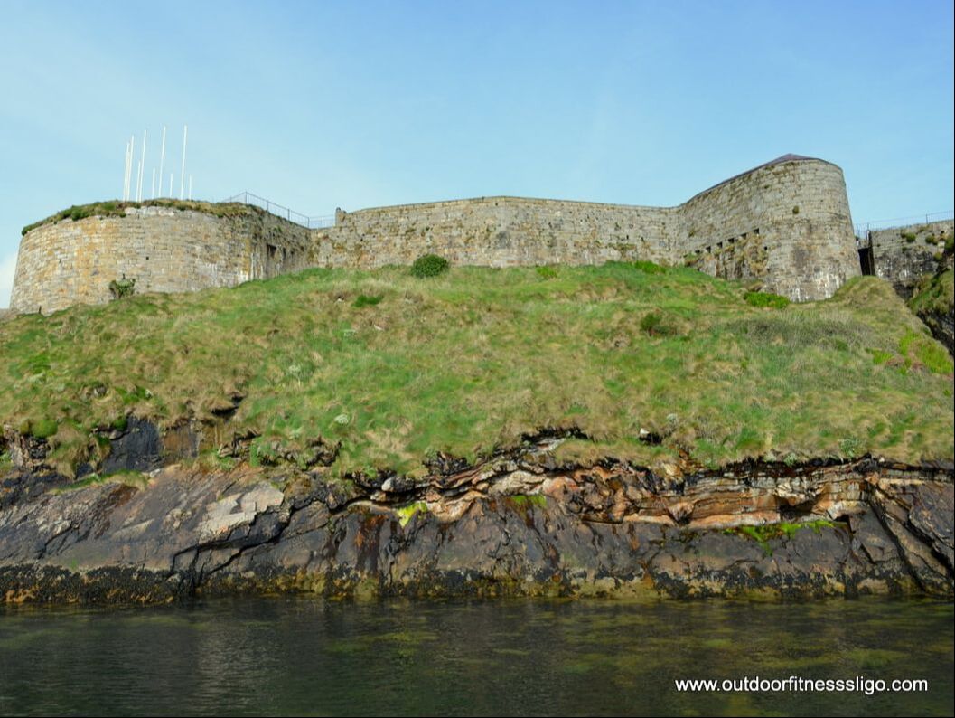
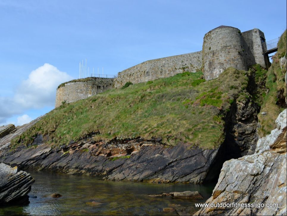
After a brief walk we decided to head further. Passing through Buncrana, we arrived soon afterwards at Dunree Fort. Dunree Fort is a coastal defence fortification which was originally built as a Royal Navy post during the Napoleonic Wars. Due to the strategic position of Dunree Fort protecting lough Swilly, The fort was used until after WWII. The fort is now a military museum exhibiting many restored canons and guns, it also includes a cafe, gift shop and many coastal walks.
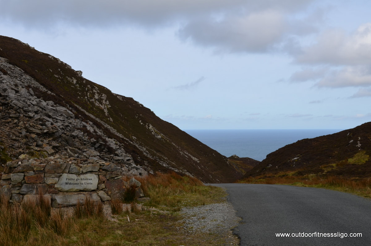
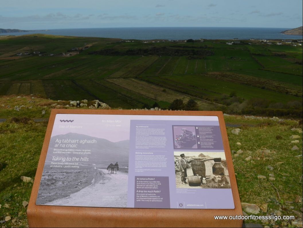
Across from the Cafe is a small path which leads down the cliffs towards a small pier. The water here is azure blue and needs to be seen to be believed. After a bit of rockclimbing at the bottom of Dunree fort, we headed back along the inishowen 100 towards Malin Head. Next on our itinerary was the gap of Mamore, a twisty scenic road which weaves itself through the Gap between 2 mountains. On top of the gap are shrines and a Holy Well which is named St Eigne's well, a popular pilgrimage place.
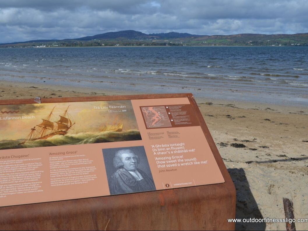
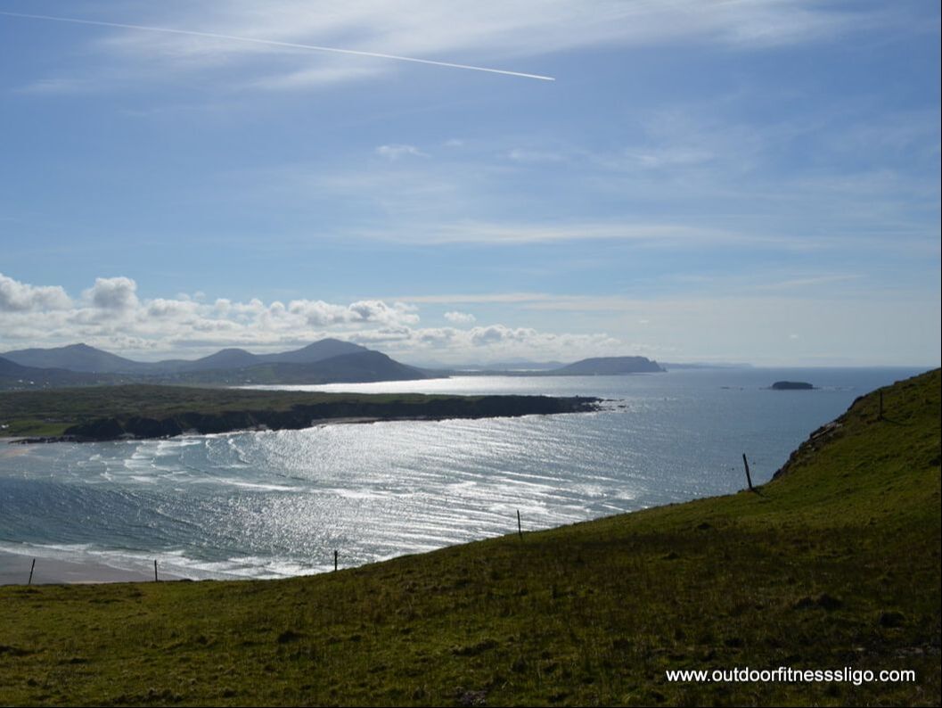
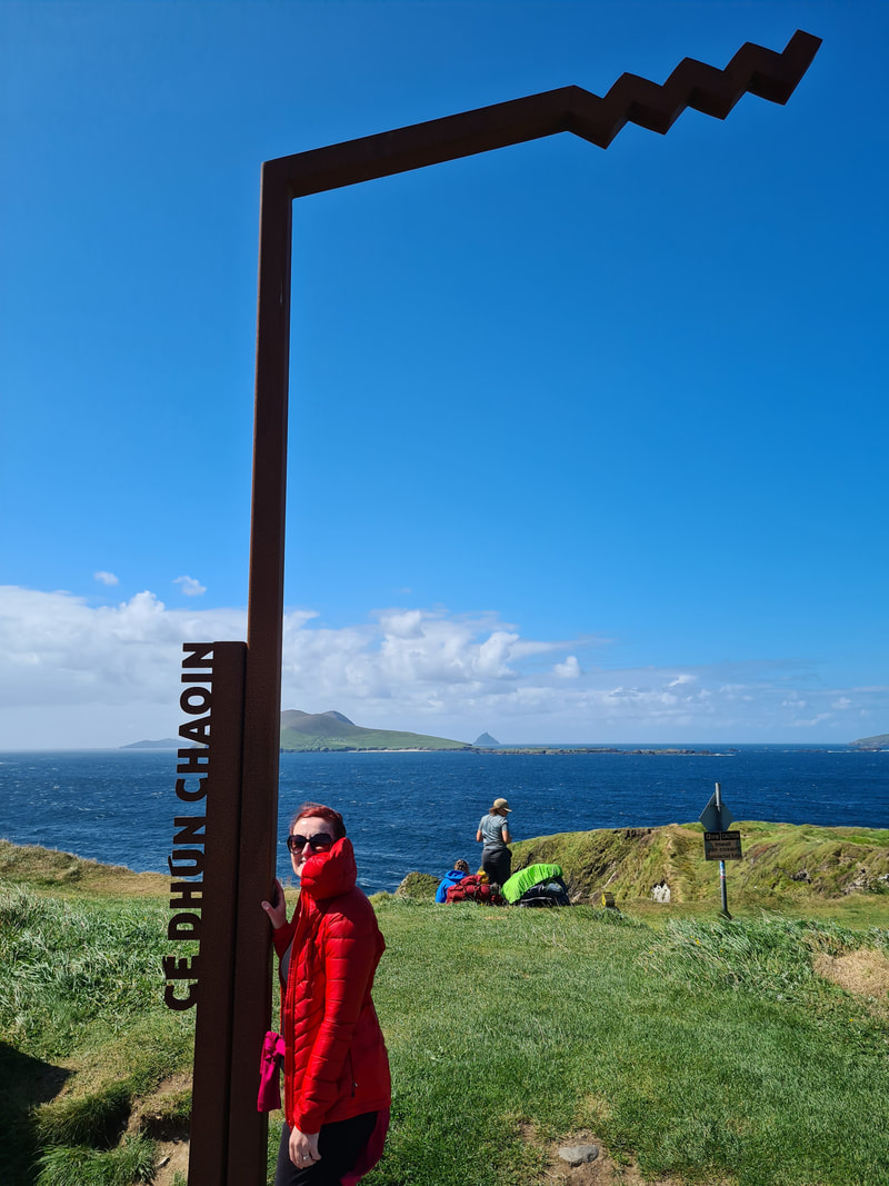
Next stop was Glenevin Waterfall Park. The start of the walk is beside the Glen House Tea rooms. The walk follows the river which meanders through the valley as far as the waterfall itself. The waterfall is approx. 30 feet high and is a spectacular sight 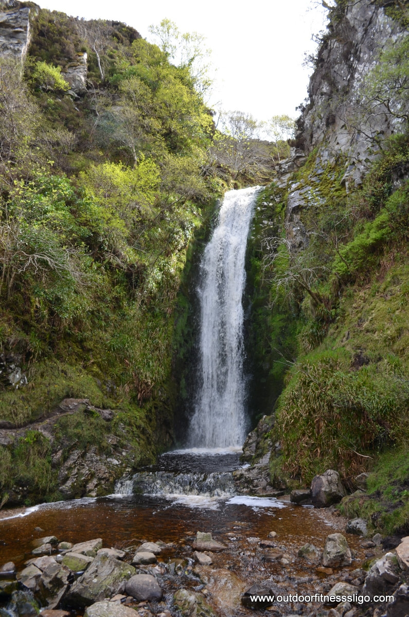 Carrying on our journey, we crossed the bridge into the village of Malin. Ones you have crossed the bridge, turn left and follow the road along the shores towards Five Finger Strand. And what can we say about five finger Strand? We believe the pictures speak for themselves. It is amazing, the water is as clear as can be , the dunes flanking the beach are spectacular, the sun was beaming down on us, ... So we decided to take a 2 hour break and enjoy the views while the kids were building sandcastles
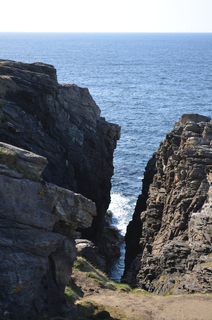
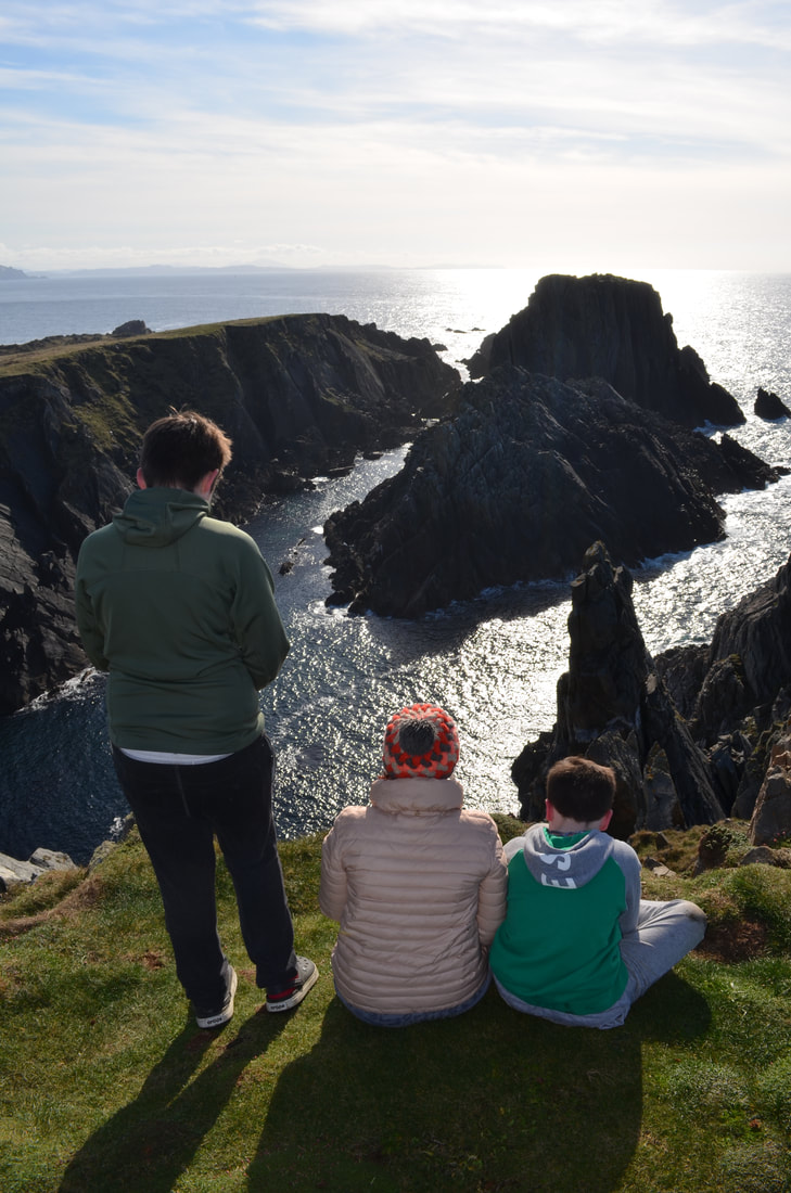
The last part of the day was what I was most excited about,... Malin Head. I had stayed with my parents in Malin Head In those days, Malin Head was just famous for it's rugged coastline, great fishing and tatched cottages. This time around, Malin Head is famous for being part of the Wild Atlantic Way, but it is also famous for it being a film location for the up and coming Star Wars movie - The last jedi . And it showed, the amount of cars at Ireland's most Northerly point had taken up all available car park spaces. Malin Head is spectacular. Where myself and my dad went fishing nearby Hell's Hole in 1984, this time around walkways had been installed along the coast towards Hell's Hole. Head in 1984 where they had rented a cottage for 4 weeks. In 1984, coming from Antwerp , Belgium , it felt like the most remote place on earth.
0 Comments
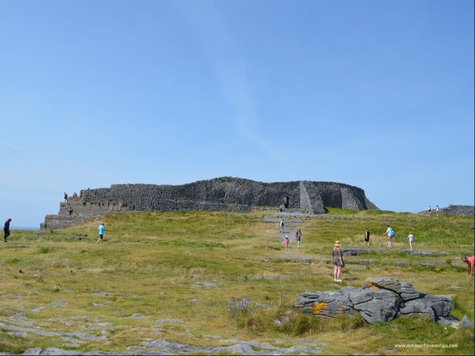
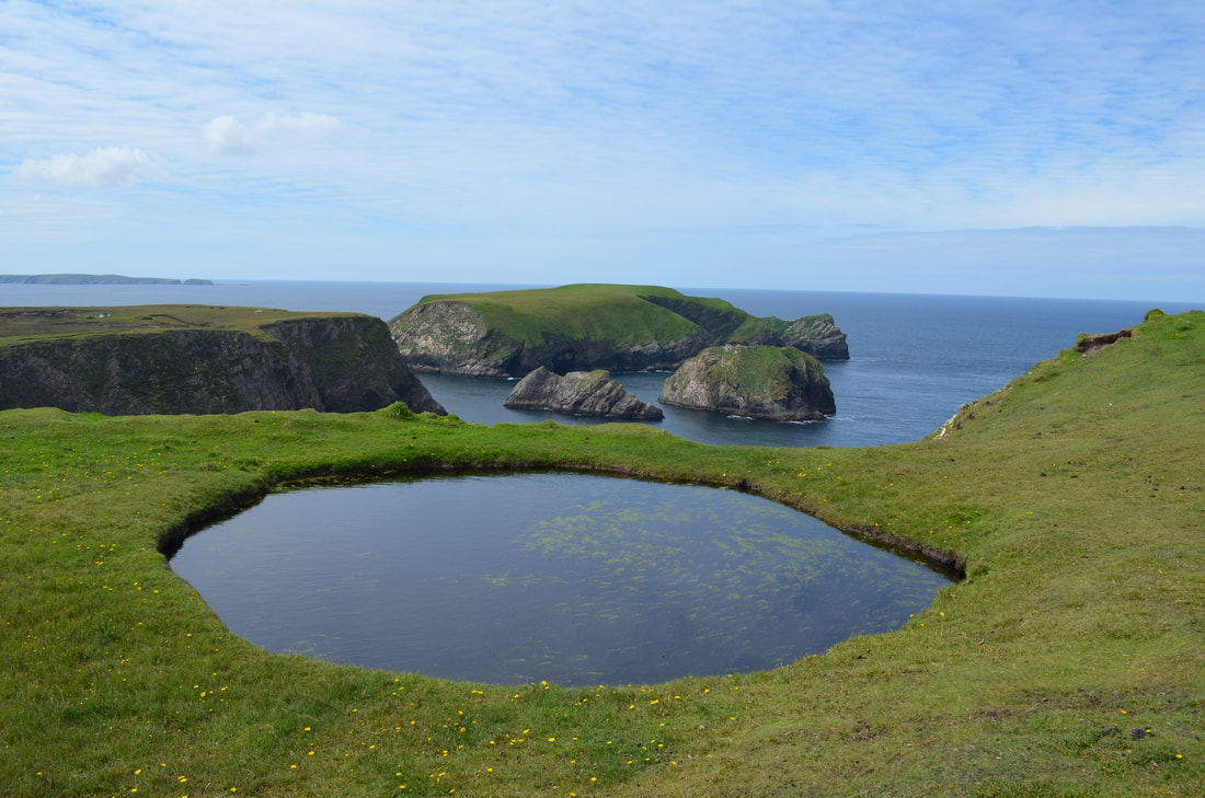
Staring across the reinforced wall towards the Inishowen Peninsula, the sun was making an appearance above Louch Swilly. On this beautiful morning in April, we would be forgiven to feel like a king on top of Grianan of Aileach, a hillfort atop the 244m high Greenan mountain at Inishowen. Imagining what a siege would have been like in it's occupied days, the gorse surrounding this mighty fort could have been Vikings trying to capture this mighty fort which dates back to the 8th or 9th century.
The short walk from the car park earlier on had given us views towards lough Swilly and Lough Foyle, and it is this demanding location which was more than likely the reason they built this fort in this location. The walls are 4.5 meters thick and 5 meters high, on the inside there are 3 terraces linked by steps. Inside the walls are 2 long passages. 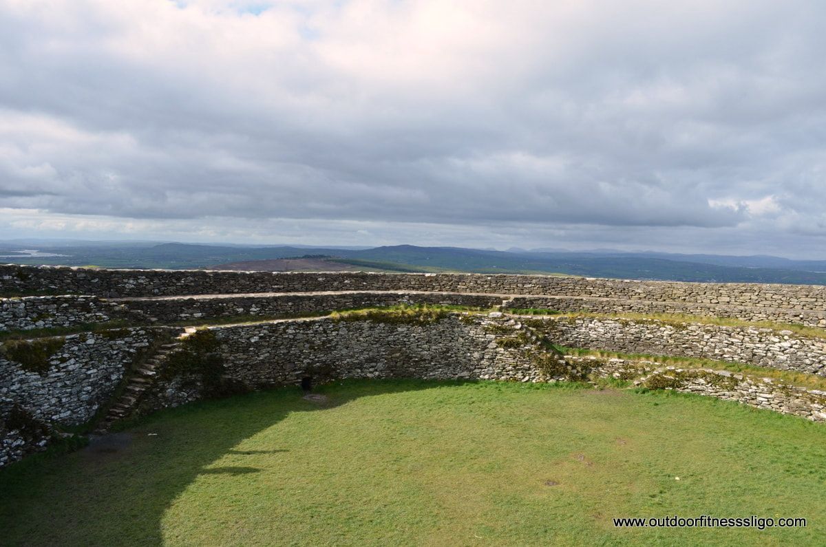 The fort was plundered by vikings in 904 and 939, the final destruction took place in 1101by the army of Muirchertach ui briain, king of Munster. In the 1870's , the fort was restored by Dr. Walter Bernard. Nowadays, there is an extensive carpark installed close to the fort, a short walk will bring you towards the fort itself. The walk is wheelchair friendly as a new path has been installed for wheelchair users. This great tourist attractions which was a hit with our kids has no admission fee.
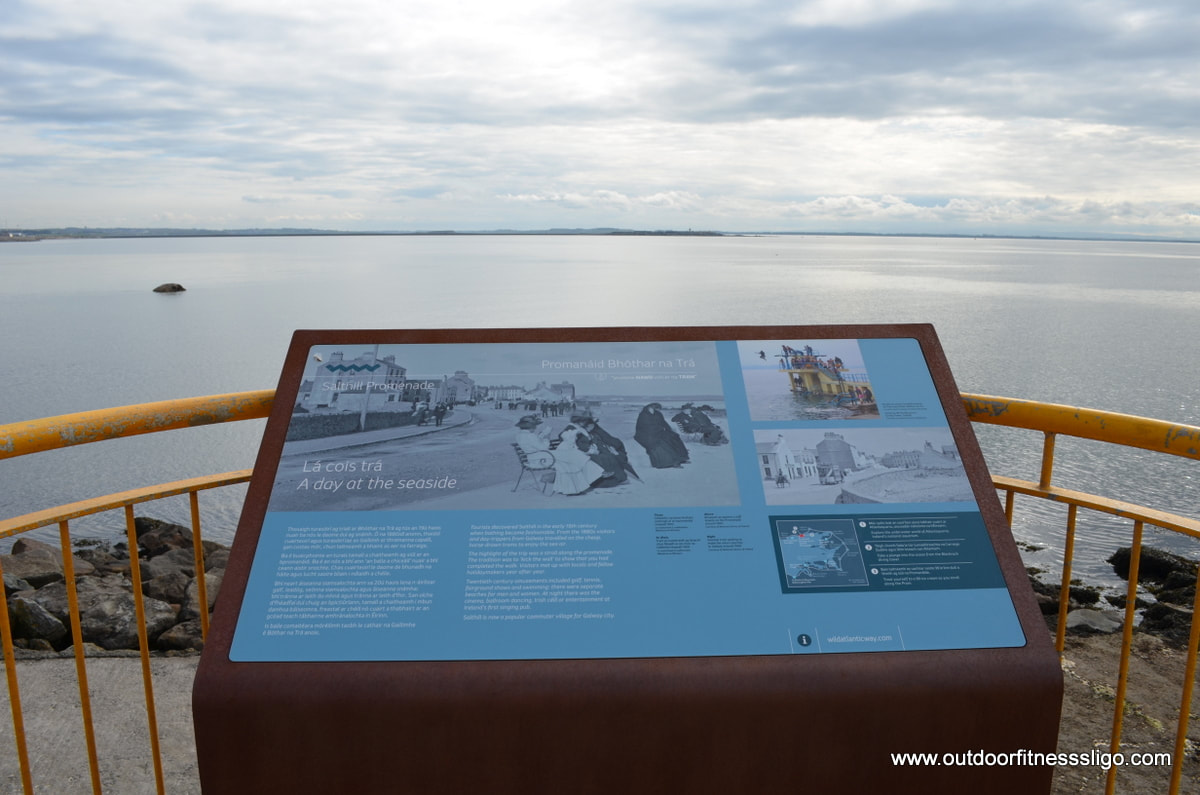
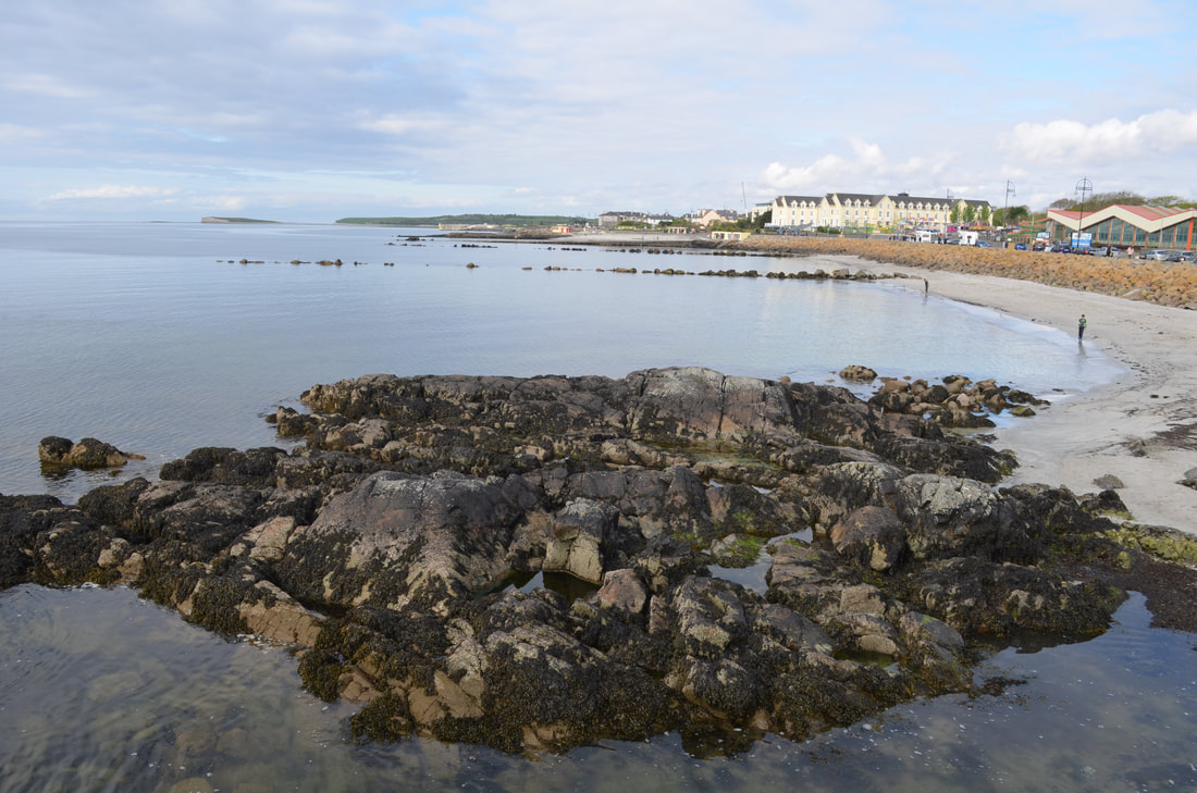
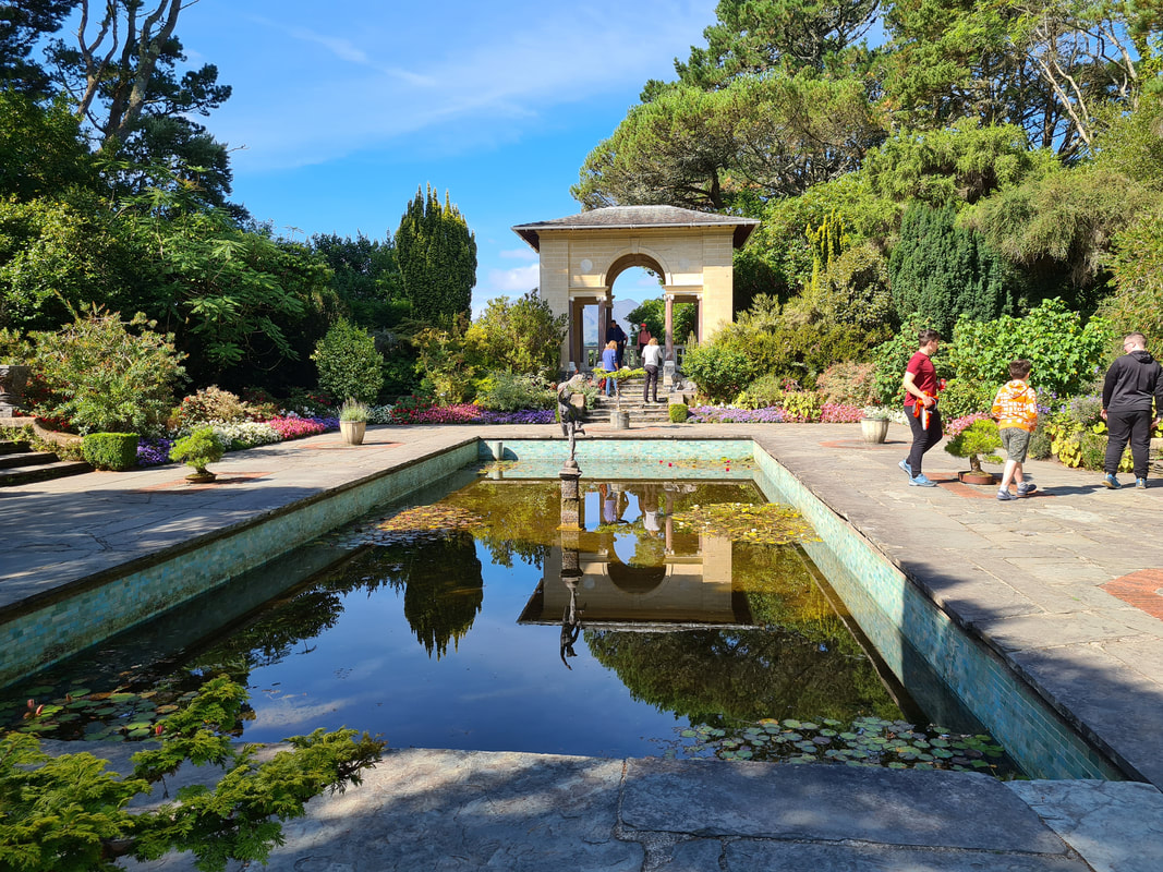
Having arrived in Galway, we decided to head to Salthill first. Salthill is a seaside area in the city of Galway which was discovered in the early 19th century when bathing became fashionable. The old horse-drawn trams used to bring daytrippers from Galway city to Salthill to enjoy the sea breeze and beach. Nowadays, the promenade seems to be the main drawing point where runners and walkers enjoy the views as far as the Burrren across Galway bay.
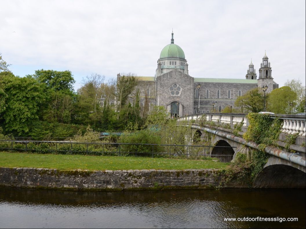
From Salthill, it is a quick 5 minute drive into the city of Galway. Having the car parked at the Cathedral, we walked across the Corrib river. The Cathedral is one of Galway's largest buildings. Building commenced in 1958 on the site of the old city prison and the cathedral was completed in 1965, making it the last great stone cathedral built in Europe.
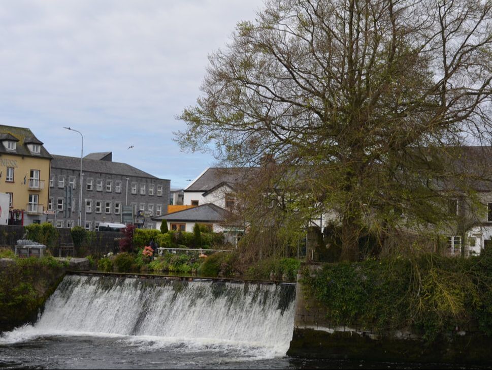
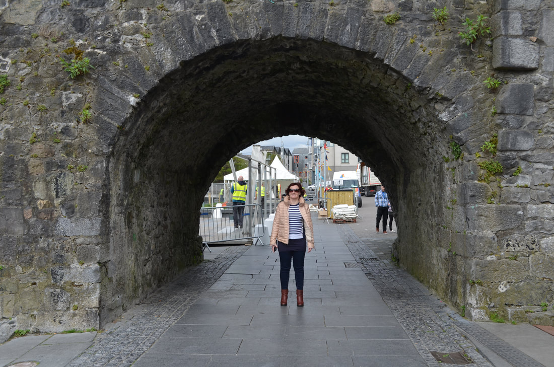
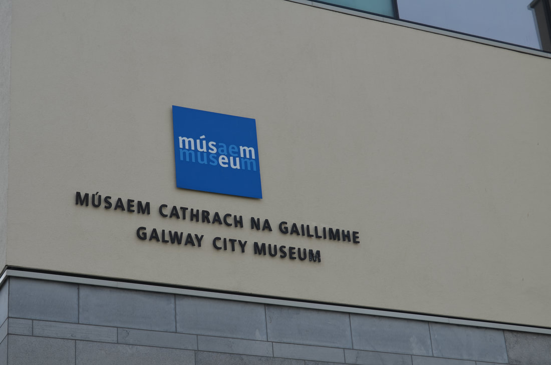
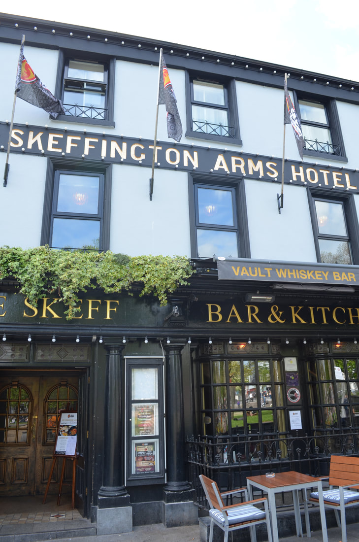
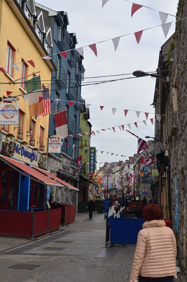
Just across the bridge, we turned into Newtownsmith. Here you will find the Friars walkway, a path which runs between the Corrib river and the Friars river. Where the Corrib river is one of the shortest rivers in Europe with a total length of only 6km, the Friars river showcases a very early piece of canal engineering. In 1178, the Friars of Claregalway abbey who were fed up taking a detour to enter the river, started the built of the canal. Galway, being a city with a high student population, is always buzzing. From the many tourists to the street buskers, it's alive and kicking. From the Galway races to the Galway arts festival, from the Volvo Ocean race to the Galway ironman, there is always something happening. And we don't know if you know, but Galway has officially been designated European Capital of Culture 2020. So loads of reasons to visit Galway in the near future. Having walked along the Corrib, we reached the Spanish Arch, a remainder of the extension of the old city walls which was built to protect the city's quays. Nearby the Spanish Arch is the Galway city museum ( http://www.galwaycitymuseum.ie/ ), a museum with a variety of permanent and touring exhibitions showcasing Galway's rich history, science and arts. Also nearby is Galway harbour, bustling with sailing yachts and fishing boats.
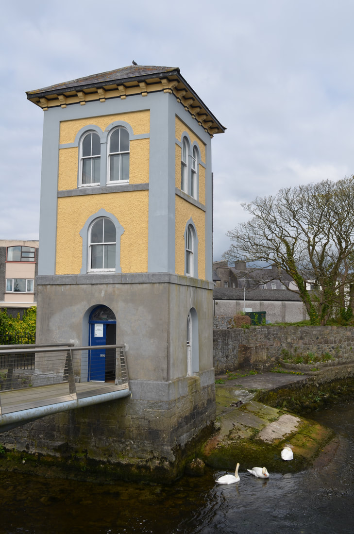
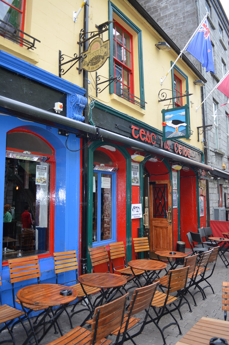
Walking back direction Wolfetone Bridge, we visited the Fishery Watchtower museum. The tower was built in 1852 by the Ashworth Brothers. The building was used over more than 120 years to monitor fish stocks and illigal fishing activity and also served as a draft netting service station. Entrance is free and guided tours are available. Afterwards, we headed towards Quay Street and Latin Quarter, Galway's busiest area. This area has an abundant selection of restaurants and pubs. We popped into Fat Freddy's for a quick lunch.
Galway is a vibrant city, from the street buskers to the interesting architecture to the colourful shops, there is loads to see. One of these must visit shops is Charlie Byrne's bookshop ( http://charliebyrne.com/ ). Charlie Byrne's is an independent bookshops which stocks 100,000's of books covering every imaginable subject. The bookshop has multiple rooms which are stocked with books from floor to ceiling.
With our day drawing to an end, all we can say is that Galway is a must visit city along the Wild Atlantic Way. It is a city with a "village" character, large enough to allow you to discover new things, small enough to get around it in a day, sample the food, watch the buskers or enjoy the vibrant atmosphere.
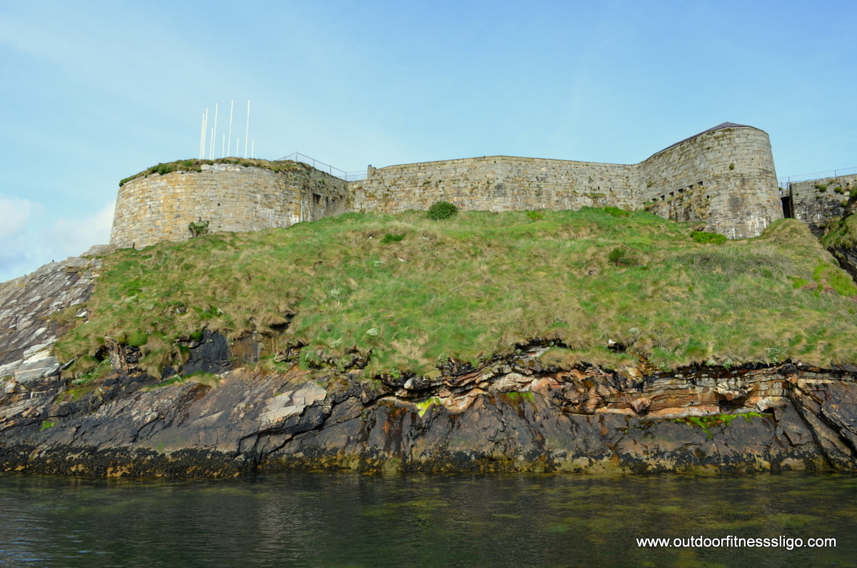
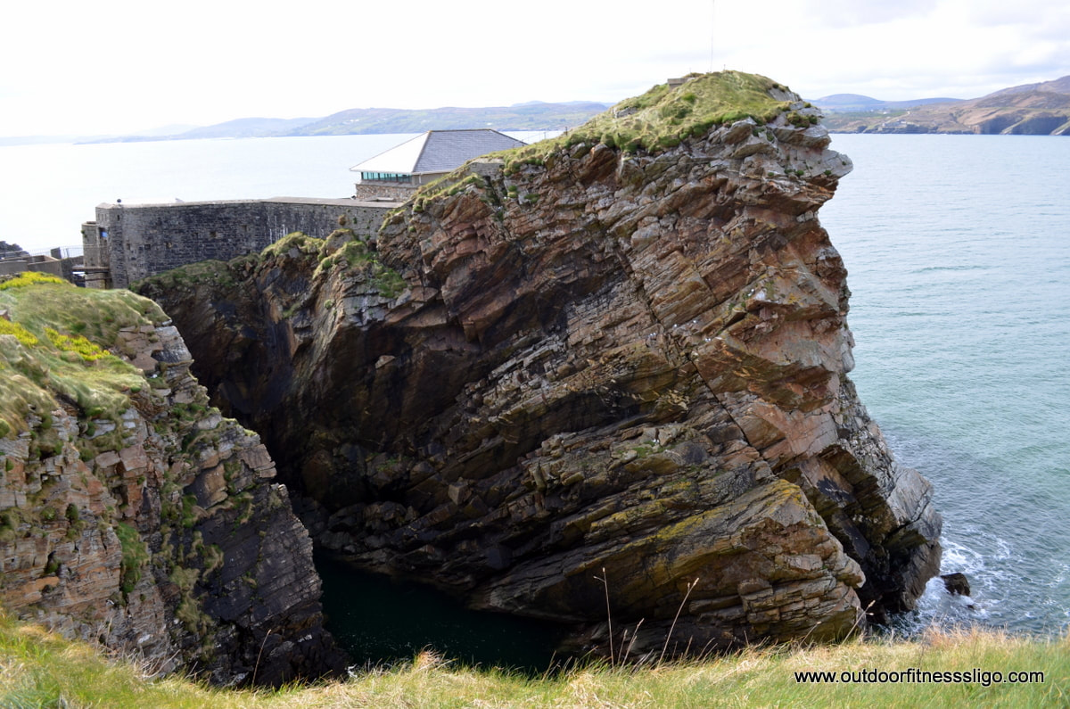
Fort Dunree located along the shores of Lough Swilly was a coastal defence fortification located along the West side of Inishowen not to far from Buncrana. It was originally built by the British following the 1798 uprising of the United Irishmen who were supported by the French. The fear of a French invasion saw the built of the fort which takes up a spectacular position on an outcrop with demanding views all across Lough Swilly.
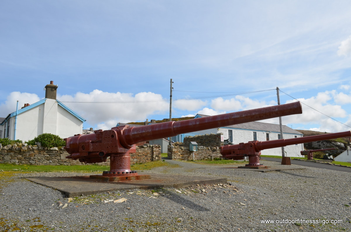
The fort houses a great military museum , the grounds contain a lot of WWI and WWII military remains which can be explored. The huge Naval artillary which were added during the 19th century are still on display. The grounds also contain a coffee shop and a gift shop.
The Saldanha suite houses a huge collection of military memorabilia and it also houses the Wildlife Discovery room. At the entrance are the remaining bones of a sperm whale where inside, you find a blackboard with an inventory of all wildlife observed around the museum during the last few months. 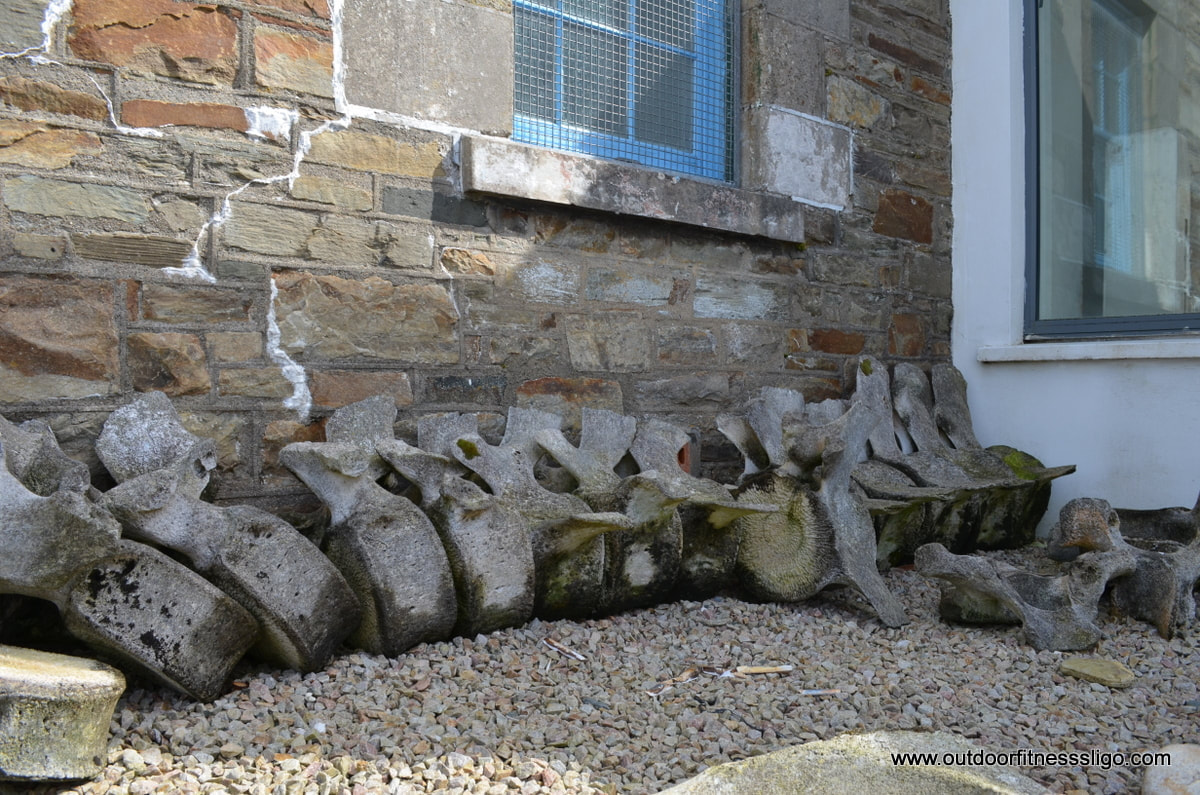 There are plenty of walks through the grounds, but just across from the coffee shop is a small path leading down to a rocky beach with the clearest water you can imagine. There is also a pier which opens up some amazing view towards the fort.
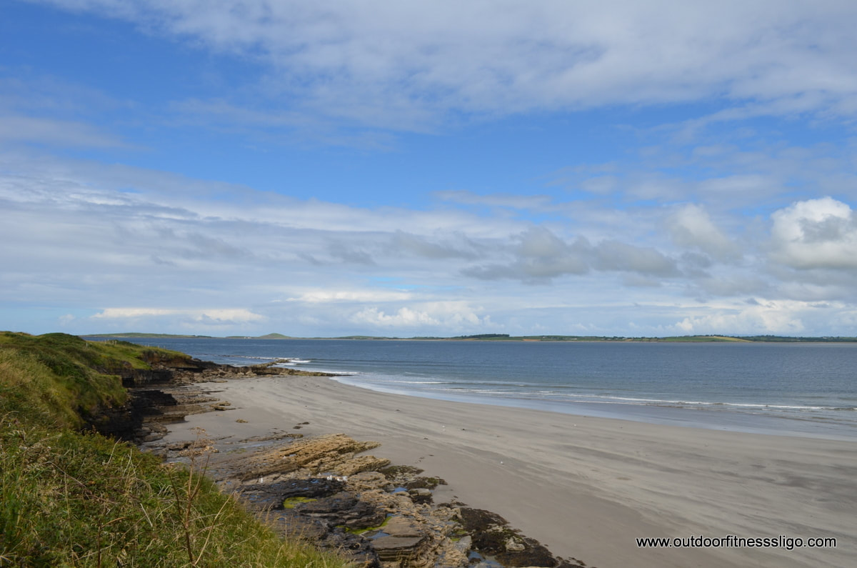
This tourist attractions is worthwhile a visit and will be a success especially with kids. Coney island is an Island located between Rosses point and Strandhill in Co.Sligo, Ireland. The island can be reached by boat from Rosses point or by walking or driving at low tide across Cummeen Strand. The causeway used for the crossing is marked by 14 pillars which will guide you towards the Island over a distance of 2.5km.
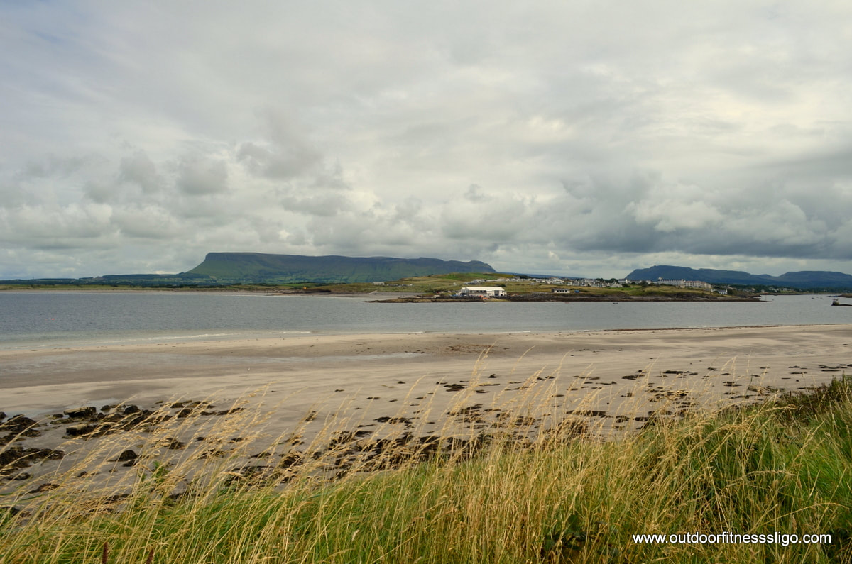
In the summer, the islands becomes busy enough with seasonal residents, but in winter time it turns very quiet. There are no shops on the Island, but there is a small pub called Michael j Ward. There is a great loop around part of the island which is worth walking. Turn into the small road signposted for the beach. The road is surrounded by lovely pastures where cows quietly graze. The views towards Knocknarea are fantastic, especially on a sunny day. Ones you reach the beach, turn towards the fields on the right and follow the headland. Views towards the Ox Mountains and Carney open up once you turn around the headland. Even Blackrock lighthouse looks closer than ever before from this beautiful remote location.
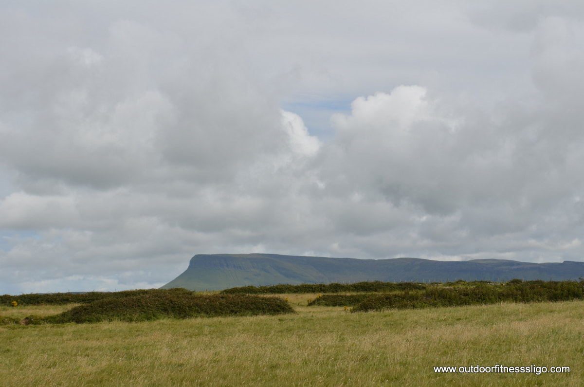
Turning around the headland, views towards Rosses point with dramatic Benbulben in the background were enjoyed during our improvised picnic. Coney Island is a gem which can be easily reached, but still doesn't draw the huge amount of visitors like some other islands. Only thing to keep in mind is the tides - otherwise you might be spending a good few hours longer on the island. This wouldn't be a major disaster as you can always pop into Michael j Ward for a pint. Another possible option we strongly advise is to go out to the island on a summer's weekend and enjoy a bit of camping, walking or just relaxing.
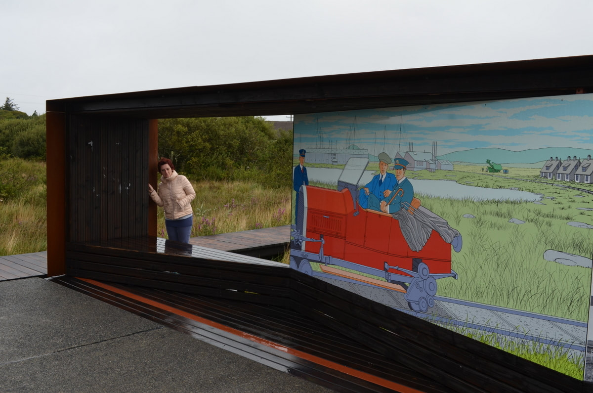
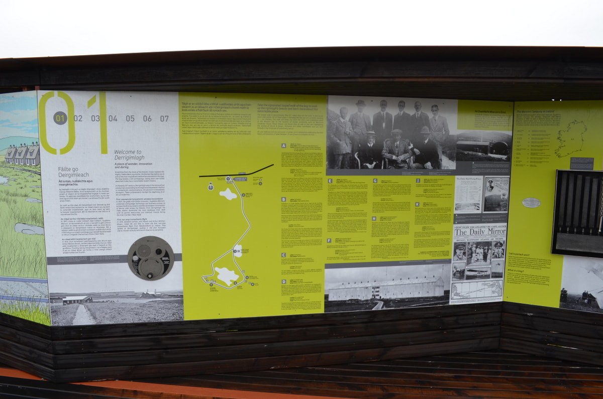
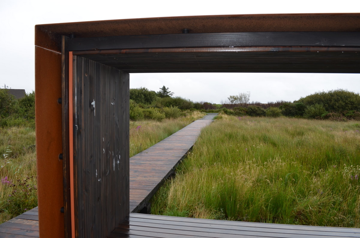
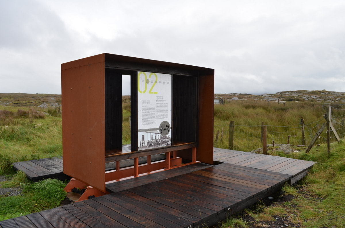
Not to far from Clifden is the Wild Atlantic Way Signature discovery Waypoint Derrigimlagh. The site is home to 2 significant historical transatlantic technical achievements which took both place around the start of the 20th Century. The first one is why we found ourselves in this barren landscape, we wanted to walk in the footsteps of Guglielmo Marconi. After having established the first transmitted wireless connection from his station in Cornwall to Newfoundland, he decided to move as far West he could, and Derrigimlagh nearby Clifden is almost as far west as you can go. But back to the start, after having parked the car, we walked across a walkway to the Wild Atlantic Way waymarker. The first thing to mention is the walkway, the land in this area is boggy which means that pending the season, it is more waterlogged or less waterlogged. If you would build a path on this type of terrain, your path would crack. So in this case, the path which was put in place is really a floating segmented bridge which floats on the bog surface and is able to move very slowly over time.
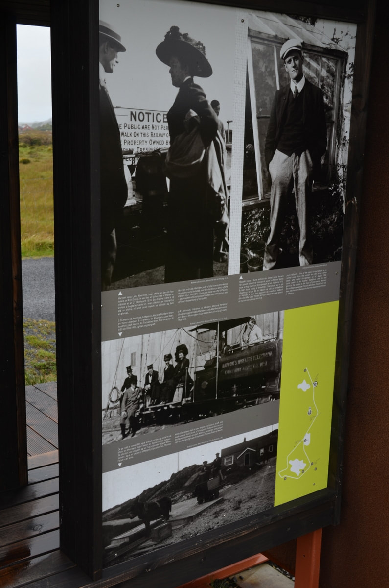
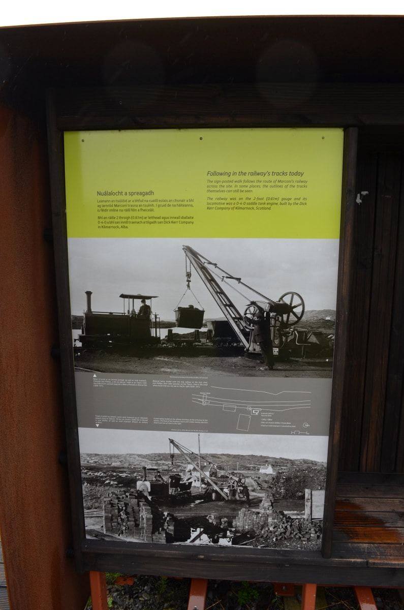
A very colourful display welcomes you to the site of Derrigimlagh Bog and explains through interactive displays the history of the site. It is also the starting point of a 5km looped walk through the bog where through 7 stop points,the history of the site is explained. And we advise you to bring a decent jacket as you never know when it will rain in this part of the country. But don't worry to much, 6 of the stop points also act as shelters. So to continue our story, Marconi established the commercial signalling station here in 1907. And it must be said it was an impressive site in this barren landscape. A huge condenser house building, a huge power house and a massive aerial system were installed as was a railway across the site. As this site had the potential to make a lot of money and as the site was significant from a research perspective, it used to be heavily guarded by British troops. During the first World War, the site had a huge number of English soldiers protecting the site and controlling people and goods entering the site. The railway was used to transport the people and goods around the extensive 300 acre site.
Walking further, we learned and discovered much more facts about the Marconi site. We even learned that on one day in August, the writer james Joyce turned up at the site in the hope of interviewing Marconi for an article, but was turned away as he didn't have the approved paperwork.
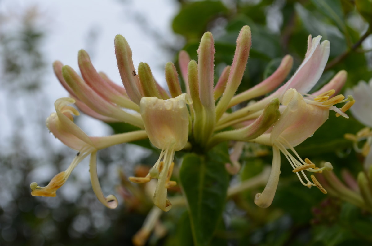
Walking along the bogroad, the views you can enjoy are incredible. The bog landscape, the lakes and the mountains in the distance result in a fantastic landscape which can be enjoyed by all. The Honeysuckle was in full bloom and the sweet scent was lingering along the bogroad, the blackberries were turning from green to black ready to be sampled later in the year. Remember how we mentioned that the site was home to 2 historical events? The second one was that it was the crash landing site of the world's first transatlantic flight. Both John Alcock and Arthur Brown had taken off in their Vickers Vimy biplane from Newfoundland some 16 hours before they crash landed on the 15th June 1919, covering the 1980 nautical miles. This flight resulted in the men winning a £10000 prize as offered by the Daily Mail newspaper for the first non-stop transatlantic flight. A few days after their crash, both men were honoured at Windsor castle during which King George V knighted them.
So after our afternoon filled by history, we decided the time had come to carry on our trip along the Wild Atlantic Way. All we can say is that the Wild Atlantic Way Waypoints are not only marked by natural beauty, but a lot of them are steeped in history as well.
The Wild Atlantic Way is known as the longest defined coastal road in the world. The Wild Atlantic Way, a 2500km route travelling from West Cork to Donegal, has been a huge success since it's launch . The route travels along the rugged atlantic coast of Ireland, taking in all the amazing scenery, tourist attractions, villages,... But although it has been huge since it's launch, it is nothing new. The roads have always been there, the amazing scenery hasn't changed in 100's of years , but the launch of the Wild Atlantic Way was a stroke of genius. We have travelled it numerous times, and we can confirm it will give you an unforgettable experience. So what can you expect? Amazing scenery:
Tourist attractions: There are many spectacular tourist attractions along the Wild Atlantic Way - from stately homes like Westport House, Bantry House and Lissadell House to imposing castles like Glenveagh Castle and Bunratty castle, there is something new to discover every day of the week. Prefer delving even further into Ireland's history, visit places like the Ceide fields in Mayo or Dun Aonghasa on the Aran Islands. Plan your trip by visiting websites like heritage Ireland or discover Ireland
Great food and accommodation: Ireland's food scene has made huge strides in the last 10 years and is comparable with some of the best in the world. With the Atlantic on the doorstep, fresh shellfish and fish is readily available. But there is a great selection of food producers who produce some of the best cheeses, meat, honey,...
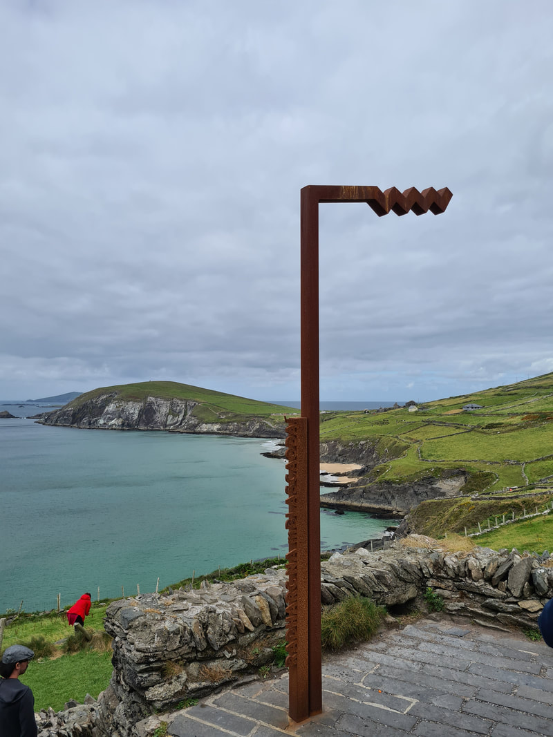
Along the route, you find loads of waypoints which are well signposted. Each waypoint is clearly marked with the WAW sign and a sign with factoids. All we can say is pack your bags, book your flights or ferry and plan your trip through the official website www.wildatlanticway.com
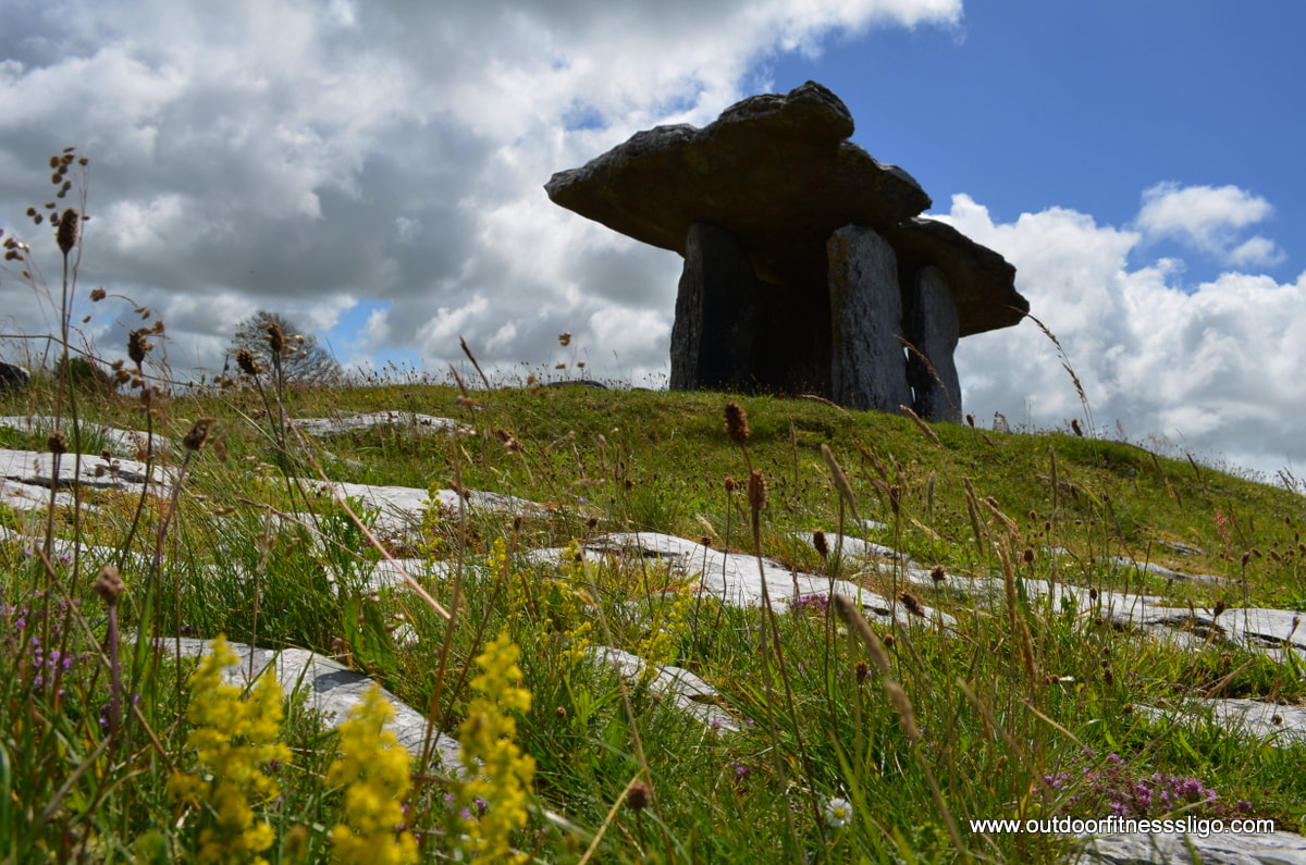
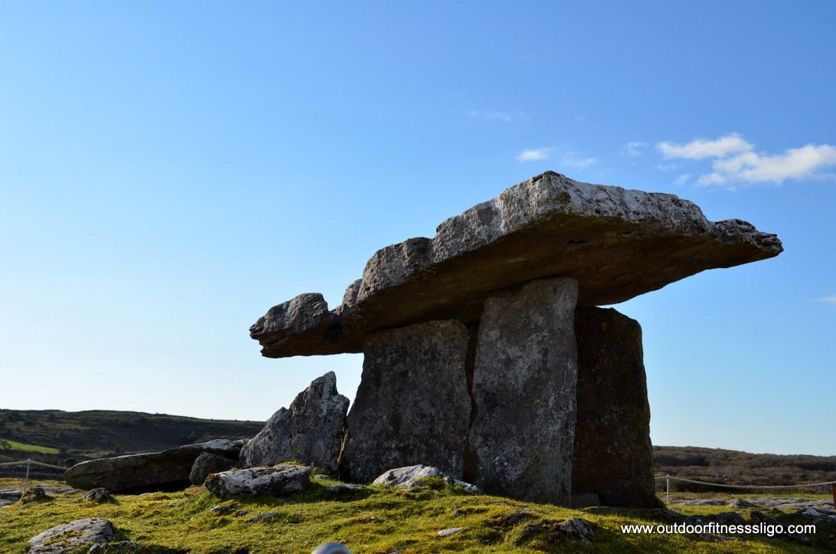
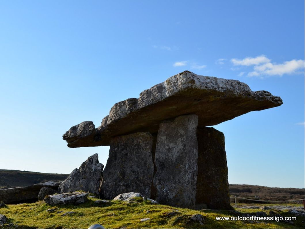
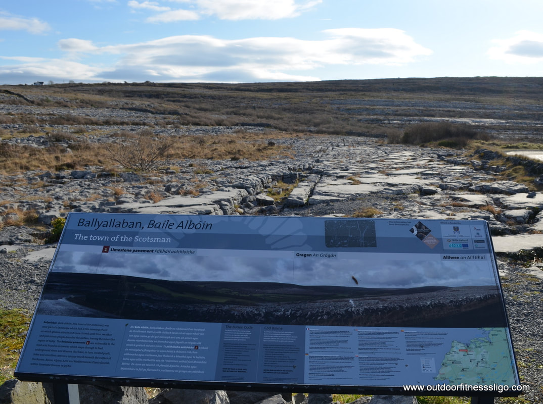
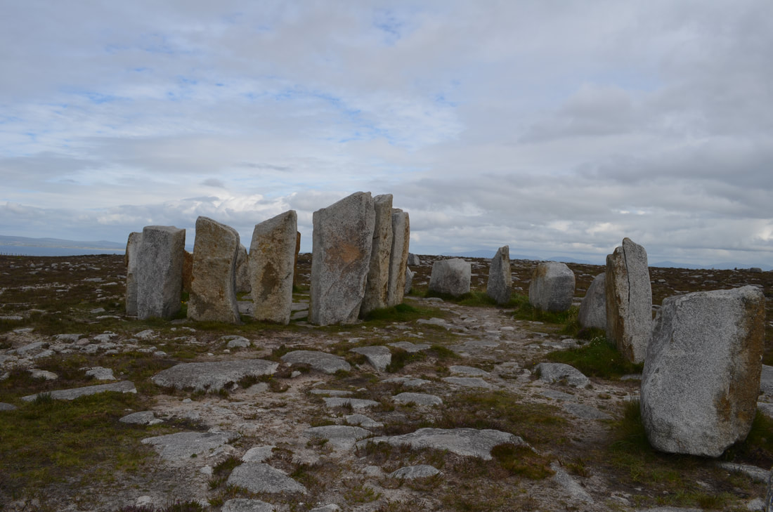
While driving along a quiet country road through the Burren, I admired the many stone walls which had been built around the many fields, all of them which were to my amazement stone free. You have to know, the Burren in co.Clare are a karst limestone plateau, and wherever you look, you see stones, stones and more stones. Those walls must have been painstakingly built over many years, maybe even handed down from generation to generation. At that moment, I noticed a sign to Poulnabrone tomb, so decided to park the car and investigate it further.
 Walking towards the tomb, information signs explained about the tomb, the landscape , the flora and fauna.
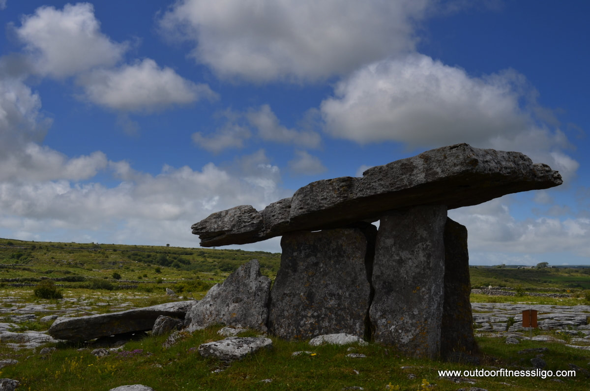
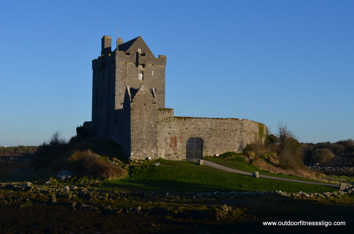
The tomb itself is a classic example of a portal tomb, flanking the entrance to a rectangular stone lined chamber which is covered by a single large capstone. When Poulnabrone tomb was excavated in the mid 80's ( The days when Duran Duran, Queen,The Cure, The Police ,... were huge and probably were being played on a walkman or cassette player when the excavation was being carried out ), it was revealed that at least 33 individuals were buried in the chamber of the tomb. The bones , which were badly defragmented, were from adults and kids, both male and female. It is believed that the bones were buried somewhere else and were transferred afterwards to the tomb. Personal possessions buried with the dead included beads, axes, flint weapons,..... Ireland has a rich history and there are a lot of Neolithic tombs spread across Ireland. Back in the car, I took off again on my journey admiring the landscape of the Burren while listening to an 80's classic, " walking on the moon" (The Police) , which couldn't be any closer to the landscape I had been walking through. On a beautiful Saturday morning, I decided to head off to co.Clare. So jumped in the car at 7am and reached Kinvara at around 9.20am. First stop, Dunguaire Castle, a castle built in 1520 by the O'Hynes Clan. Unfortunately , like most tourist attractions in Ireland, the castle is only open to visitors between April and mid September. So i just walked around the fortified castle along the path where I enjoyed the crisp morning air and watched birds wading along the shores.
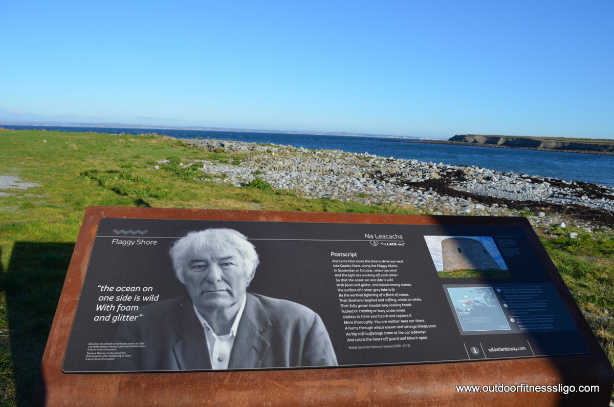
The next 2 stops along the Wild Atlantic Way are Taught Beach and Flaggy Shore. Taught beach is a Blue flag beach popular with families in the summer, Flaggy Shore is the perfect location to see limestone pavements and fossils that are embedded in the rocks and enjoy the views as far as Connemara and Galway.
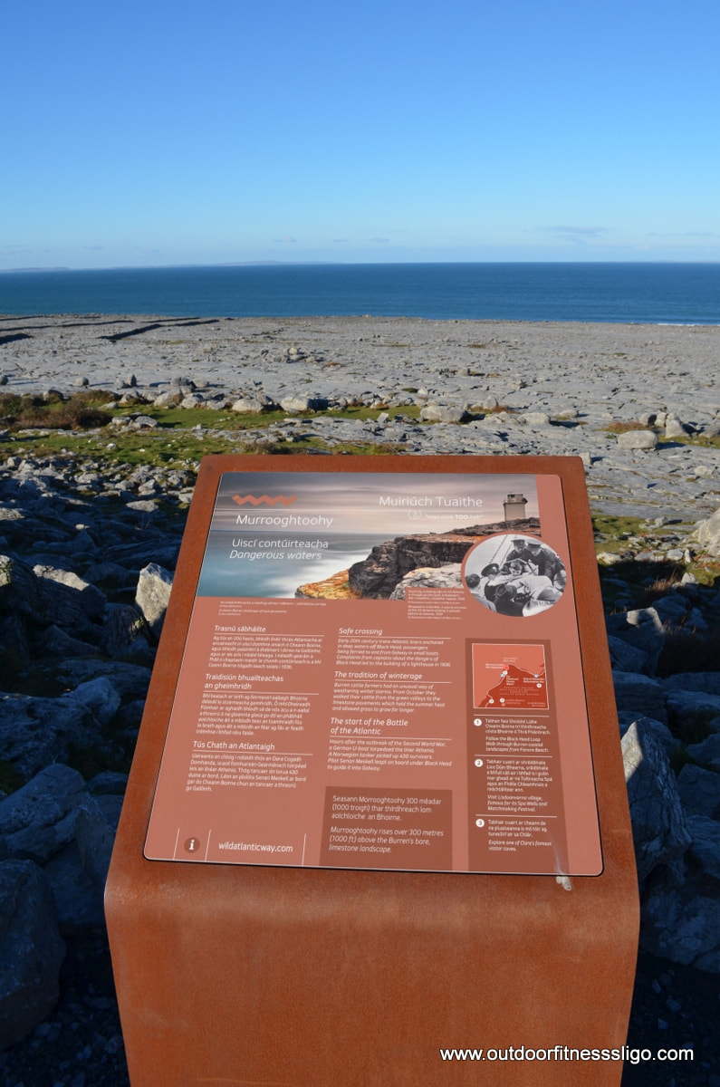
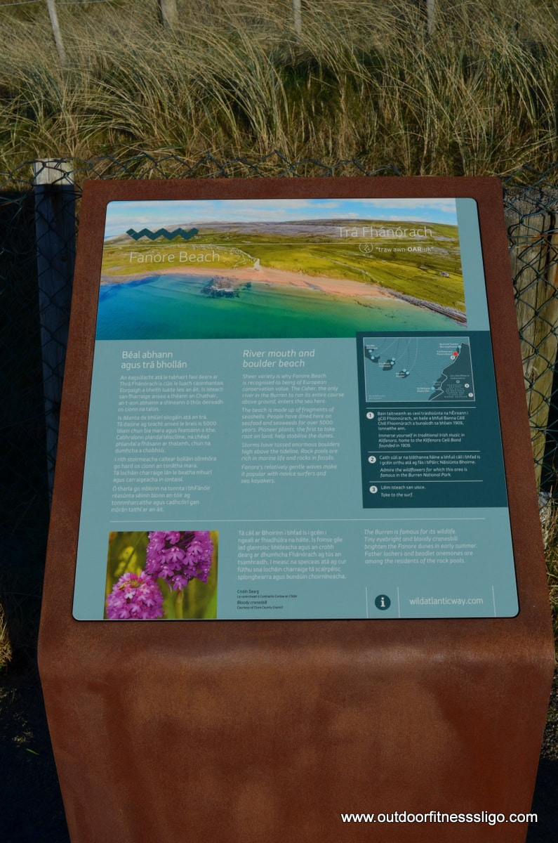
Carrying on my journey towards the Cliffs Of Moher, i passed Fanore Beach, an amazing sandy beach flanked by impressive sand dunes. The Caher river, the only river in the Burren which flows it's entire lenght above ground, is flanked by this blue flag beach. Leaving this amazing spot, I travelled further while enjoying the views as far as Connemara and the Arran islands. I had heard reports that the waves at Doolin Pier were good, so decided to make a detour. The waves, flanked by the rising cliffs on the opposite site of Doolin pier and the sun shining down on the waves combined with the blue skies reminded me more of Hawaii/ Madeira rather than Ireland.
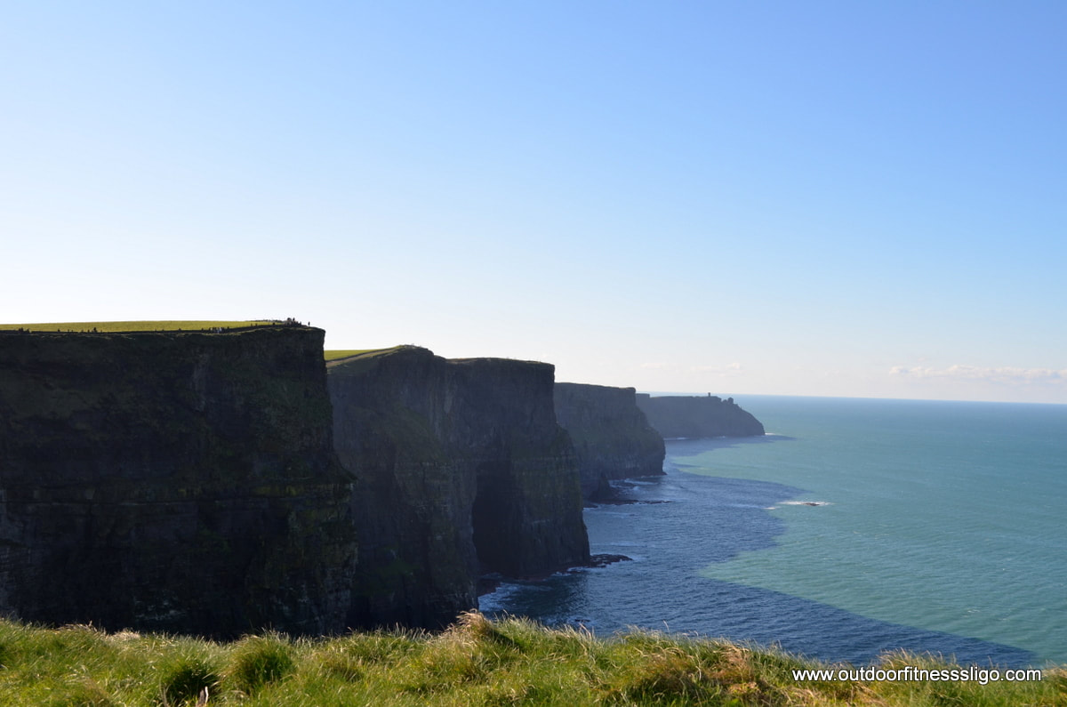
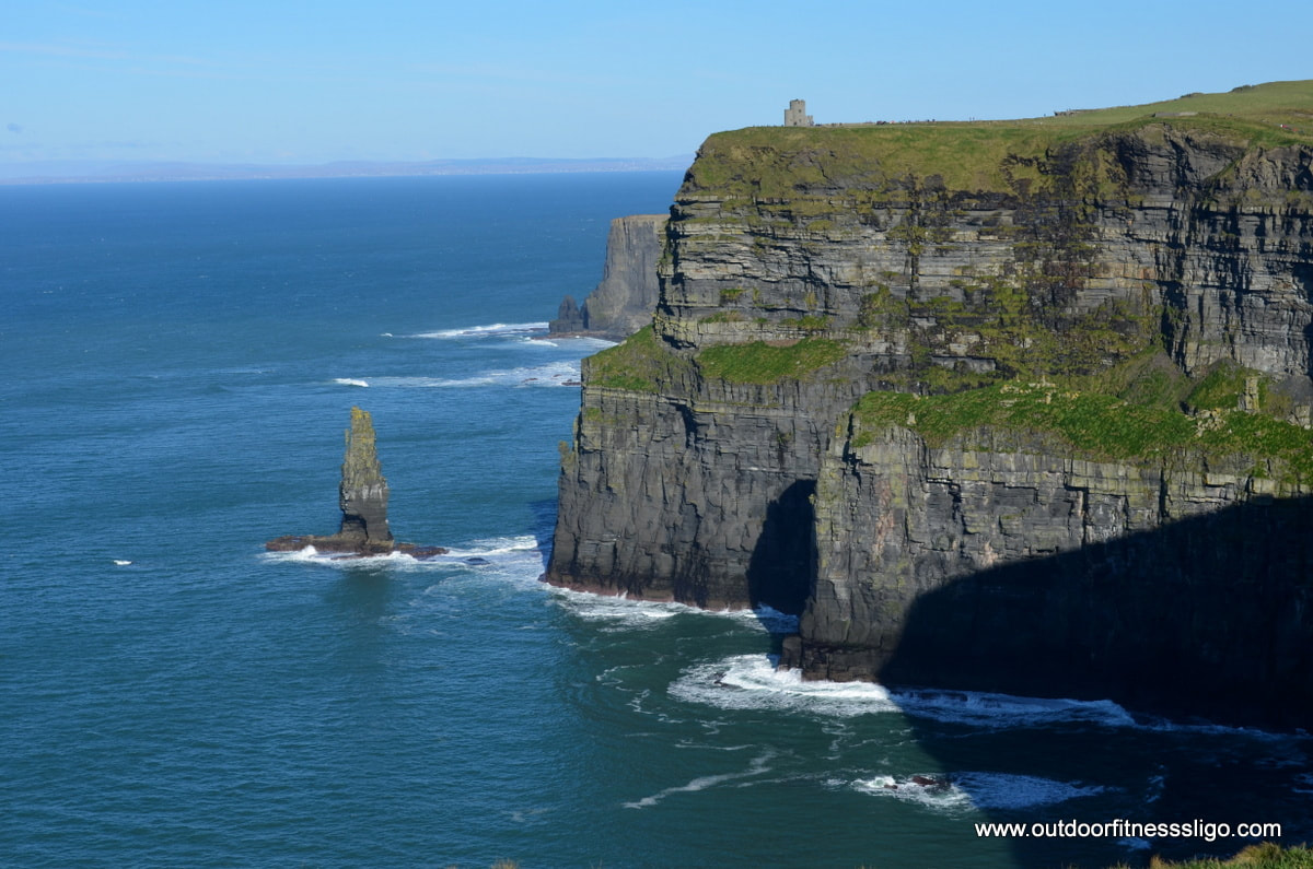
After a refreshing break, I carried on my travels to reach the Cliffs of Moher car park. The car park is €6 for a car, problem was that there was only 1 paybooth opened which meant that there was a significant enough traffic queue to get into it. My advise is to park in Doolin and hike towards the Cliffs of Moher along the Cliffs of Moher coastal walk . Once parked up, I hiked along to cliffs and enjoyed the Cliffs of Moher visitor Centre building. To get more detail on the Cliffs of Moher, read the following blog (Cliffs of Moher)
Afterwards, I headed toward Lahinch, a popular surf town in Co.Clare. The beach is perfect for surfers starting off, and there were at least 50 students in the water enjoying the clear waters of the Atlantic. From here, i turned back homewards, but not without taking a detour to Kilfenora , the gateway to the amazing Burren. The Burren is one of Ireland's 6 National Parks. The Burren are dominated by a Karst landscape, and the landscape is composed of limestone pavements with cracks known as "grikes". These cracks are the perfect location for flowers to bloom and you will find in Spring and summer an abundant amount of flowers ranging from arctic, Mediterranean and alpine flowers. The Burren visitor centre was closed , so I decided to have a look at Vaughan's pub. The pub featured in the Father Ted episode "Are you right there father Ted?" .
My last stop for the day was Poulnabrone Dolmen, probably one of Ireland's most photographed portal Dolmen. I enjoyed co.Clare immensely , the weather turned out to be amazing, the only 2 issues not relating to co.Clare, but in general is that all tourist attractions are closed until April, the second one was that i wasn't able to get any stamps for my Wild Atlantic Way passport as Post Offices close at 1pm. When i asked the information desk at 1 of Irelands major tourist attractions (Cliffs of Moher) if they had the stamps, the answer was no.
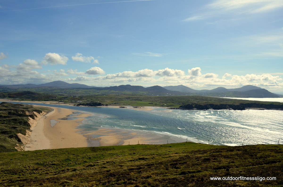
County Mayo never fails to surprise. And this time was no different, we headed to Achill Island . Achill Island is the largest island of the coast of Ireland, but can be reached by a bridge connecting the mainland with Achill Sound. The Island is marked by rugged mountains, peat bogs and tall sea cliffs, and how can we forget, blue flag beaches. Our final destination on the Island was Keem Strand, a secluded beach at the very western tip of Achill. So when we arrived at Achill Island, we rolled across the bridge into Achill Sound. We entered the tourist office and post office to get some further stamps in our Wild Atlantic Way passport. After the village , we turned left onto the L1405. First stop, Wild Atlantic Waypoint "An cheibh bheag" or Cloghmore pier at Kildavnet.
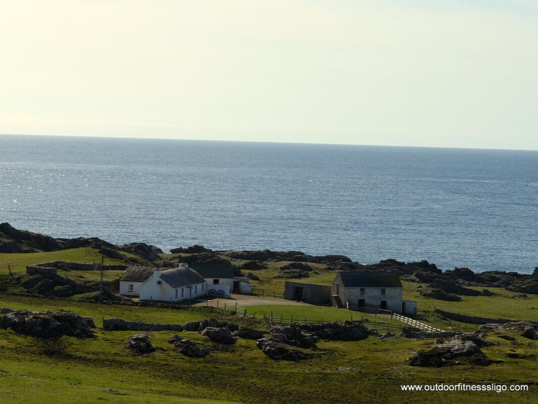
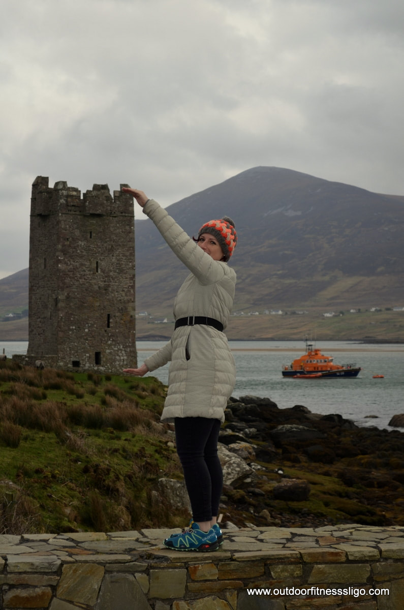
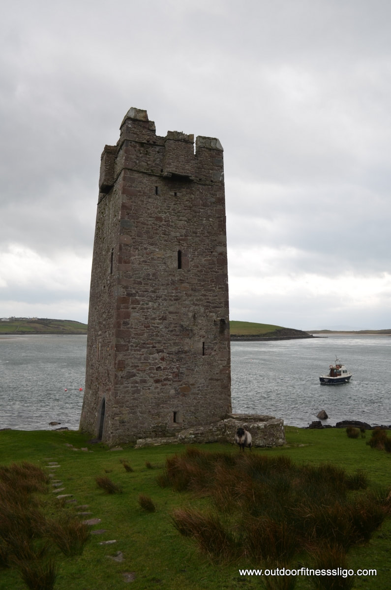
From the pier, you are able to take a ferry to Clare island. There is also Grace O'Malley's castle, a 15th century tower house. It is believed that the famous pirate queen Grace O'Malley established the castle while she reigned the waters during the 16th century. The tower is 12m in height and has 3 storeys. You can enter the tower, and that allowed us to take a break, admire the bay and use the opportunity for taking some pictures
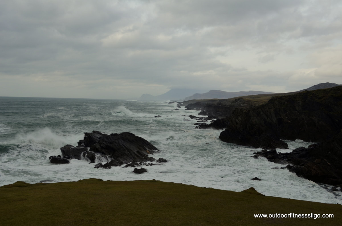
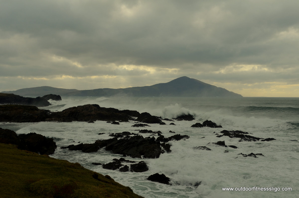
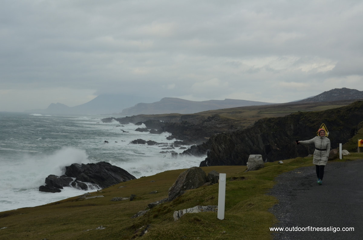
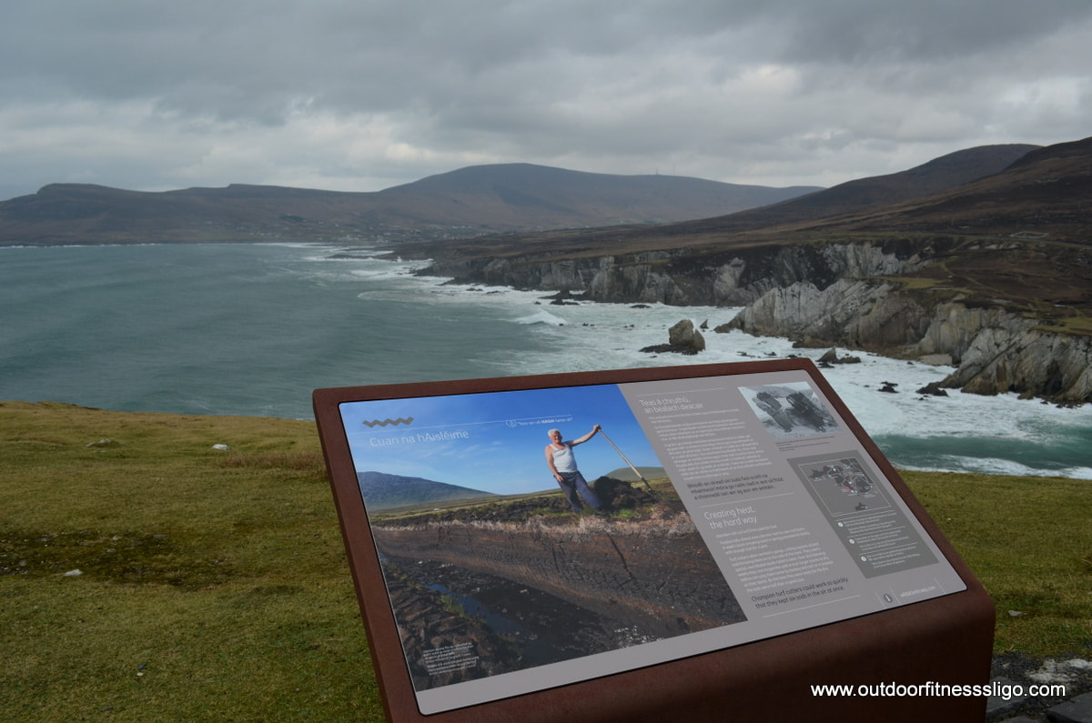
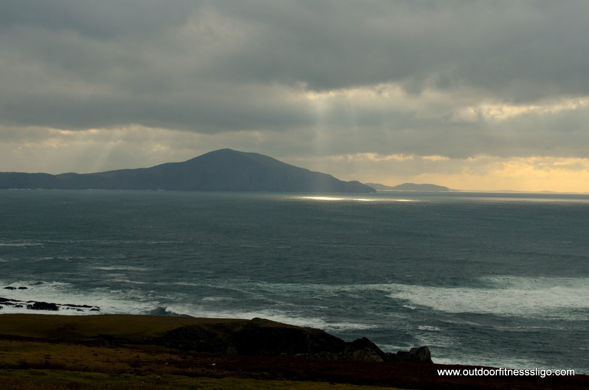
Carrying on, we headed around the headland where we were welcomed with views towards Clare Island. The sea was rough, the waves were amazing and crashed against the rocks with all their power. Further down the road, we reached Ashleam Bay which is flanked by White Cliffs. This is another waypoint "Cuan na hAisleime". From the vantage point, you have some sharp hairpin bends which bring you closer towards the pebble beach where the waves were crashing onto the shore. Carrying on our journey, we reached the main road again where we turned towards Keel . When driving around Achill Island, you will recognize some of the scenery from the blockbuster movie "Banshees of Inisherin" which was filmed on Achill Island. We can only imagine how many additional tourists will visit this stunning part of Ireland.
One thing we noticed is how many sheep roam freely along the roads on Achill Island, even in the village of Keel, sheep were wandering along the roads. Keel was very quiet as we drove through it, probably because it was early February, but it looks like a summer destination where the population probably expands 10 folded as it is flanked by an amazing beach which invites you to participate in the many watersports on offer.
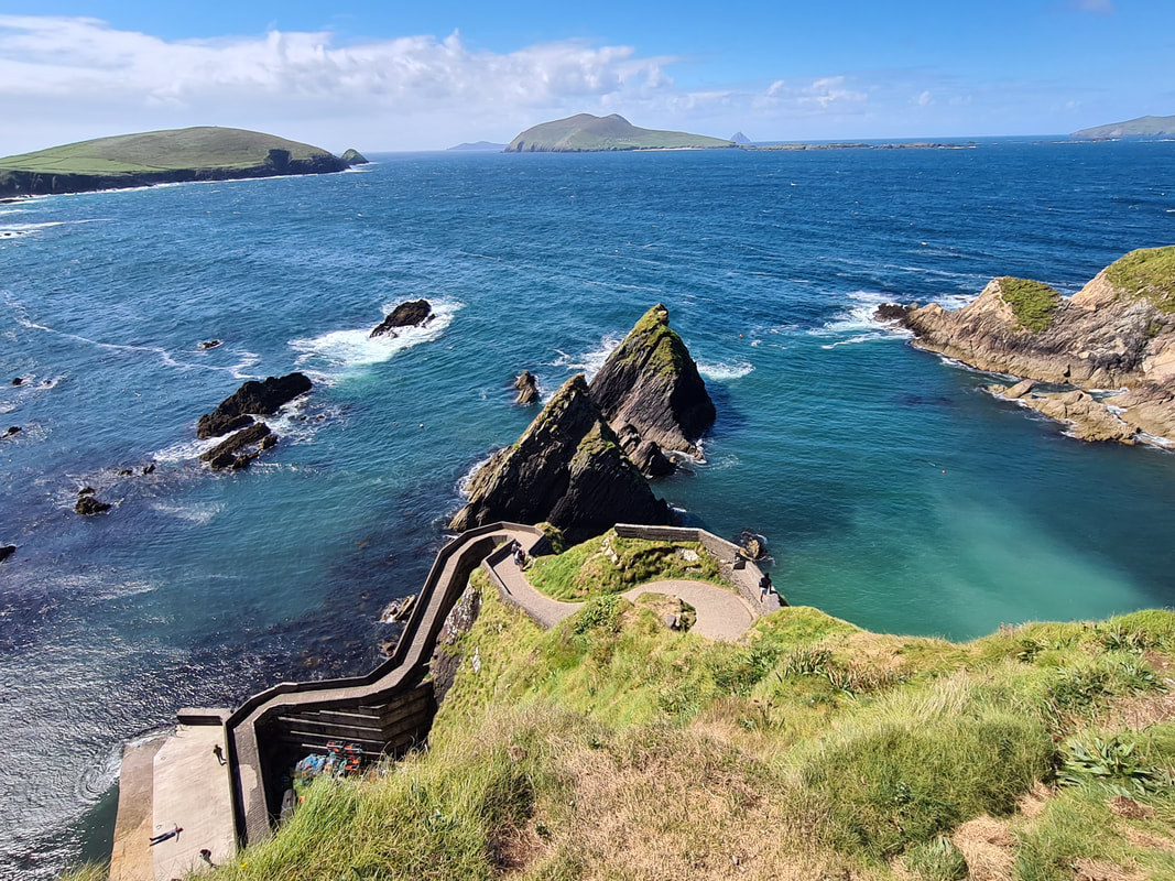
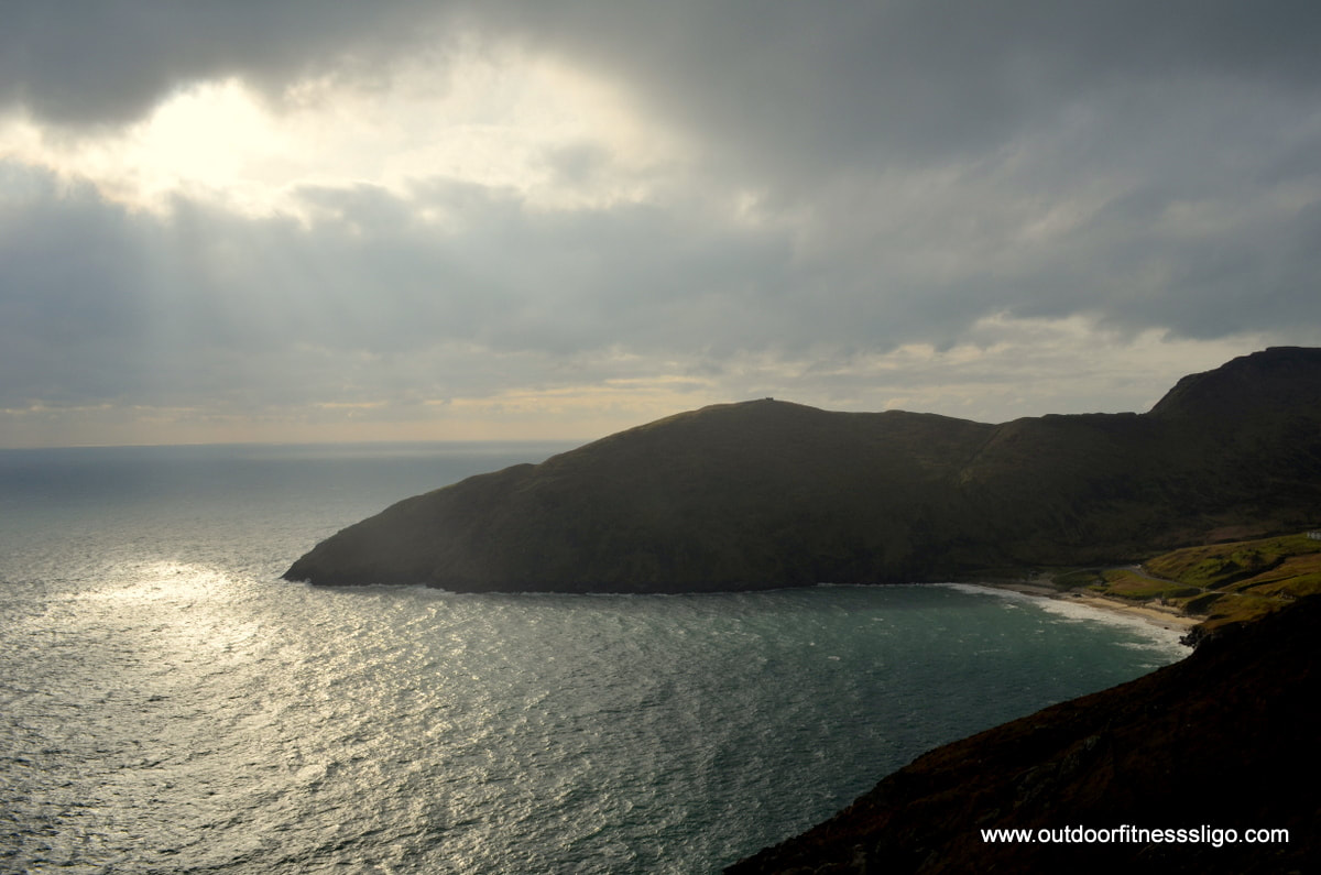
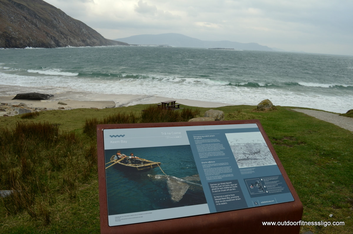
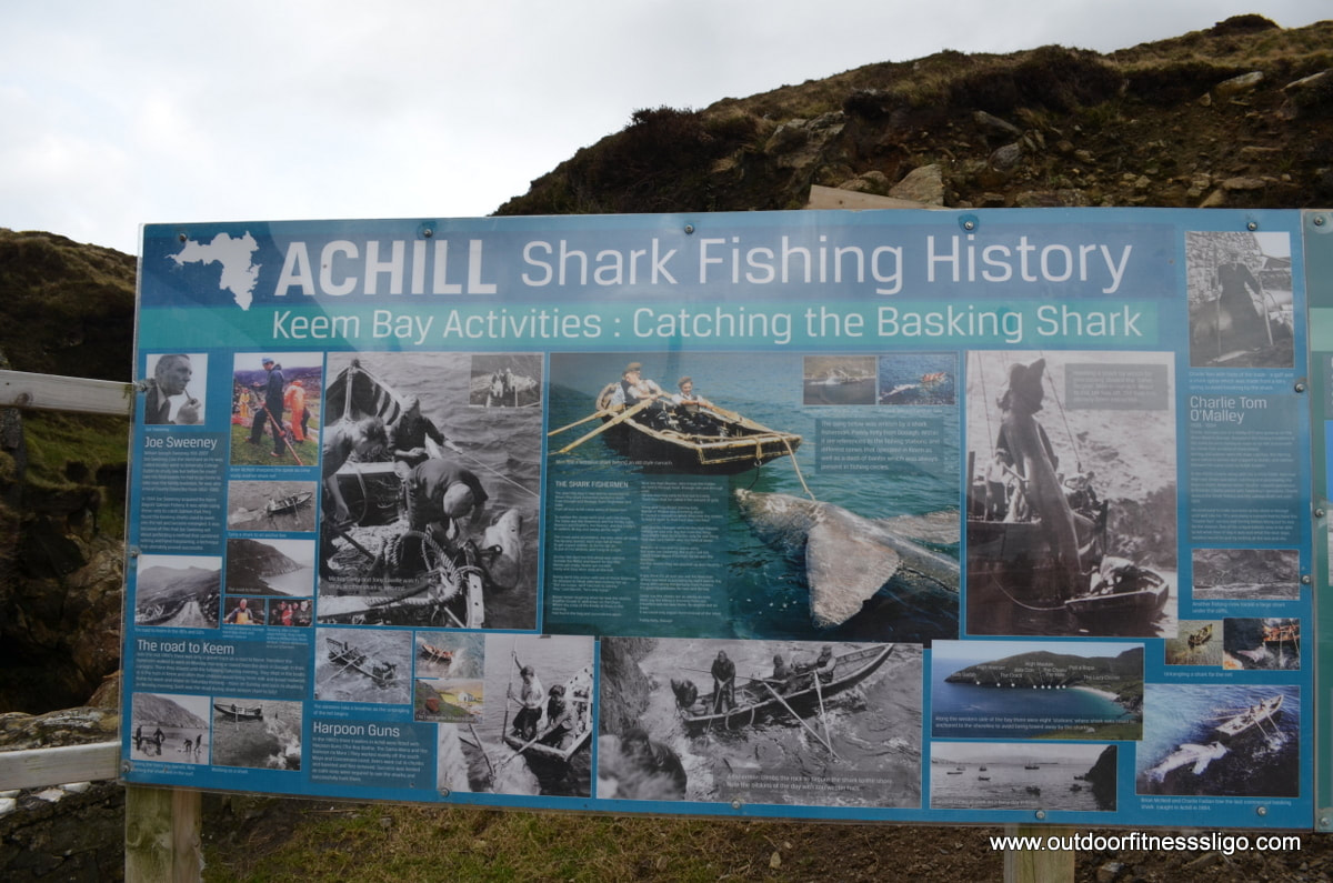
In order to reach Keem strand, you have to follow the spectacular clifftop road which leaves Keel. The views across the Atlantic Ocean are amazing and we were lucky, getting close to Keem Bay, the sun decided to break through the clouds and give us an amazing display of colours , from the azure blue of the water to the white sand of Keem Strand. The bay is horseshoe shaped and is flanked on either side by cliffs. This bay was used for a booming fishing industry and the local boats "Currach" were used in the fishing industry. The waters around Achill Island are frequented by Basking sharks and it was these sharks which were once caught between the 1950's and 1980's. And Keem strand was the end of our Achill adventure. Achill Island is an amazing spot, from the crashing waves onto the shore to the white blue flag beaches, but it is Keem Strand where you can look out over the vast expanse of water, enjoy the amazing display of colours and believe you are the only person on Achill Island. Again probably because it was February, looking at the amount of carpark space, Keem Strand is a popular spot during the summer months.
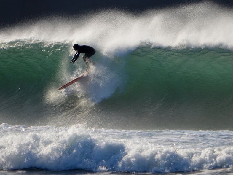
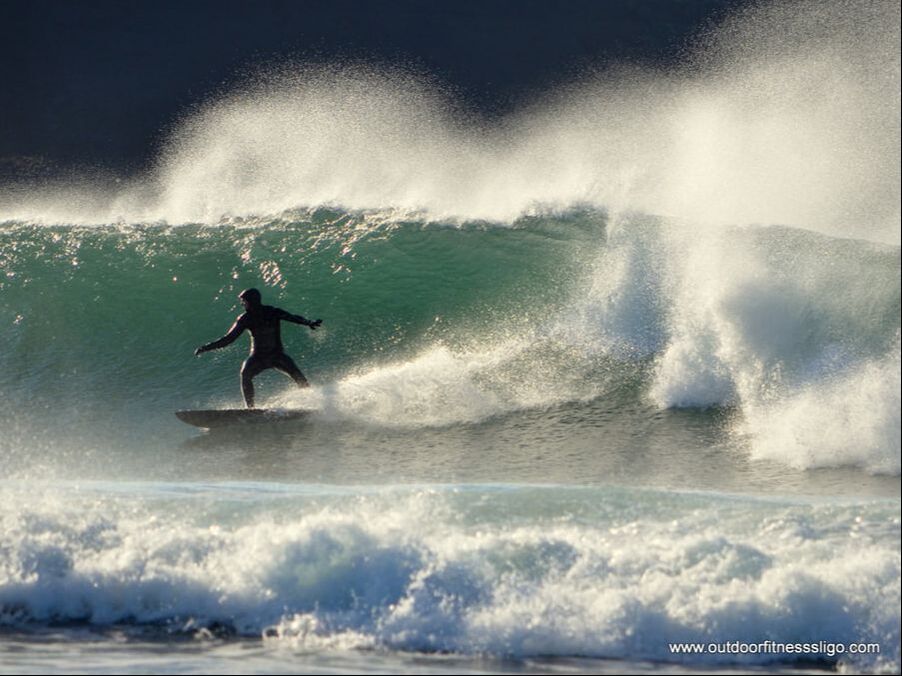
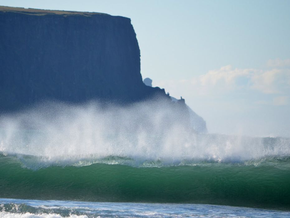
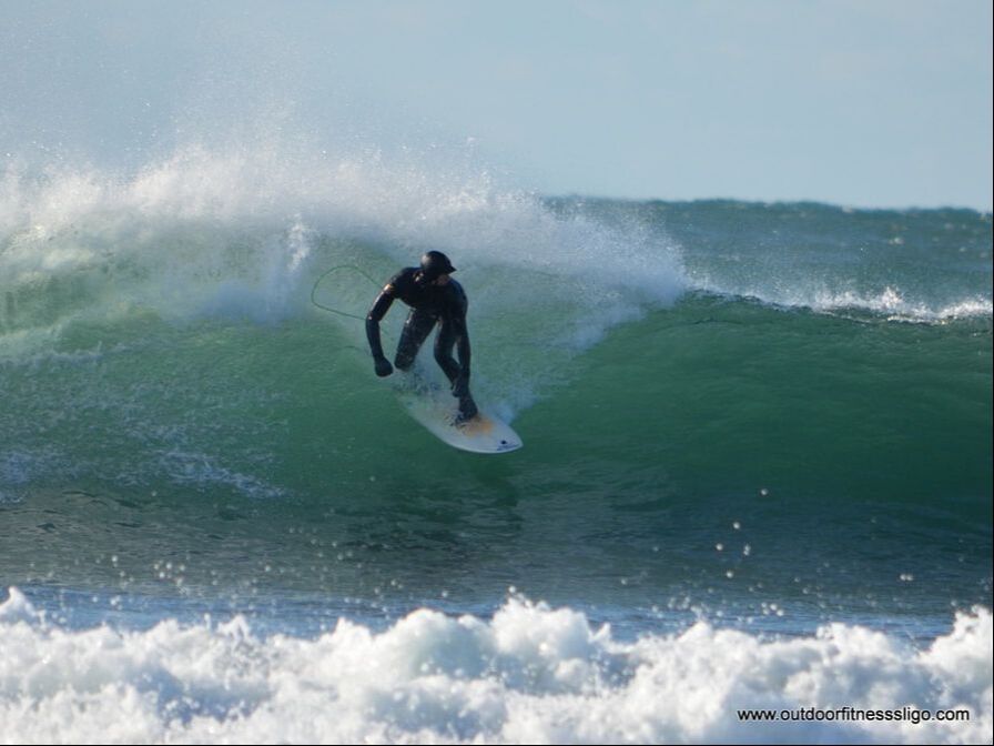
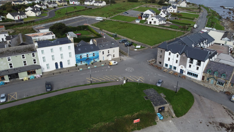
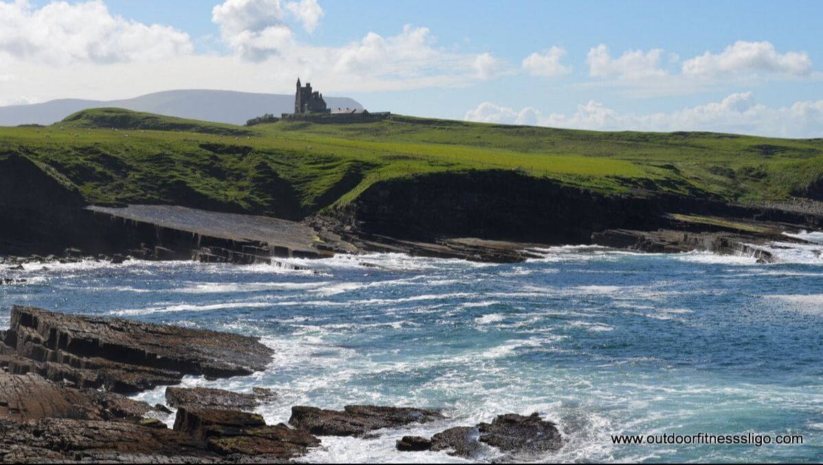
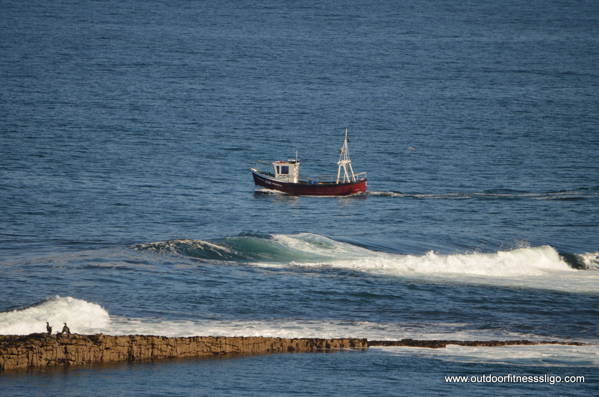
Mullaghmore is a small fishing village in Co.Sligo. Nearby the village is an amazing blue flag beach. The waters are always calm at the beach due to it's sheltered nature. But make your way around the headland and witness the power of the Atlantic Ocean.
And in the last few years, Mullaghmore has established itself as one of the best big wave locations in the world. When the weather conditions are right, a lot of the best big wave surfers head over to Mullaghmore to enjoy some Tow-in surfing.
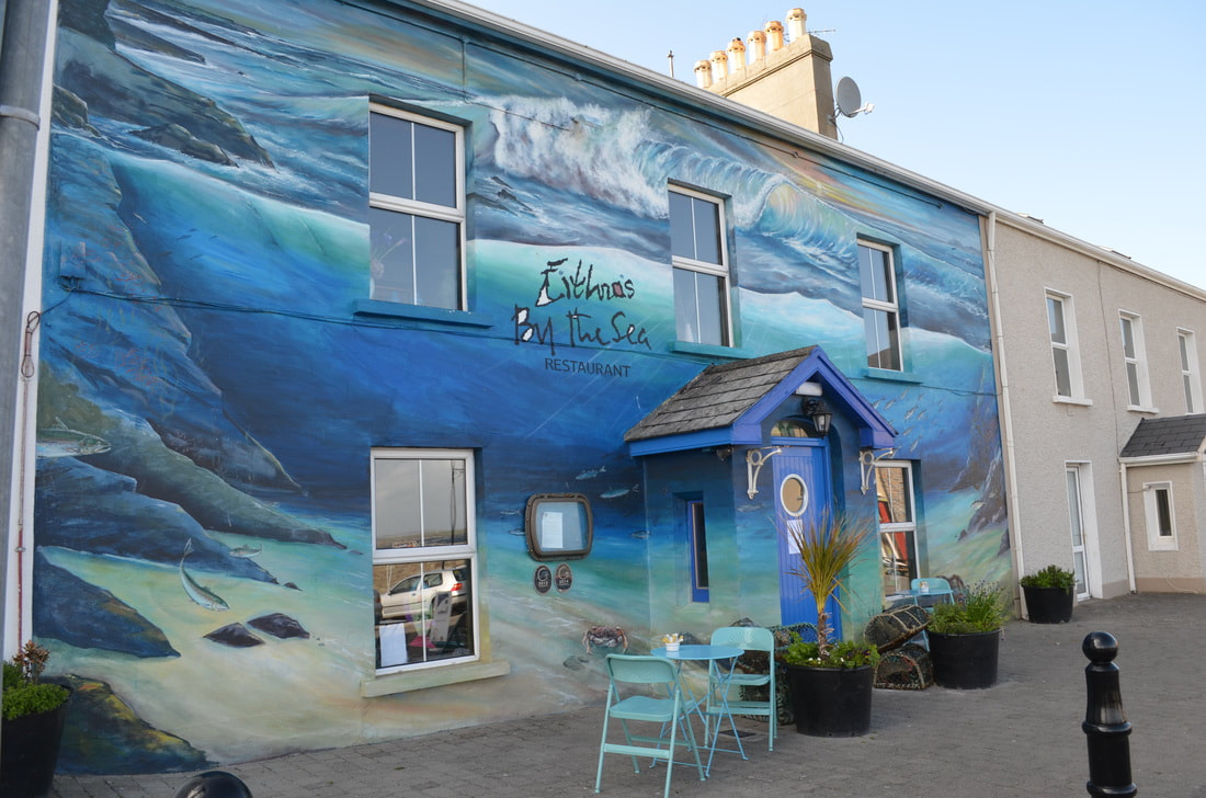
But Mullaghmore has more than just surfing. Any water based sport can be done around the headland, from sailing to coasteering to fishing. Feeling hungry afterwards,head to Mullaghmore village and enjoy a mouthwatering meal at Eithnas seafood restaurant. Try the oven baked fillet of hake or the Mullaghmore wild Atlantic lobster, some of the daily specials which can be found on the menu. Afterwards, walk around the headland admiring the amazing sunsets and views as far as Slieve League in Donegal.
As part of our Wild Atlantic Way pages we wanted to create on www.outdoorfitnesssligo.com , we decided to take a day trip to county Mayo, targeting the north coast from Ballina to Belmullet. And we decided to stop at all the Wild Atlantic Way Discovery points . First stop, Killala Quays. it was still early in the morning, so it was quiet in killala. From Killala, we followed the coastal road towards Lackan Strand. Lackan Strand is another Discovery Point along the Wild Atlantic Way. Lackan strand looks out onto the Atlantic offering breathtaking views as far as Sligo and Donegal.
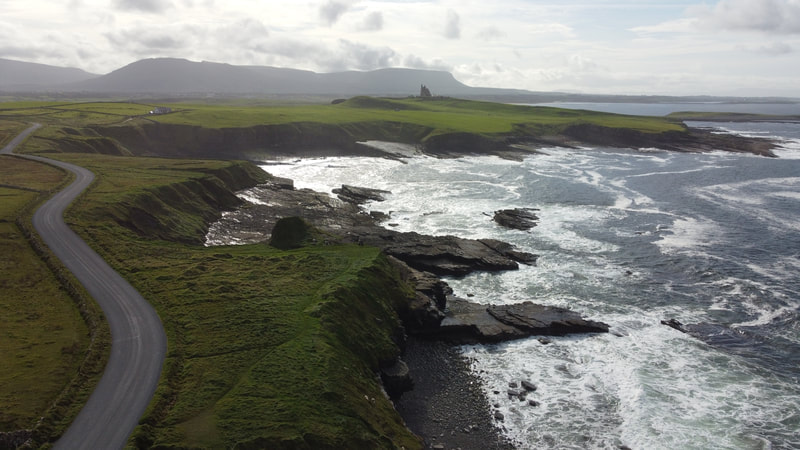
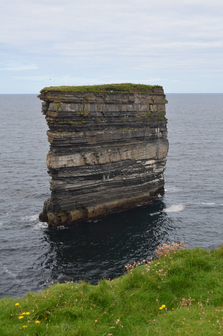
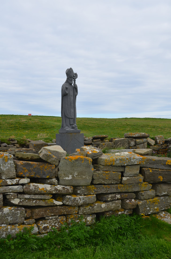
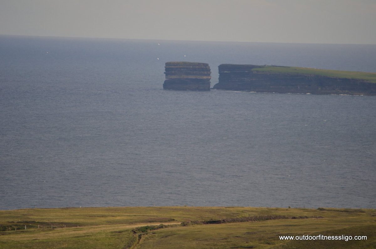
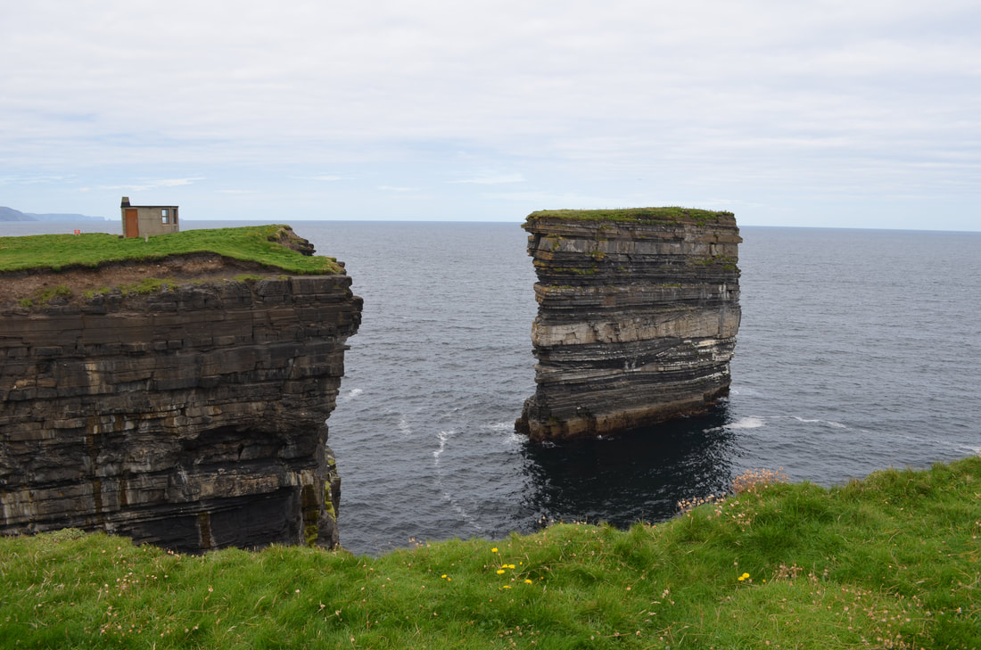
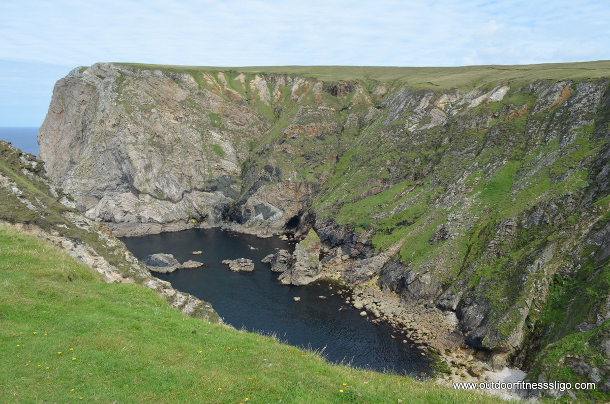
Next on route was Downpatrick Head. Downpatrick Head used and still is an important pilgrim destination. St Patrick founded a church here, ruins can still be seen within the landscape. The very spectacular sea-stack is called Dún Briste. Many birds can be seen breeding along the rocks of this stack. There are also multiple blowholes, the largest one being Poll Na Seantainne which on a stormy day is spectacular.
Afterwards, we headed towards the Ceide Fields in Ballycastle. Here, you can enjoy the views towards dramatic cliffs along the Co.Mayo coast. The Ceide Fields visitor centre (https://www.outdoorfitnesssligo.com/blog/ceide-fields-neolithic-site) is worthwhile a visit. They are the oldest known field systems in the world. The remains of the stone walls, houses,.. are buried under the huge layer of peat. After the Ceide Fields, we headed towards our next discovery point, Benwee Head. Benwee Head is the ideal location for walking as you have waymarked walks along the cliff edges with spectacular views of the Wild Atlantic ocean.
After having stretched our legs, we headed towards Belmullet where we had to cover our next 5 Discovery points. After a stop in Belmullet's Post office, where we got our Wild Atlantic Way passport stamped, we headed towards blacksod. On the way to Blacksod, you pass another discovery point called Elly Beach , a fine beach with the clearest waters suitable for swimming and watersports.
From here, it is a short drive to Blacksod lighthouse which was built in 1862. In June 1944, a decision was made to go ahead with the D-Day landings based on a detailed weather report from Blacksod Bay. The lighthouse itself is spectacular as it is built from massive granite blocks.  Afterwards, it was back direction Belmullet in order to visit Falmore. Here , you find a granite boulder sculpture that was created as part of the sculpture trail in County Mayo. The views toward Achill Island are impressive.
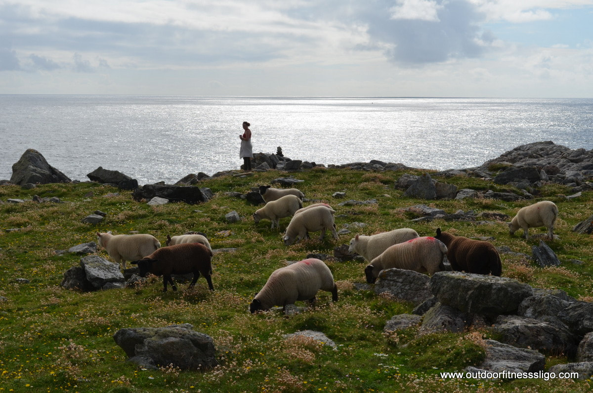
Heading back towards Belmullet, we visited Annagh Head. Here, we found ourselves surrounded by sheep, which in our view must be the happiest sheep on the planet due to the fact that they have some of the most amazing views towards the Atlantic Ocean with not a soul in the vicinity. Annagh Head is home to some of the oldest rocks on Ireland. The ancient rock called Gneiss is millions of years old and is similar to the ones found in Greenland.
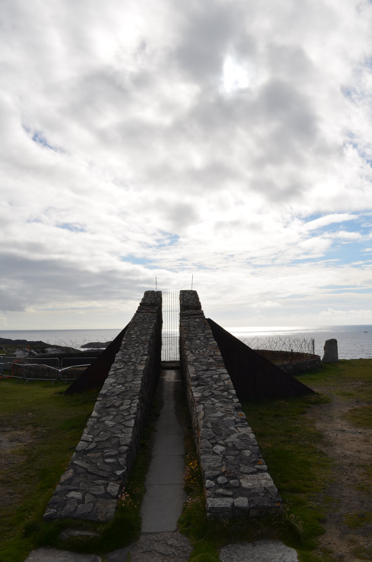
Afterwards, we headed towards Doonamoe Blowhole, another discovery point. Here you will find another sculpture which is called 'Thin Places' and is build around the blowhole.. It is two shrines dedicated to those Lost at Sea. 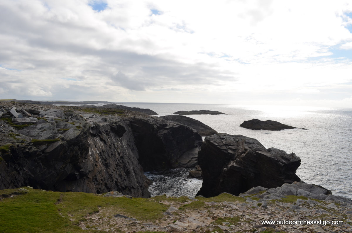
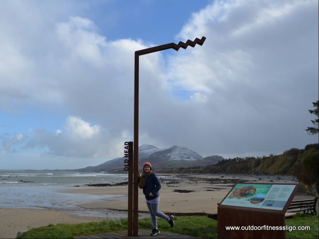
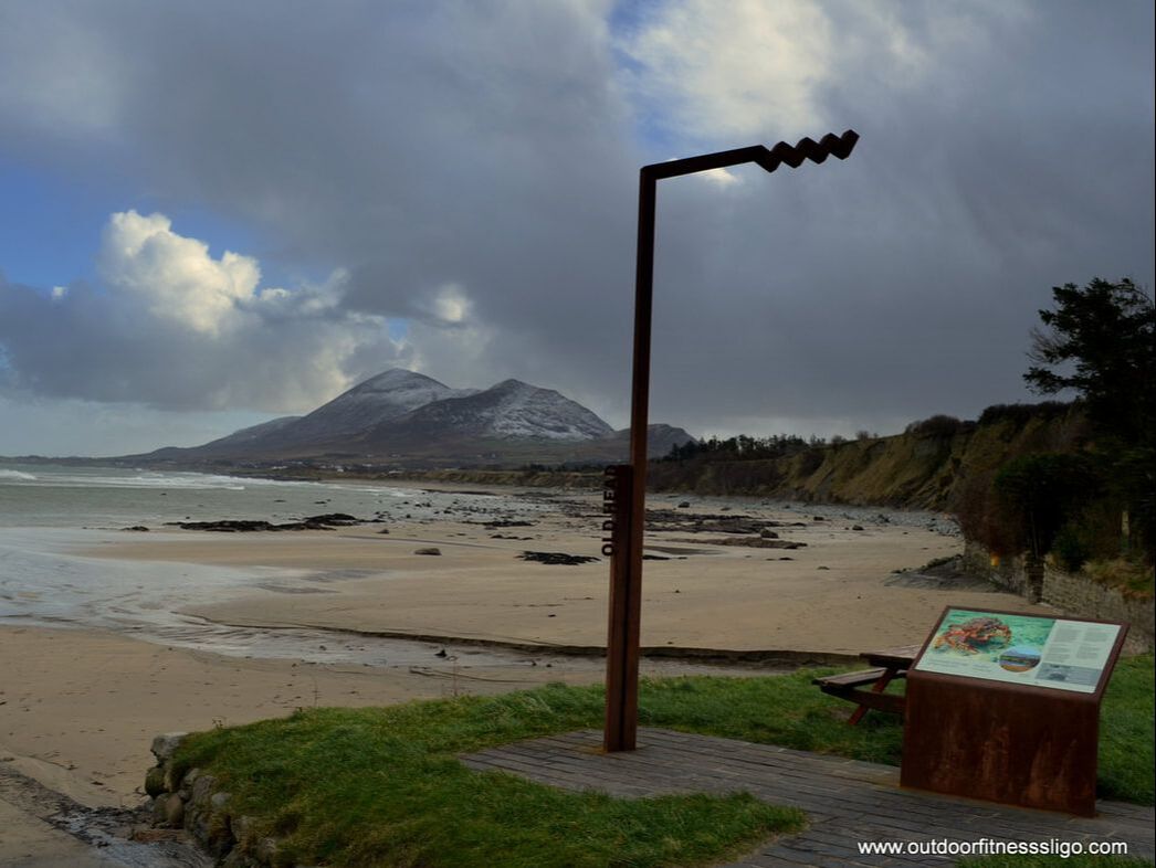
Our last stop of the day was Ceann iorrais, an amazing location for walks and watching sealife. And right in front of us was a tiny seal who just came to say goodbye when we said goodbye to county Mayo after enjoying an amazing daytrip along the Wild Atlantic Way 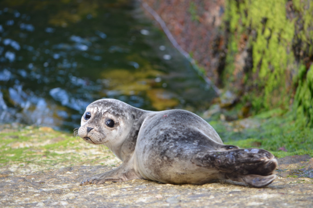 Old Head is located close to the town of Louisburgh in Co.Mayo. Old Head Beach is fabulous during any season. The beach has views towards Croagh Patrick and is sheltered by cliffs and native woodland. Here you find one of Ireland's few coastal Atlantic Oak woods which runs as far as the beach where it provides a dramatic backdrop for this co. Mayo beach.
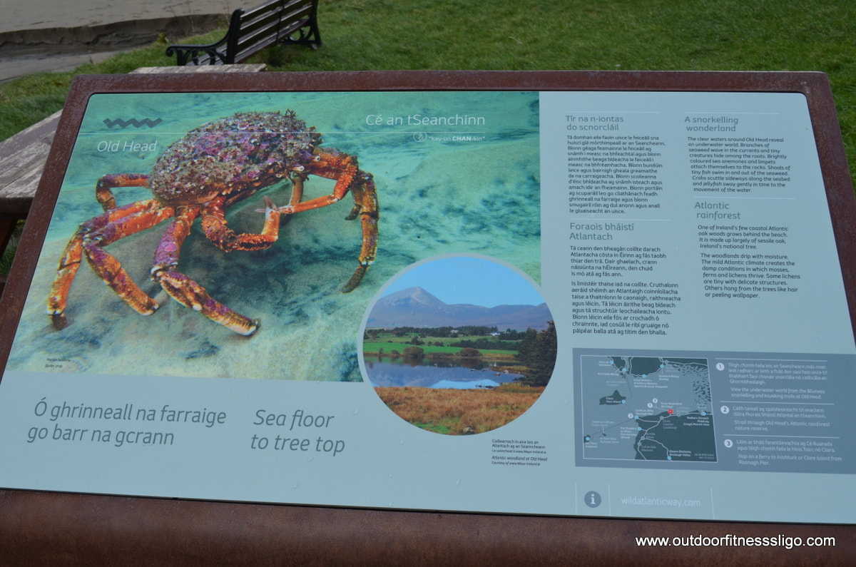
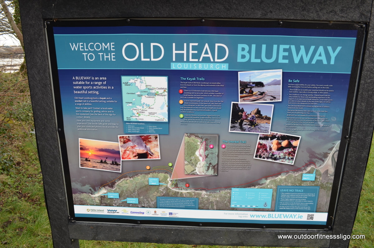
But Old Head is more than just a beach, it is also home to the Old Head Blueway, an area suitable for a range of watersports. The pristine Atlantic Waters are the perfect location for snorkeling allowing you to admire the underwater world of the Atlantic - discovering different types of seaweed, fish, crabs and sea urchins ,...
As part of the Blueway, you have Kayak and snorkel trails. As part of the kayak trail, you have 3 options:
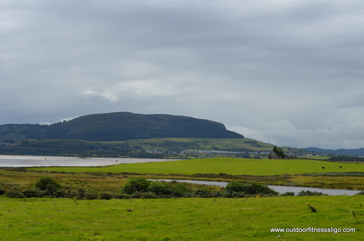
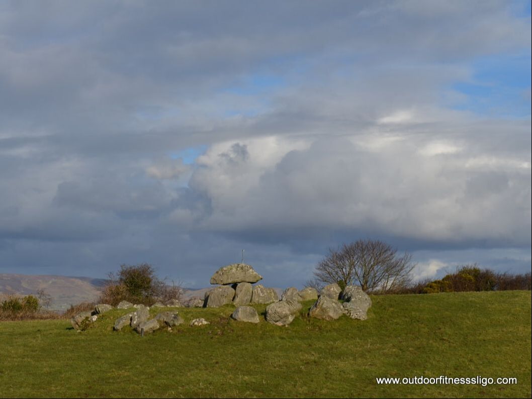
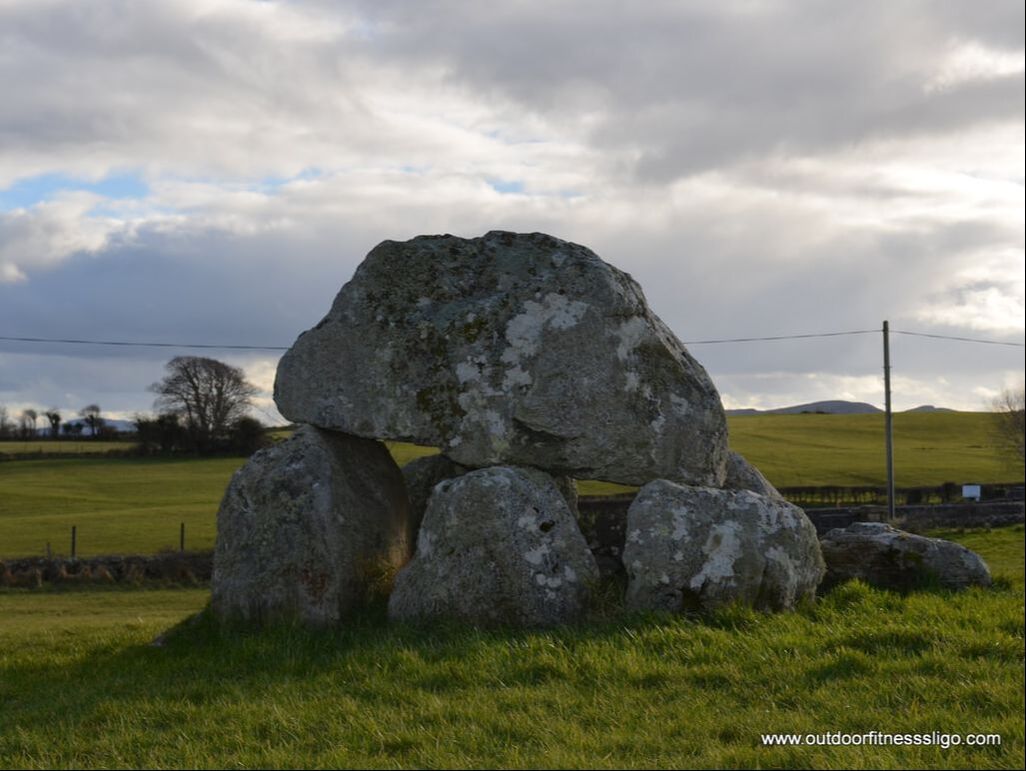
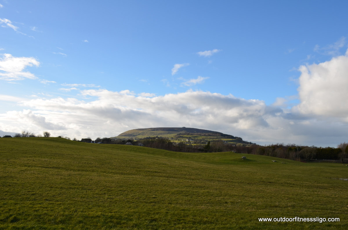
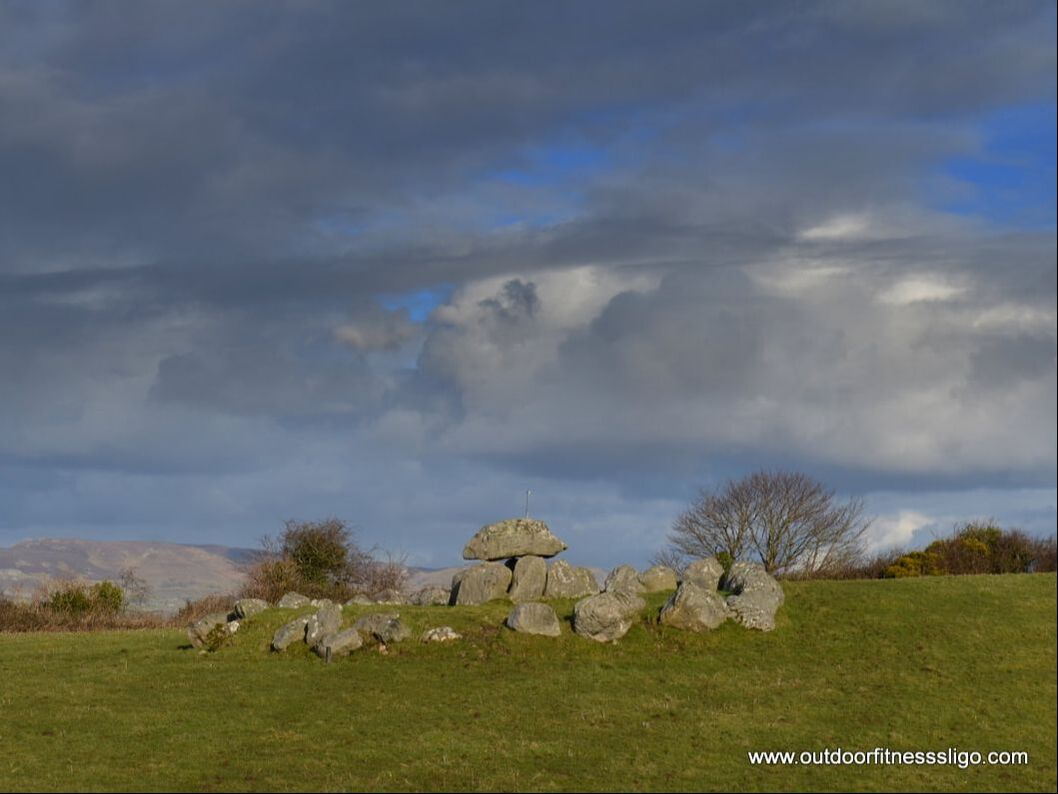
a) a 5.5km trail which runs from Old Head and Lecanvy pier which passes a few beaches and rocky outcrops. This trail is great for beginners. b) A more exposed trail runs from Old Head to the beach at Calla, along the 5km route you will pass fabulous caves. This trail is for the more experienced kayaker. c) A 3km western trail extends beyond the headland, so still some experience will be required. The snorkel trail runs along the beach and traverses North from the pier towards the western headland. From here, you can decide to walk back along the beach or snorkel back. Under the watchful eye of Queen Maeve's grave on top of Knocknarea, we arrived at Carrowmore Megalithic Tombs in Co.Sligo. What is special about Carrowmore is that it is the largest cemetery of megalithic tombs in Ireland. The site is managed by the Office of public works, and a small visitor center is located at the site. Nowadays, approx. 30 monuments survive although it is thought that approx. 60 existed, but some got lost during the 18th & 19th century due to quarrying and field clearing. The visitor center opens it's doors from March to October and provides guided tours and self guided mult- lingual tours. Most of the tombs are satellite tombs which circle the main cairn called Listoghil (cairn 51). The small satellite tombs existed out of a central megalith burial chamber which is surrounded by a stone circle.
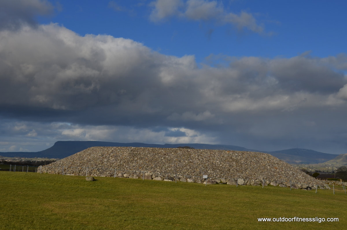
Cairn 51 or Listoghil has been restored and is an impressive sight with Benbulben in the background. It was erected around 3500BC and is 34 meters in diameter. It has a box shaped chamber with the only megalithic art found at Carrowmore.
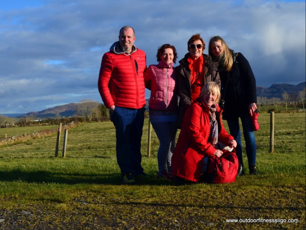
We met the lovely Marian, Ellen and Joanna who were visiting the tombs as well. Marian used to run the Red Cottage B&B in Sligo town where now it is her daughter Karen who runs this busy B&B (https://www.redcottagesligo.com/). Her friend Ellen was over for a visit from Tipperary where Joanna was over from Poland to visit some friends. Sligo is worth a visit, and if you are interested in megalithic history, you won't be disappointed with all the avaliable tourist attractions... ( www.choosesligo.com)
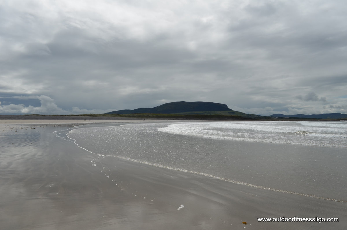
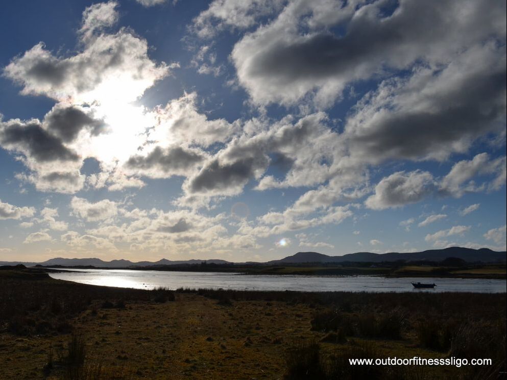
On a Baltic morning, we decided to visit south Co.Sligo . Probably the lesser visited part of Co.Sligo, we wanted to sample what it has to offer. And we can start by saying that it has a lot to offer, and should be on every bucketlist. Starting off in Sligo town, our route took us as far as Beltra where we turned right after the village onto the Wild Atlantic Way coastal road. After approx. 3 km, we turned right towards Portavade. It is a cul the sac road, but at the end of it, you are greeted by fabulous views across Ballysadare beach and Strandhill.
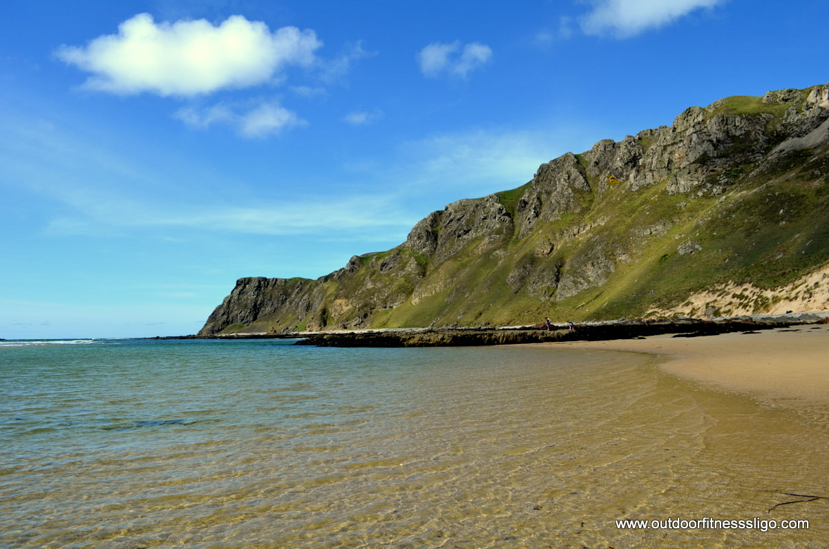
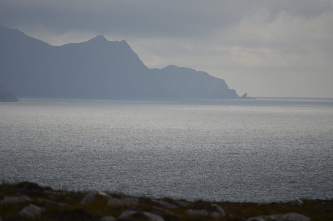
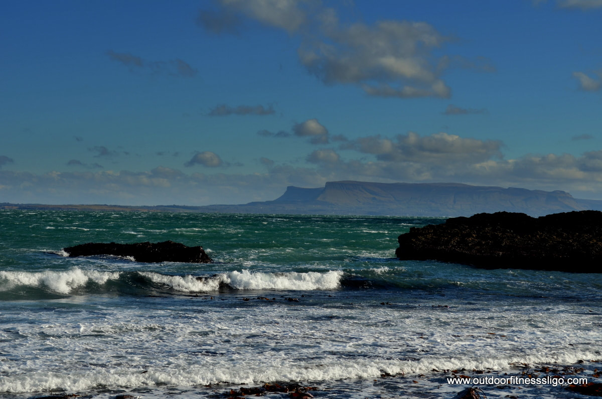
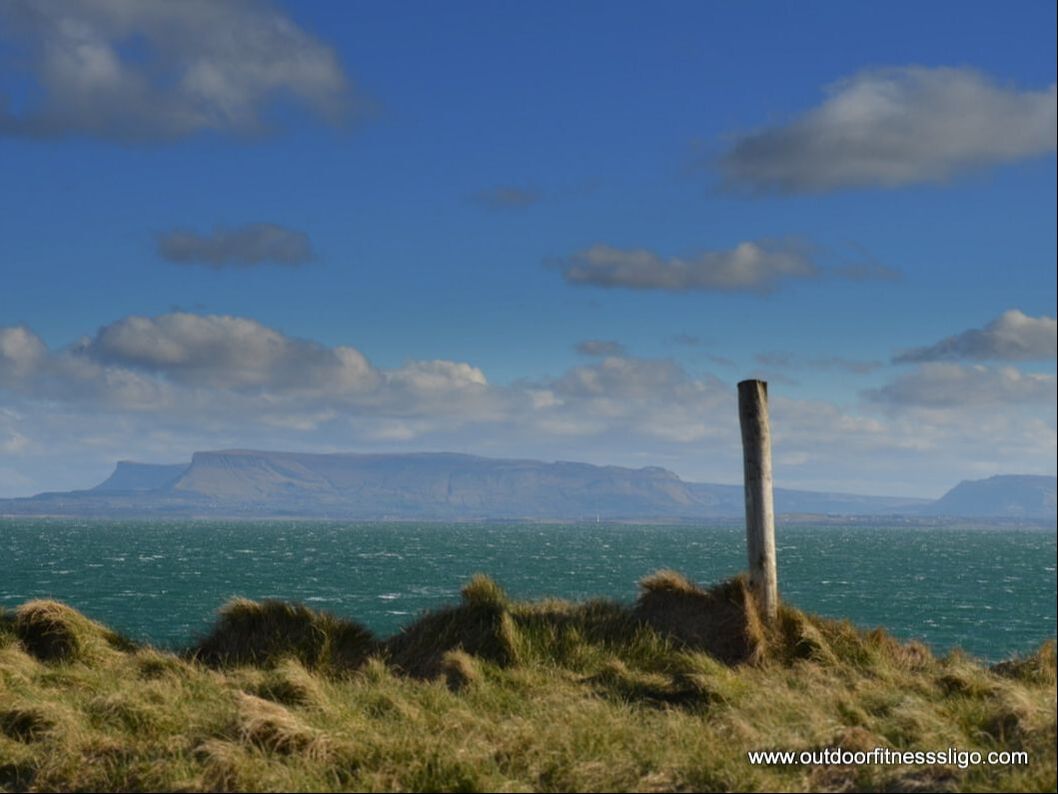
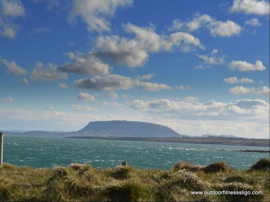
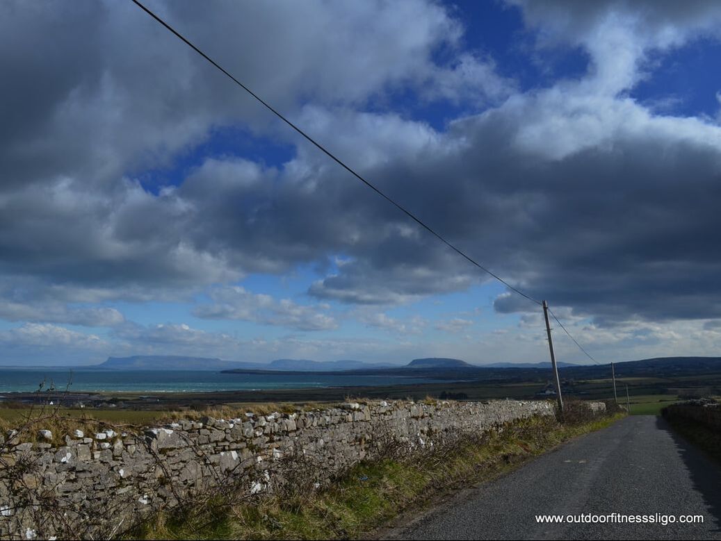
Our next stop along the coastal route was Aughris Head. At Aughris pier, you will find the start of the fabulous Aughris Head walk which follows the rocky shoreline ending at a small but impressive beach which at the best of times is very quiet. The walk gives you views across Sligo Bay towards Knocknarea and the Dartry mountains and on a clear day as far as Donegal (Slieve League)
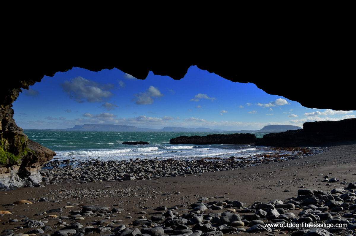
After having crossed the beach, we found some small sea caves which are great for taking some dramatic pictures towards the Dartry mountains. After having returned to the car, we headed back to the coastal route to stop at our next scenic location - Trawee Beach.
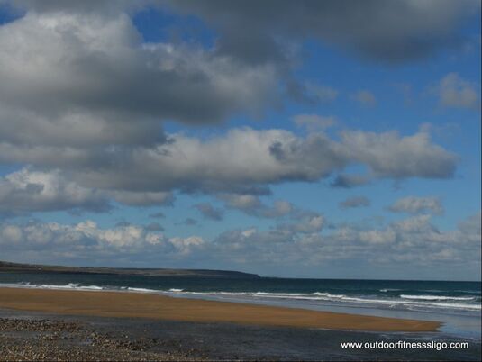
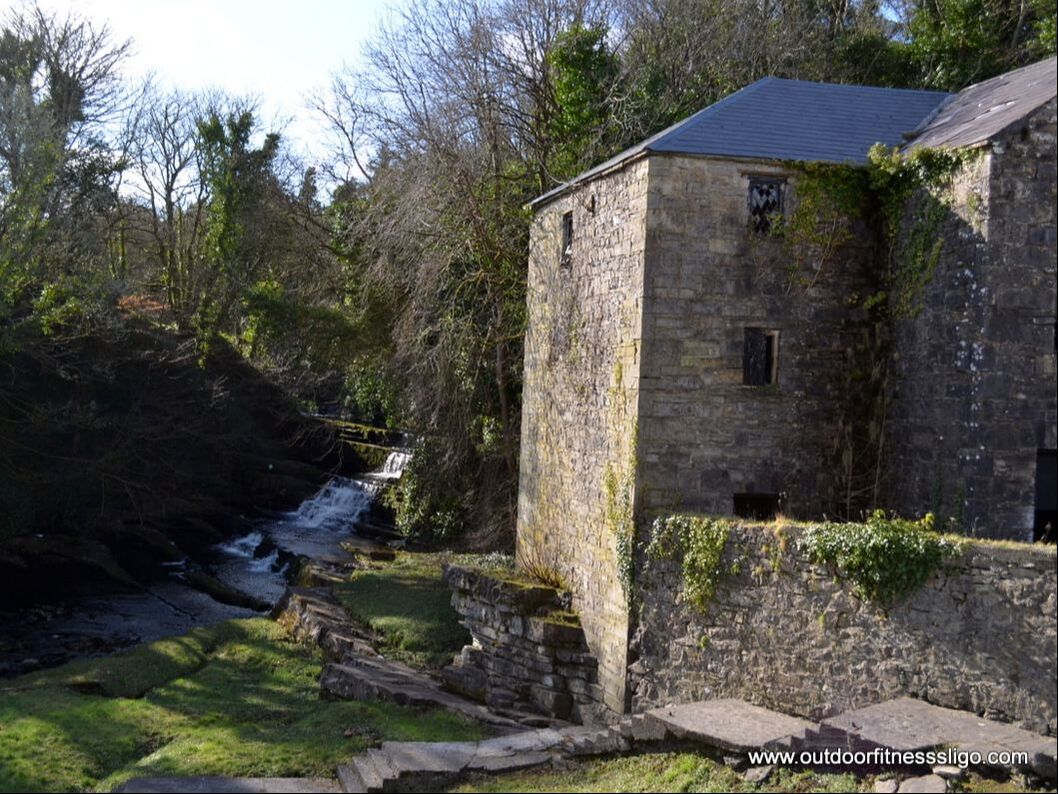
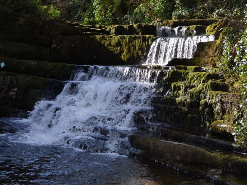
Next destination was Easkey, but the beauty of the landscape made us stop another few times along the route to take further pictures. The roads are quiet, the views are fabulous, what more could you wish for during a relaxing coastal drive. We decided on this particular day that we would go as far as Easkey and have lunch at Pudding Row, but unfortunately there was some event on and it was closed for business. Easkey is an interesting town in South Sligo, it is home to one of the best surfing spots in Co.Sligo , but it is also home to Easkey tower and the famous split rock. The huge boulder, which is split in 2 is approx 6.5 meters by 2.5 meters, and it is believed that the rock was carried down from the Ox Mountains by the retreating glaciers at the end of the ice age. But local folklore tells the story of Fionn Mac Cumhaill who arrived on top of the Ox Mountains where he was challenged by another strong man called Cicsatoin to compete in a rock throwing competition. The challenge was to reach the sea, but Fionn's rock fell short which made him angry. In anger, he pulled his sword and split the rock in two. 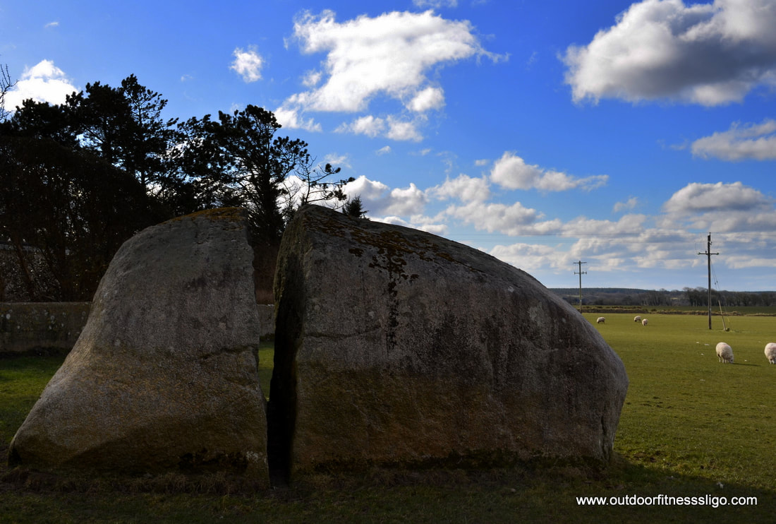 From Easkey, we headed towards Dromore West where we took a quick stop to check out the Dunneill river which cascades down some beautiful waterfalls. A stairwell brings you towards the waterfalls, for the more adventurous you can follow a scenic riverside walk.
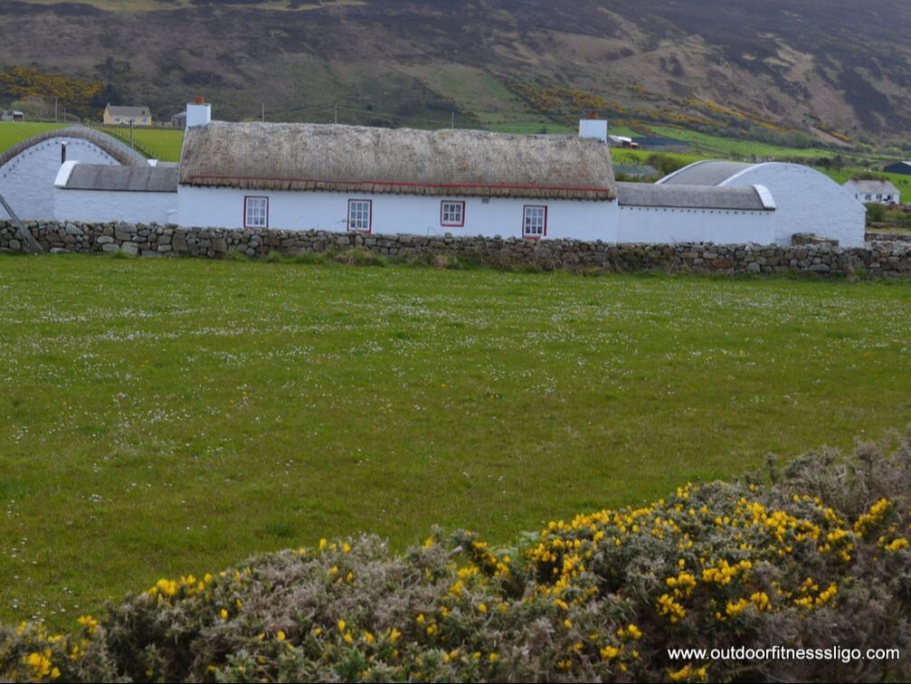
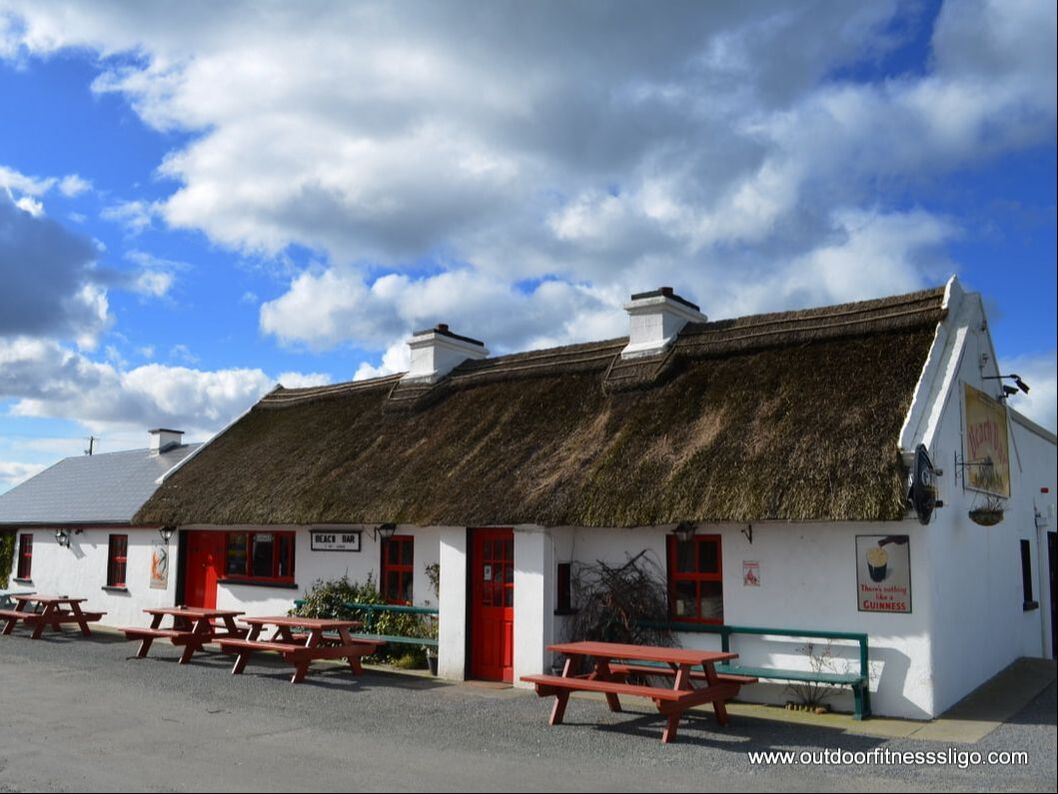
Heading back towards Sligo town, we passed a sign guiding us to the Beach Bar. Being hungry, we decided to chance our luck and have a quick lunch. Arriving at the beach bar (www.thebeachbarsligo.com/ ) , you can't but notice the beauty of this old charm thatched pub which sits literally on the beach. We were in luck, just when we arrived, the door was opened. Inside, a warm open fire welcomed us on this particular cold day.
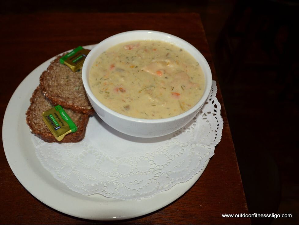
We went for the seafood chowder which was served piping hot and was accompanied by 2 homemade slices of bread. The chowder was one of the best I had ever sampled, the amount of fish in the bowl was unbelievable and the chowder turned out to be a meal in itself. After having warmed ourselves by the fire, we hit the road again and turned away from the sea towards the Ox Mountains, more specific a road which is known as Ladies Brae (Follow the signposts from Skreen). Ladies Brae is a fabulous route which takes you through the heart of the Ox Mountains. The only living souls you meet are the many sheep which just look up and slowly move toward the side of the road.
The Ox Mountains and it's surroundings are fabulous for adventure sports, so if you are adventurous, give wildwetadventures.ie/ or www.oxmountainadventurecamp.ie/ a shout and they will get you to discover the wild unspoiled beauty of South Sligo. So, as you can see, it is amazing what you can do in South Sligo in a couple of hours. One moment, you can be on a beach , then walk along some waterfalls followed by a drive through the mountains. South Sligo is diverse, the landscapes are ever changing and the scenery is to die for. |
�
About the AuthorWe are Peter & Dolores De Bie. We love the great outdoors, discovering new parts of the world and writing about our adventures along the Wild Atlantic Way and further afield Categories
All
|


 RSS Feed