|
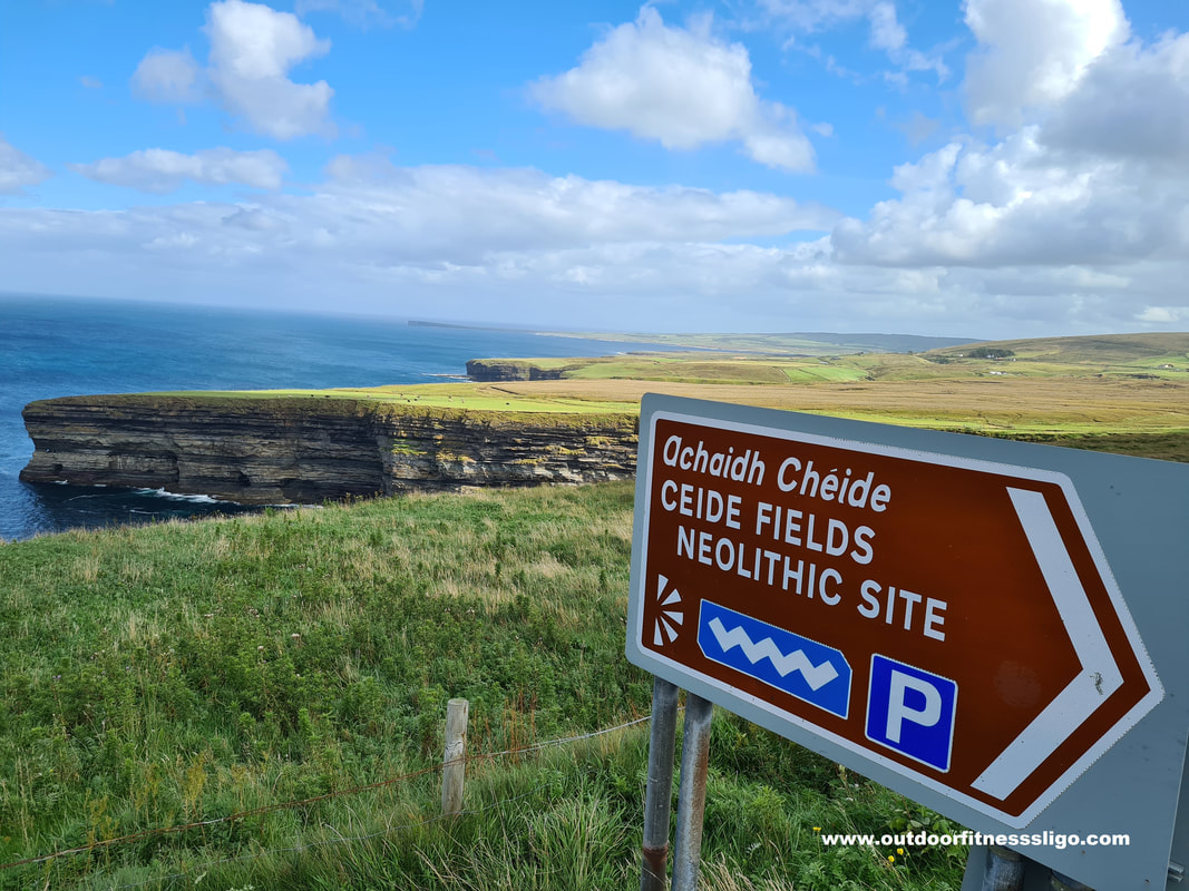
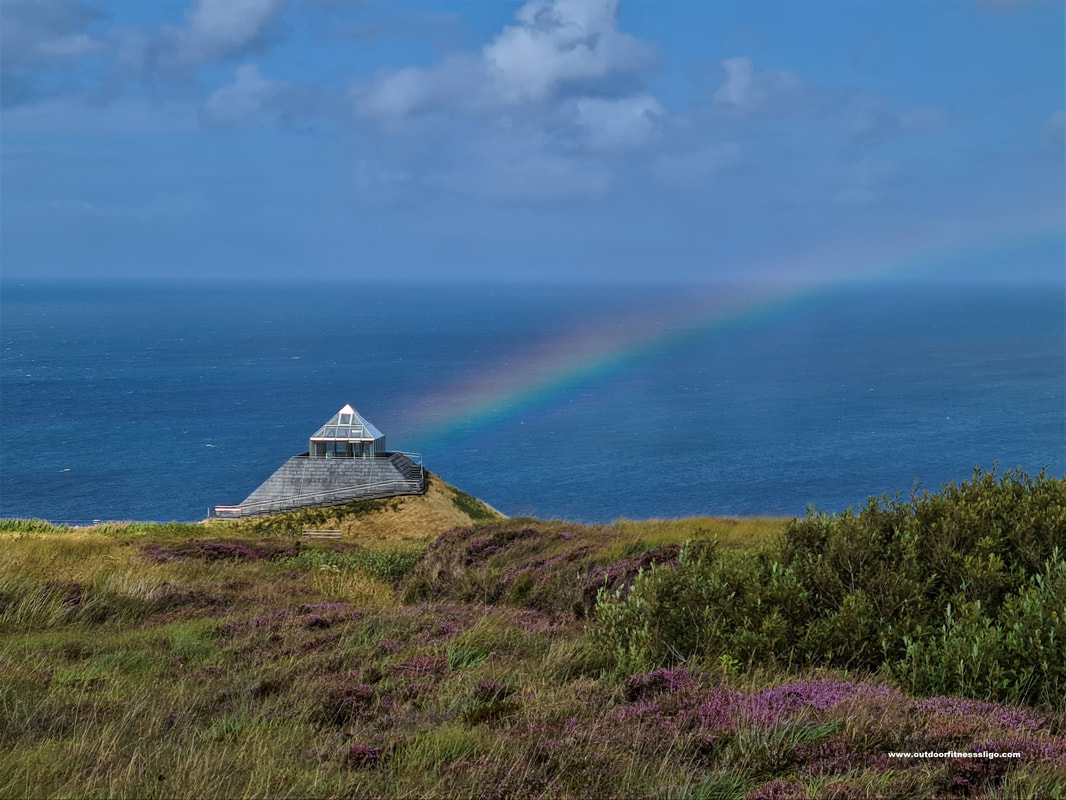
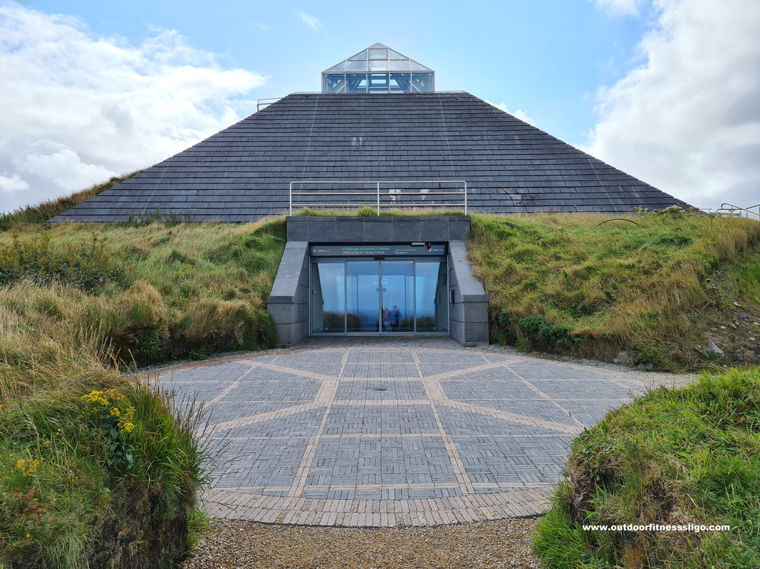
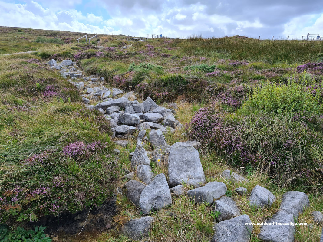
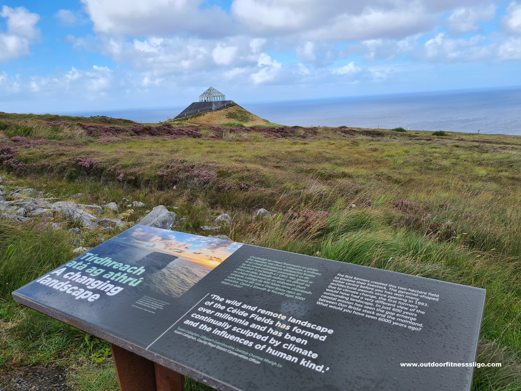
The rugged North Mayo coastline is just spectacular. With its cliffs and bogland, it can be wild even on a day in August. Within this barren landscape, a pyramid-like structure sits half buried in the landscape. But it's not the only thing buried underneath this bogland. Beneath the wild landscape lies a system of fields, dwelling areas and megalithic tombs which together make up the most extensive Stone Age monument in the world. The pyramid-like structure is the award-winning visitor centre which went through an extensive €2.6 million investment. The enhanced experience at this renewed visitor centre includes an improved interpretation that tells the archaeological story of the site, but also its discovery. ( https://heritageireland.ie/places-to-visit/ceide-fields/ ). The stone-walled fields extend over hundreds of hectares and are the oldest known globally, dating back almost 6,000 years. They are covered by a natural blanket bog with its own unique vegetation and wildlife.
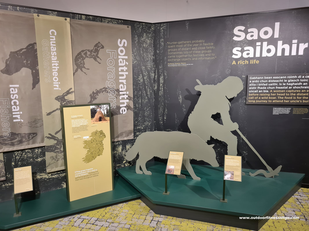
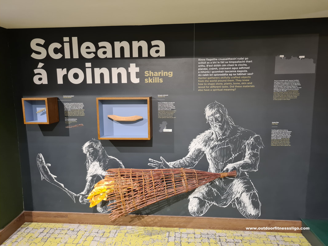
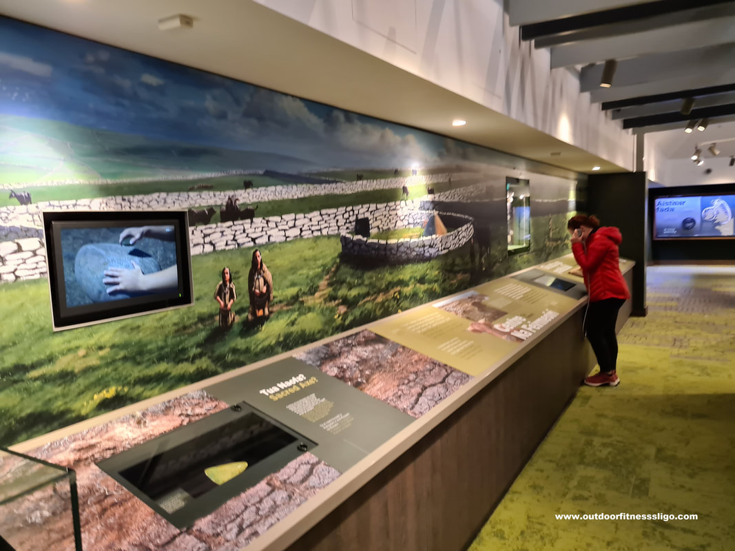
Entering the visitor centre, you are welcomed by a huge piece of bog oak. A new state-of-the-art audio-visual exhibition encourages you to learn more about the rich heritage of the region. The first thing we entered was an immersive 360-degree room where an animated movie is projected all around you on the walls. The movie transports you back in time allowing you to meet the Stone Age people who once created the fields and dwellings underneath the blanket bog.
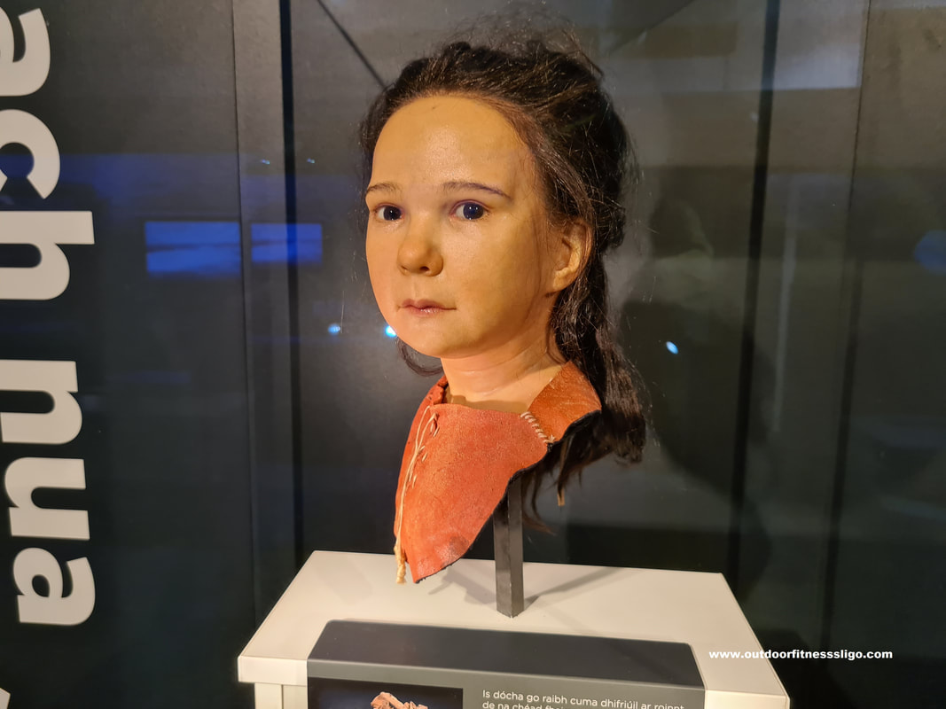
.The first floor of the visitor centre explains how these settlers arrived in Ireland, the tools they used, the clothes they wore and much more interesting facts. A lot of interactive features keep old and young entertained throughout the visitor centre. The whole experience is just fabulous with every small detail linking the exhibition to the fields below. For example, the green carpets reminded us of the fields and stone walls,.... Interactive features like holograms, games and films educate you further on life during the stone age.
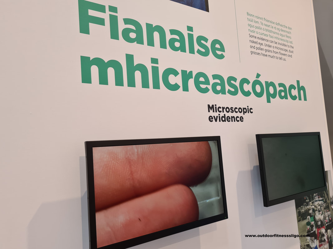
The second floor of the visitor centre explains in detail Archaeology and the work which was conducted in establishing and finding the fields and dwellings below the bogland. A very popular part of this exhibition is the microscope where you can play around with a microscope. The boys loved this part, especially when they decided to zoom in and have a look at their fingers. Another flight of stairs brings you to the viewing deck from where you can admire the scenery, but also fight against the strong Atlantic breeze.
After the exhibition, you can walk around the bog following a boardwalk which brings you along some excavated walls and dwellings. On the particular day we visited the Ceide Fields, we were greeted by a rainbow. Along the boardwalk, you can try the find some of these walls yourself by pushing a long metal rod into the bog , this in the hope of finding some of these ancient walls.
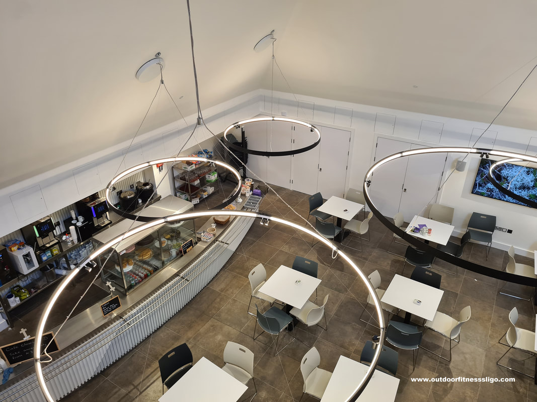
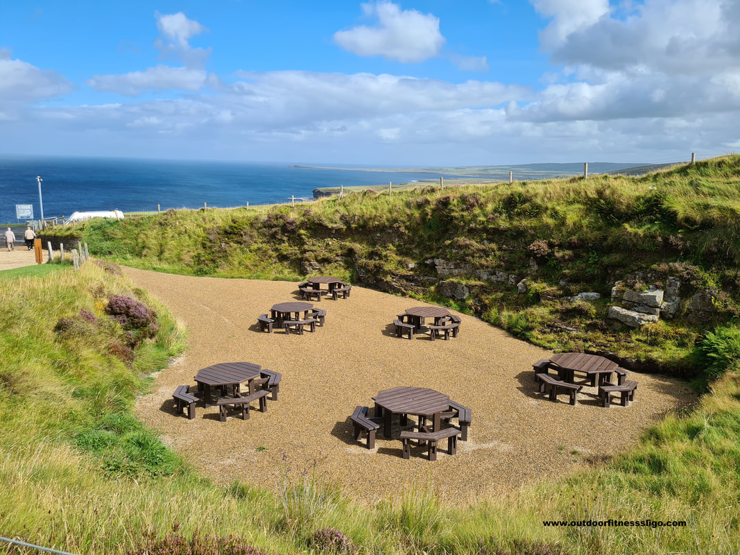
All displays and exhibitions are in Irish and English with written translations available in Dutch, French, German, Italian, Polish and Spanish. if your visit made you hungry, you can enter the cafe where you can try some food or head outwards to the picnic area where you can admire the stunning views. Across the road is also a viewing platform which allows you to stand on the edge of the high cliffs. The cliffs of North Mayo have featured on television during one of the Red Bull Cliff dives where world-renowned cliff divers jumped from these stunning cliffs into the cold Atlantic.
0 Comments
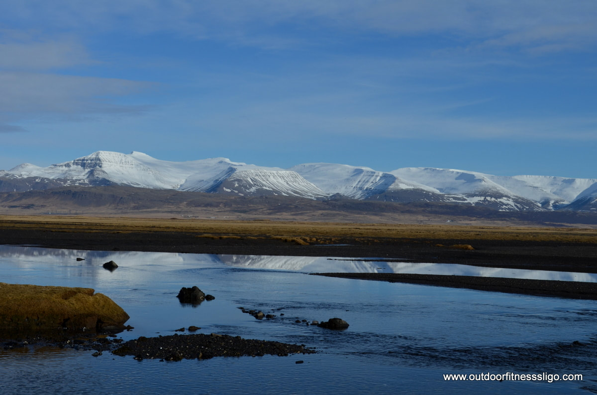
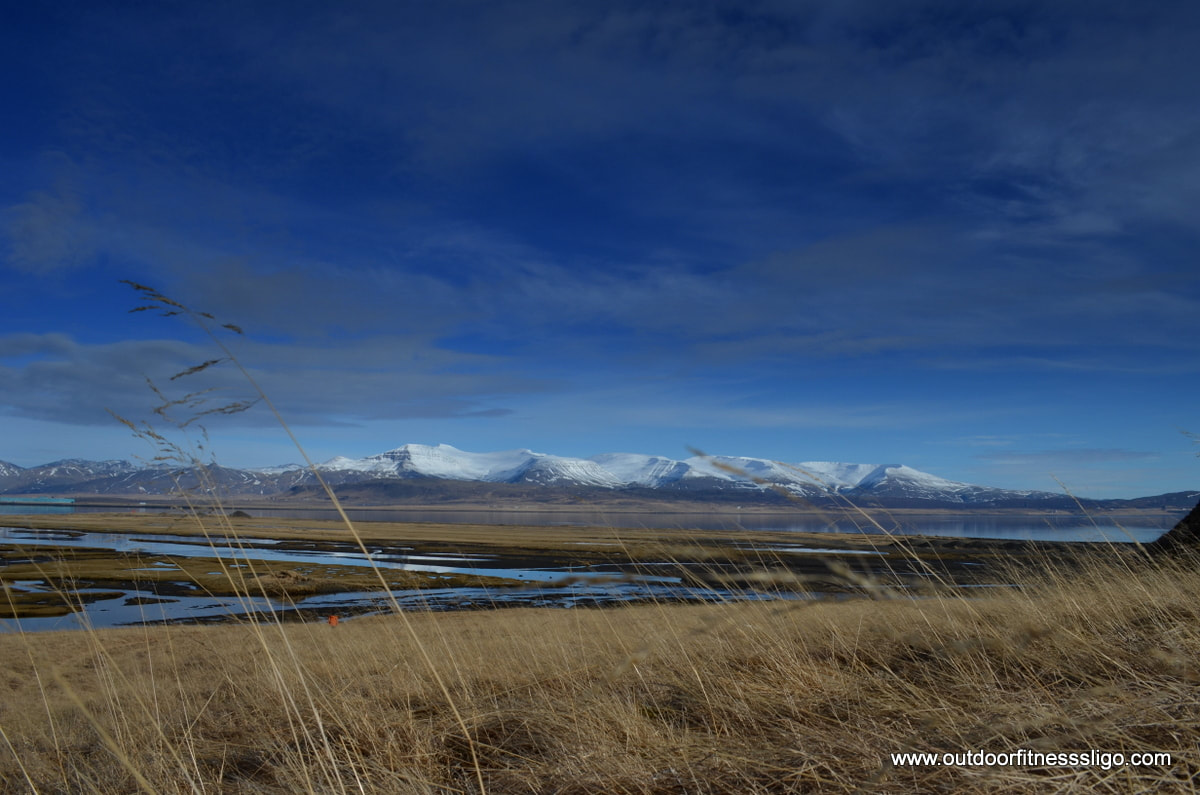
Taking road 54 from Stykkisholmur towards Budardalur in April was a pleasant experience. The unsurfaced road meanders around fjords and beautiful scenery is around every corner. Here we were, 7 people in a jeep on the way to Eiriksstadir on a beautiful day in April. The snow was disappearing and making way for an Icelandic spring.
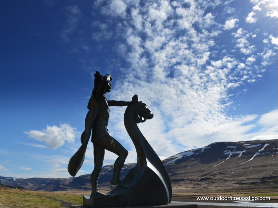
We were heading towards Eiriksstadir, a reconstructed viking longhouse and former homestead of Erik the Red, the first European to discover Greenland. The homestead was the birthplace of his son Leif Eiriksson, the first known European discoverer of the Americas. The unsurfaced route 586 towards the homestead is beautiful, especially around Haukadalsvatn, a beautiful lake which looked inviting with it's deep blue colours.
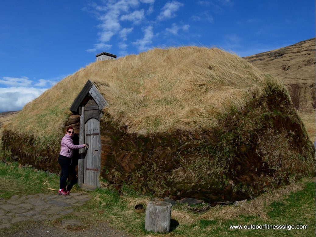
The open air museum was closed on this particular day in April, but we still enjoyed walking around the area and the replica longhouse. Next stop was the town of Budardalur where we searched for a restaurant, unfortunately to no avail. But a lot of the Icelandic petrol stations have a small restaurant. As the weather was great, we decided to have an improvised picnic, although jackets and hats were still required. In the town is a small pool with two seals which was visited to the delight of the children.
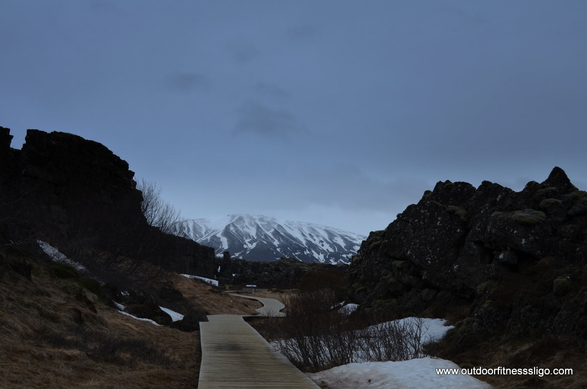
"Come quickly inside and get out of the cold" said the blonde haired lady in the tourist shop. It was late March, and we found ourselves in Thingvellir National Park (https://www.thingvellir.is/en/) in South Western Iceland. This trip had been a family affair, my parents were married 50 years and had decided that instead of having a huge party in Ireland or Belgium, they wanted to go to Iceland with ourselves. I suppose my adventurers side definitely comes from my parents who have always loved travelling to lesser known locations, mingling with the locals and experiencing local food and traditions. So here we were, the entire gang in this beautiful national park which is a World heritage park since 2004.
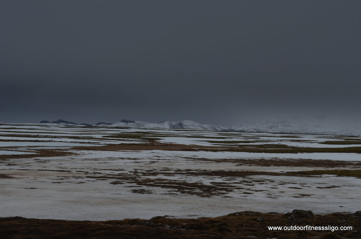
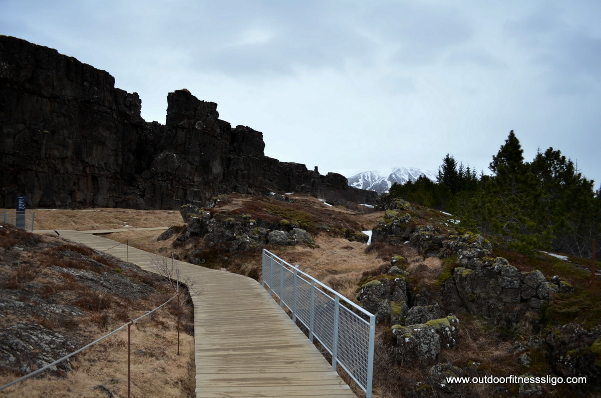
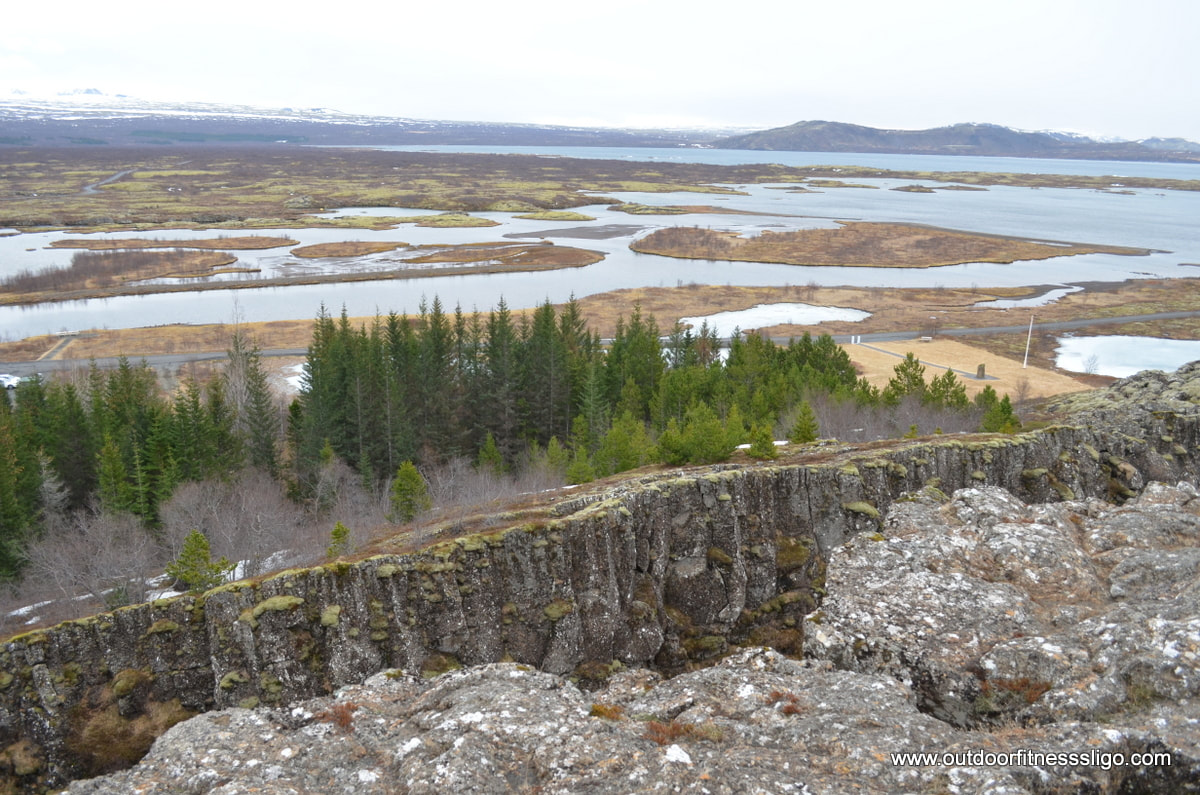
It looked like Thingvellir was ready to be covered by a layer of snow again, a dark sky glooming and in stark contrast with the snow covered mountains. A spine-chilling wind made us wrap-up even warmer, getting ready to walk between the North American and Eurasian plates. The area is also home to Iceland's largest natural lake which is popular with divers who like the idea of diving between tectonic plates.
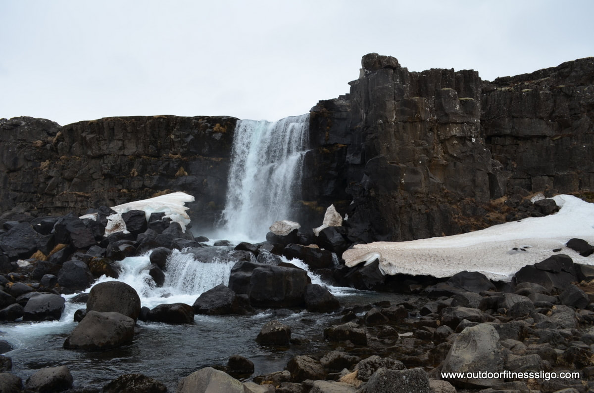
Walking along the path, we admired the waterfall's where the kids enjoyed the areas which were still covered by snow. Thingvellir is associated with the Althing, better known as the Icelandic parliament which was established on this site back in 930AD. Thingvellir is one of the three main tourist attractions in what is known as the golden circle, and we would advise nto arrive early in the National park to avoid the many bus loads of tourists. When we visited the park, some of the paths were still closed due to snow blocking them. We have already plans made to return during the summer and discover this area in more depth.
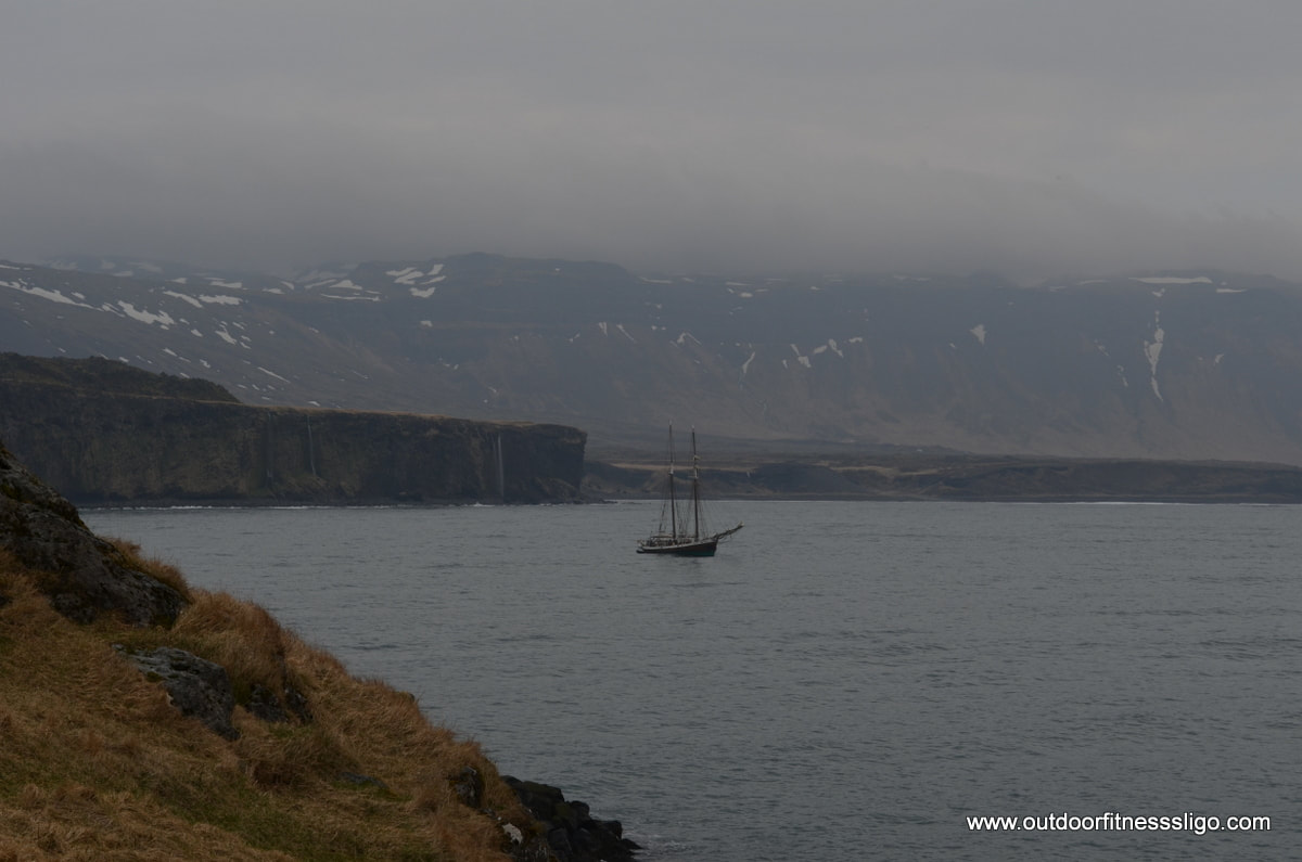
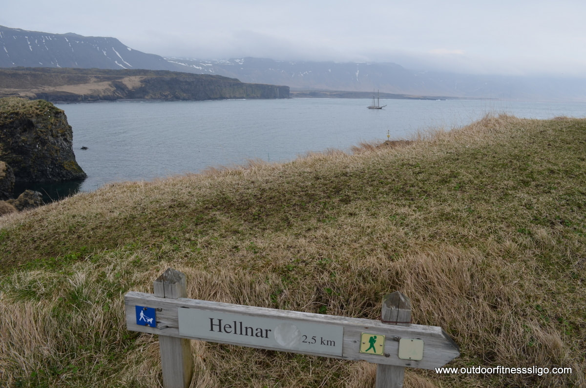
Snæfellsjökull National Park is located on the western tip of the Snaefellsnes peninsula in Iceland. High volcanic peaks, massive sea cliffs , lava fields and golden sandy beaches make up this dramatic landscape which was immortalised by Jules Verne's Journey to the centre of the earth. On this particular day in late April, we found ourselves along the southern stretch of the circular seaside route driving into Arnarstapi. Where the weather had been promising when we left the beautiful town of Stykkisholmur earlier that morning, the weather deteriorated quickly the closer we got to the ice cap covered Snæfellsjökull. The small town of Anarstapi is a good base to start the 2.5km coastal walk to Hellnar which passes through old lava fields and eroded caves. The harbour of Arnarstapi is a good starting point with it's dramatic sea cliffs and waterfalls.
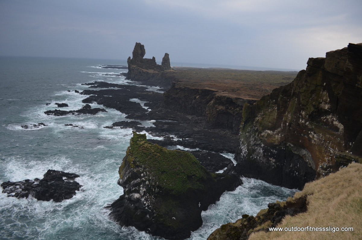
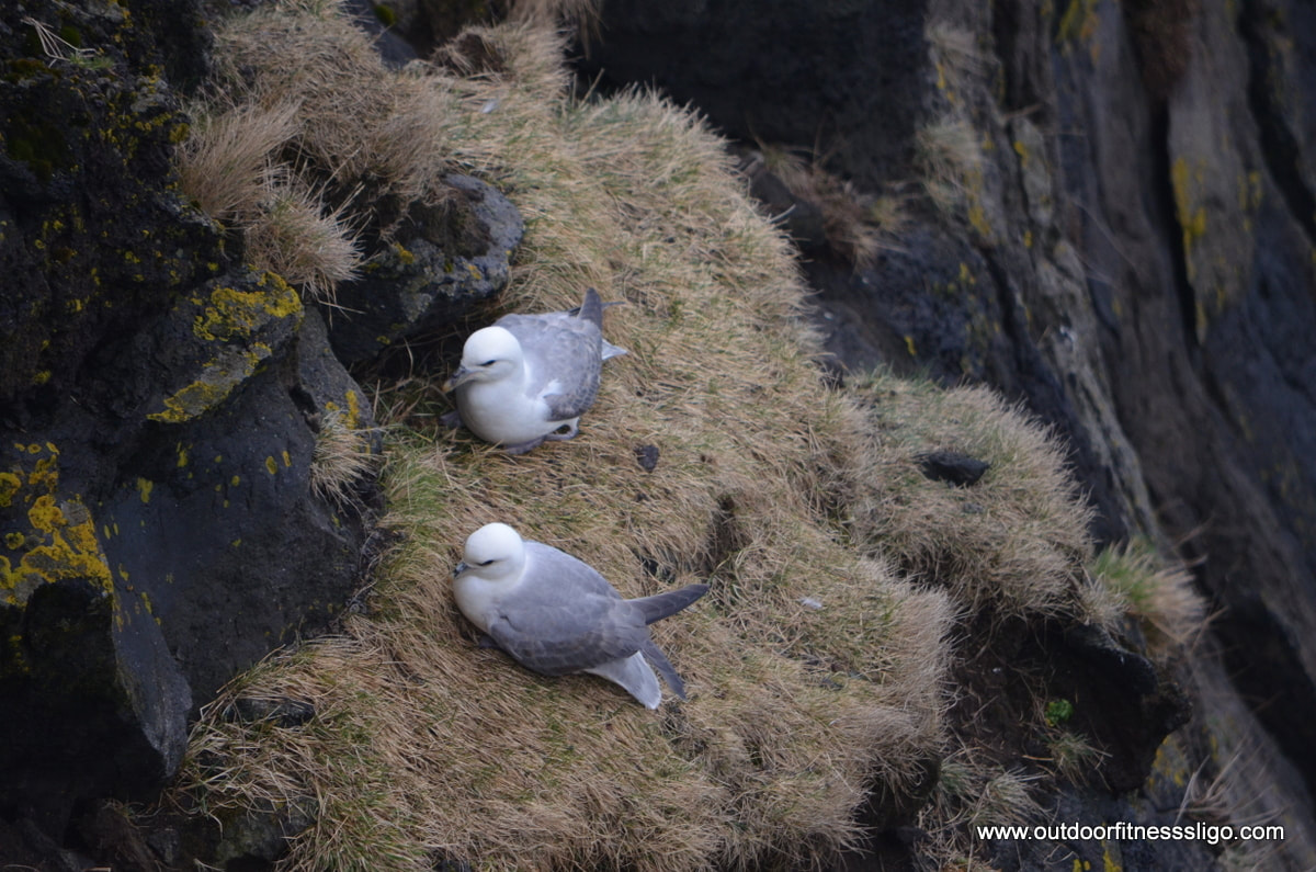
We had planned to take a break in Hellnar at a small cafe / restaurant called Fjoruhusid which is located right on a black basalt beach. It has a small terrace from where you can admire the dramatic coastline, but unfortunately it was closed at this particular time. Next stop were the amazing sea cliffs and the natural basalt towers of Londrangar. You could be forgiven for thinking that you are an extra in Lord of the Rings heading towards Barad-dur (Dark Tower), the basalt rock standing tall in this unforgiven landscape. Looking down towards the cliffs from any of the viewing platforms along the looped walks gives you a perfect location to admire the thousands of nesting birds, but also the odd seal which is hunting for some fresh fish.
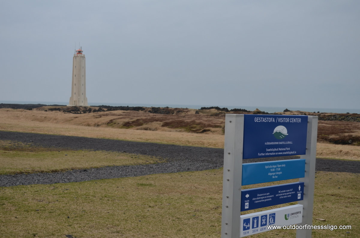
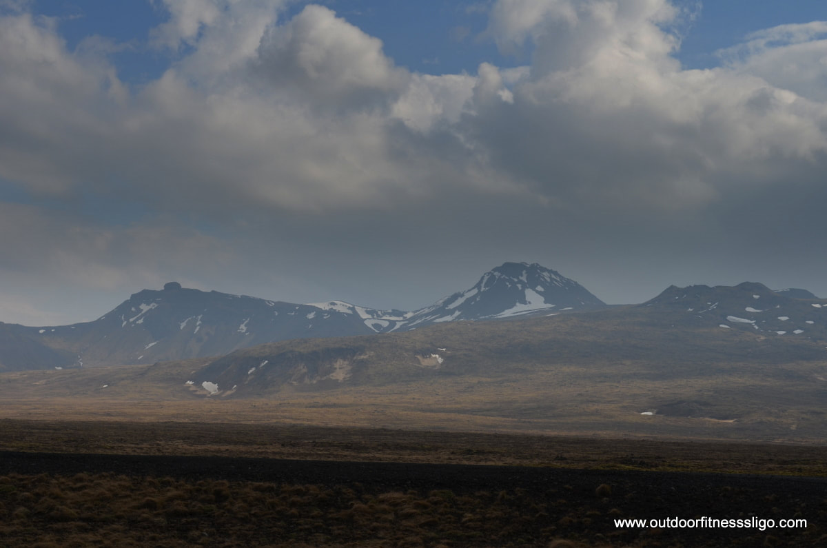
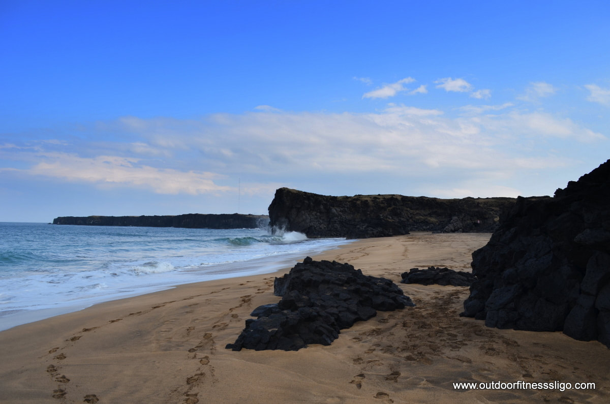
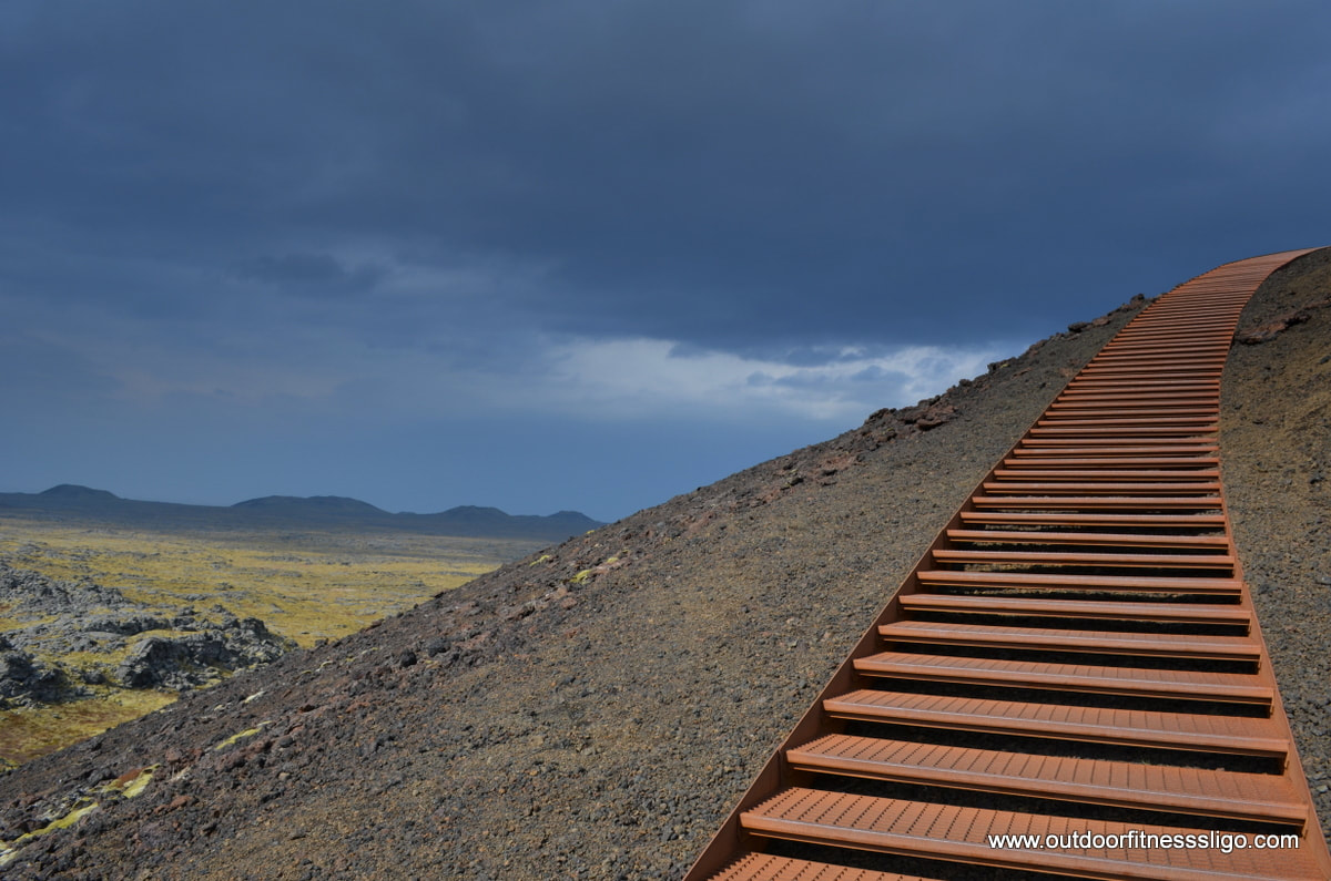
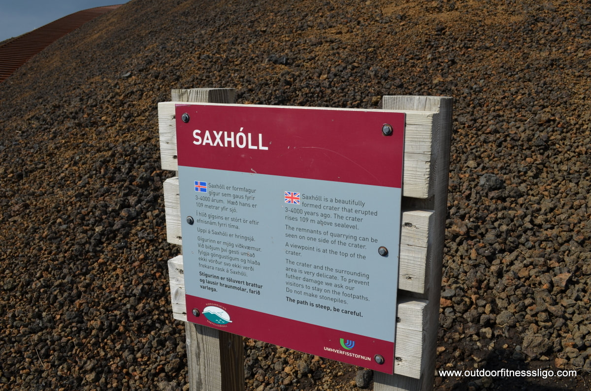
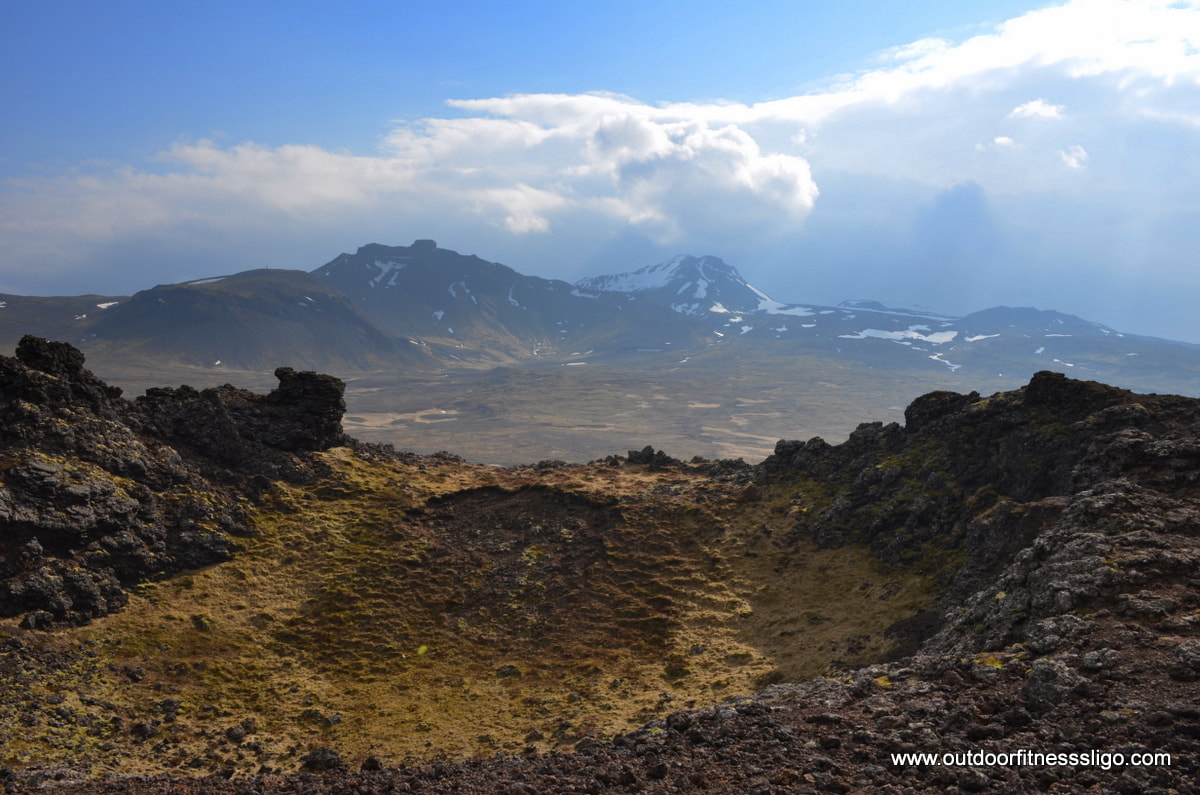
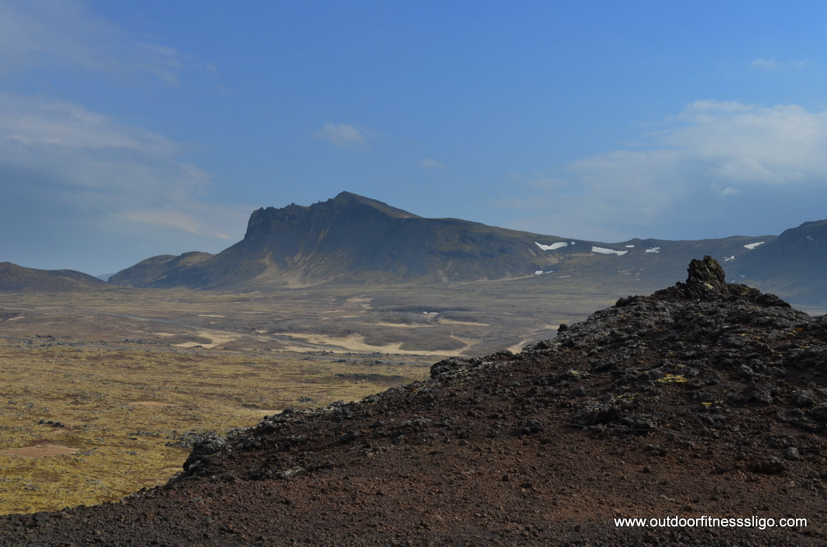
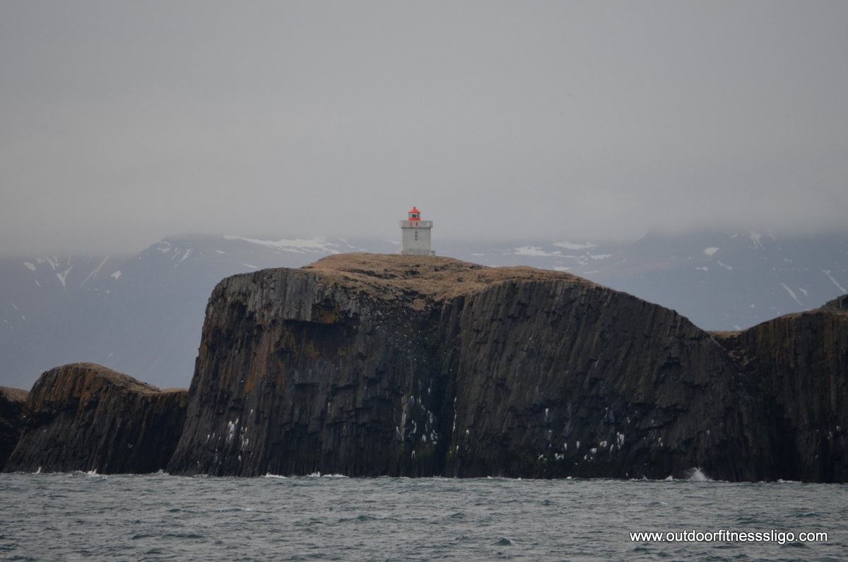
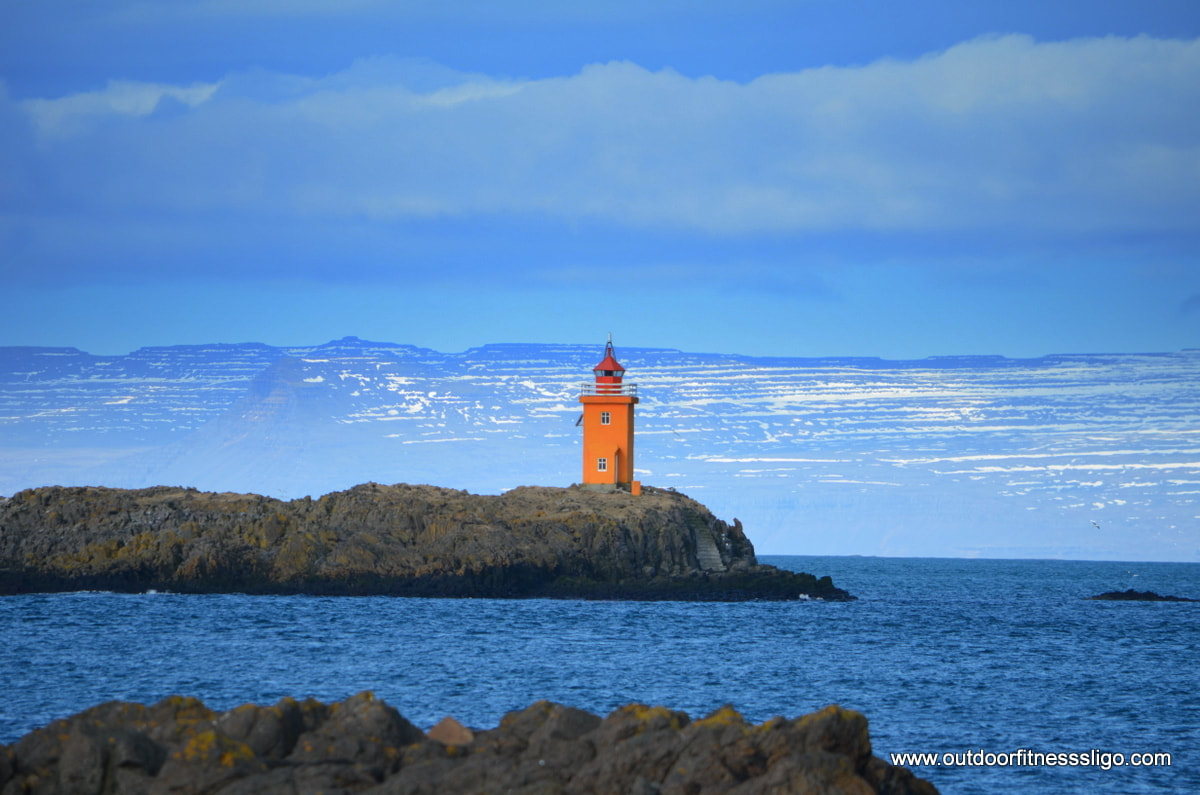
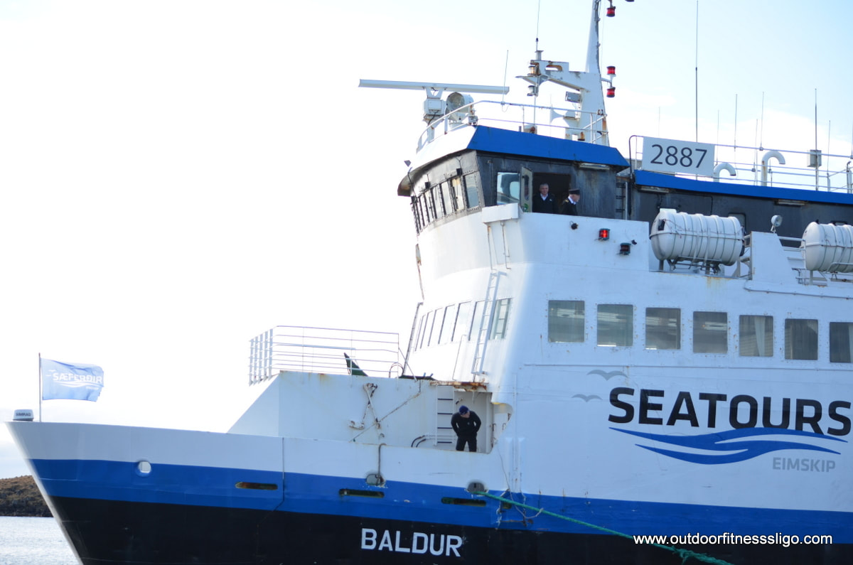
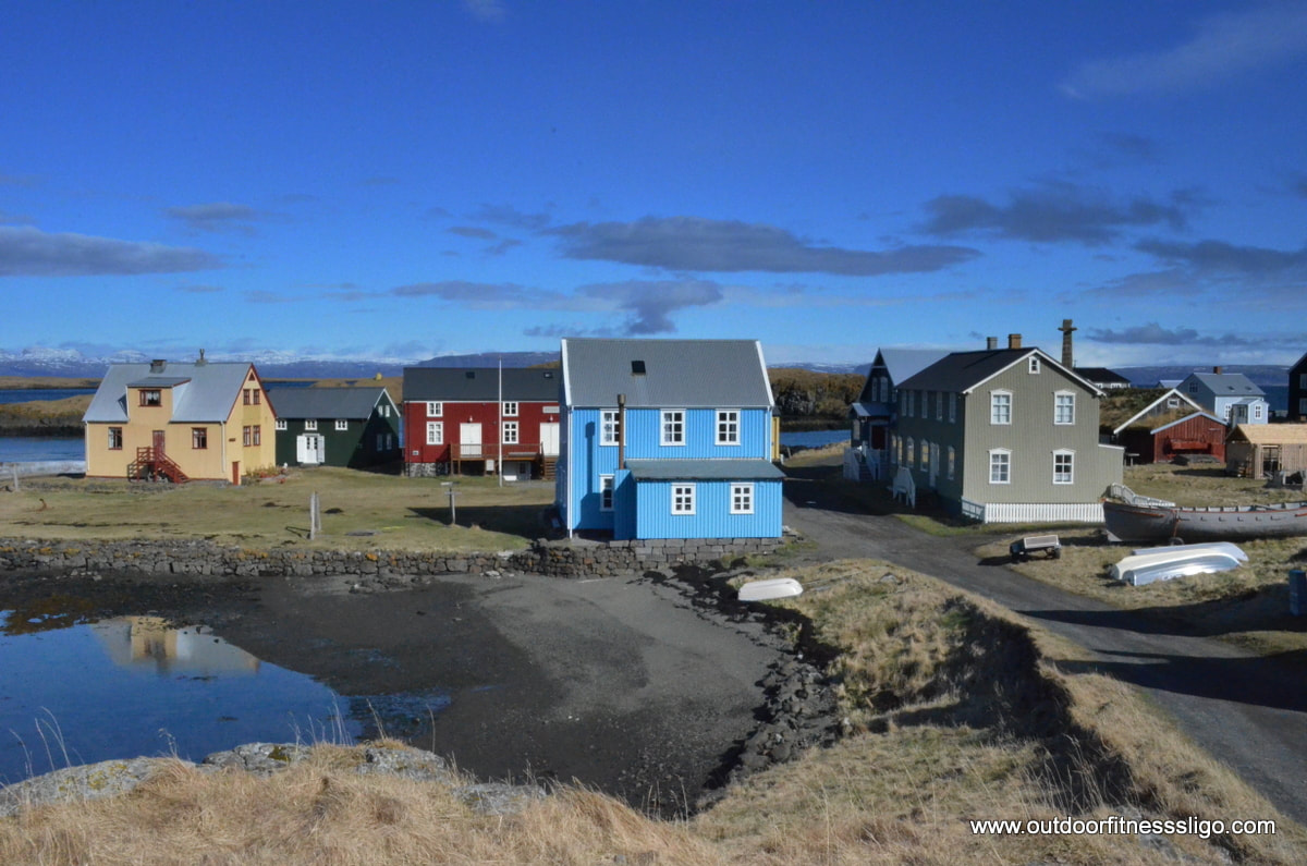
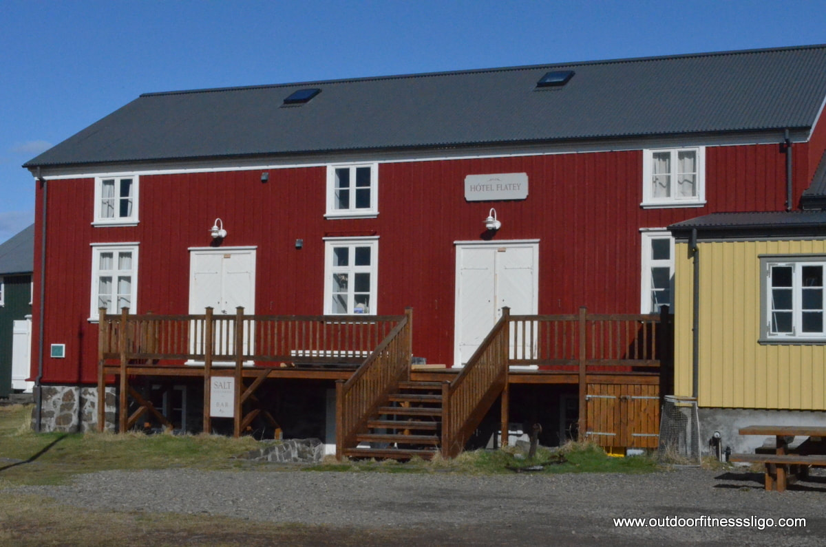
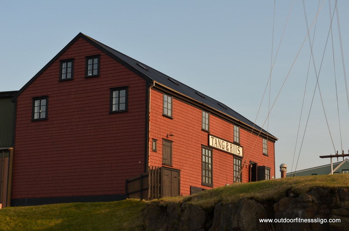
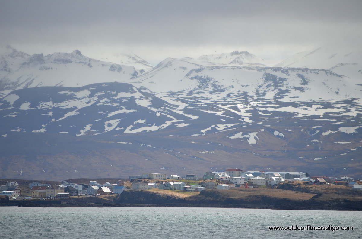
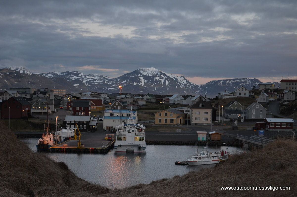
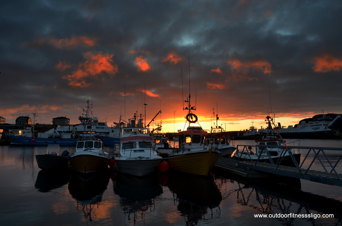
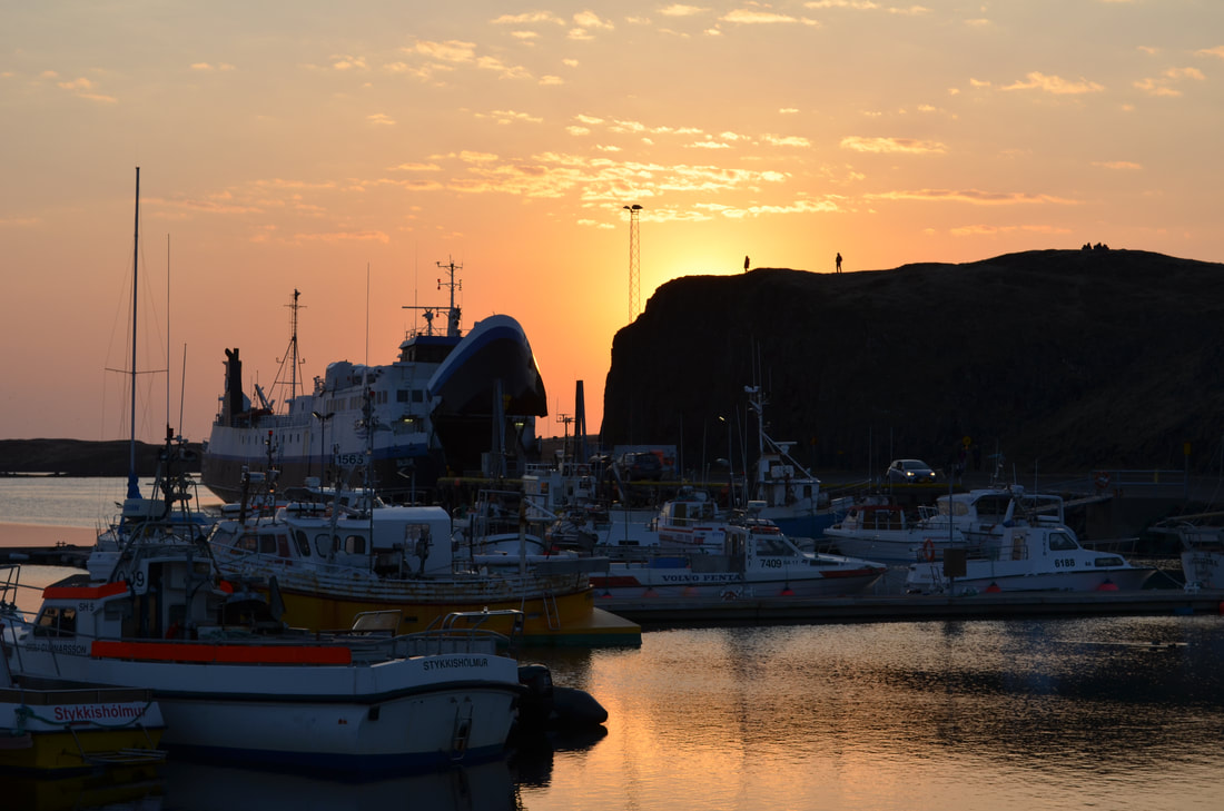
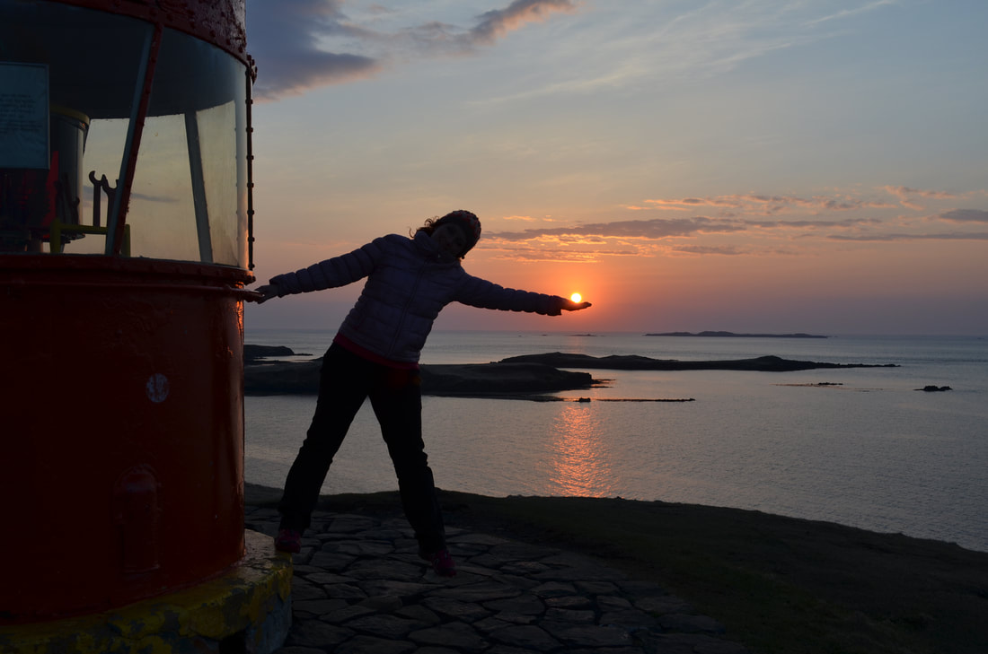
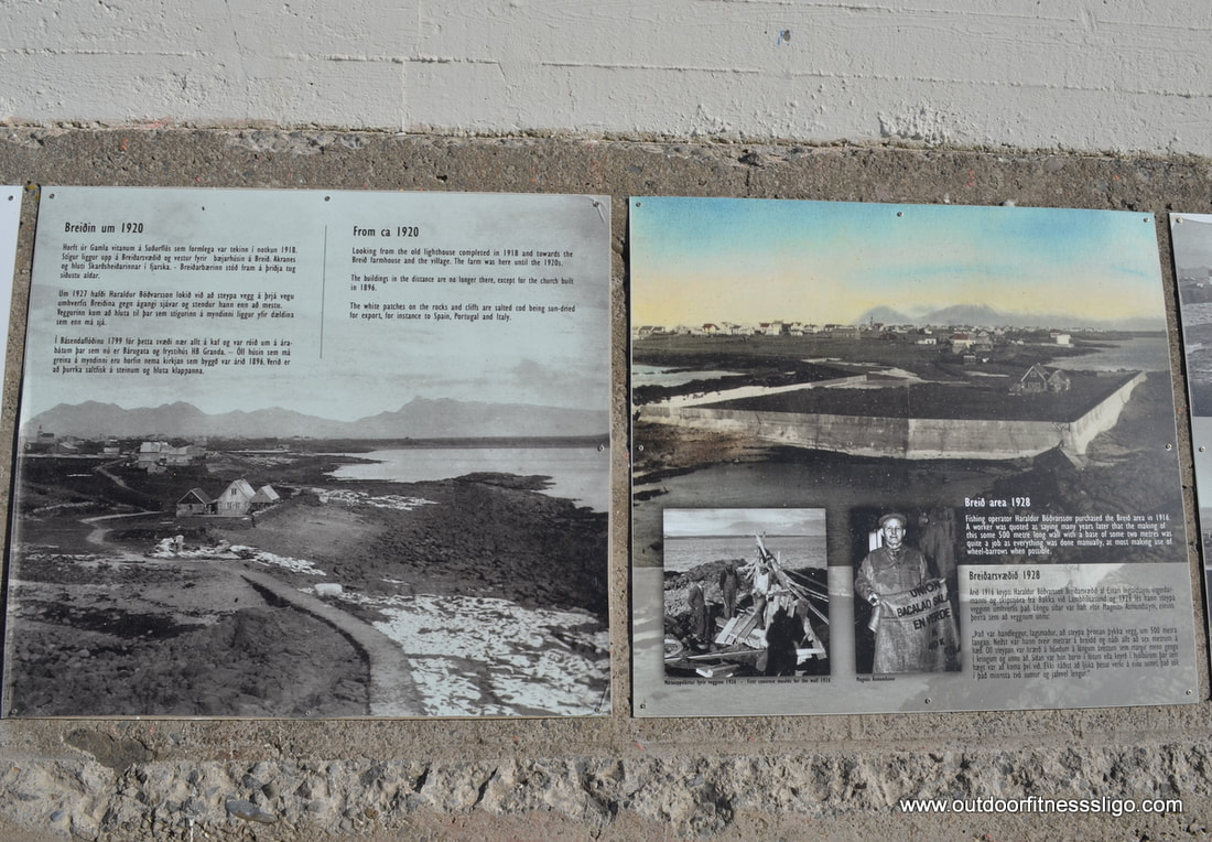
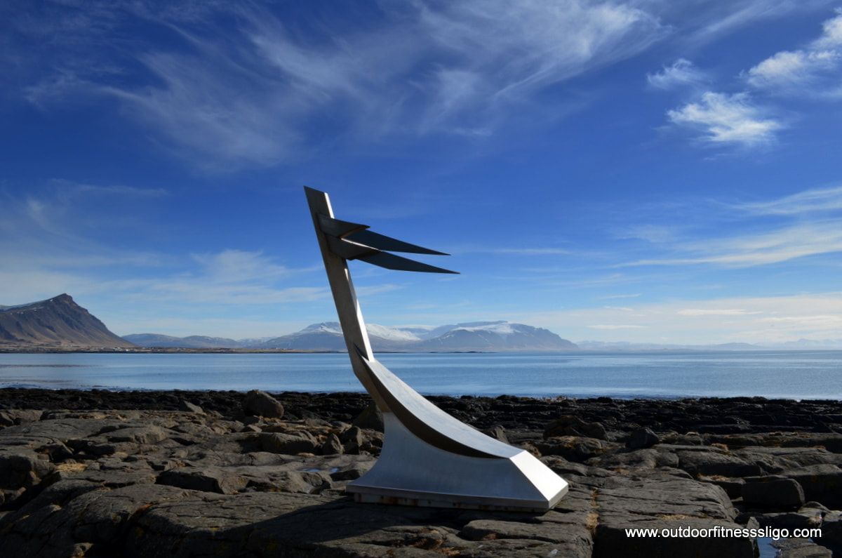
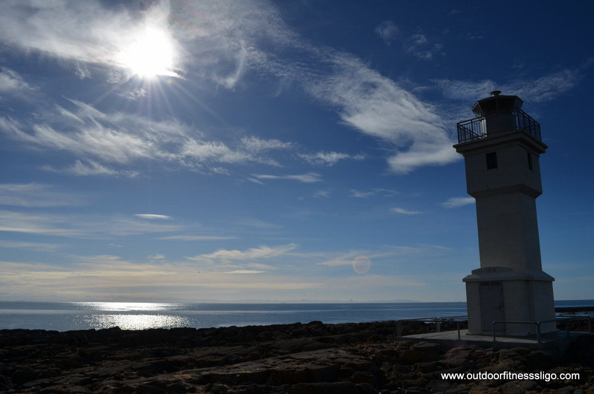
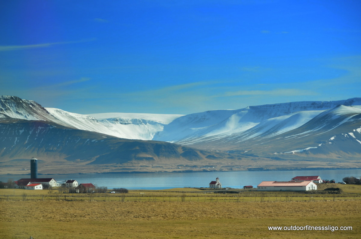
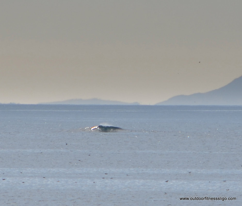
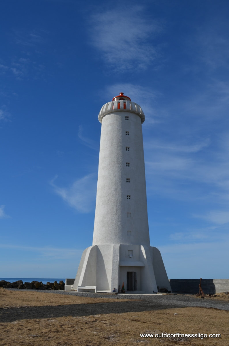
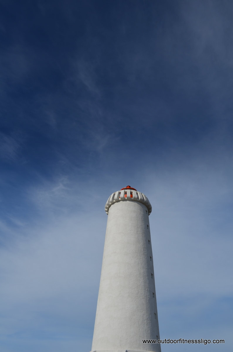
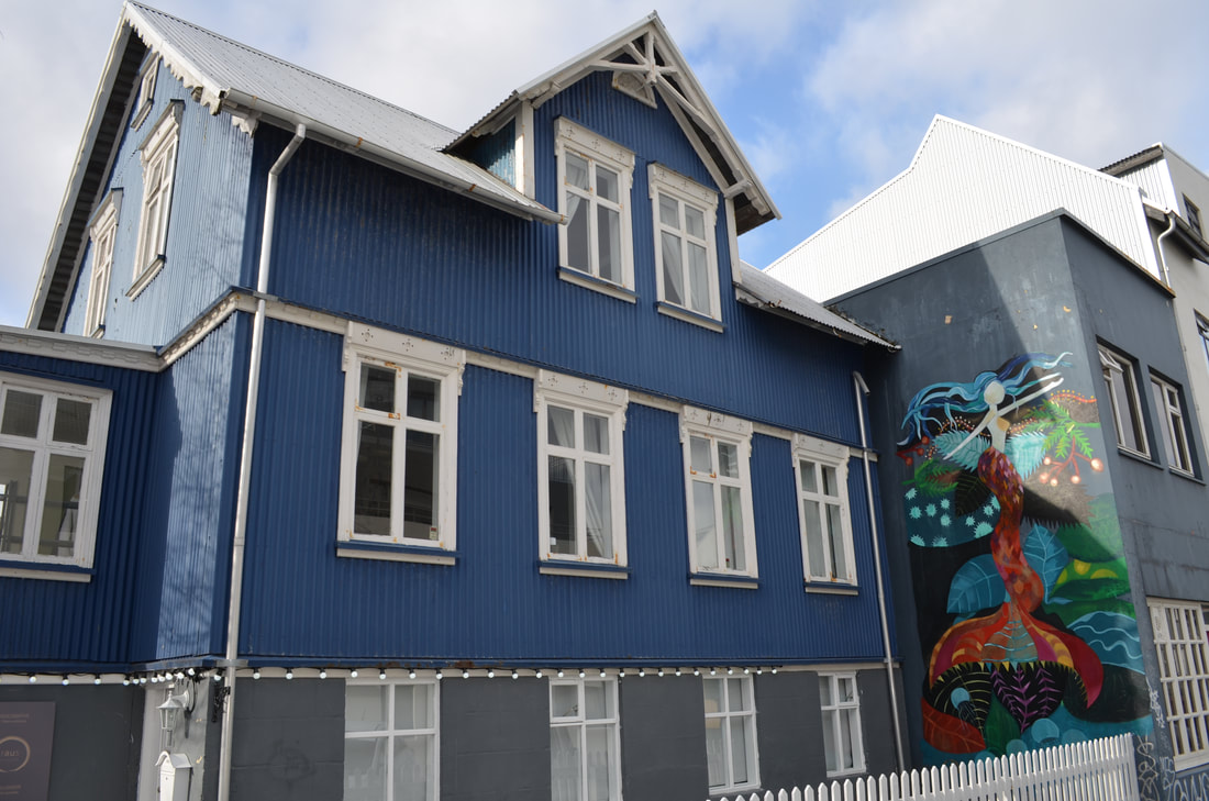
Next stop was Saxholl crater, a meter high crater which has a metal stairwell the whole way to the top. From the top, we enjoyed the views towards the Atlantic Ocean and the expansive moss-covered lava fields. Saxholl erupted some 3000 years ago and is responsible for creating the landscape we were admiring from the top of this small volcano on this beautiful day in April. Yes, the weather in Iceland can change rapidly, where the sun shines one moment, next you could be caught in fog, showers or even snow. Driving further through this vast barren landscape, we reached a beautiful small sandy beach called Skardsvik beach . What is unique about this beach is not a black volcanic beach but it is a golden sandy beach. Having parked the car on the small car park, we admired the flowers which were trying to grow between the basalt rocks surrounding this beautiful beach. Walking towards the beach, we passed an ancient viking grave. Where the beach and the crystal clear water might be inviting for a swim, don't be fooled, the sea is bitterly cold and can be very rough. When we visited Snæfellsjökull National Park in April, it was quiet. With a 5 hour drive from Reykjavik, it is not frequented by daytrippers, but rather by tourists touring Iceland. The natural beauty of this region makes it into a must-visit location when visiting iceland. With it's diverse and fascinating landscape, from the fjords to the snow covered volcano's, we can see why this area was immortalised by Jules Verne, but even further back through many of the Icelandic Saga's Next is Vatnshellir cave which has become a very popular tourist attraction, so we decided to give this a miss. From her onwards, you really enter the heart of the national park. And lucky for us, the weather started to clear and the sun made an attempt to break through the low-hanging clouds. It is like time stood still on the remote island of Flatey , the largest island among a cluster of about forty other small islands located in Breidafjordur bay on the northwestern part of Iceland. On a sunny day in late April, we had embarked on an adventure to this remote island which is only accessible by boat from either Stykkishólmur or Brjánslækur during the summer. But during the Easter holidays, the odd ferry stops at the island to allow people access to their remote holiday homes during the school holidays. We had embarked Baldur, a large enough ferry which is operated by Seatours. We found ourselves and another 2 people on this ferry which leaves Stykkisholmur around 9am. The ferry navigates the bay passing the many islands, a perfect opportunity to admire the many birds flying between these remote islands. The ferry only stops for a couple of minutes at Flatey to carry on it's travels towards Brjánslækur. On it's way back to Stykkisholmur, the ferry stops again for a couple of minutes to pick you up again. The island is entirely traffic free, so no cars allowed. By the time we arrived at Flatey, the sun had made a welcome appearance and provided the first heat after the long Icelandic winter. Flatey is a beautiful Island where only 2 families are permanent residents on the Island. Walking the short distance from the pier towards the village along the gravel road, you are welcomed by sheep and chickens. The colourful houses on Flatey were built more than hundred years ago, all of them are well preserved and well kept by it's current owners. Most of the houses are currently holiday homes owned by Icelandic families who's parents or grandparents used to live on the island. And as it was the Easter holidays, many of the houses were occupied. If you decide to stay on the Island and you have luggage to carry, one of the local farmers will transport your luggage with his tractor for a small fee. The village itself has a small beach, and it is here where you also find Flatey hotel which only opens it's doors during the summer. During Easter when we visited the Island, there is nothing open, so it is advisable to bring your own food and drink with you. Walking through the village , it is hard to imagine what life on this island would be during the long winter months. With no street lights, we can only imagine how dark it would be during those long winter nights when the island is covered with snow. But during the summer months, sitting outside on your patio, it must be amazing to see those midnight sunsets. We love Iceland, but visiting Flatey was an experience in itself, one we would highly recommend. In the 2013 film "the secret life of Walter Mitty" , Stykkisholmur was one of the destinations which Ben Stiller was trying to reach. On this particular afternoon in late April, it was our destination. And after a 3.5 hour drive from Keflavik airport in the pouring rain, we rolled into Stykkisholmur where the sun made an attempt of greeting us to this beautiful remote Icelandic town located on the North coast of Snaefellsnes peninsula. And from the moment we drove into the town, we knew we would have a fabulous time in this beautiful harbour town. The old wooden houses are just as they were 100 years ago, and the whole village centres itself around the harbour which is protected by Sugandisey Island. The town was the first community in Europe to receive the Earthcheck Environmental Certification, and it is obvious how clean the town is. The village is a thriving community where you can watch the fish being unloaded at the harbour every evening or visit one of the three museums in the town. In the village, you find the volcano museum where the private collection of Haraldur Sigurdsonn, a world renowned volcanologist is on display. Then there is the Library of water where you find 24 glass columns which are filled with melted ice from some of the glaciers around Iceland. The third museum is the Norwegian House, a house built in 1832 using Norwegian timber, which has been lovingly restored. The house now serves as the regional museum for the Snaefellsnes peninsula. So on our first evening, we decided to walk around the town. The first thing you notice walking around the village is how clean all the streets are. The houses around the harbour are just beautiful, all of them having the year of their built displayed on the wall. Looking at these dates, most of them dated back to the early 1900's. Stykkisholmur is a busy enough town mainly due to the harbour from where you can take the Ferry Baldur which daily crosses Breidafjörður Bay between Stykkishólmur on the Snæfellsnes peninsula and Brjánslækur in the north of Iceland. This ferry also stops during the holiday season at Flatey Island, a beautiful small island in Breidafjörður Bay . Stykkisholmur has really 2 parts to the town, the "old part" as we call it which centres around the harbour, and the "new part" which centres around the imposing modern church and open air swimming pool. The latter one was a hug hit with the boys who wanted to go swimming in the pool most days, mainly due to the large outdoor pool and slides. And don't worry, even though the snow is still on the mountains in April, the geothermal heated pool is nice and warm. And after the swim, they loved nothing more than getting a hotdog from Meistarinn, a great hotdog stand on the outskirts of town. There is a great selection of accommodation and restaurants in Stykkisholmur, so staying overnight is not a problem. What could be a problem is the restaurants. There is only a handful of restaurants, and even in April they were busy, so booking a table is essential. We really enjoyed walking around the town , especially watching the fishing boats deliver their catch of the day at the pier. And it was amazing to see how quickly the fresh fish was unloaded and transported away. Another favorite was walking to the lighthouse on Sugandisey Island, once an island only reachable by boat, but nowadays reachable by road. From the carpark, a stairwell brings you onto the island and from here you can admire the beautiful sunsets. Another favorite is to do a spot of birdwatching, many of them breeding at the island's rock formations. We will definitely return back to one of Iceland's most beautiful towns. So if you are planning on visiting the Snaefellsnes peninsula, we would recommend staying in Stykkisholmur. The fishing town of Akranes is a stones throw away from Iceland's capital Reykjavik, especially now that you can reach it through the Hvalfjordur tunnel rather than driving around Hvalfjordur (Although we recommend driving this fabulous route around the fjord). Driving into Akranes on a day in late March, it felt like spring was making an appearance early in the season. And as it was a public holiday, not to many businesses were open on this particular day. But we didn't mind as we wanted to enjoy the great outdoors and the warm spring air. Our first stop was Akranes lighthouse, a picturesque area around the harbour where 2 lighthouses give you plenty of photo opportunities. Thousands of birds floated around in the water enjoying the spring sunshine, the views were far and wide. The largest of the lighthouses is open to the public and is still in operation where the smaller one is currently not used anymore. Walking towards the lighthouses, photographs educate you on what life was like in Akranes back in the early 1900's After the lighthouses, we made our way over to Langisandur beach in Akranes, a long sandy beach with a promenade popular with walkers. It is also home to Íþróttabandalag Akraness. Yes, Akranes has a long history of soccer and has produced talented soccer players over the years. And on this glorious day where the sea was as calm as it can be, we spotted a whale in the distance breaching the water. unfortunately, it was to far away to get a real good look, but we were still happy to witness this spectacle from far. The area around Akranes is one of natural beauty. Driving around hvalfjordur ( https://www.outdoorfitnesssligo.com/destinations-further-afield-travel-blog/hvalfjordur ) is highly recommended.
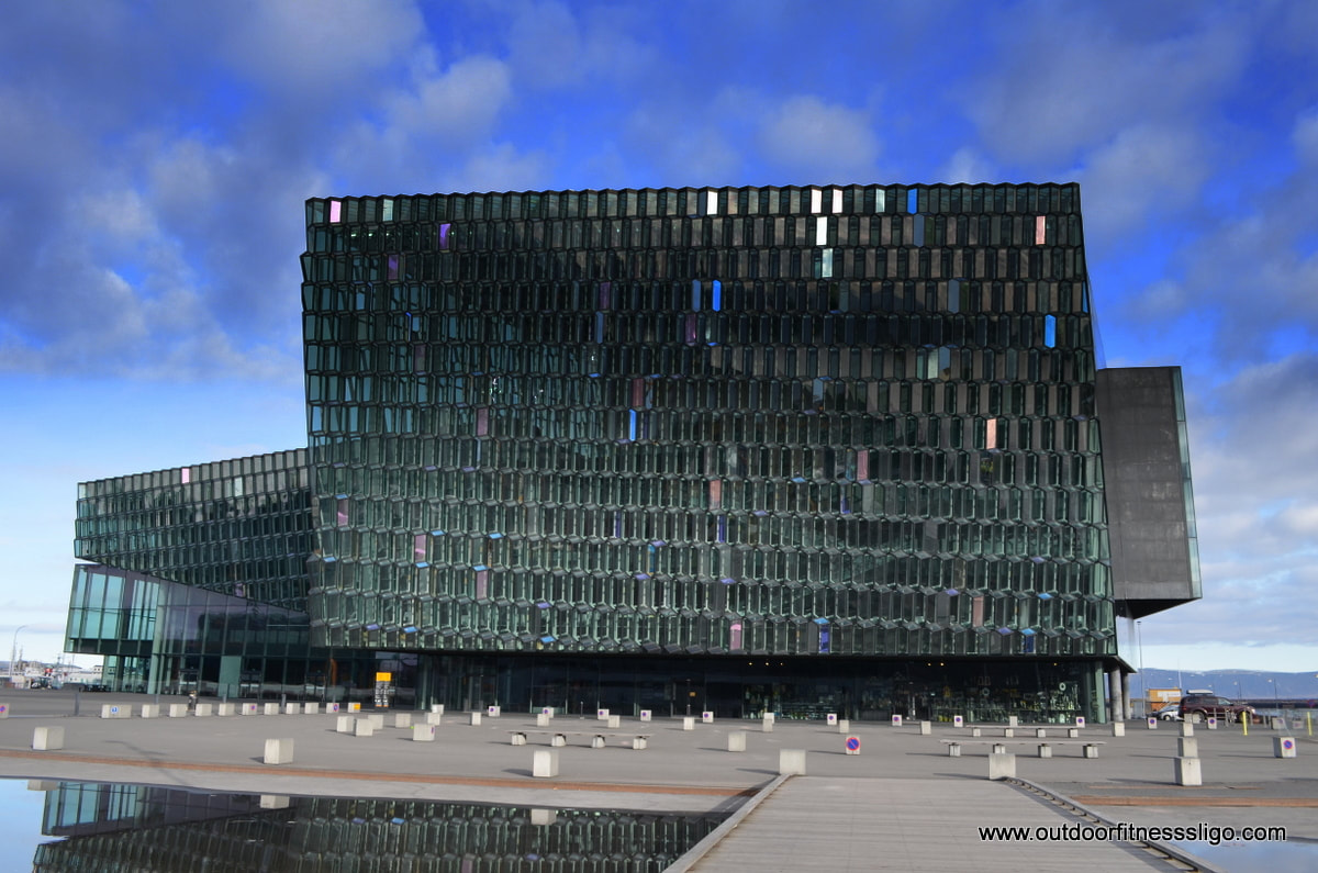
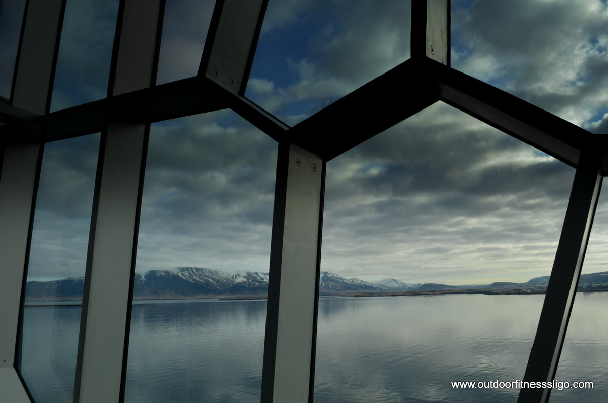
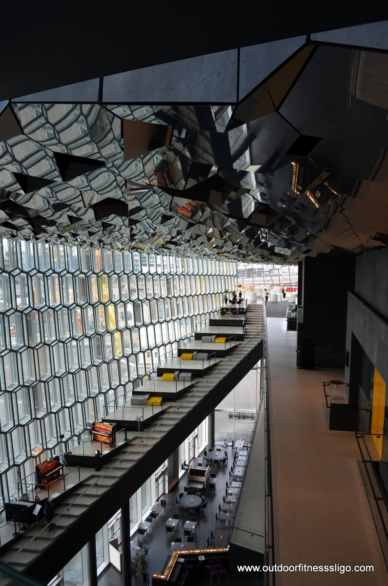
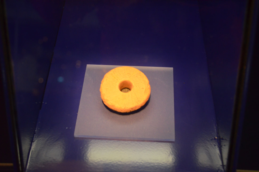
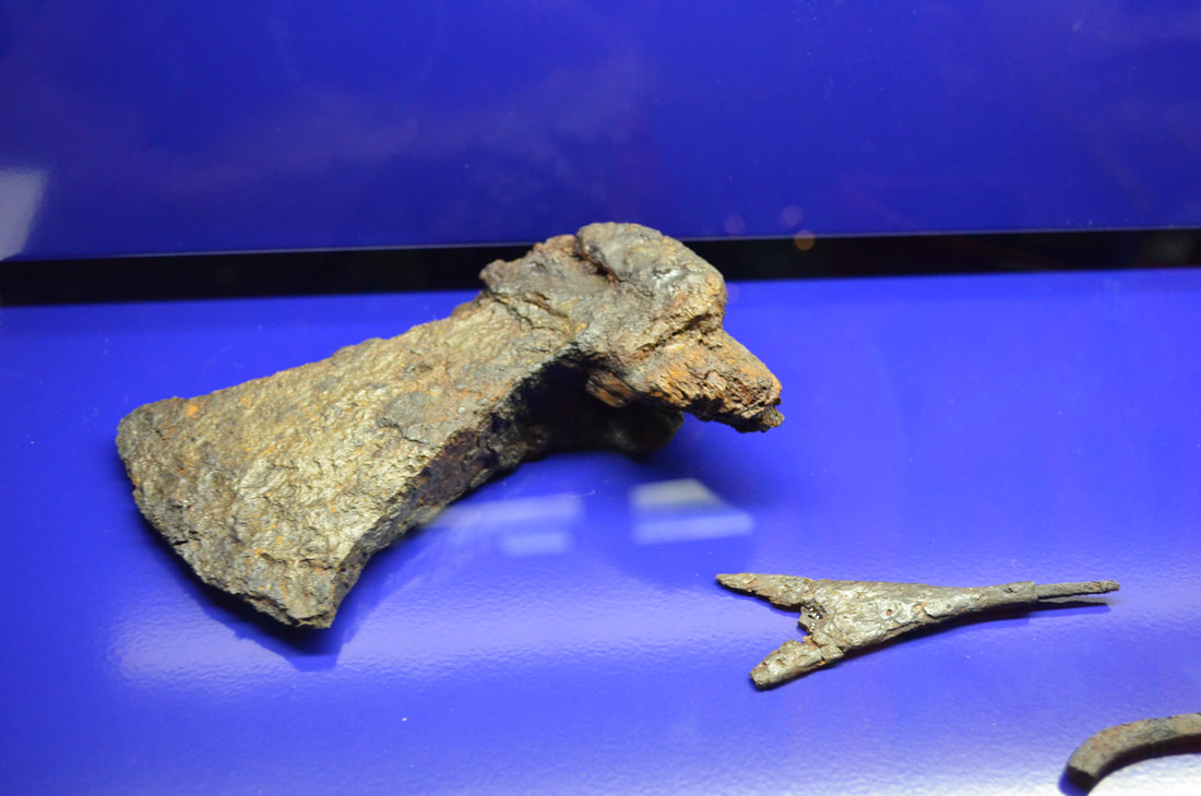
We found ourselves in downtown Reykjavik with a few hours on our hands, so we decided to walk around the capital of Iceland and enjoy all what it has to offer. We started at the Harpa concert hall close to the marina, a distinctive glass building inspired by the basalt landscape of Iceland. The interior is just fabulous, from the black concrete to the yellow tones of the doors and feature walls, it is worthwhile walking to the top floor of this building and looking down towards the lobby. 
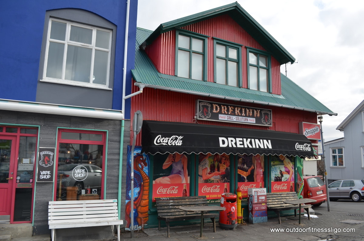
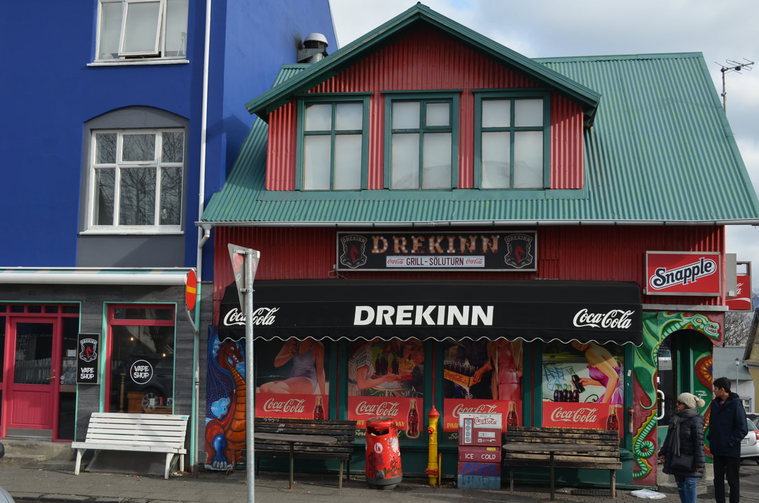
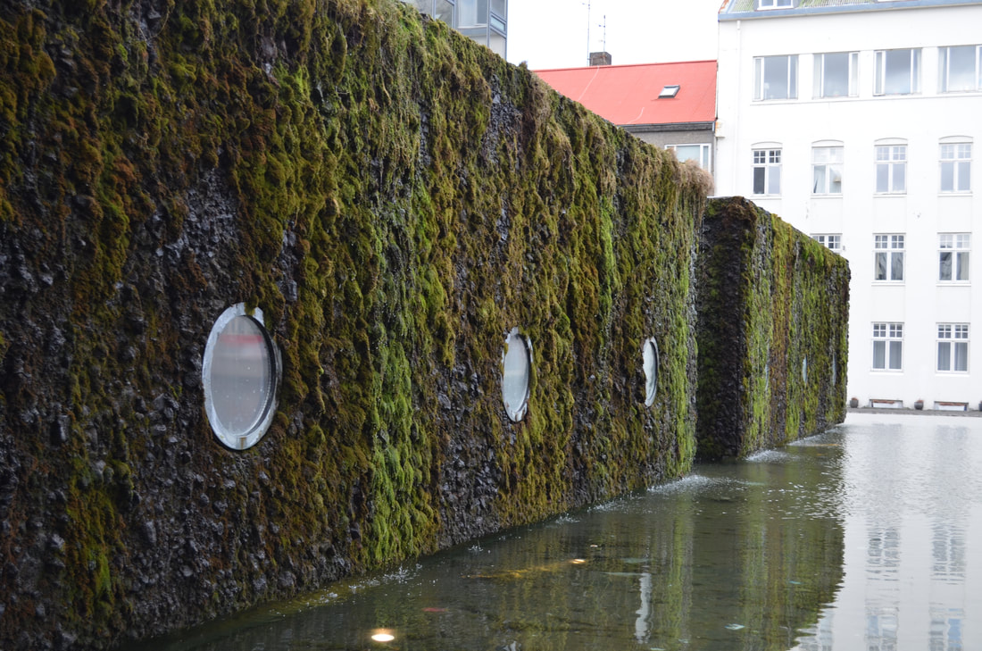
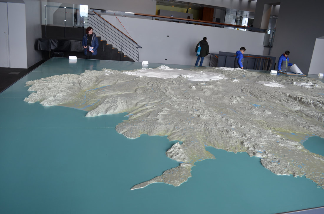
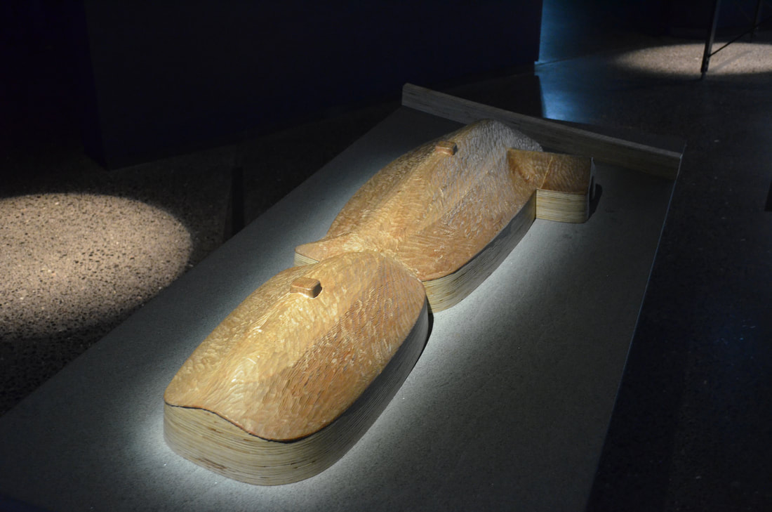
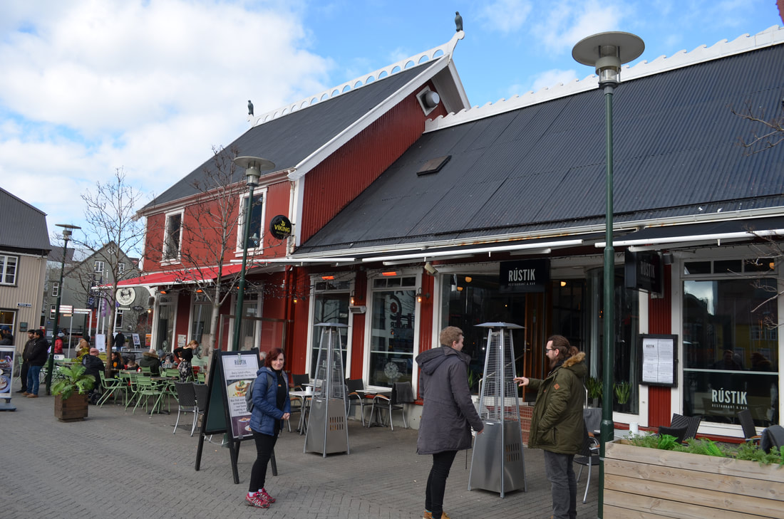
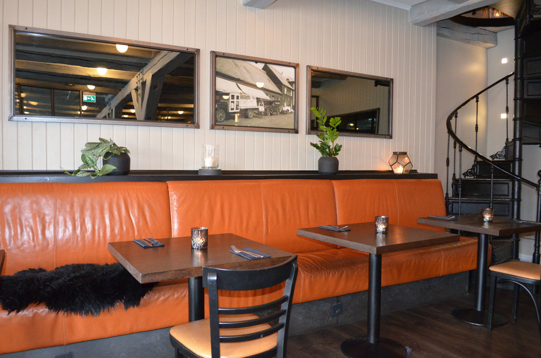
From here, we turned left towards the much photographed Hallgrimskirkja. At 74.5m height, it is one of Iceland's tallest structures. It took more than 40 years to finish the construction which started back in 1945. The church is also home to an observation deck within the tower which can be reached by lift. From the Harpa Concert hall, we turned into Laekjargata where we passed Stjornarrad (cabinet house) which once served as a prison, but is now the home to the prime minister offices. Walking back towards the town hall, we passed the colourful Drekkin convenience store which has been in business for 40 years. Drekkin is now also a fastfood joint where you can buy fastfood at a reasonable price. Walking back through the many back streets, we admired the many colourful facades of the houses, some of them bearing fabulous graffiti. The town hall is worth a visit. This modern building is located at the shore of lake Tjørnin. In the concrete building , you can find Reykjavik's official tourist office, but the building is also home to an impressive 3D relief map of Iceland. The building has an outside wall which is build from rock covered in moss, a nice feature within the centre of reykjavik. A short walk brought us to the settlement exhibition, home to the oldest relics of human habitation in Reykjavik. During the excavation, they also discovered a viking longhouse from the tenth century which now forms the focal point for the entire exhibition. The longhouse was left in it's original location, and the interactive displays let you discover what living in a longhouse would have been like. Many tools were also excavated and are now also on display showcasing axes, tools,.... At the entrance into the exhibition, there is also a great place where kids can dress up as vikings, play viking games or try out writing their name in Runes After an educational stop, we decided to get some retail therapy in as well as we ended up at Reykjavik's permanent Christmas shop (Jolahusid). Here you can find Christmas decorations and listen to Christmas songs year round. Next stop was Kolaportid flea market where different vendors sell new and used items, but this is also a location where you can buy traditional Icelandic food. After all that walking around, we were hungry. And being in Reykjavik, there is ample opportunity to find food. We decided to have lunch at Rustik (rustik.is/), a nice vibrant restaurant with a relaxing atmosphere where we enjoyed the fish of the day. So our few hours in Reykjavik were a great break from all the outdoor activities we had done during our visit to Iceland. Reykjavik is vibrant, it is colourful and is a must visit location, even if it is just for a couple of hours.
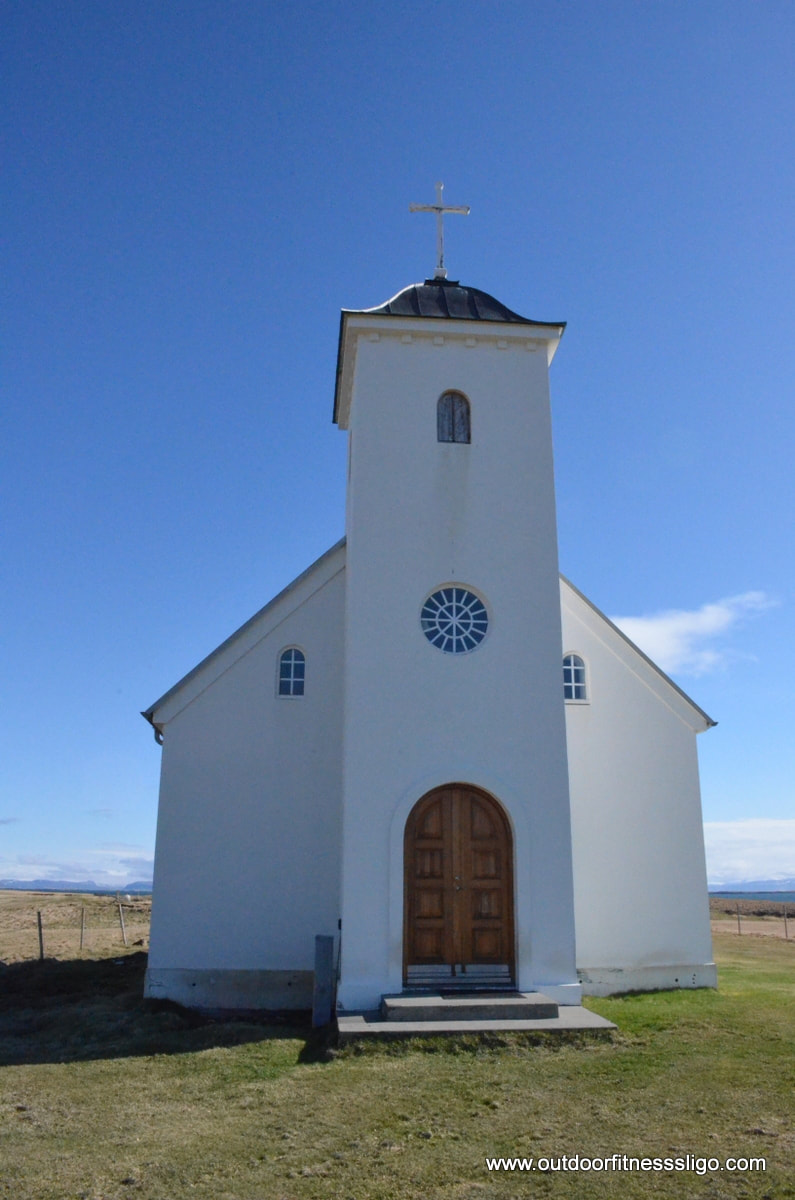
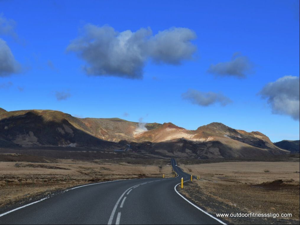
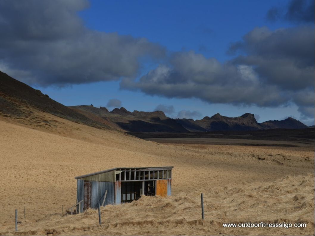
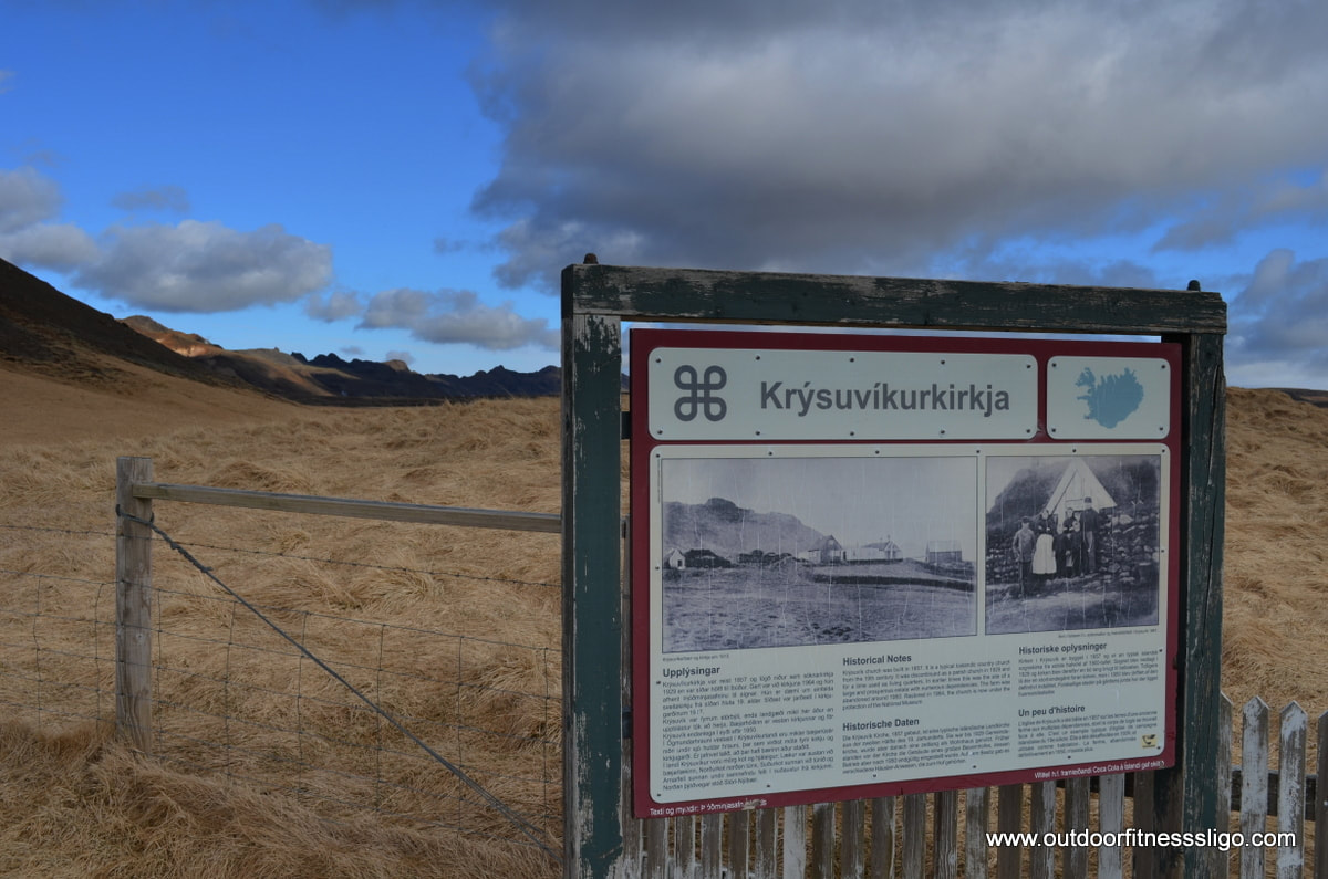
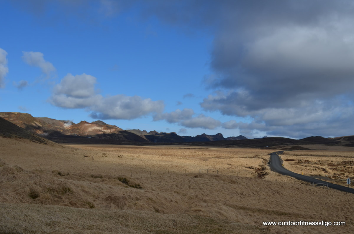
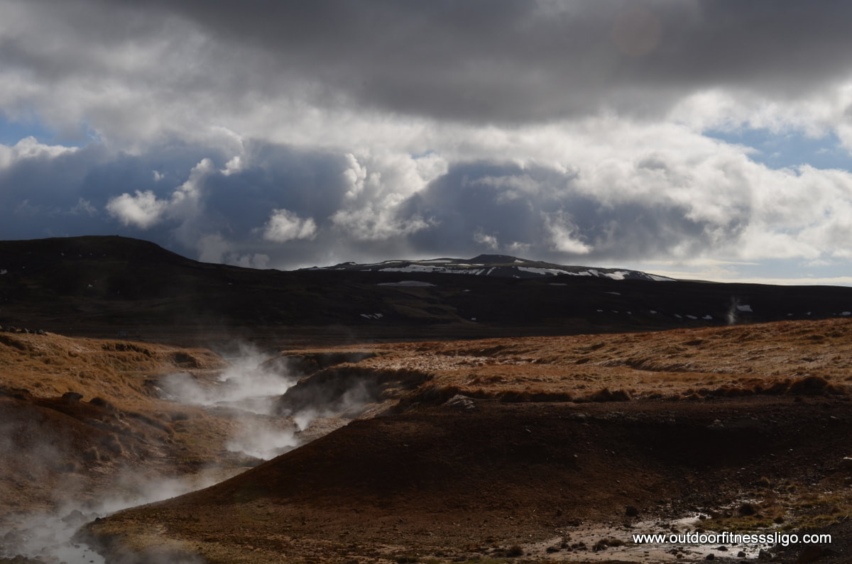
We followed road 427 from Grindavik along the Southern Coast of Reykjanes towards our destination of the day, Krysuvik Geothermal Area. The road was quiet, the skies were blue and the landscape was barren on this particular morning. Turning from road 427 onto road 42, we found ourselves driving on fabulous smooth roads towards the mountain range in the distance. The area is barren, but the different tints of brown and copper are in stark contrast with the blue skies on this beautiful morning in late March. First stop was Krysuvikkurkirkja, a small church which is now under the protection of the National museum. We continued our journey until we reached Krysuvik geothermal area.
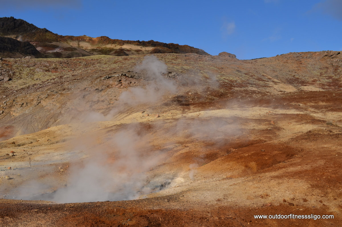
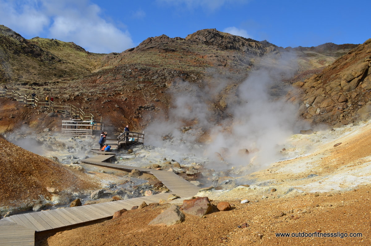
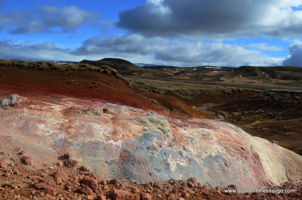
A busy enough car park welcomed us to this remarkable location. The area is right in the middle of the fissure of the mid-Atlantic ridge and is known as the Krysuvik geothermal area. The main geothermal area where we stopped is known as Seltun. From the carpark, a wooden boardwalk runs in between the hotsprings which are marked by green and yellow coloured banks. A slight sulphur smell lingers between the mountains within the valley.
Hot mud pools are present as well, bubbling away like a hot stew on a fire. Only difference is that the stew is mud and best to be avoided. The multiple colours of reds, browns, copper ,... are just fabulous and make this area into a must visit location. Multiple signs give detailed explanations about the area and make it into an educational trip for adults and kids alike.
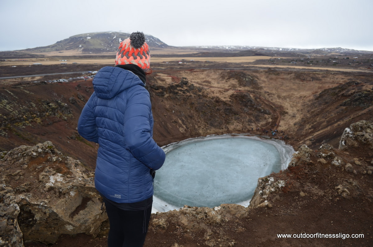
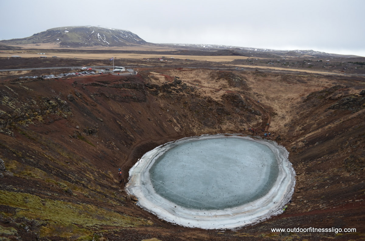
Driving on route# 35, we passed the Kerid crater lake which is located in the Grimsnes area in South Iceland. Having parked the car in the car park, we paid the entrance fee of 400ISK and walked along the edge of the Caldera The volcanic rock is red in colour, and was in a stark contrast with the frozen crater lake. The Caldera is approx. 55m deep and is marked by steep flanks. From the carpark is a path towards the crater lake. The path follows the contours of the lesser sloped flank which is also the only one which shows some vegetation in this harsh climate. The crater has been used for some concerts in the past, mainly due to it's fantastic accoustics. The most famous artist to have sang here is Bjork who in 1987 performed from a platform in the middle of the lake.
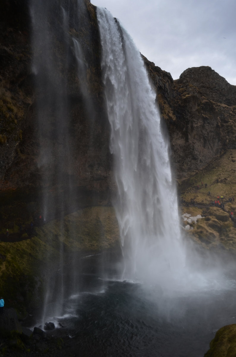
When you drive from reykjavik along the South Coast towards Vik, you can't but notice the huge farms in the area between Selfoss and Hvolsvollur. The area is made up of the fertile lowlands flanked on one side by the majestic Hekla. In the far distance, we spotted our destination of the South icelandic Highlands with the famous Eyjafjallajokull volcano. With our destination slowly getting closer, we got excited to visit the Seljalandsfoss waterfall. The car park at the waterfall is very busy, and it made us aware again that iceland is a busy tourist destination.
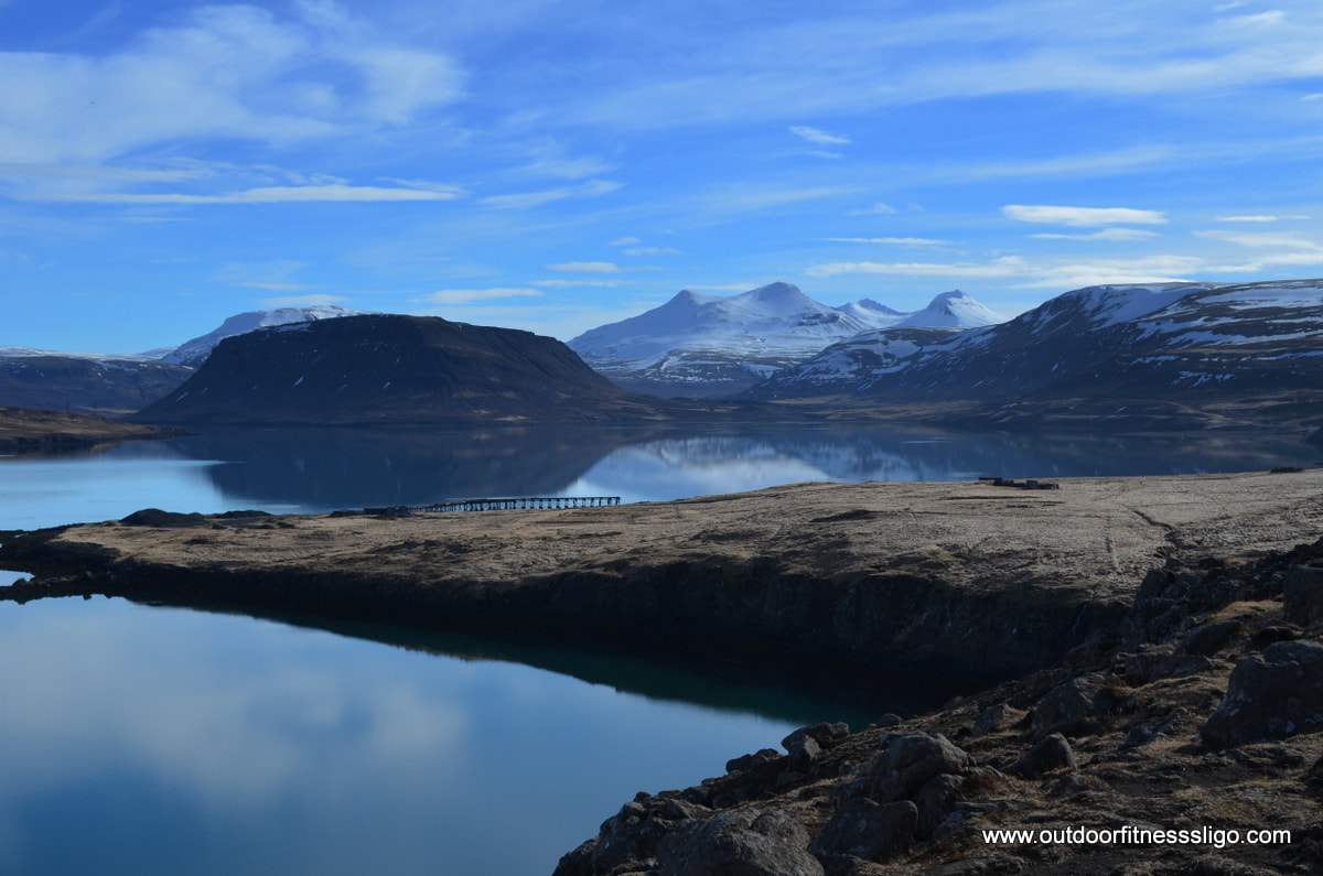
After having paid the small car park fee, we made our way over to the waterfall which thunders down from a height of 40 meters. The waterfall is unique as the shape of the waterfall and cavity behind the waterfall allow you to walk around it and view the waterfall from behind. The day we visted was dull and overcast, but on a sunny day you get fabulous views from behind the waterfall from where you can admire the multi-coloured rainbows created by the sunlight and water droplets. On the day we visited, we just got drenched due to the strong wind which lifted the water towards the back of the cavity where the path runs, but that made it even more spectacular. It is a fabulous location, but it is a very busy one. So the advise we give is to arrive very early or very late and enjoy the waterfall on your own. 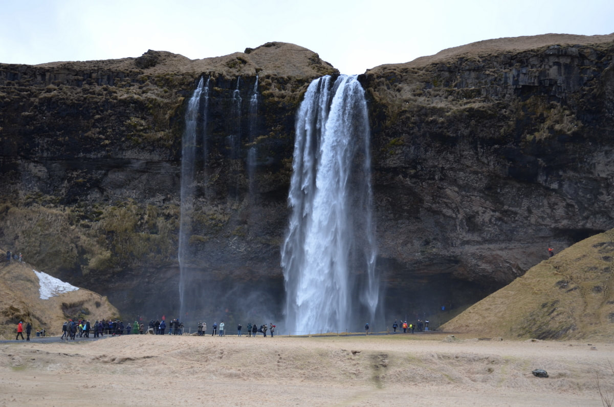 Hvalfjordur or the Whale fjord is only a 30 minute drive from reykjavik, but the fjord with it's calm waters, snow-capped mountains and waterfalls is a must visit. Since the tunnel underneath Hvalfjordur was built to eliminate the need to drive around this particular fjord, the area has become very quiet and tranquil. From the moment you turn-off onto route 47, all traffic disappears and you be one of the only road users on this well maintained route. On this particular day, the water was like a mirror, the snow capped mountains were glistening in the March sunshine.
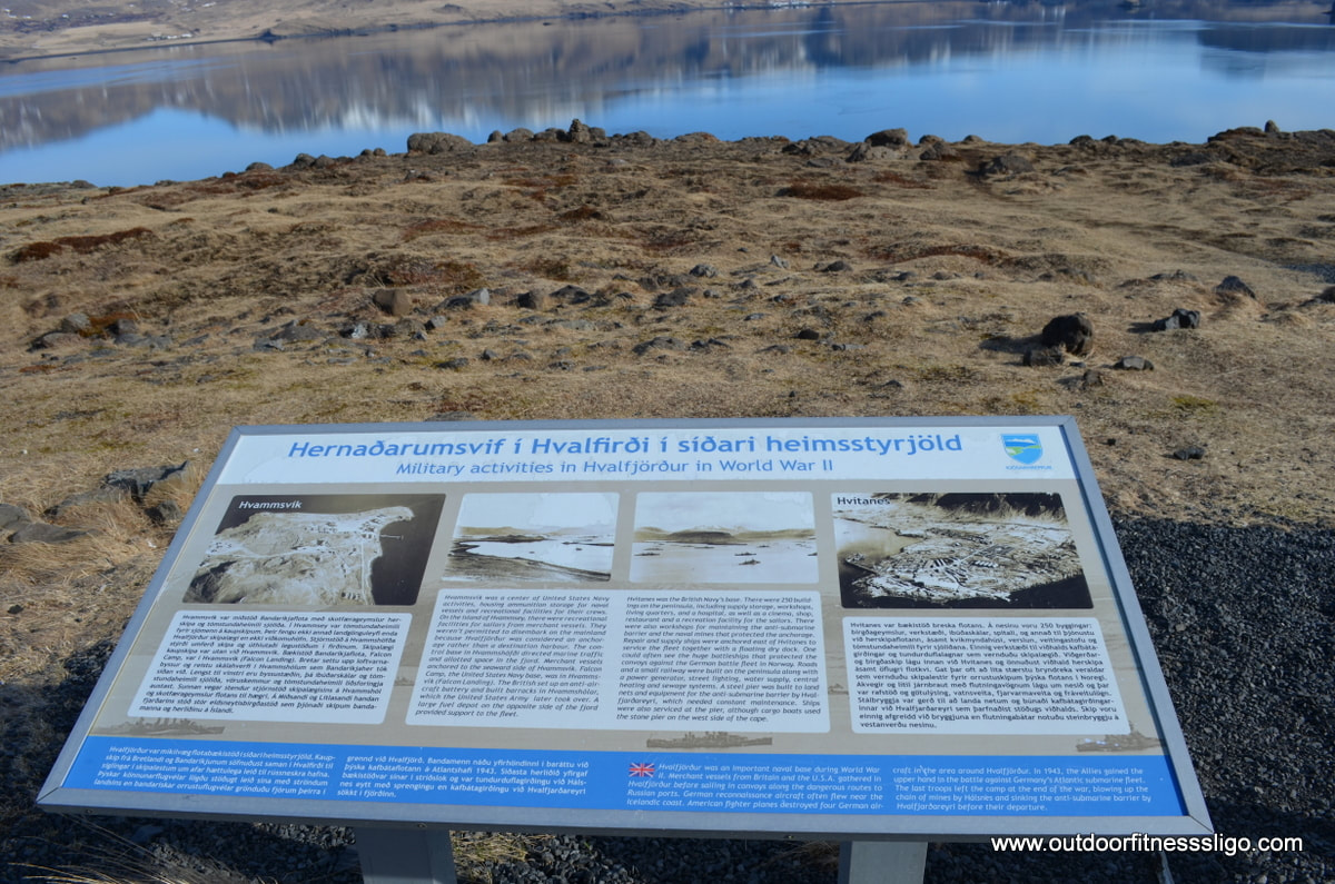
In the fjord, although the name suggests it, you wouldn't really see any whales. But there is still a whaling station which is the only one left in Iceland. During World War 2, a naval base of the British and American Navy was located in this fjord, some of the buildings and piers are still visible. At the end point of the fjord is a hiking trail to the formerly highest waterfall of Iceland , named Glymur. The trail follows the edge of the river gorge and is a spectacular walk, at one point passing through a short cave and having to cross a thin bridge.
Driving around the fjord, you will notice the many summer houses against the flanks of the mountains. If you are interested in learning more about the WW2 occupation by British and American navy of Hvalfjordur, you should visit the War and peace museum (http://www2.warandpeace.is/). This museum has a great range of artifacts and information and is worth a visit. The drive around the fjord is worth the detour, and we recommend driving around the fjord rather than taking the tunnel underneath it, just to enjoy the tranquility and beauty of this fjord.
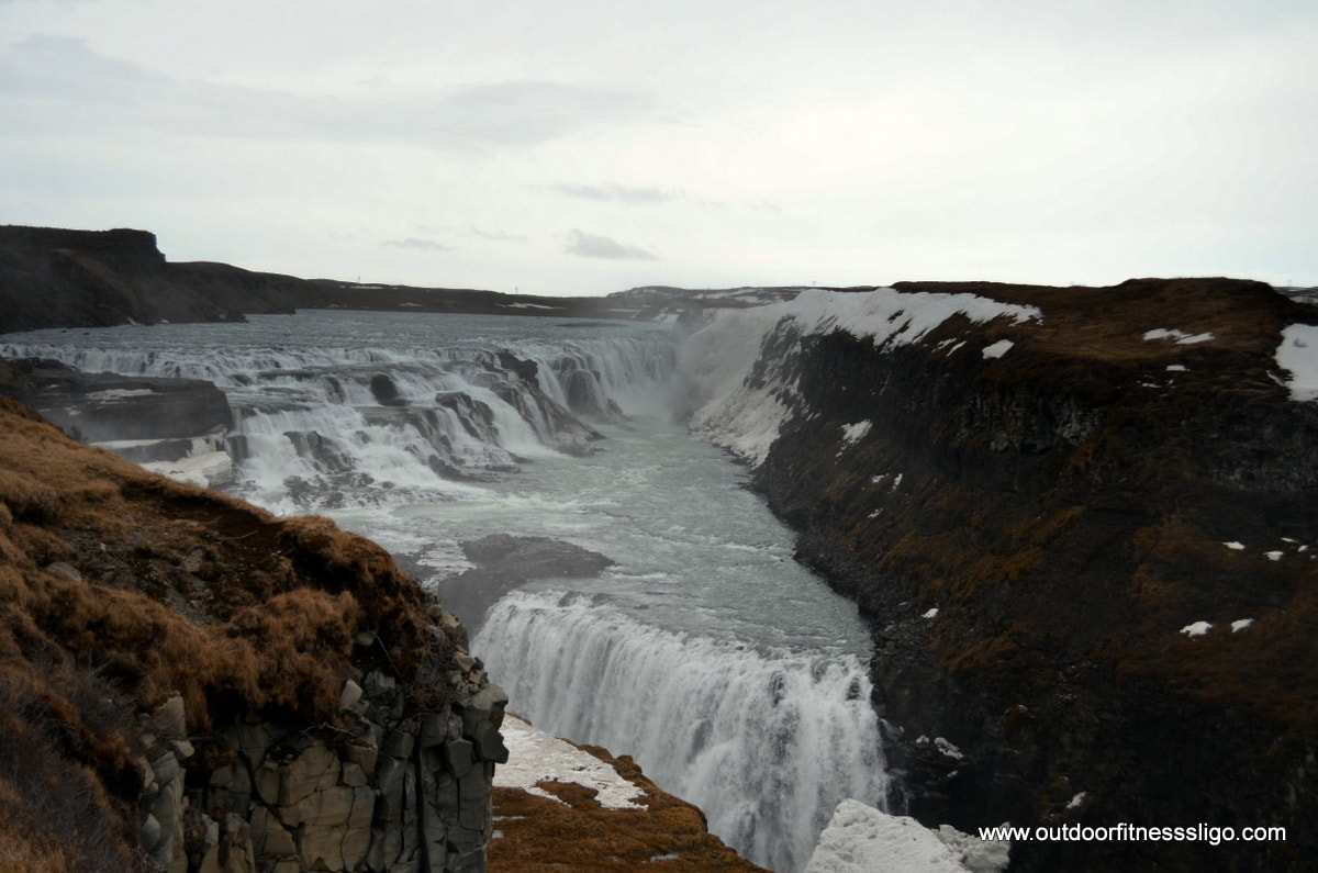
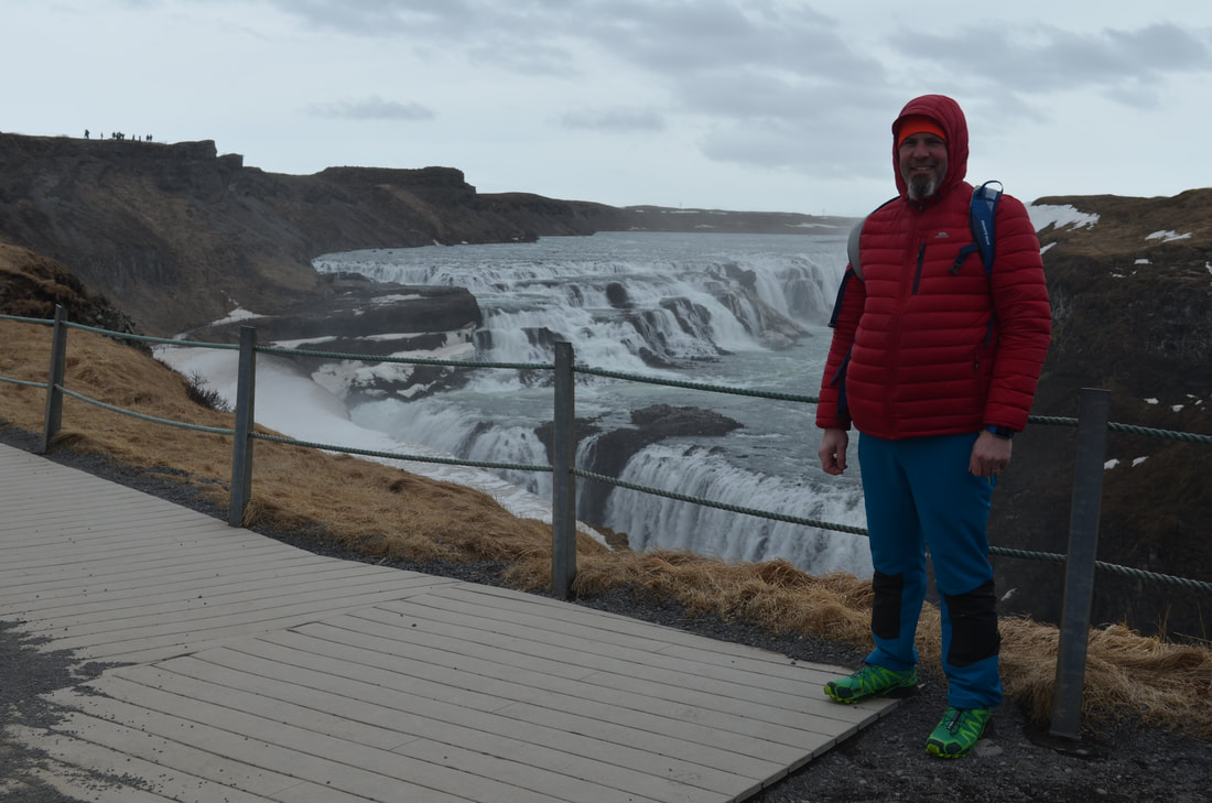
When you are in Iceland for the first time, one must do tourist attraction is the Golden Circle route, a popular tourist route of approx 300km. On this route, one of the must see attractions is Gullfoss waterfall ( http://gullfoss.is/ ) . And it must be said, these tourist attractions are busy. The large car park was busy with buses and cars. A large tourist shop and restaurant welcome the many tourists, but we headed straight for the waterfall. A path and stairwell brings the many tourists towards the waterfall.
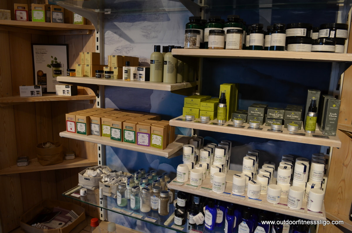
Ice and snow were lingering at the foot of Gullfoss waterfall, a huge waterfall at the Hvita river. Here, the waterfall plunges rapidly down 2 stages to a depth of 32 meters. The day was bitterly cold and the wind had picked up significantly since early morning, so we decided to keep moving. A path which starts at the lowerr viewing point brings you as close to the waterfall as possible. This path will be closed in icy conditions for safety reasons. Heading back to the visitor center, we decided to have a quick browse in the tourist shop.
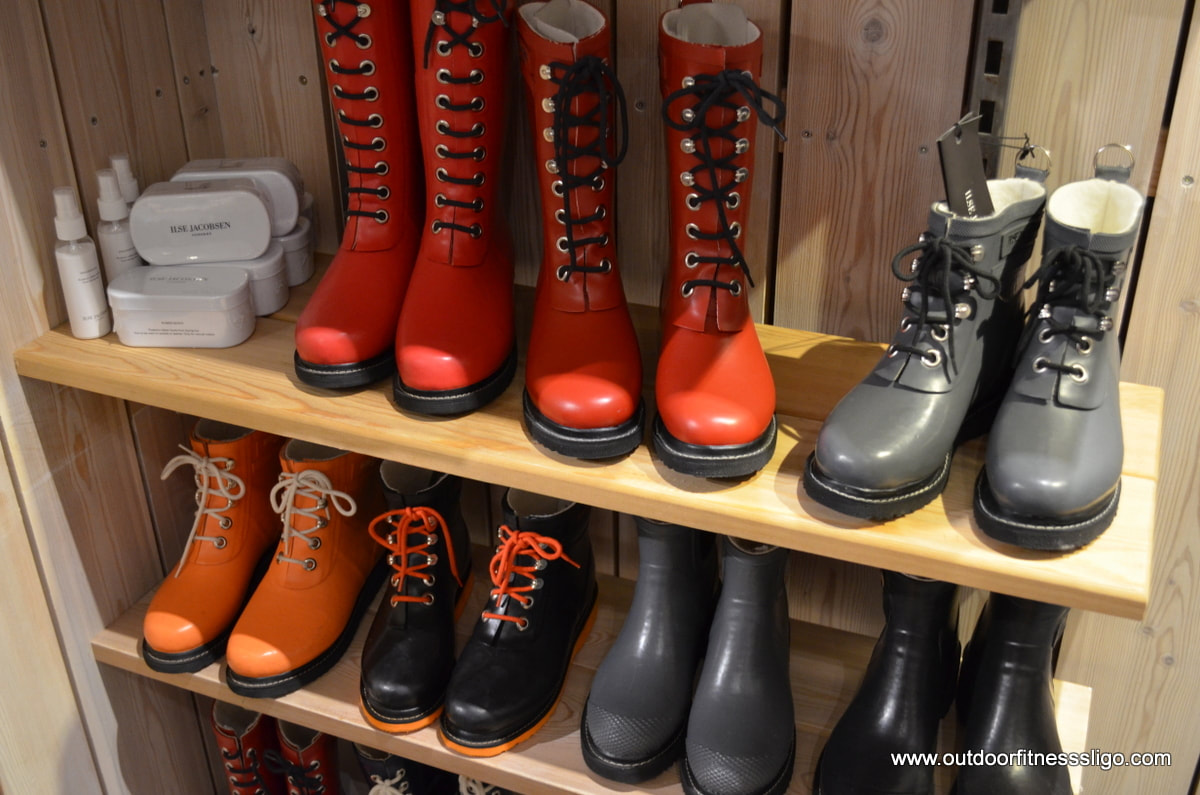
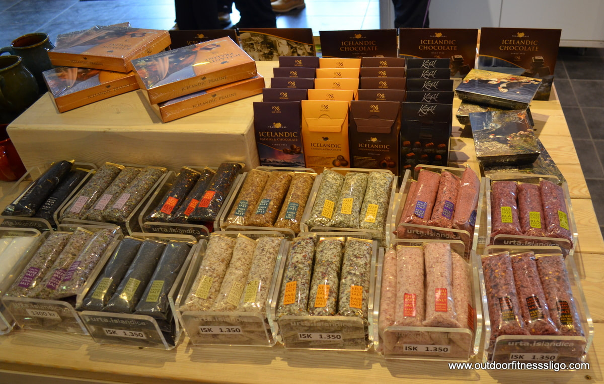
In the shop, there was a large selection of Icelandic products ranging from food to clothes. We liked the colourful wellies from designer Ilse Jacobsen, the Urta Icelandica black lavasalt ( https://www.urta.is/) had us intrigued.
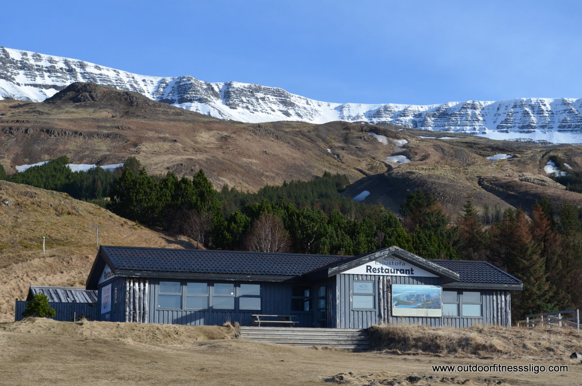
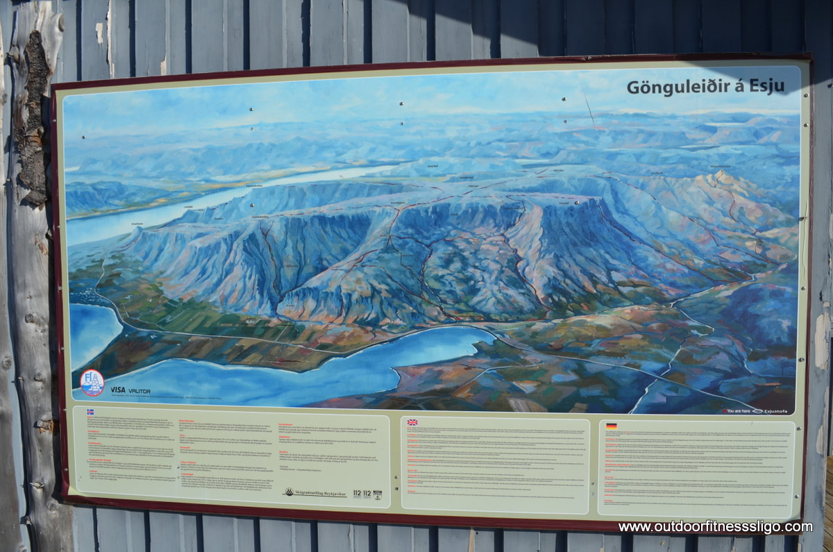
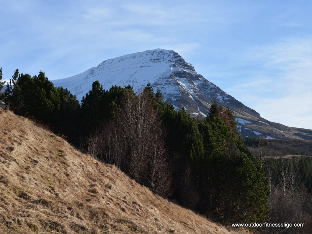
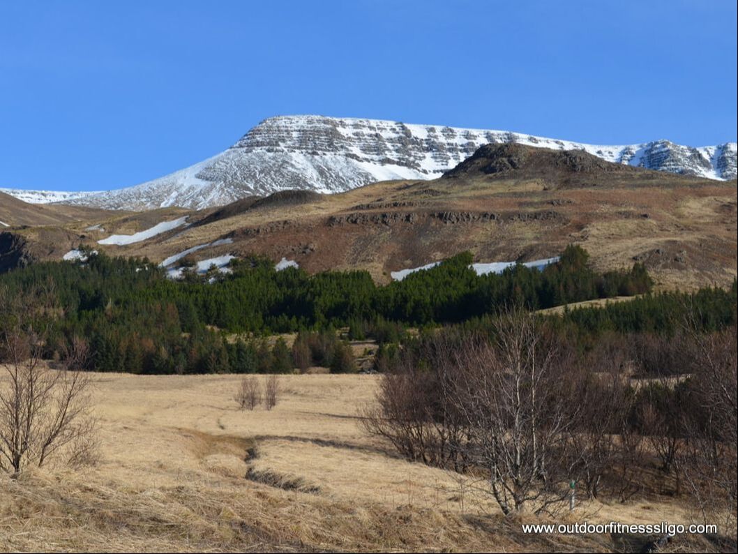
Mount Esja dominates the skyline from Reykjavik and is seen as the most popular area for outdoor recreation around Reykjavik. Mount Esju is popular with daytrippers , and it is here where you can find many kiking trails . Mount Esja (914m) is part of a volcanic mountain range . The trails are clearly marked based on their difficulty rating, so there is trail for every level of fitness and capability.
The most popular trail in the park is the trail up Dverfellshorn, which stands 770m tall. The area is also the playground for the annual Mount Esja Ultra (http://mtesjaultra.is/) where the racers have to run a 7km loop 11 times. The views on a clear day are just fabulous.
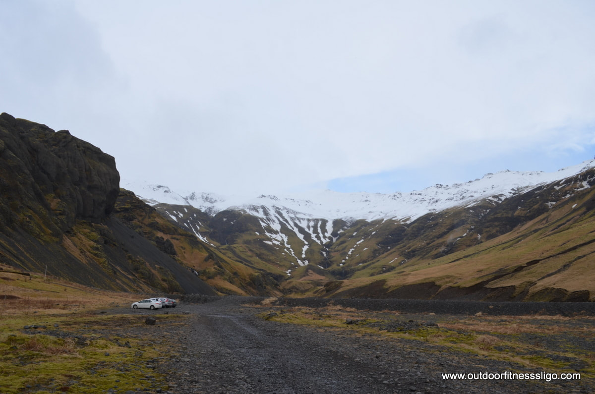
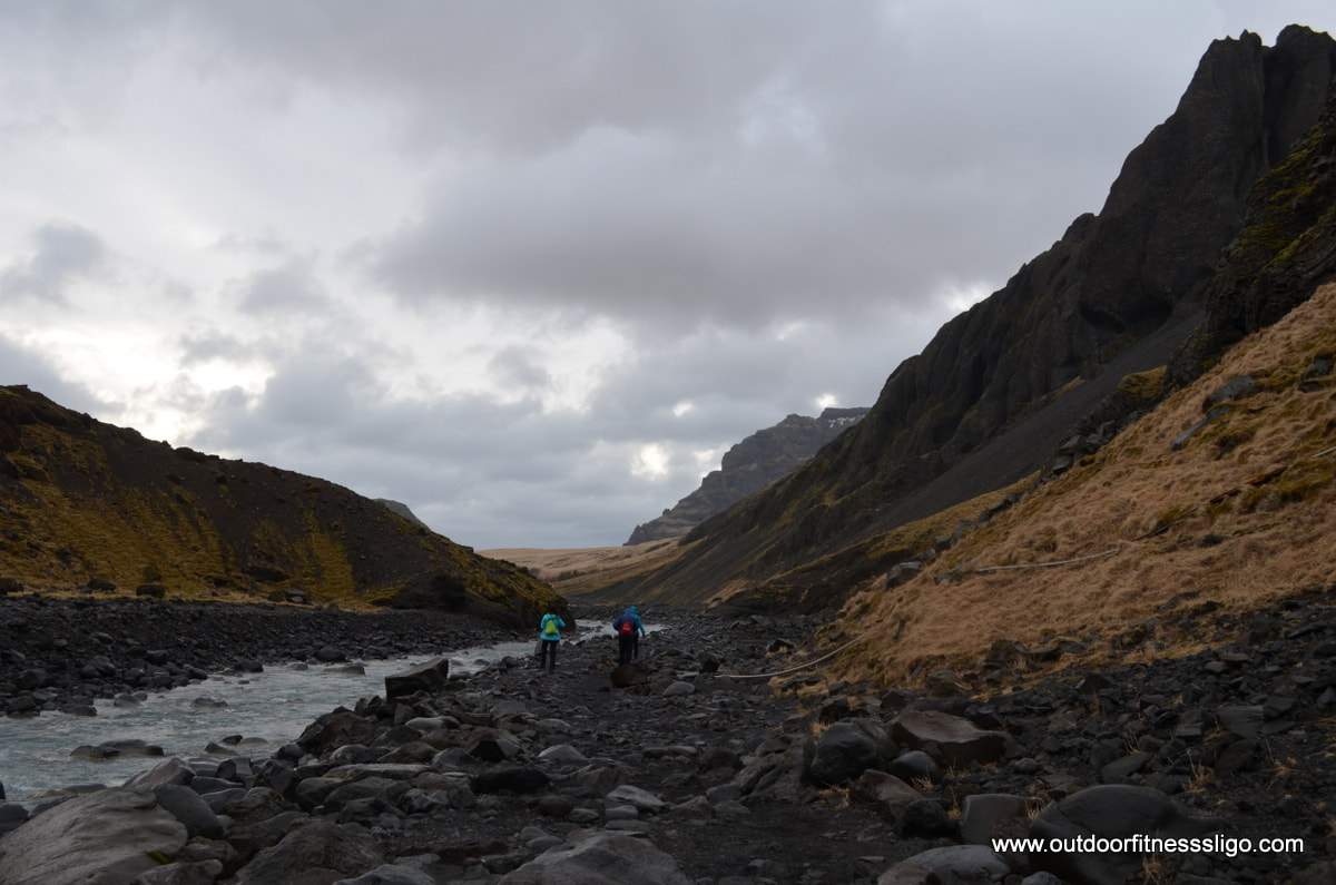
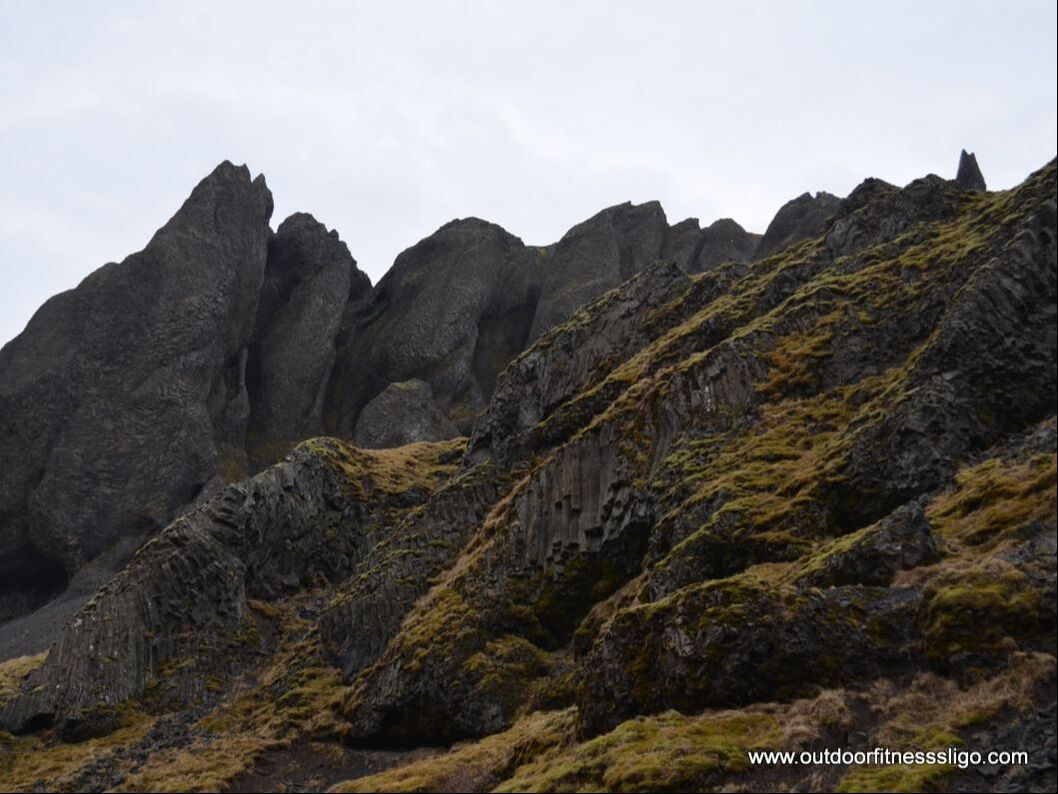
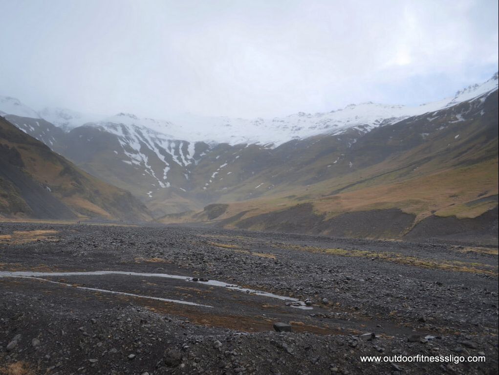
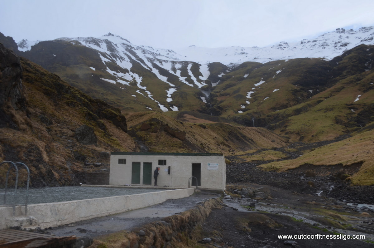
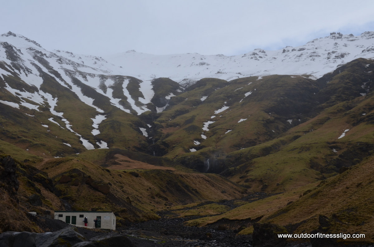
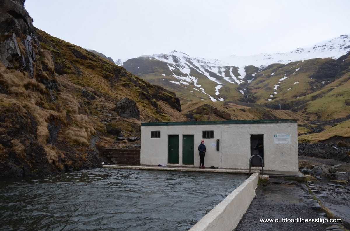
I know it can be windy in Iceland, but on this particular day in March, 140 km/hr winds came racing down the mountain flanks into the valleys below Iceland's infamous Eyjafjallajokull glacier. And we had the great idea to go for a swim in Iceland's oldest pool, Seljavallalaug swimming pool. Having parked the car at the unsurfaced car park, we were barely able to open the doors of the car due to the howling wind. Heading deeper into the valley following the riverbed, we started to think it might be smarter to turn back to the car, this as the wind was making walking barely possible. But the thought of being able to swim in a geothermal heated pool in the middle of the mountains had been for a long time on my bucket list, so we carried on with our walk, or should I say snail-paced struggle against the strong headwind. Following the riverbed, we admired the amazing rock formations on the left of the river, basalt rocks in all different shapes draped in moss.
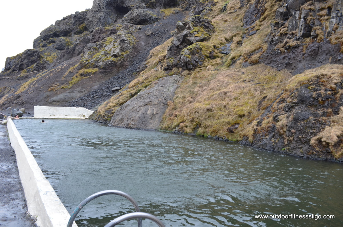
Turning around the corner deeper into the valley, the wind picked up even further, forcing us at some stages to crouch into a small ball in order to avoid being blown over. Between the gusts, we carried on with our struggle until we reached the pool after a 30 minutes hike. The 25 meter pool is at a comfortable temperature thanks to it's geothermal heating, the small dressing rooms are very basic but practical. On 1 side of the pool, a rock functions as 1 of the pool walls, the other 3 are made out of concrete. The pool is free to use, but a donation box is there to support the volunteers who maintain the swimming pool. The water comes from a hot spring nearby.
A quick change and I finally managed to tick another item of my bucketlist, a refreshing swim in the geothermal heated pool was brilliant fun. But we also think about safety, and with the wind picking up even stronger, we decided to head back after a quick swim in this fabulous pool. At this stage, the wind had become so strong that it was pushing us back towards the car in record time.
|
�
About the AuthorWe are Peter & Dolores De Bie. We love the great outdoors, discovering new parts of the world and writing about our adventures along the Wild Atlantic Way and further afield Categories
All
|


 RSS Feed